Hurricane Isaac
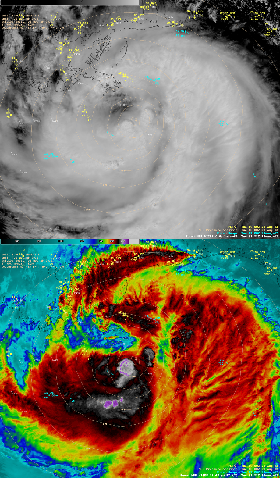
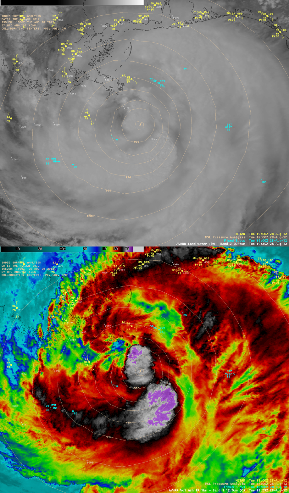
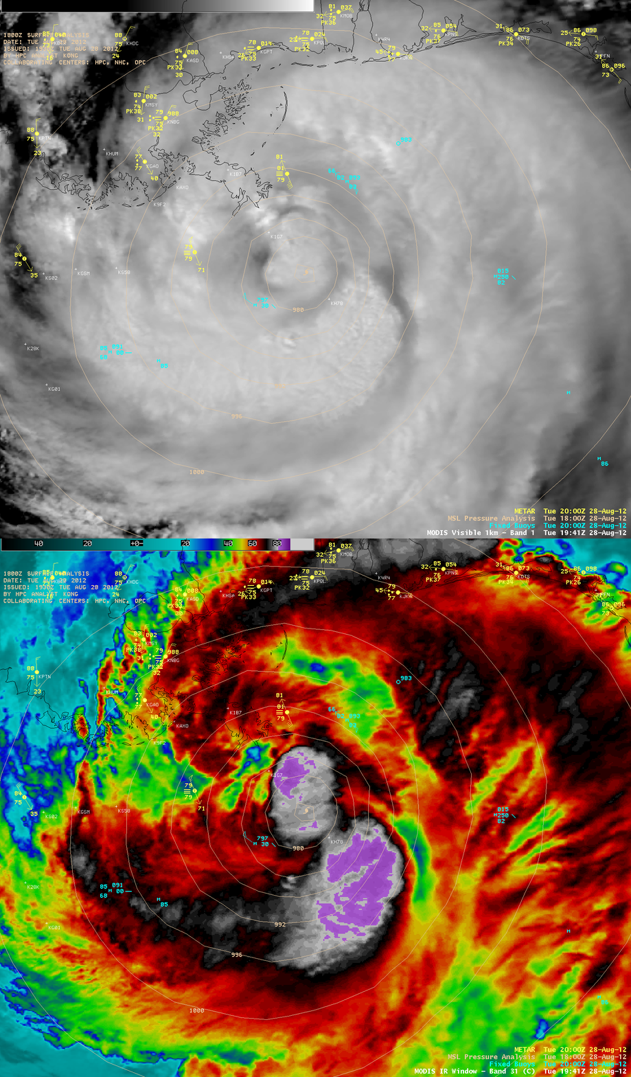
Isaac reached Category 1 hurricane intensity mid-day on 28 August 2012. AWIPS images of 1-km resolution visible and IR data from the VIIRS, AVHRR, and MODIS instruments (below) showed curved banding features and convective bursts with overshooting tops, along with cloud top IR brightness temperatures as cold as -86º C.
McIDAS images of 1-minute interval Super Rapid Scan Operations for GOES-R (SRSOR) 0.63 µm visible channel and 10.7 µm IR channel data (below) showed the detail and temporal evolution of the convective bursts that developed near the center of the circulation of Hurricane Isaac as it made landfall over the Mississippi River delta region along the southeast Louisiana coast around 23:45 UTC.
===== 29 August Update =====
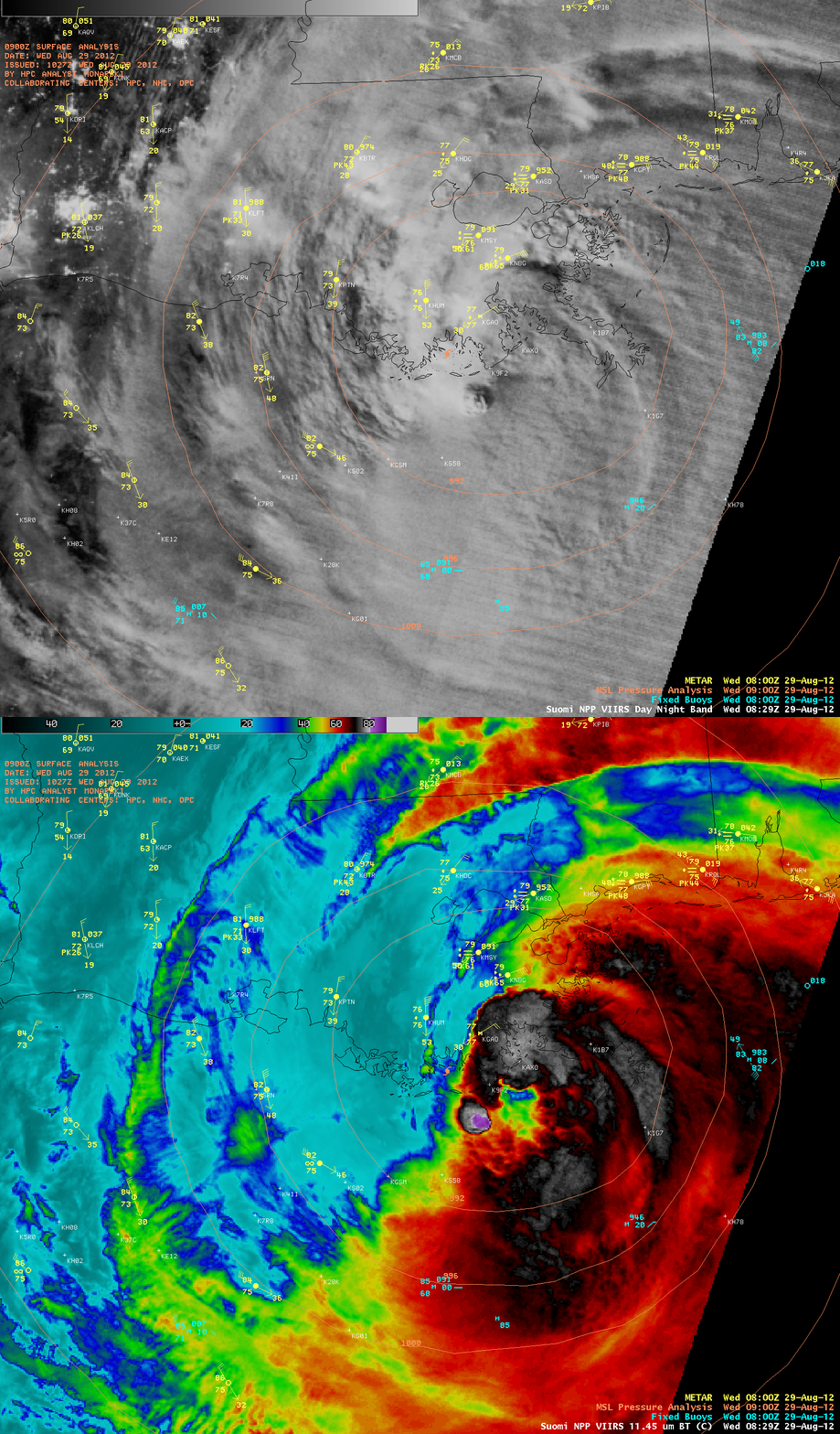
A comparison of night-time AWIPS images of Suomi NPP VIIRS 0.8 µm Day/Night Band data with the corresponding 11.45 µm IR data (below) at 08:29 UTC (3:29 AM local time) showed some spiral banding structure within the eastern semicircle of Isaac, along with an isolated area of deep convection immediately offshore (the minimum IR brightness temperature associated with this feature was -88 C). City lights could be seen in the northwestern portion of the image, where there were breaks in the clouds or only a thin veil of high clouds covered the area.


