Starting Date [Julian Day]
(Day of Week)
|
Test Schedule Name |
Duration |
Center Point (coverage) |
Comments |
Links (large files) |
October 25-31, 2012
|
SRSOR |
299/ 17:45 UTC - 305/ 15:55 UTC |
Various |
Fast animation of Sandy |
6-Days (25-31):
1-min:Youtube, mp4 (128 MB)
1.5-min: mp4 (128 MB)
2-min: mp4 (128 MB)
|
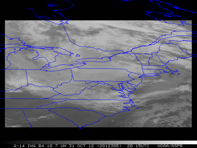
October 31 [305]
(Wednesday) |
SRSOR |
305/ 11:14:30 UTC - 305/ 22:44:30 UTC |
41N 78W |
Sandy |
6-Days (25-31):
Youtube, QuickTime (483 MB)
|
October 30 [304]
(Tuesday) |
SRSOR |
304/ 11:14:30 UTC - 305/ 11:14:30 UTC |
41N 76W |
Sandy |
AM:Youtube, QuickTime
14-19 UTC:Youtube, QuickTime
|
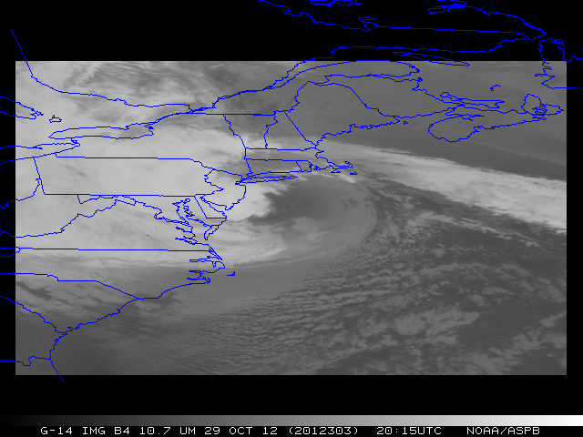
October 29 [303]
(Monday) |
SRSOR |
303/ 11:14:30 UTC - 304/ 11:14:30 UTC |
38.5N 73W |
Sandy (landfall) |
AM:Youtube, QuickTime
11-17 UTC:Youtube, QuickTime
Landfall (VIS+IR):Youtube, QuickTime
Entire day (daylight):
Youtube, QuickTime |
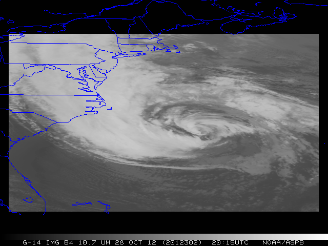
October 28 [302]
(Sunday) |
SRSOR |
302/ 11:14:30 UTC - 303/ 11:14:30 UTC |
34N 73W |
Sandy |
AM: Youtube, QuickTime
14-19 UTC: Youtube, QuickTime
Entire day (daylight):
Youtube, QuickTime |
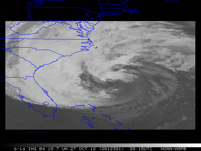
October 27 [301]
(Saturday) |
SRSOR |
301/ 11:14:30 UTC - 302/ 11:14:30 UTC |
31N 76W |
Sandy |
AM:Youtube, QuickTime
Entire day (daylight):
Youtube, QuickTime
PM:Youtube, QuickTime |
October 26 [300]
(Friday) |
SRSOR |
300/ 11:14:30 UTC - 301/ 11:14:30 UTC |
27.5N 77W |
Sandy |
AM: Youtube, QuickTime
14-18 UTC:
Youtube, QuickTime
Entire day (daylight):
Youtube, QuickTime
PM:Youtube, QuickTime |
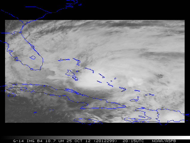
October 25 [299]
(Thursday) |
SRSOR |
299/ 17:44:30 UTC - 300/ 11:14:30 UTC |
25N 76W |
Sandy |
Youtube, QuickTime |
...
... |
.... |
... |
... |
No SRSOR due to GOES-13 anomalies |
September 24 [268]
(Monday) |
Default |
268/ 01:30:30 UTC - 269/ 10:14:30 UTC |
- |
No SRSOR due to GOES-13 anomalies |
September 23 [267]
(Sunday) |
SRSOR |
267/ 10:14:30 UTC - 268/ 01:30:30 UTC |
39W 113W |
Truncated SRSOR due to GOES-13 anomalies |
September 22 [266]
(Saturday) |
CEFD |
266/ 10:14:30 UTC - 267/ 10:14:30 UTC |
- |
30-min Full Disk |
FD |
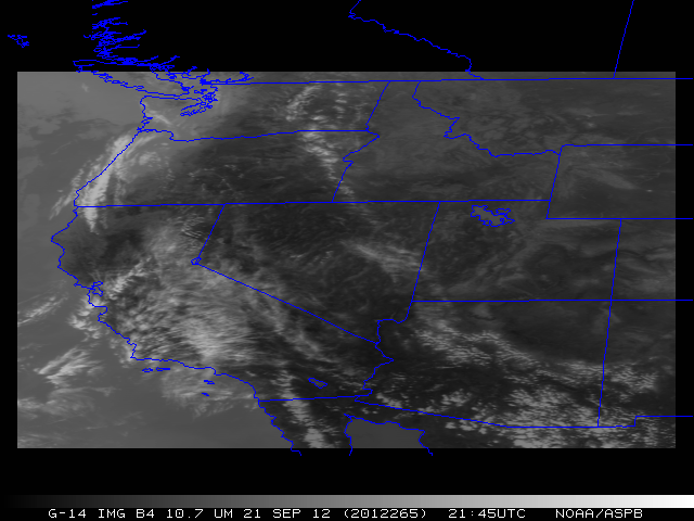
September 21 [265]
(Friday) |
SRSOR |
265/ 10:14:30 UTC - 266/ 10:14:30 UTC |
39N 116W |
Pacific NW |
OR |
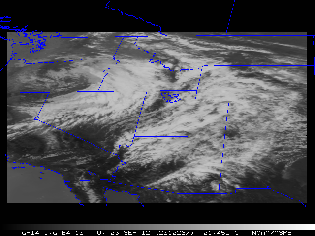
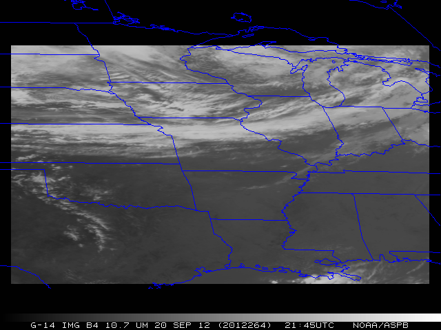
September 20 [264]
(Thursday) |
SRSOR |
264/ 10:14:30 UTC - 265/ 10:14:30 UTC |
37N 93W |
OK and eastern US |
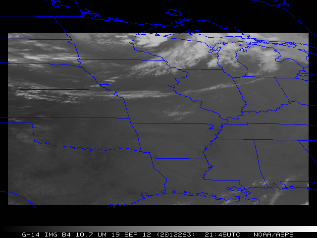
September 19 [263]
(Wednesday) |
SRSOR |
263/ 10:44:30 UTC - 264/ 10:14:30 UTC |
37N 93W |
OK and eastern US |
WI |
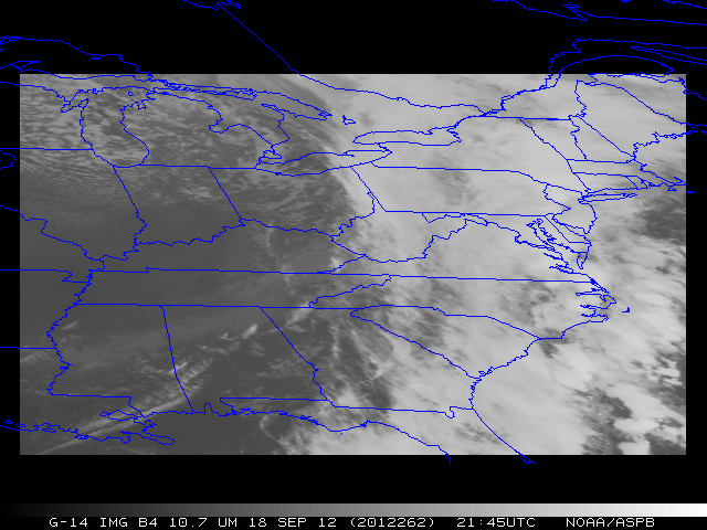
September 18 [262]
(Tuesday) |
SRSOR |
262/ 10:14:30 UTC - 263/ 10:44:30 UTC |
37N 82.5W |
East coast, convection. |
DC WI |
September 17 [261]
(Monday) |
Default |
261/ 10:14:30 UTC - 262/ 10:14:30 UTC |
- |
- |
September 16 [260]
(Sunday) |
Default |
260/ 11:14:30 UTC - 261/ 10:14:30 UTC |
- |
- |
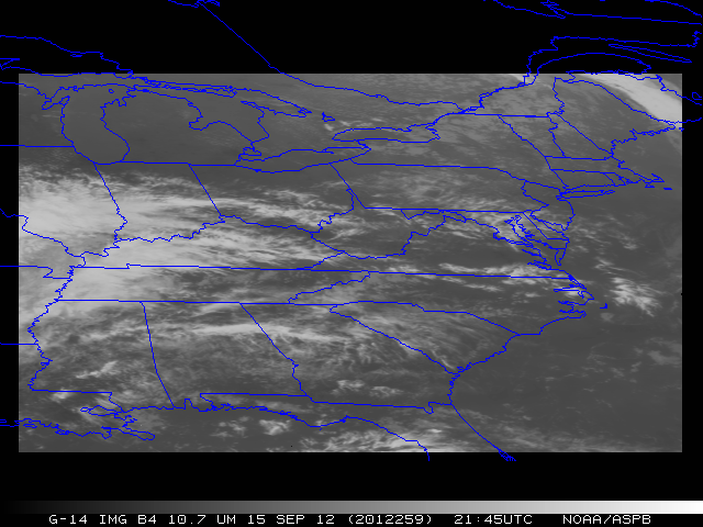
September 15 [259]
(Saturday) |
SRSOR |
259/ 11:14:30 UTC - 260/ 11:14:30 UTC |
37N 82W |
East Coast Frontal System. |
PA |
September 14 [258]
(Friday) |
CEFD |
258/ 11:14:30 UTC - 259/ 11:14:30 UTC |
- |
Testing FD schedule. |
FD: WV FD: Vis |
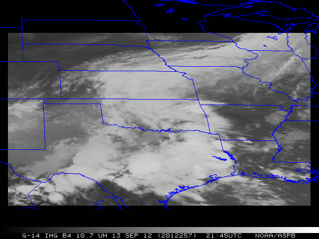
September 13 [257]
(Thursday) |
SRSOR |
257/ 10:14:30 UTC - 258/ 10:14:30 UTC |
35N 97W |
Convection over Norman. |
OK |
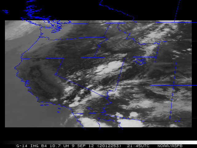
September 12 [256]
(Wednesday) |
SRSOR |
256/ 10:14:30 UTC - 257/ 10:14:30 UTC |
39N 99W |
Fire potential over MN |
N.TX |
September 11 [255]
(Tuesday) |
SRSO |
255/ 10:14:30 UTC - 256/ 10:14:30 UTC |
39N 102W |
SRSO testing. |
September 10 [254]
(Monday) |
SRSO |
254/ 10:14:30 UTC - 255/ 10:14:30 UTC |
38N 105W |
SRSO testing (No data 09:05 - 20:05 UTC) |
September 09 [253]
(Sunday) |
SRSOR |
253/ 10:14:30 UTC - 254/ 10:14:30 UTC |
39N 116W |
Fires, convection, etc. |
SW IR: OR VIS: OR |
September 08 [252]
(Saturday) |
SRSOR |
252/ 10:14:30 UTC - 253/ 10:14:30 UTC |
37N 82W |
Thunderstorms over East Coast |
Vis NY G13_vs_G15 |
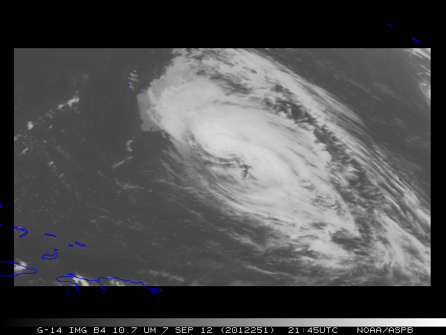
September 07 [251]
(Friday) |
SRSOR |
251/ 10:14:30 UTC - 252/ 10:14:30 UTC |
27N 63W |
Leslie. |
Leslie |
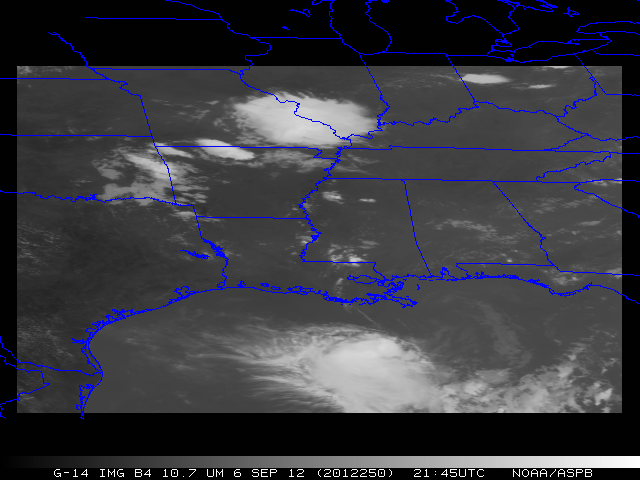
September 06 [250]
(Thursday) |
SRSOR |
250/ 14:14:30 UTC - 251/ 04:14:30 UTC |
32N 91W |
Slight risk over OK and 90L in Gulf. |
90L with lightning |
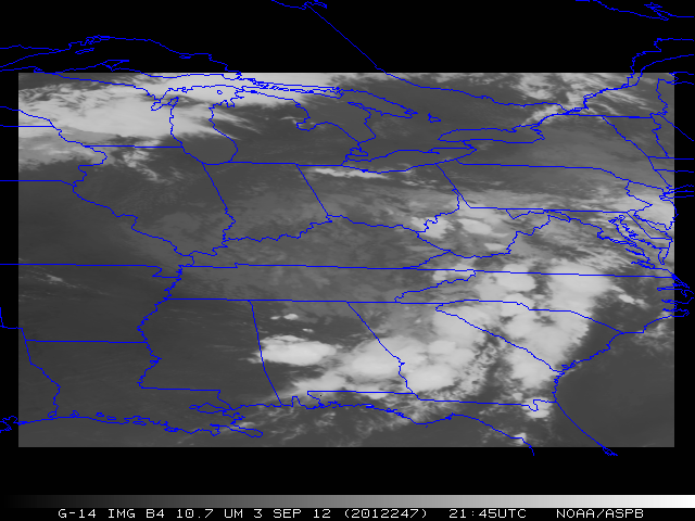
September 05 [249]
(Wednesday) |
RSO |
249/ 04:14:30 UTC - 250/ 14:14:30 UTC |
N/A |
Standard RSO testing |
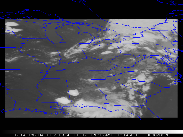
September 04 [248]
(Tuesday) |
SRSOR |
248/ 14:14:30 UTC - 249/ 04:14:30 UTC |
37N 85W |
Convection over WI, AL, etc. |
IR: WI VIS: WI IR: Gulf |
September 03 [247]
(Monday) |
SRSOR |
247/ 19:44:30 UTC - 248/ 04:14:30 UTC |
37N 85W |
Afternoon convection |
Convection over VA/NC |
September 02 [246]
(Sunday) |
SRSOR |
246/ 19:44:30 UTC - 247/ 04:14:30 UTC |
37N 85W |
Afternoon convection |
N. AL |
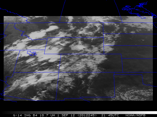
September 01 [245]
(Saturday) |
SRSOR |
245/ 11:44:30 UTC - 246/ 02:44:30 UTC |
40N 107W |
Fire wx, convection, smoke |
MT smoke and convection |
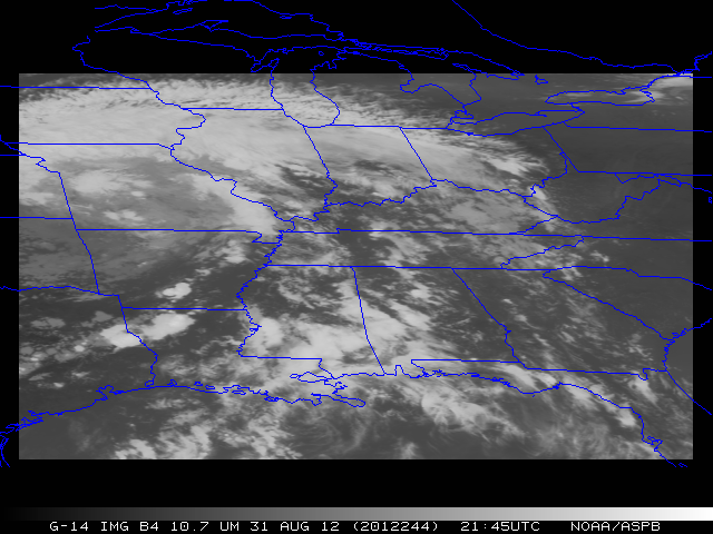
August 31 [244]
(Friday) |
SRSOR |
244/ 09:44:30 UTC - 245/ 04:14:30 UTC |
35N 88W |
Isaac |
WI/IL |
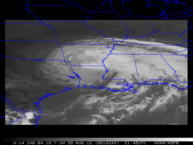
August 30 [243]
(Thursday) |
SRSOR |
243/ 09:14:30 UTC - 244/ 04:44:30 UTC |
32N 92W |
Isaac. |
AL |
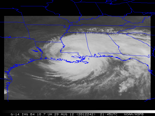
August 29 [242]
(Wednesday) |
SRSOR |
242/ 09:14:30 UTC - 243/ 04:44:30 UTC |
30N 90W |
Isaac. |
Isaac (landfall) |
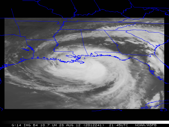
August 28 [241]
(Tuesday) |
SRSOR |
241/ 09:44:30 UTC - 242/ 04:44:30 UTC |
29N 89W |
Isaac. |
Isaac |
August 27 [240]
(Monday) |
SRSOR |
240/ 09:44:30 UTC - 241/ 04:44:30 UTC |
27N 85W |
Isaac. |
Isaac |
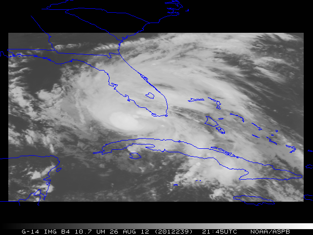
August 26 [239]
(Sunday) |
SRSOR |
239/ 09:44:30 UTC - 240/ 04:44:30 UTC |
25N 81W |
Isaac. |
Isaac (FL) |
August 25 [238]
(Saturday) |
SRSOR |
238/ 09:44:30 UTC - 239/ 04:44:30 UTC |
22N 77W |
Isaac (noisy data due to thunderstorms near Wallops). |
|
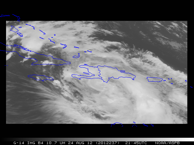
August 24 [237]
(Friday) |
SRSOR |
237/ 09:44:30 UTC - 238/ 04:44:30 UTC |
19N 72W |
Isaac. |
Isaac Overshooting Tops |
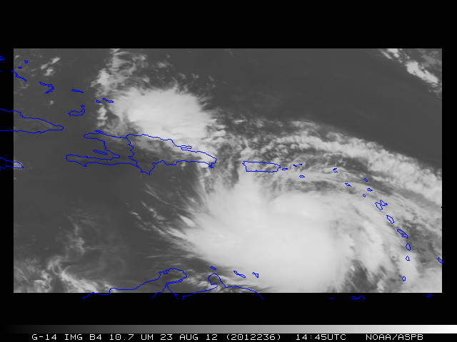
August 23 [236]
(Thursday) |
SRSOR |
236/ 09:14:30 UTC - 236/ 15:11:30 UTC |
18N 68W |
Isaac and East-West Maneuver. |
Isaac |
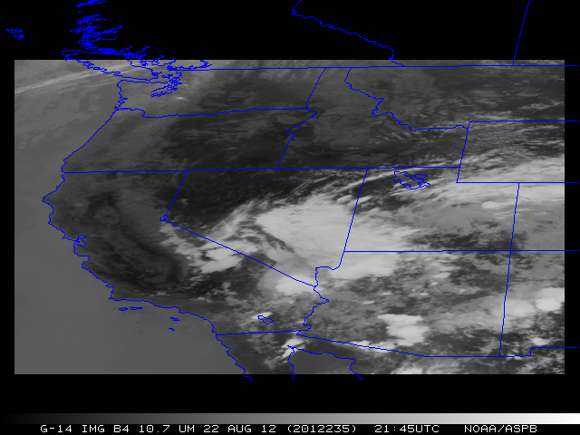
August 22 [235]
(Wednesday) |
SRSOR |
235/ 09:44:30 UTC - 236/ 04:44:30 UTC |
39N 116W |
PacNW, fires, smoke etc. |
Rains in Las Vegas |
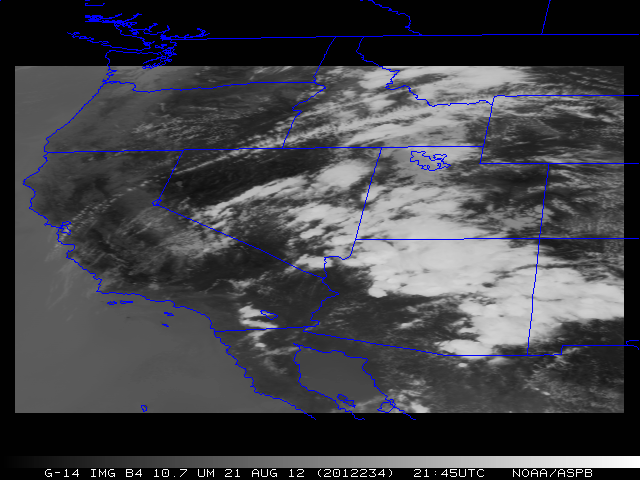
August 21 [234]
(Tuesday) |
SRSOR |
234/ 21:44:30 UTC - 235/ 04:44:30 UTC |
37N 115W |
Maneuver means no data before ~21:45 UTC. |
Hot spots and smoke over CA |
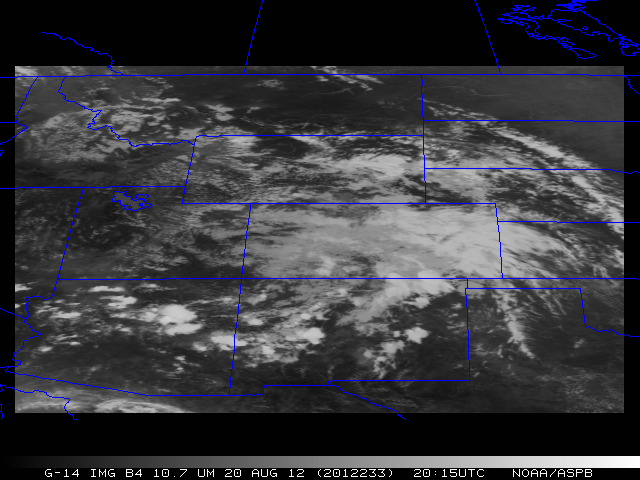
August 20 [233]
(Monday) |
SRSOR |
233/ 09:14:30 UTC - 234/ 02:44:30 UTC |
39N 107W |
Convection over CO, etc. |
AZ |
August 19 [232]
(Sunday) |
Default |
- |
- |
- |
- |
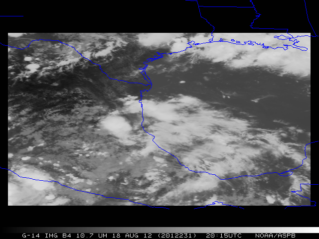
August 18 [231]
(Saturday) |
SRSOR |
231/ 09:14:30 UTC - 232/ 04:44:30 UTC |
23N 97W |
Tropical (Helene) |
Helene |
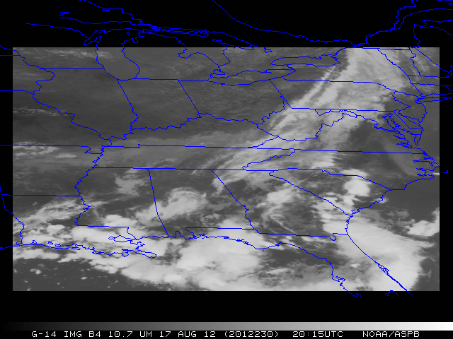
August 17 [230]
(Friday) |
SRSOR |
230/ 09:14:30 UTC - 231/ 02:44:30 UTC |
35N 85W |
Convection over AL, etc. |
Clouds over East Coast |
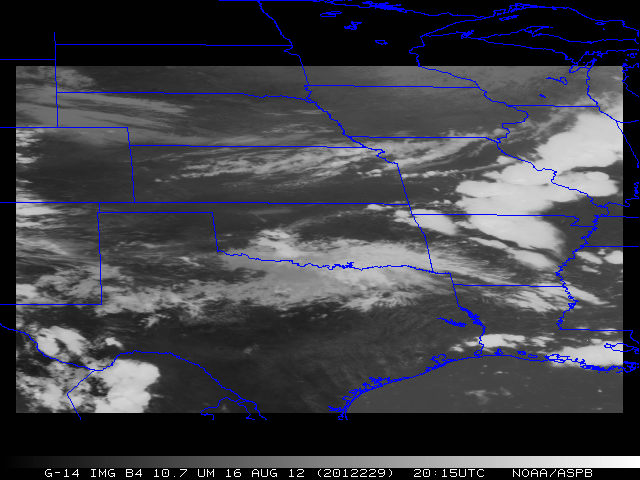
August 16 [229]
(Thursday) |
SRSOR |
229/ 11:14:30 UTC - 230/ 01:44:30 UTC |
35:13N 97:27W |
Norman, OK w phased-array radar. |
Overshooting Tops MO: Vis |
