Using polar-orbiter MODIS and AVHRR imagery to supplement degraded geostationary GOES imagery
After 20:30 UTC on 21 March 2012, GOES-15 (GOES West) experienced a bad momentum unload, and at this point the satellite went into a sun acquisition mode (a “safe mode”) and stopped transmitting data (latest GOES-15 status messages). NOAA/NESDIS immediately began to operate GOES-13 (GOES East) in continuous Full Disk scan mode, in order to provide imagery as far west as possible every 30 minutes. However, due to the extreme viewing angle from GOES-13 (positioned over the Equator at 75 degrees West longitude), the image quality over the western US was degraded (since the effective pixel resolution was so large). In addition, Alaska, Hawaii, and the Pacific Region were effectively without useful GOES imagery (although some of these areas could make use of Japanese MTSAT imagery to help fill the GOES-15 imagery gap).
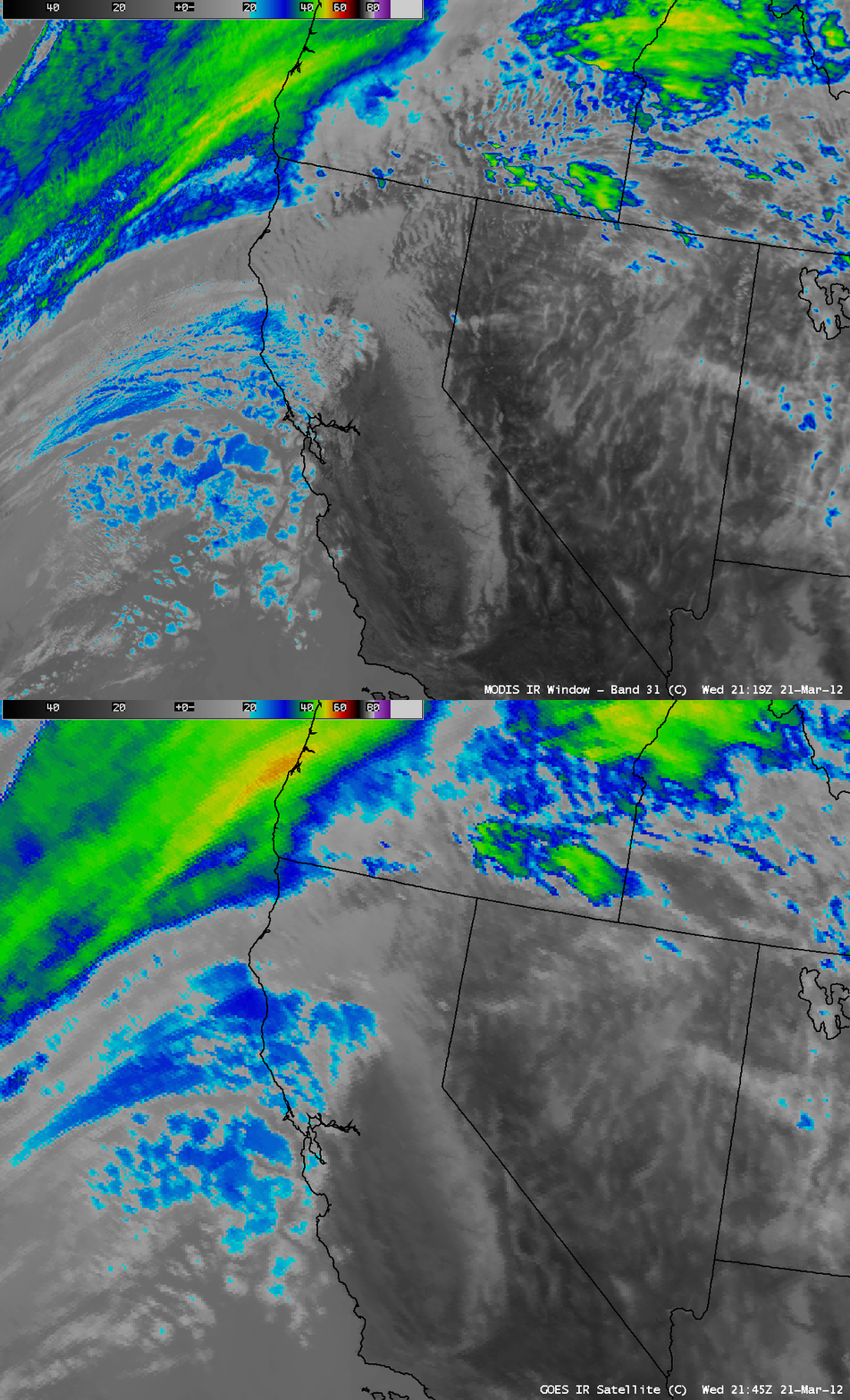
Shortly after the GOES-15 outage, AWIPS comparisons of a 1-km resolution MODIS 6.7 µm water vapor image with the corresponding GOES-13 6.5 µm water vapor image (above) as well as the MODIS 11.0 µm IR channel image and the corresponding GOES-13 10.7 µm IR image (below) demonstrate the value of using higher spatial resolution polar-orbiter (from the Terra and Aqua satellites) MODIS imagery to supplement the degraded geostationary GOES-13 imagery during the GOES-15 outage. In these 2 examples, the GOES-13 viewing angle for San Francisco, California is 65 degrees, making the effective resolution of the “4 km” IR and water vapor image pixels closer to 16 km. In addition, the large satellite viewing angles were creating a significant “parallax error“, shifting the apparent location of high cloud features to the northwest.
========================================================
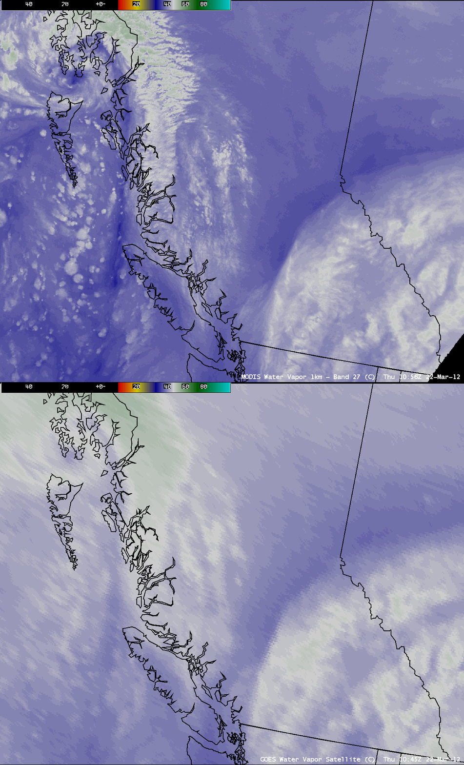
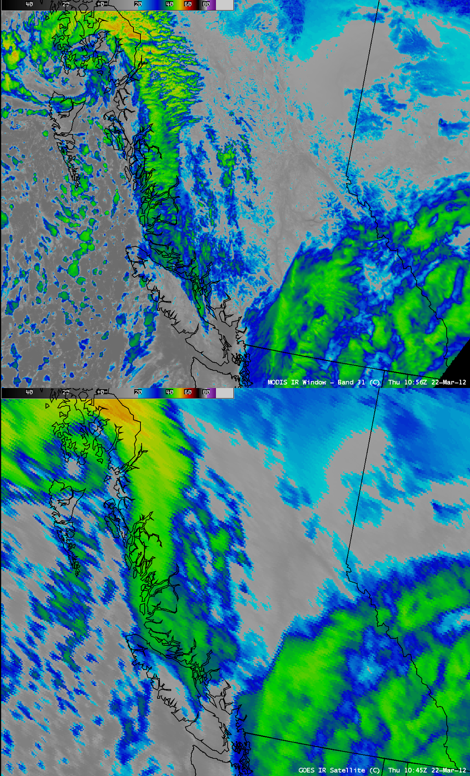
On the following day, AWIPS comparisons of a MODIS 6.7 µm water vapor image with the corresponding GOES-13 6.5 µm water vapor channel image (above) as well as a MODIS 11.0 µm IR channel image with the corresponding GOES-13 10.7 µm IR channel image (below) showed a storm moving into the far southern panhandle of Alaska. In the case, the GOES-13 satellite viewing angles for Seattle, Washington and Juneau, Alaska were 71 degrees and 82 degrees, respectively.
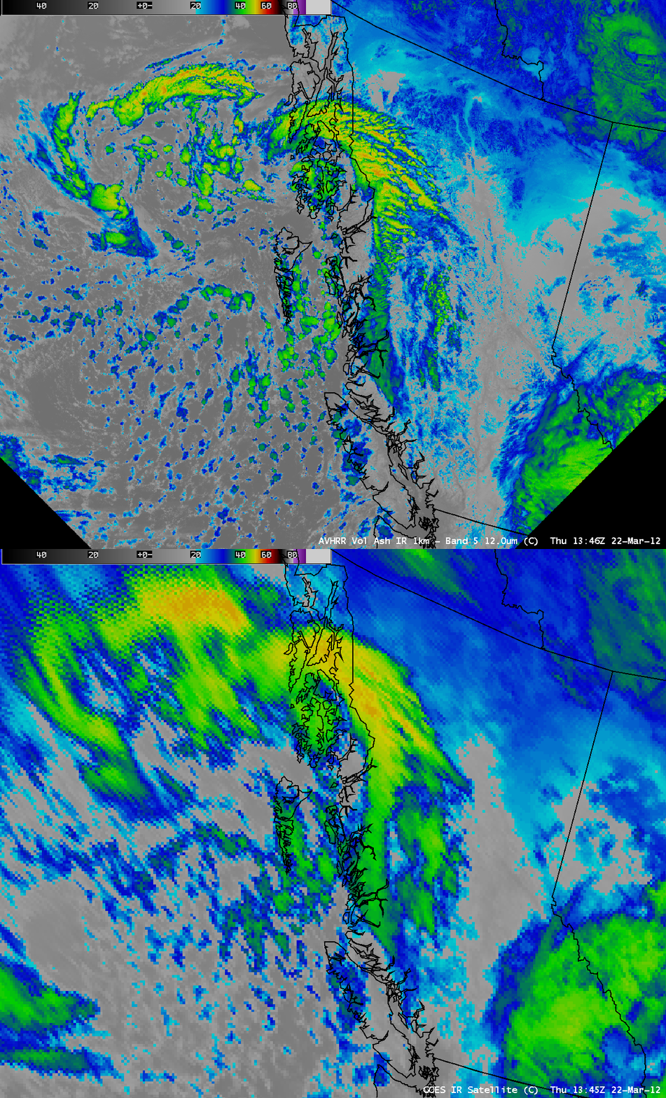
Similarly, an AWIPS comparison of a 1-km resolution POES AVHRR 12.0 µm IR image with the corresponding GOES-13 10.7 µm IR image (below) shows another source for polar-orbiter satellite imagery to supplement GOES in this type of situation.
CIMSS participation in GOES-R Proving Ground activities includes making a variety of POES AVHRR and MODIS images and products available for National Weather Service forecast offices to add to their local AWIPS workstations. Currently there are 57 NWS offices receiving MODIS imagery and products from CIMSS.


