Super Rapid Scan Operations (SRSO) images of Tropical Storm Don
The GOES-R Proving Ground requested that the GOES-13 satellite be placed into Super Rapid Scan Operations (SRSO) mode to monitor the development of Tropical Storm Don as it approached the far southern coast of Texas on 29 July 2011:
Subject: Administrative, GOES-13 (GOES-East) SRSO scheduled for July 29
*Topic*: GOES-13 (GOES-East) SRSO is scheduled for: July 29, 2011
*Correction*: *Product(s) or Data Impacted:* GOES-13 (GOES-East)
Imager Data and Products*Date/Time Issued*: July 29, 2011 1705 UTC
*Product(s) or Data Impacted:* GOES-13 (GOES-West) Imager Data and
Products*Date/Time of Initial Impact*: July 29, 2011 J/date 210 1815 UTC
*Date/Time of Expected End*: July 29, 2011 J/date 211 0115 UTC
*Length of Event*: 7 hours
*Impacts on Users and Significance*: Smaller PACUS frame with shortened Southern Hemisphere scan (Southern Hemisphere scan hourly). Increased frequency of images over area of interest (see Details)
*User Actions*: None.
*Details/Specifics of Change*: GOES-R Proving Grounds Testing Over Tropical Storm Don in the Gulf of Mexico at 27 North and 96 West
*Requestor: *CIRA
McIDAS images of GOES-13 0.63 µm visible channel data (above; click image to play animation; also available as a QuickTime movie) showed a number of convective bursts associated with the tropical storm — note that there were several periods where images were available at 1-minute intervals while GOES-13 was in SRSO mode. The ABI instrument on GOES-R will actually be able to provide images as frequently as every 30 seconds over special regions of interest (such as tropical cyclones or severe thunderstorms).
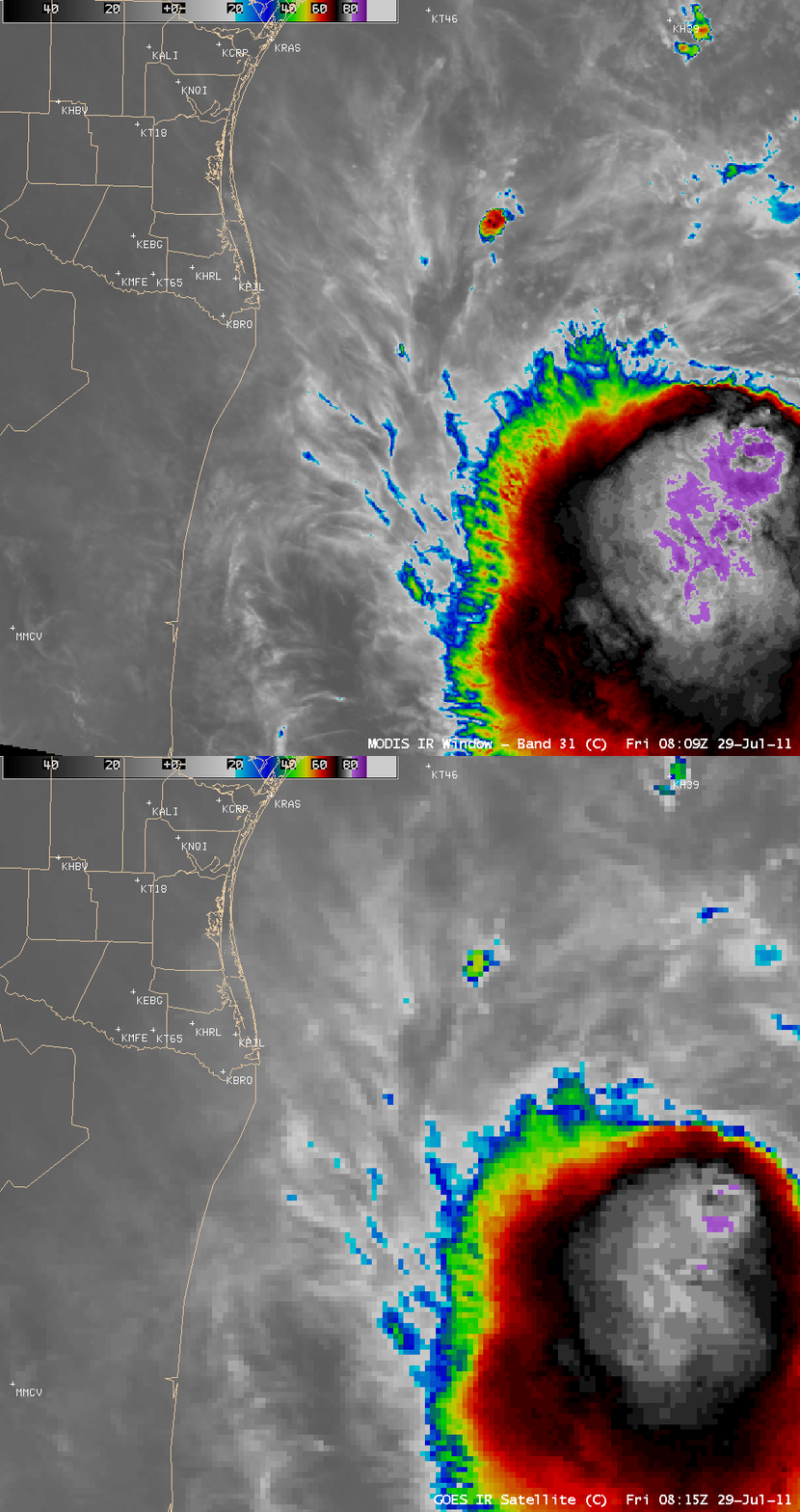
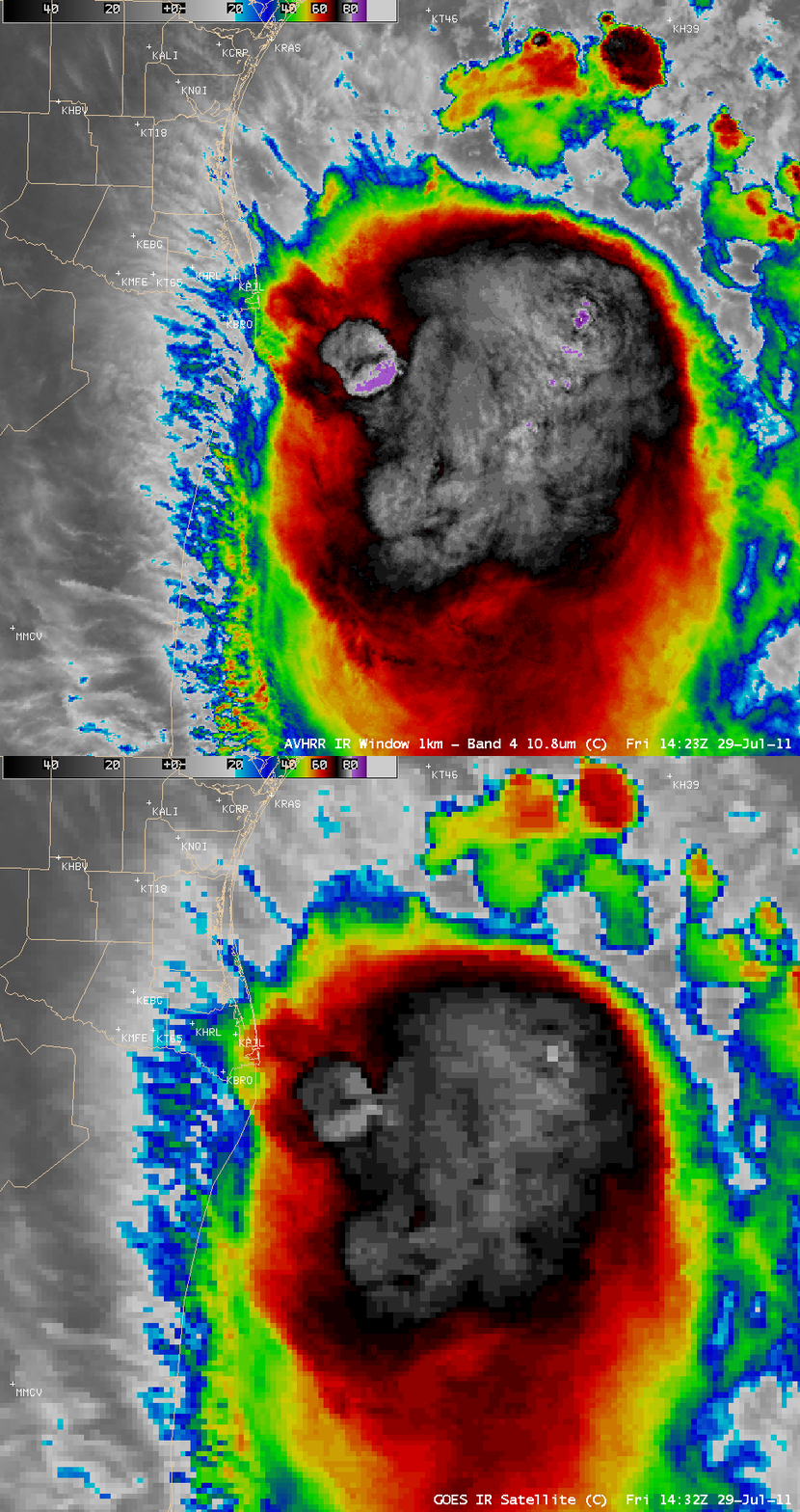
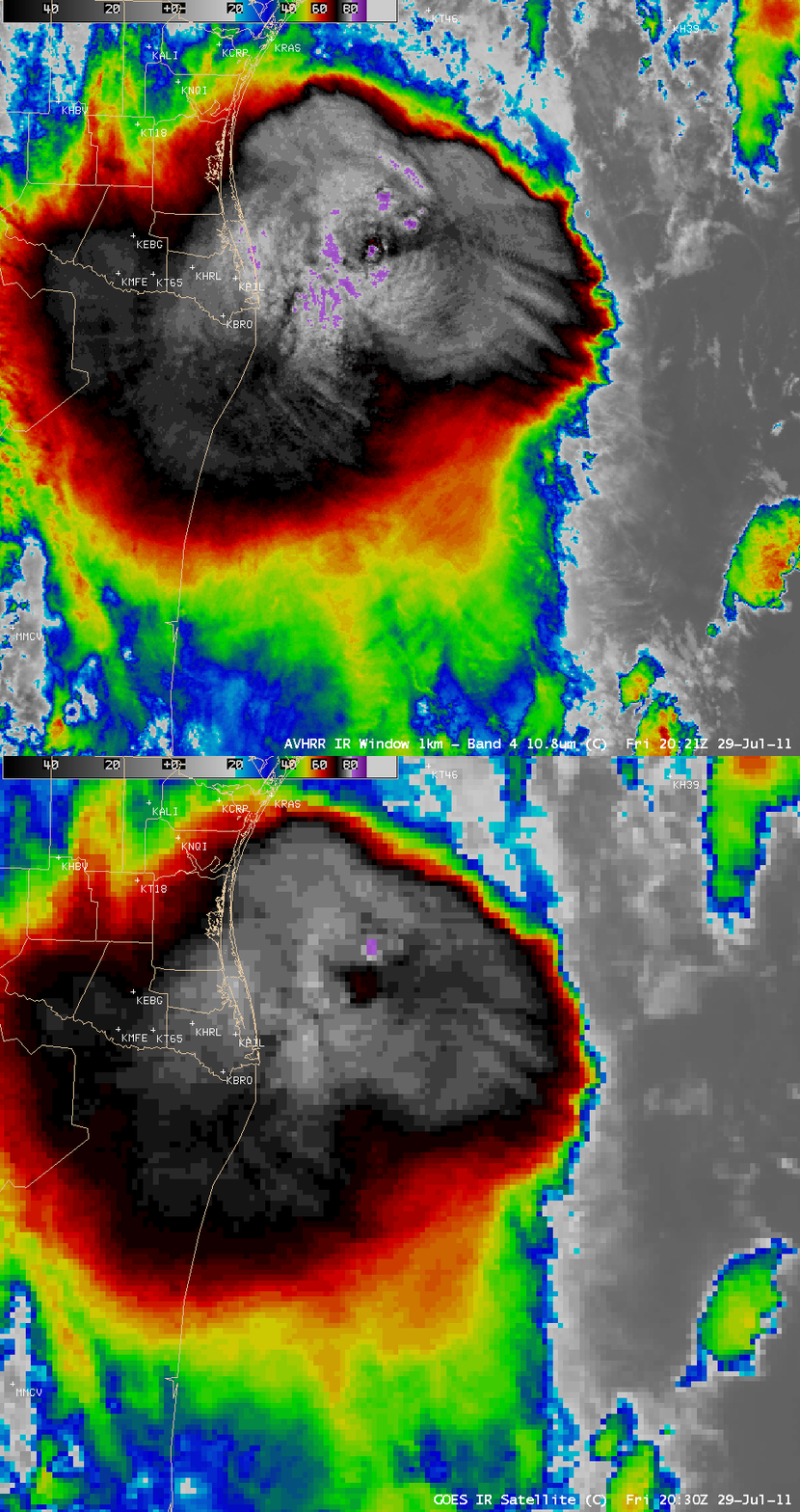
A sequence of three AWIPS images of 1-km resolution MODIS and POES AVHRR IR data (below) displayed intricate cloud top structures and very cold cloud top IR brightness temperatures — as cold as -90ºC (darker violet color enhancement) on the 14:23 UTC MODIS image and the 20:21 UTC POES AVHRR image.
For the three individual 1-km resolution MODIS and POES AVHRR IR images above, comparisons with the corresponding 4-km resolution GOES-13 IR images are shown below. There are slight time differences between the MODIS/AVHRR IR and the GOES-13 IR images — but the majority of the northwestward shift in the location of features on the GOES images is due to parallax.
Even though the spatial resolution of the IR channels on the ABI instrument on GOES-R will be 2-km, these 1-km resolution comparisons still serve to demonstrate that improved spatial resolution should allow better detection of such detailed cloud top structures and cold cloud top IR brightness temperatures associated with tropical cyclones.


