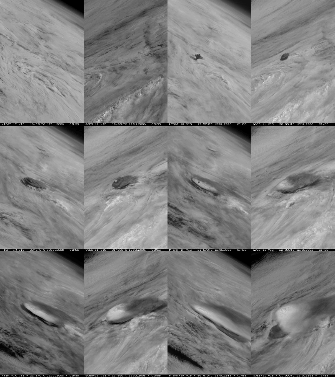
Volcanic plume from Okmok moves over the Pacific Northwest
On the morning of 17 July 2008, we received the following email from Ron Miller at the National Weather Service forecast office in Spokane, Washington:
Can you tell me what you think the “clouds” are over the PacNW this morning. You can only see them on the first few visible images of the morning. Looking out out window we can’t detect them. Given the flow pattern over the past 24-48 hours, I have a hard time believing that it’s wildfire smoke from CA. One possibility is Volcanic Ash from Okmok, since after it’s eruption, the ash cloud drifted southeast and essentially hung out in the Gulf of AK trough. Any ideas?
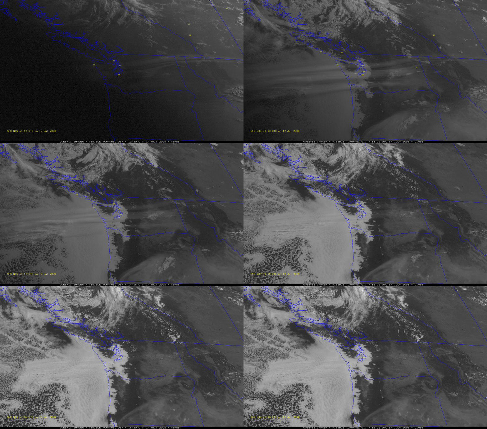
Excellent question, Ron — thanks for bringing this case to our attention! As it turns out, the Okmok volcano erupted in the Aleutian Islands on 12 July, as can be seen in a comparison of visible images from the MTSAT-1R and GOES-11 satellites (above | QuickTime animation; see also: Google Earth AVHRR false color image | VISIT Meteorological Interpretation Blog | GOES-11 visible Java animation) — and 5 days later, GOES-11 (GOES-West) visible imagery (below) did indeed reveal a portion of the volcanic plume (actually, three separate thin plumes) drifting eastward over the Pacific Northwest region early in the day on 17 July. The thin volcanic plumes seen on the GOES visible imagery — which were likely composed primarily of ice crystals and sulfur dioxide (SO2) — were high-altitude features (verified to exist at an altitude around 11-12 km by CALIPSO), so they showed up on the visible imagery before the lower-altitude smoke (from to wildfires that had been burning in northern California) which became illuminated by the rising sun a bit later in time. Forward scattering was more favorable at the times of the earlier visible images, enhancing the appearance of the volcanic plume features — then, as the sun angle increased into the mid-morning hours, the thin volcanic plumes became less apparent on the visible imagery (but the thick low-level smoke drifting northeastward across Oregon continued to remain obvious).
The corresponding GOES-11 10.7-12.0 µm “split window IR difference” product did not show a clear signal of volcanic ash content in the plume (nor was there an obvious plume signal in either the GOES-11 10.7 µm IR window, 3.9 µm shortwave IR, or 6.5 µm water vapor imagery). However, an Aqua MODIS IR difference image (below) did show the signature of an SO2-rich plume (darker blue colors) stretching east-northeastward across the Pacific Ocean and reaching western Washington and Oregon around 11:00 UTC (5am local time). The daily evolution of the SO2 plume can also be seen in an animation of Ozone Measuring Instrument (OMI) images. Compare the 3-plume structure seen on the MODIS IR difference image with the similar plume structure seen on an AIRS brightness temperature difference image.
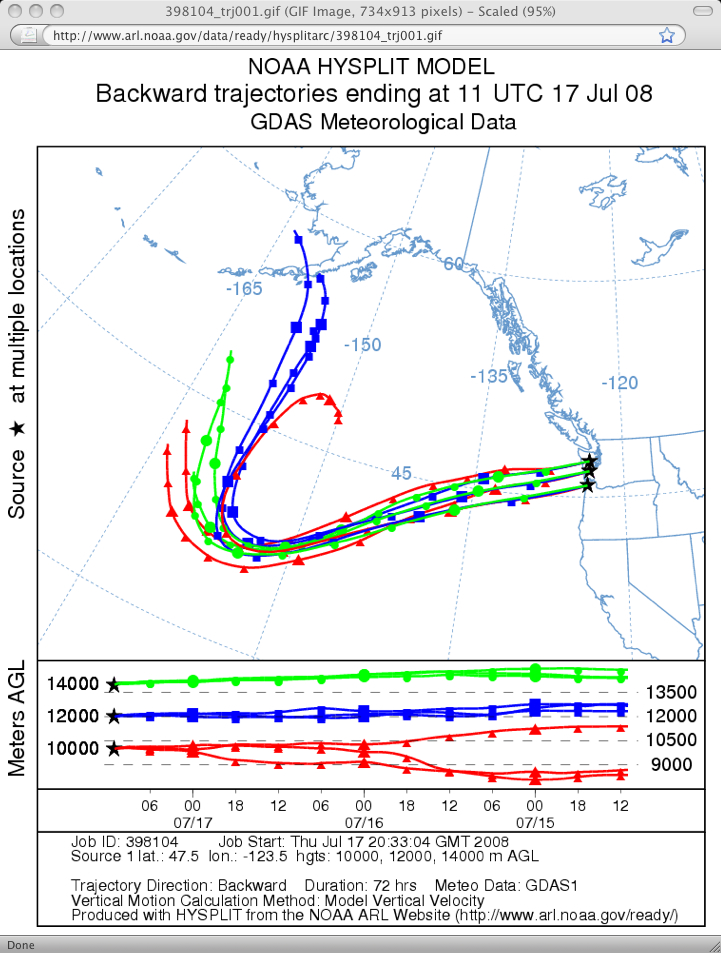
NOAA Air Resources Laboratory HYSPLIT model backward trajectories (below) indicated that high-altitude air parcels arriving over western Washington and far northwestern Oregon at 11:00 UTC on 17 July had likely been transported southward, then east-northeastward across the Pacific Ocean during the previous 72-hour period.
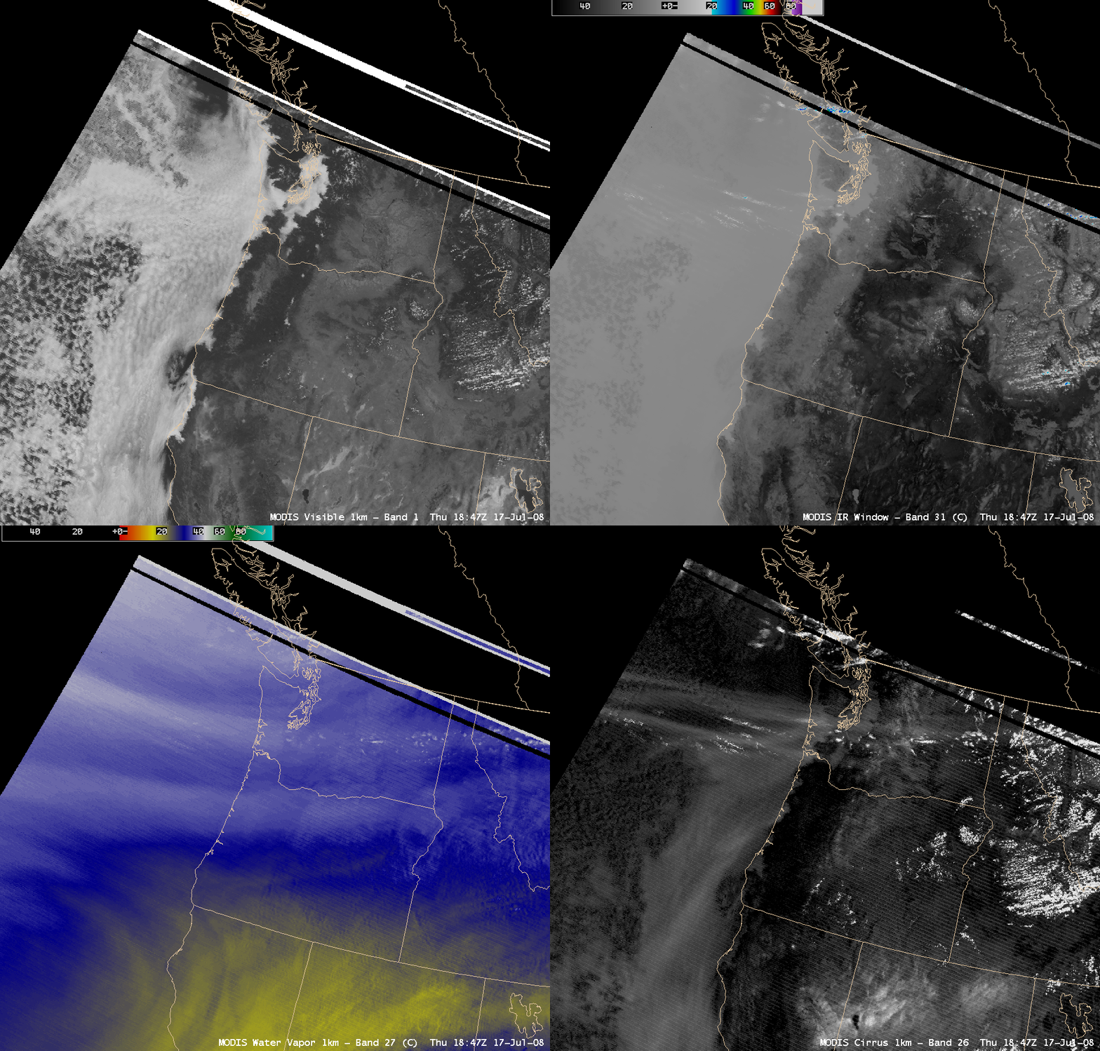
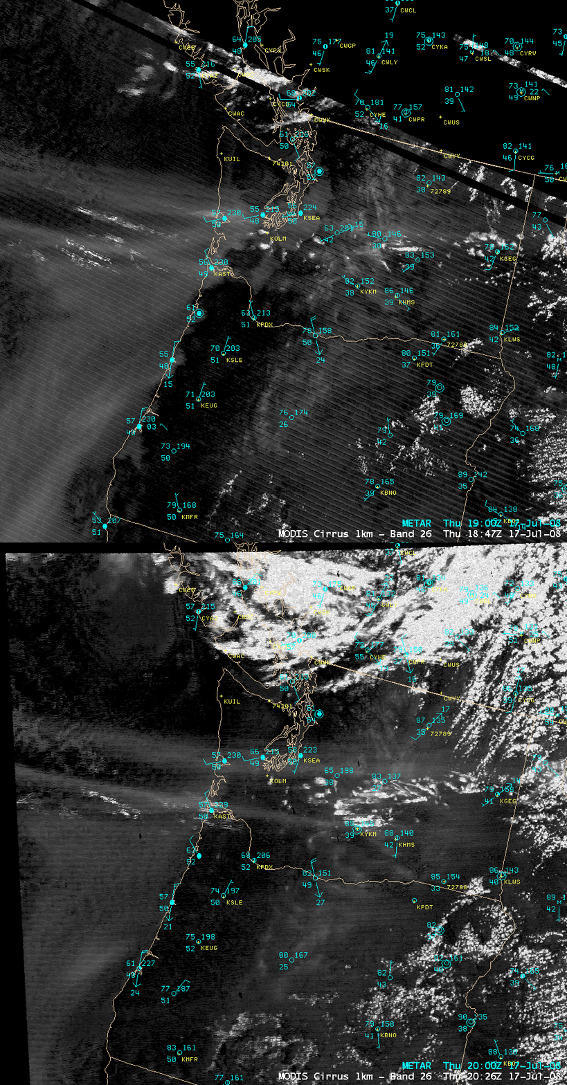
A comparison of AWIPS images of the MODIS visible, IR window, water vapor, and cirrus detection channels from 18:47 UTC (11:47 am local time) on 17 July (below) show that there was no obvious volcanic plume signature on either the visible or IR images at that time. However, a brighter “plume signal” did show up in the cirrus detection channel image (which seems to correspond roughly to the northernmost of two moist plumes on the water vapor image).
The MODIS cirrus detection channel is a daytime-only “near-IR” channel (centered at 1.6 µm) which is sensitive to particles that are efficient scatterers of light (such as ice crystals, volcanic ash particles, airborne dust or sand, etc). Two consecutive MODIS cirrus detection images from the Terra (18:47 UTC) and Aqua (20:26 UTC) satellites (below) both show evidence of a subtle volcanic plume signal (brighter white streaks), which appeared to be moving farther inland over the Pacific Northwest.
By the end of the day on 17 July, a favorable forward scattering angle (with the sun getting lower in the western sky) allowed the volcanic plume to again be seen on GOES visible channel imagery — but this time using the GOES-12 (GOES-East) satellite (QuickTime animation). The plume had moved eastward along the US/Canada border during the day, drifting across parts of northern North Dakota and even far northwestern Minnesota by sunset!
===== 18 July Update =====
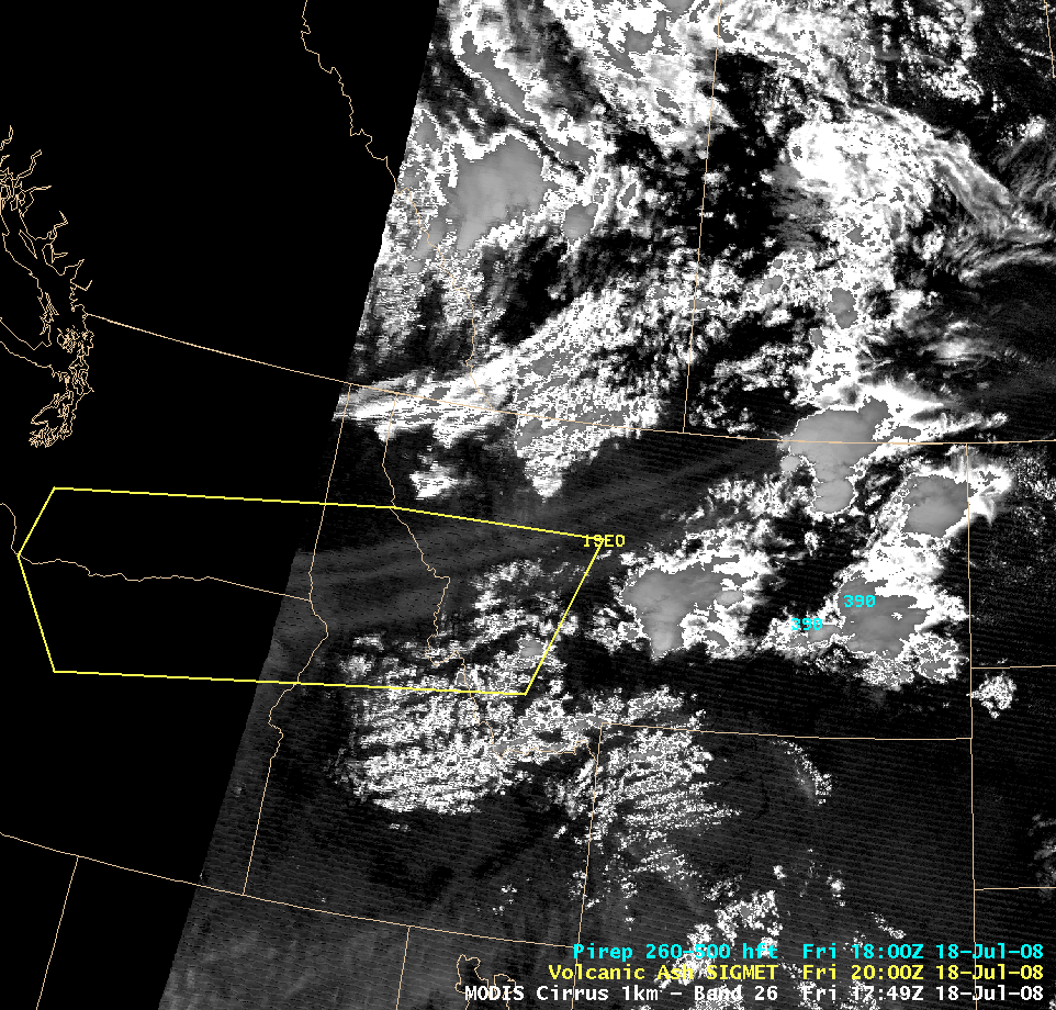
The volcanic plume was again evident on early morning GOES-11 visible imagery (Animated GIF), stretching from the Pacific Northwest states all the way to southern Manitoba and southern Ontario in Canada. During the afternoon and early evening hours, there were numerous pilot reports from aircraft encountering the plumes over northern Oregon, southwestern Washington, and other parts of the Pacific Northwest region, prompting the issuance of a Volcanic Ash SIGMET advisory.
A 17:49 UTC AWIPS image of the MODIS 1.3 µm near-IR “cirrus detection” channel (above) suggested that the Volcanic Ash SIGMET advisory could perhaps have been extended a bit farther northeastward across Montana — note the slightly brighter “streaky” volcanic plume signature heading northeastward across Idaho into Montana, beyond the eastern boundary of the SIGMET (outlined in yellow). In fact, the boundary of the Volcanic Ash SIGMET was indeed extended northeastward soon thereafter (Animated GIF).
Blog reader Tom Patton later sent us an email asking about some photos taken over western Montana around sunset on the evening of 18 July:
"...driving through the upper Deer Lodge Valley at about sunset. I recall coming over the divide into the southeast end of the valley, which offers a good westerly view of the mountains, and noticing what I considered to be a striking sunset. The "clouds" were almost iridescent in whites and blues. I think what I noticed most was the lack of red. The clouds were also unusually 'streaky'."
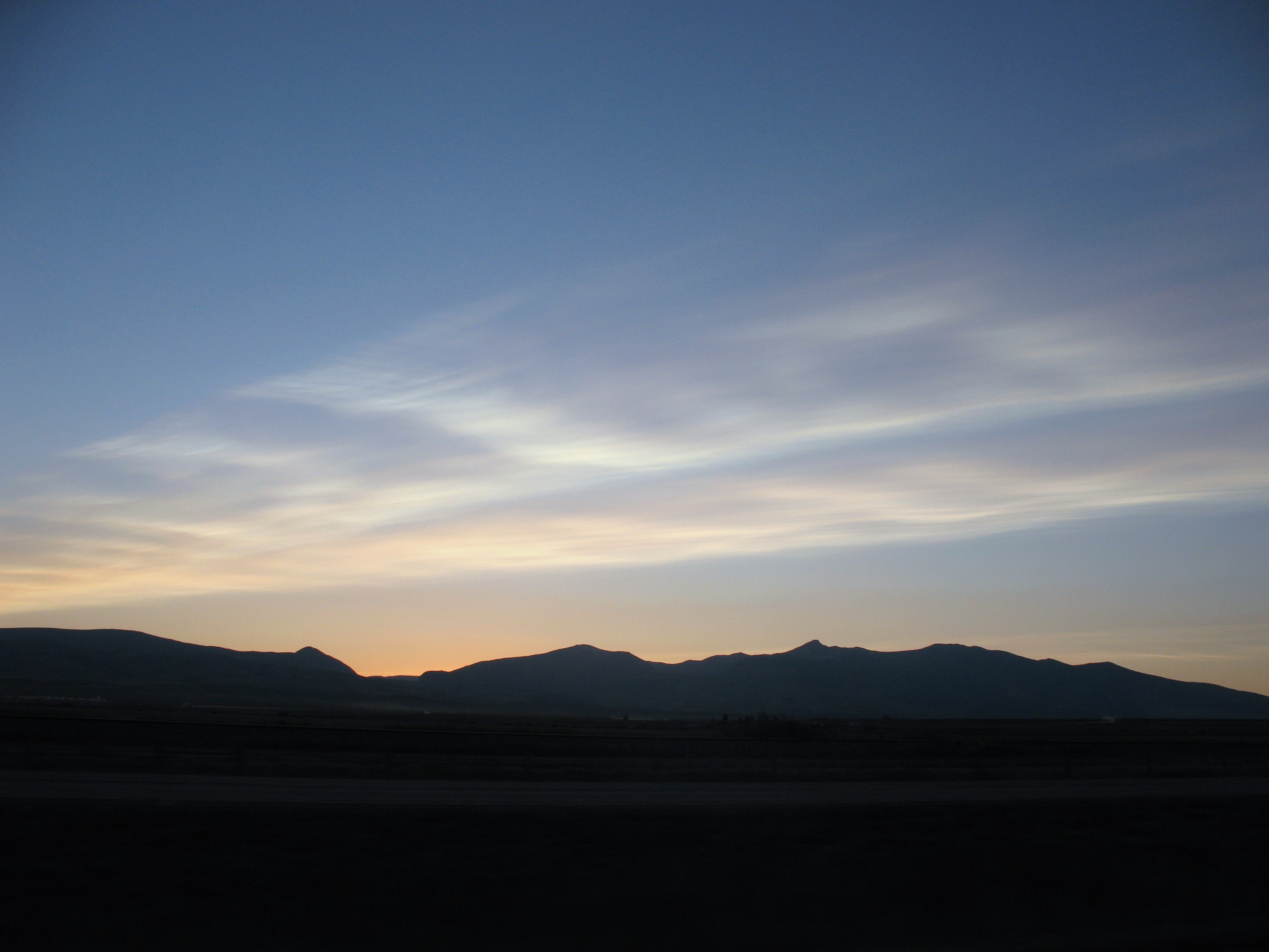
Volcanic clouds over western Montana on 18 July (photo by Margaret Patton, Research Office, Montana Tech of The University of Montana)
So are the “clouds” seen in the photo above simply cirrus clouds, or are they volcanic clouds from the Okmok eruption? If we examine the GOES-12 10.7 µm IR images for the few hours leading up to the time that the photo was taken, we see that there is no obvious signal of “meteorological clouds” (such as thick cirrus) evident on the IR imagery over western Montana or to the west over Idaho. However, the thin volcanic plumes really jump out on GOES-12 visible images, with a favorable “forward scattering angle” late in the day. At first glance, the GOES-12 water vapor images suggest that the volcanic plumes may have been embedded in a much broader “moisture plume” — however, the volcanic clouds were likely at an altitude above which was being sampled by the GOES-12 water vapor channel (which is generally the 300-700 hPa layer, or altitudes between 10,000 and 30,000 feet).
There were also photos of the volcanic clouds taken by aircraft pilots over Billings, Montana the following evening (photo 1 | photo 2 | photo 3).


