Earl approaches the East Coast of the United States

Morphed Microwave Imagery
Morphed Microwave Imagery (MIMIC), above, shows the evolution of the structure of Earl’s eye over the past 48 hours as Earl has strengthened from a Category 3 storm back to Category 4.

POES AVHRR 0.63 µm visible and 10.8 µm IR images
An AWIPS view of NOAA-16 AVHRR imagery (0.63 and 10.8 micron data, including ocean buoy reports) from just past 1200 UTC on 2 September, above, shows a well-defined eye nearly surrounded by convective clusters with temperatures near -75 C.
The northwestward motion of Hurricane Earl could be seen in a sequence of AWIPS images of POES AVHRR 10.8 µm IR and MODIS 11.0 µm IR data (below).

POES AVHRR 10.8 µm IR and MODIS 11.0 µm IR images
The visible imagery loop from this morning (below; also available as a QuickTime movie) from GOES-15 shows a steady motion just west of north.

GOES-15 0.63 µm visible channel images
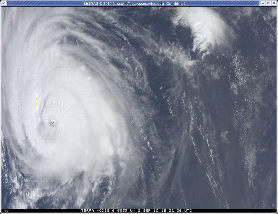
Click here for a true-color image of Earl derived from Terra MODIS data.