Fires in Oklahoma and Arkansas
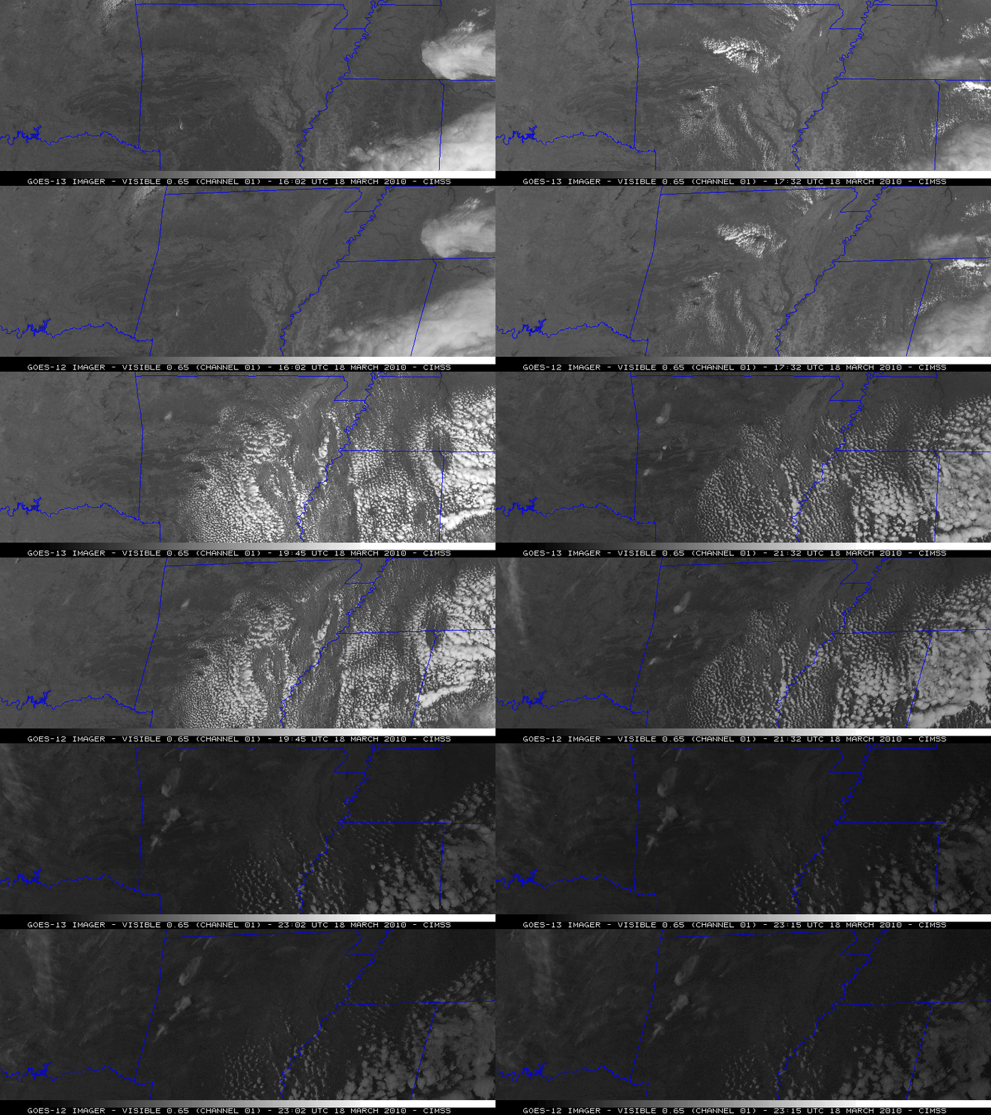
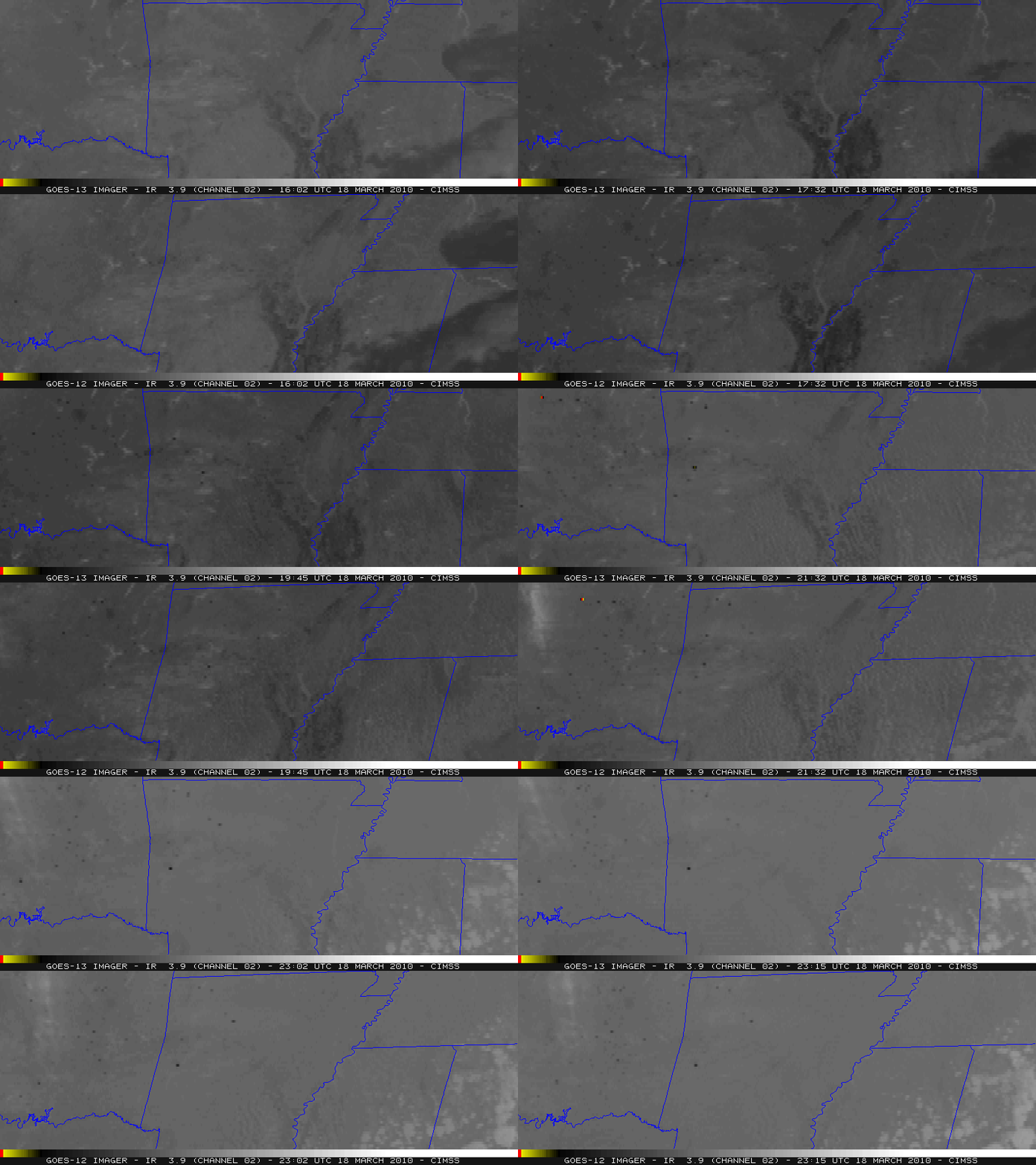
McIDAS images comparing 1-km resolution GOES-12 and GOES-13 0.65 µm visible channel data (above) revealed several smoke plumes over parts of eastern Oklahoma and western Arkansas, while the corresponding 4-km resolution GOES-12 and GOES-13 3.9 µm shortwave IR images (below) showed numerous “hot spots” (black to yellow to red pixels) due to widespread fire activity that had flared up across that region on 18 March 2010. Even though there were a number of smoke plumes seen in eastern Oklahoma, the most obvious smoke plumes (in term of size and brightness on the visible imagery) were apparent in northwestern Arkansas.
.
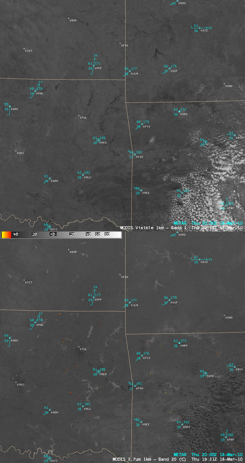
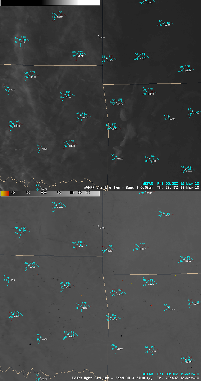
AWIPS comparisons of the 1-km resolution MODIS visible and 3.7 µm shortwave IR images at 19:31 UTC (above) and the 1-km resolution AVHRR visible and 3.7 µm shortwave IR images several hours later at 23:43 UTC (below) showed that many more fire hot spots could be detected with the use of higher spatial resolution shortwave IR images (GOES vs MODIS at 19:31 UTC | GOES vs AVHRR at 23:43 UTC). The spatial resolution of the shortwave IR channels on the ABI instrument of GOES-R satellite will be 2 km, which will be an improvement over the 4 km resolution on the current GOES satellites.
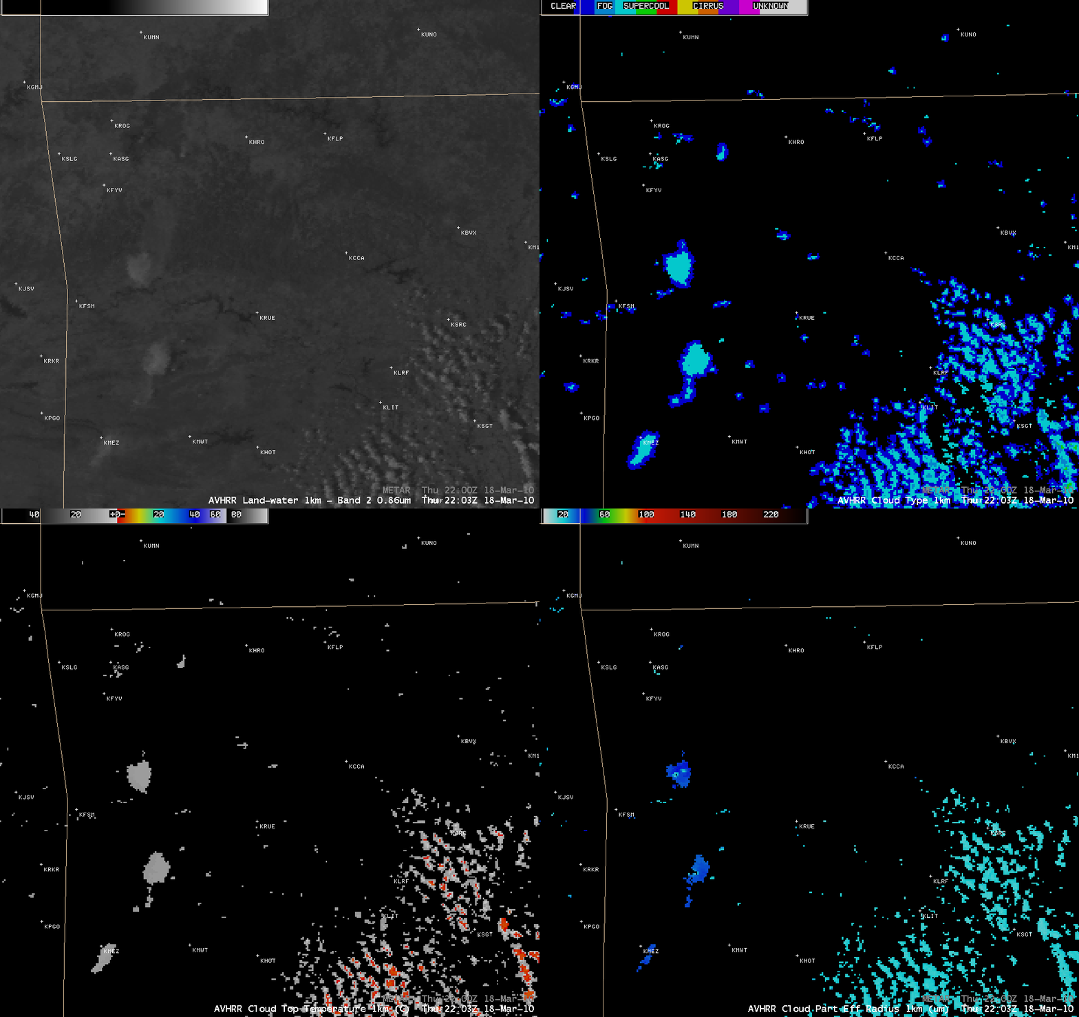
A closer view over northwestern Arkansas using the AVHRR visible channel, Cloud Type Product, Cloud Top Temperature, and Cloud Particle Effective Radius products at 22:03 UTC (below) showed the following: (1) the 3 large smoke plumes over northwestern Arkansas as well as the smaller cumulus clouds off the the east were composed primarily of water droplets (cyan color enhancement); (2) the Cloud Top Temperature values of the large smoke plumes were quite warm (+10 to +12º C, gray color enhancement), while some of the smaller cumulus clouds off to the east were beginning to exhibit CTT values several degrees below freezing (red to orange color enhancement); (3) the Cloud Particle Effective Radius values in the smoke plumes were significantly larger (30-40 µm, darker blue color enhancement) than those of the cumulus clouds off to the east (15-20 µm, cyan color enhancement).


