Why 1-minute satellite data matters: Monitoring Fires
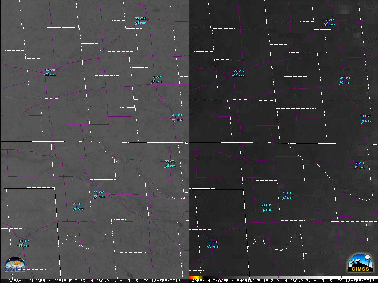
![GOES-14 0.63 µm Visible (top) and 3.9 µm Shortwave Infrared (bottom) images [click to play MP4 animation]](https://cimss.ssec.wisc.edu/satellite-blog/wp-content/uploads/sites/5/2016/02/480x1280_AGOES14_B12_GOES14_VIS_SWIR_OK_AR_FIRE_18FEB_2016049_225800_0002PANELS.GIF)
GOES-14 0.63 µm Visible (top) and 3.9 µm Shortwave Infrared (bottom) images [click to play MP4 animation]
![GOES-14 0.63 µm Visible (left) and 3.9 µm Shortwave Infrared (right) images [click to play MP4 animation]](https://cimss.ssec.wisc.edu/satellite-blog/wp-content/uploads/sites/5/2016/02/960x640_AGOES14_B12_GOES14_VIS_SWIR_OK_FIRE_ZOOM_18FEB_2016049_230500_0002PANELS.GIF)
GOES-14 0.63 µm Visible (left) and 3.9 µm Shortwave Infrared (right) images [click to play MP4 animation]
The two plots below show GOES-14 pixel values of 3.9 µm IR brightness temperature at the initial Buffalo fire site (top plot, at 36:51º N, 99:48º W) and at a site just to the northeast (bottom plot, at 36:54º N, 99:43º W) through which the moving fire propagated. The blue line shows every value, nominally at 1-minute intervals. The red dots show points sampled every five minutes. Very small temporal scale changes in the fire cannot be captured with a 5-minute sampling interval.
GOES-14 Shortwave Infrared (3.9 µm) Brightness Temperatures at 36:51:36º N, 99:48:27º W, 2040-2230 UTC on 18 February 2016 [click to enlarge]
GOES-14 Shortwave Infrared (3.9 µm) Brightness Temperatures at 36:54:44º N, 99:43:22º W, 2115-2200 UTC on 18 February 2016 [click to enlarge]
![GOES-15 (left), GOES-14 (center), and GOES-13 (right) 3.9 µm Shortwave Infrared images covering the initial period 2030-2100 UTC [click to play animation]](https://cimss.ssec.wisc.edu/satellite-blog/wp-content/uploads/sites/5/2016/02/160218_goes15_goes14_goes13_shortwave_ir_Buffalo_OK_fire_initial_30_minutes_anim.gif)
GOES-15 (left), GOES-14 (center), and GOES-13 (right) 3.9 µm Shortwave Infrared images covering the initial period 2030-2100 UTC [click to play animation]
A faster animation covering a longer 2.5-hour period from 2030-2300 UTC is shown below. Again, a true sense of the fast northeastward speed of fire propagation could only be gained using 1-minute imagery.
![GOES-15 (left), GOES-14 (center), and GOES-13 (right) 3.9 µm Shortwave Infrared images covering the 2.5-hour period 2030-2300 UTC [click to play animation]](https://cimss.ssec.wisc.edu/satellite-blog/wp-content/uploads/sites/5/2016/02/160218_goes15_goes14_goes13_shortwave_ir_Buffalo_OK_fire_anim.gif)
GOES-15 (left), GOES-14 (center), and GOES-13 (right) 3.9 µm Shortwave Infrared images covering the 2.5 hour period 2030-2300 UTC [click to play animation]
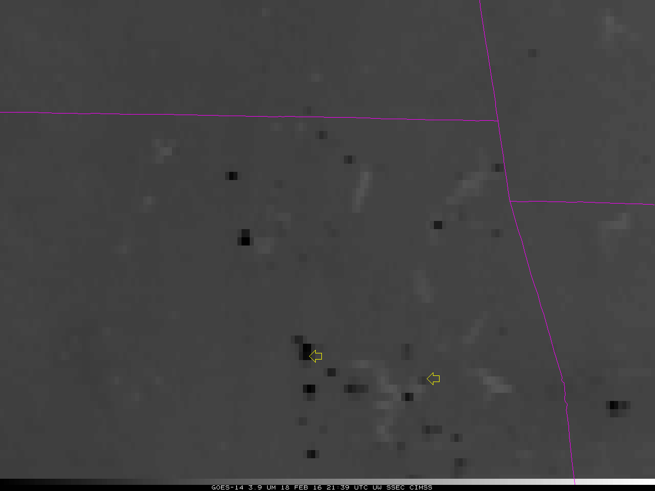
![GOES-14 Shortwave Infrared (3.9 µm) images [click to play animation]](https://cimss.ssec.wisc.edu/satellite-blog/wp-content/uploads/sites/5/2016/02/GOES14_FIRE_18FEB_2016_2139_2301anim.gif)
GOES-14 Shortwave Infrared (3.9 µm) 9mages [click to play animation]
![GOES-14 Shortwave Infrared (3.9 µm) Brightness Temperatures at, 2138-2301 UTC on 18 February 2016 at 35:31:17 N, 96:05:55 W [click to enlarge]](https://cimss.ssec.wisc.edu/satellite-blog/wp-content/uploads/sites/5/2016/02/1MinuteTrace_2_5MinuteDots_toggle.gif)
GOES-14 Shortwave Infrared (3.9 µm) Brightness Temperatures from 2138-2301 UTC on 18 February 2016, at 35:31:17º N, 96:05:55º W [click to enlarge]
![GOES-14 Shortwave Infrared (3.9 µm) Brightness Temperatures at, 2138-2301 UTC on 18 February 2016 at 35:23:51 N, 95:20:52 W [click to enlarge]](https://cimss.ssec.wisc.edu/satellite-blog/wp-content/uploads/sites/5/2016/02/1MinuteTrace_5MinuteDots_toggle.gif)
GOES-14 Shortwave Infrared (3.9 µm) Brightness Temperatures from 2138-2301 UTC on 18 February 2016, at 35:23:51º N, 95:20:52º W [click to enlarge]
===== 19 February Update =====
Seen below are RealEarth comparisons of Aqua MODIS and Suomi NPP VIIRS true-color Red/Green/Blue (RGB) images from the early afternoon of 18 February (before the Buffalo OK fire) and 19 February (after the Buffalo OK fire), which revealed the long southwest-to-northeast oriented burn scar. As seen on the GOES-14 animation above, the fire crossed US Highway 183 just to the north of Buffalo (that portion of the highway was closed for several hours).
![Aqua MODIS true-color images on 18 February and 19 February [click to enlarge]](https://cimss.ssec.wisc.edu/satellite-blog/wp-content/uploads/sites/5/2016/02/160218-19_modis_truecolor_OK_fire_burn_scar_anim.gif)
Aqua MODIS true-color images on 18 February and 19 February [click to enlarge]
![Suomi NPP VIIRS true-color images on 18 February and 19 February [click to enlarge]](https://cimss.ssec.wisc.edu/satellite-blog/wp-content/uploads/sites/5/2016/02/160218-19_viirs_truecolor_OK_fire_burn_scar_anim.gif)
Suomi NPP VIIRS true-color images on 18 February and 19 February [click to enlarge]
![Suomi NPP VIIRS true-color and false-color images [click to enlarge]](https://cimss.ssec.wisc.edu/satellite-blog/wp-content/uploads/sites/5/2016/02/160219_viirs_truecolor_falsecolor_OK_fire_burn_scar_anim.gif)
Suomi NPP VIIRS true-color and false-color images [click to enlarge]
===== 27 February Update =====
![Landsat-8 false-color RGB images on 18 February (a few hours prior to the start of the fire) and 27 February (several says after the fire) [click to enlarge]](https://cimss.ssec.wisc.edu/satellite-blog/wp-content/uploads/sites/5/2016/02/160218_160227_landsat8_falsecolor_Buffalo_OK_burn_scar_before_after_anim.gif)
Landsat-8 false-color RGB images on 18 February (a few hours prior to the start of the fire) and 27 February (several says after the fire) [click to enlarge]