In spite of a brief downgrade, Sandy maintains hurricane intensity
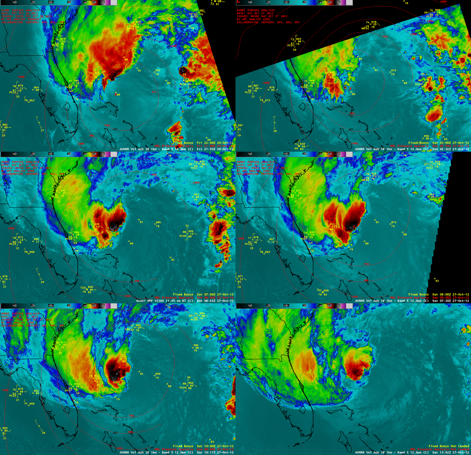
During the overnight hours after midnight on 27 October 2012, Sandy was briefly downgraded to a Tropical Storm by the National Hurricane Center (discussion archive). A sequence of AWIPS images of 1-km resolution POES AVHRR 12.0 µm, MODIS 11.0 µm, and Suomi NPP VIIRS 11.45 µm IR images (above) showed persistent pockets of deep convection north and west of the center of the tropical cyclone.
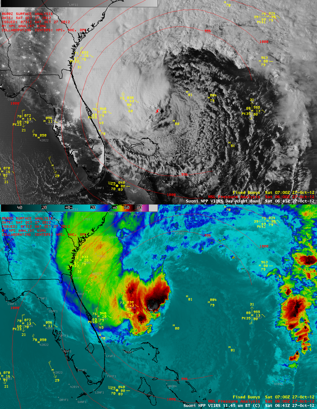
Since the Moon was in the waxing gibbous phase (at 97% of full moon phase), it provided ample illumination for a “night-time visible” image using the Suomi NPP Day/Night Band (DNB) at 06:43 UTC or 2:43 AM local time (below). A few overshooting top features could be seen in the DNB image, which corresponded with the areas of colder cloud top IR brightness temperatures seen on the VIIRS 11.45 µm IR image at that same time.
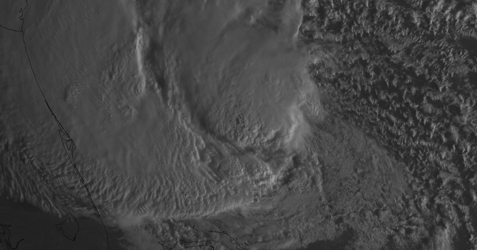
After sunrise, GOES-14 1-minute interval SRSOR visible channel data (below; click image to play HD format QuickTime movie) showed great details of the deep convective development north and west of the partially-exposed low-level circulation center.
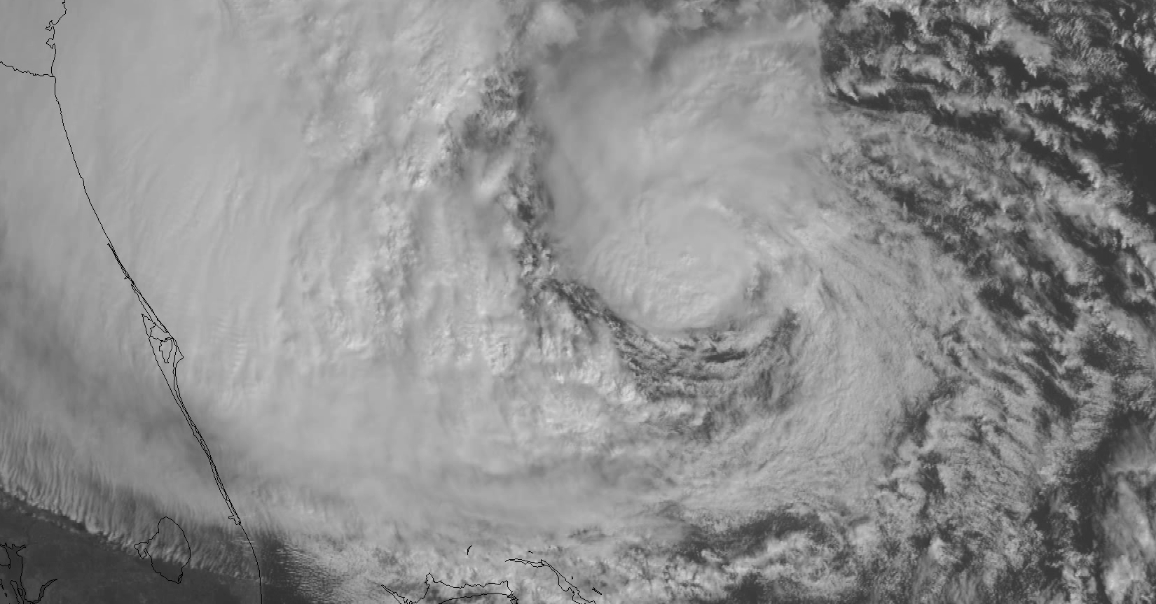
Additional GOES-14 SRSOR images during the afternoon hours (below; cick image to play HD format QuickTime movie) continued to show the development of convective bursts just north of the partialy-exposed low-level circulation center.
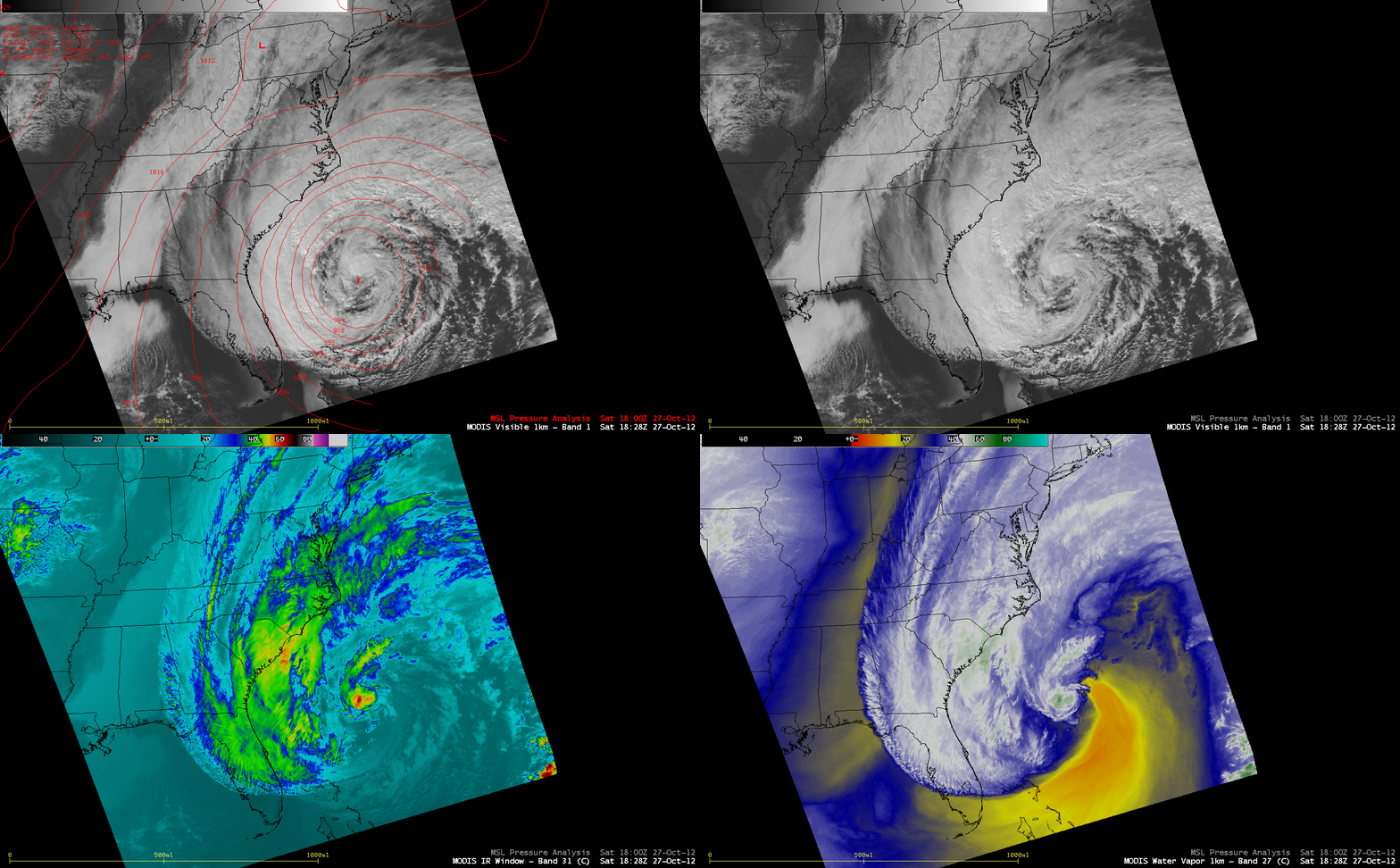
A larger-scale view using MODIS 0.65 µm visible, 11.0 µm IR, and 6.7 µm water vapor channel images (below) showed the very large size of the cloud field associated with Sandy (which had re-gained hurricane intensity by this time). Also evident on the MODIS water vapor channel image was the large intrusion of dry air wrapping around the southern and eastern quadrants of Sandy, hinting at the early stages of a transition from a tropical system to an extratropical system.
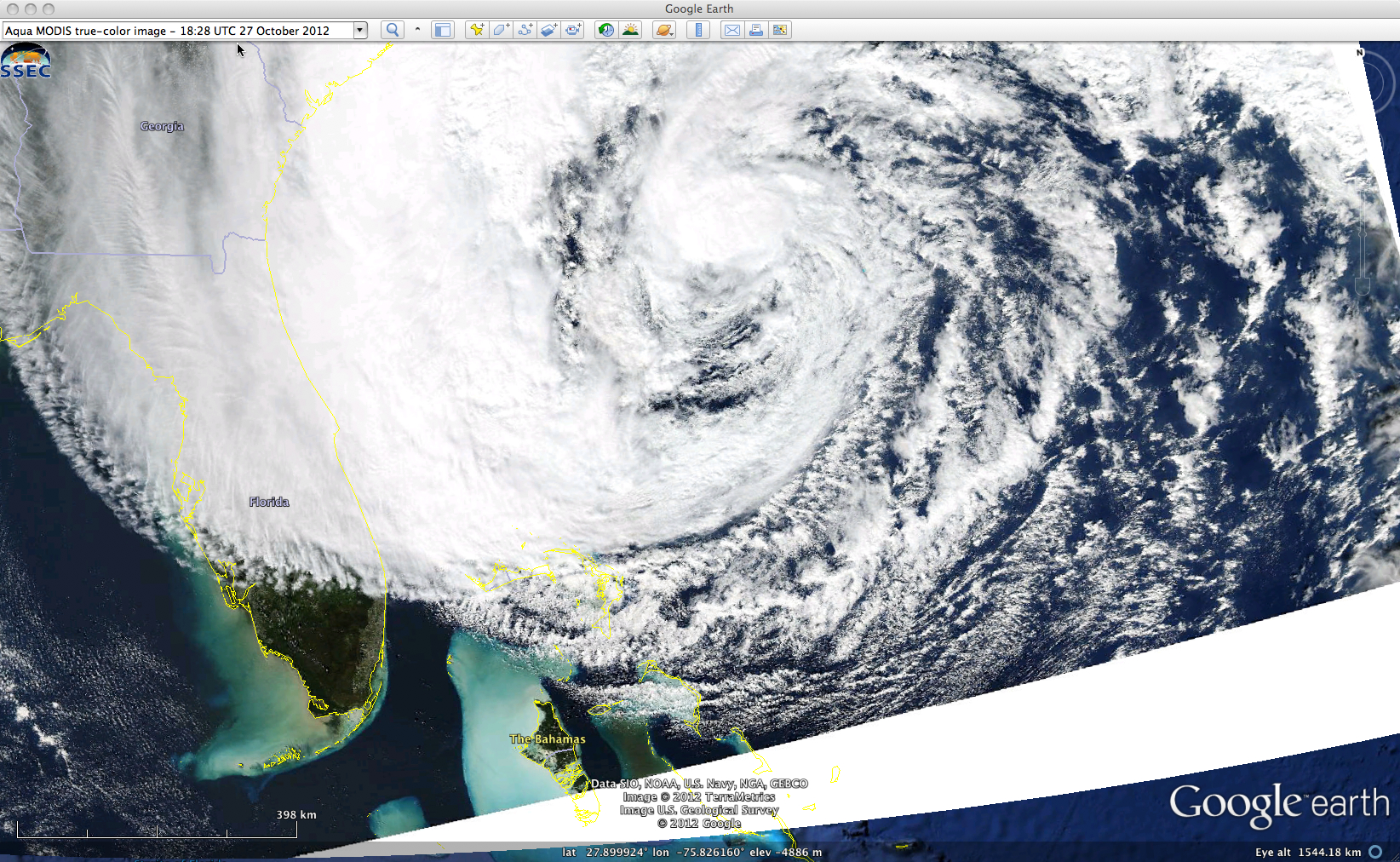
An Aqua MODIS true-color Red/Green/Blue (RGB) image from the SSEC MODIS Today site (below) revealed large areas of increased turbidity in the waters just west of Florida and the Bahamas, due to mixing from the strond winds associated with Hurricane Sandy.
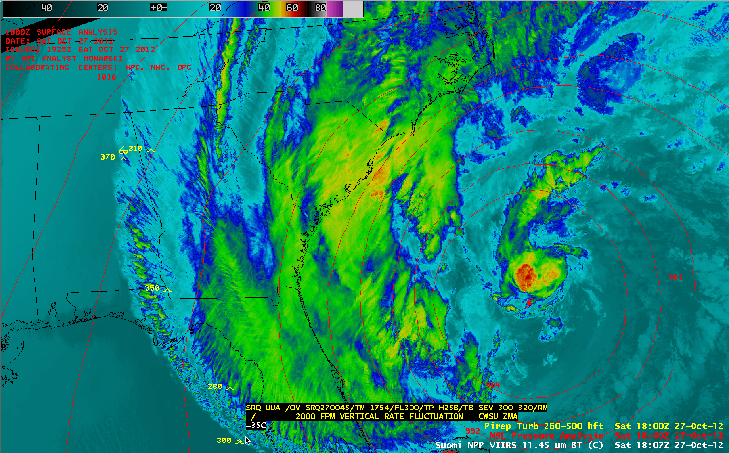
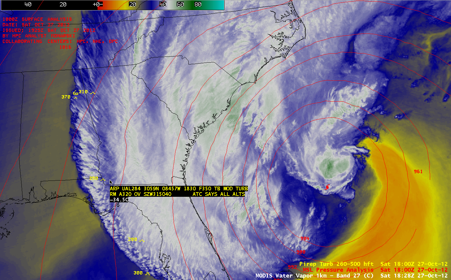
Finally, it was observed that there were a number of pilot reports of moderate to severe turbulence near the western periphery of the cloud shield of Sandy, where there were also hints of a transvese banding structure. Two notable pilot reports are displayed on Suomi NPP VIIRS 11.45 µm IR and MODIS 6.7 µm water vapor channel images (below).


