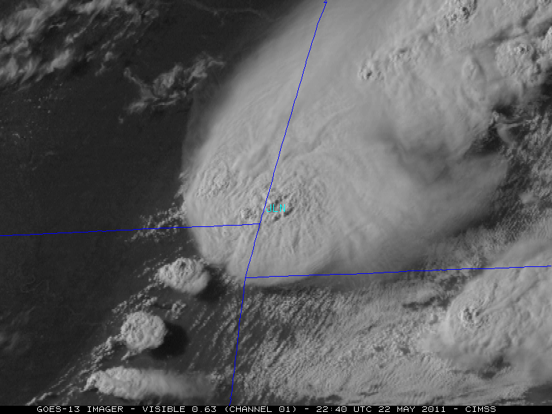
McIDAS images of GOES-13 Visible (0.63 µm) data (above) showed the rapid development of a supercell thunderstorm that produced the deadly tornado which struck Joplin, Missouri (station identifier JLN) on 22 May 2011. The GOES-13 satellite had been placed into Rapid Scan Operations... Read More
")
GOES-13 Visible (0.63 µm) images [click image to play animation]
McIDAS images of GOES-13 Visible (0.63 µm) data
(above) showed the rapid development of a supercell thunderstorm that produced the deadly tornado which struck Joplin, Missouri
(station identifier JLN) on
22 May 2011. The GOES-13 satellite had been placed into Rapid Scan Operations (RSO), providing images as frequently as every 5-10 minutes. Very distinct overshooting tops could be seen with this large thunderstorm as it developed in extreme southeastern Kansas and moved eastward ahead of an advancing cold frontal boundary. According to the
National Weather Service Springfield MO damage survey, the Joplin tornado produced EF-5 damage with a path width of 3/4 mile and a path length of 6 miles, and was responsible for 132 deaths and 750 injuries.
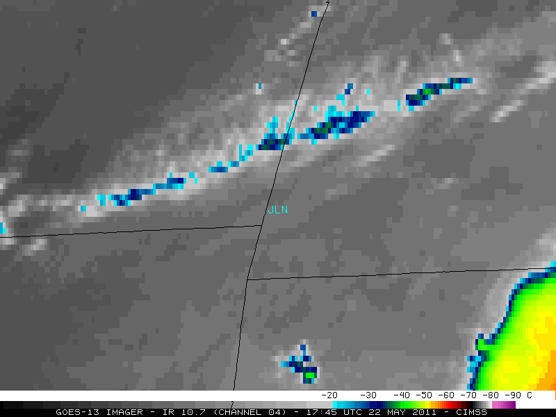
The corresponding GOES-13 Infrared (10.7 µm) images are shown below. The Joplin tornado began to move into the city around 22:41 UTC or 5:41 pm local time (Visible/Infrared image toggle).
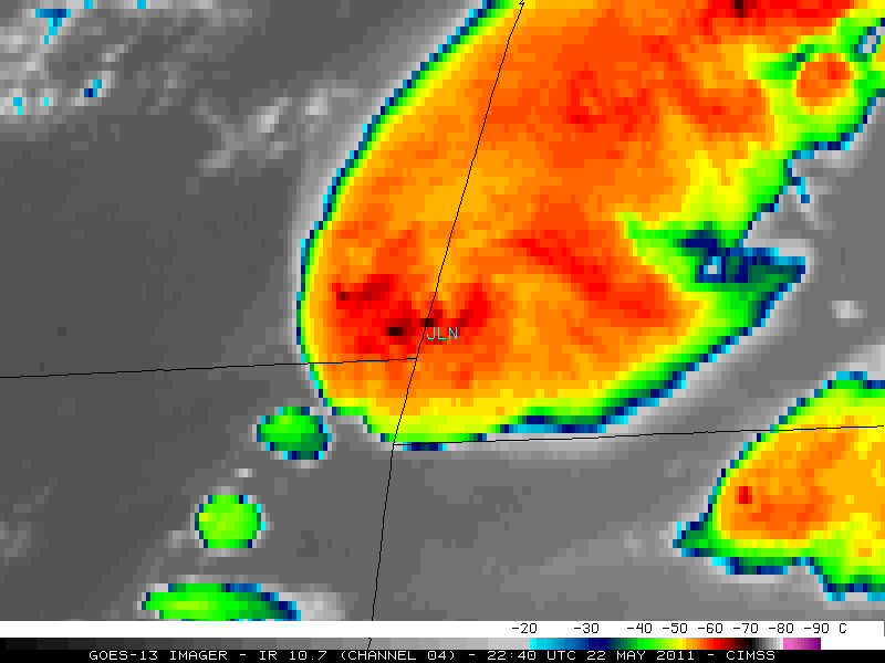
GOES-13 Infrared (10.7 µm) images [click to play animation]
A 250-meter resolution MODIS true color Red-Green-Blue (RGB) image from the
SSEC MODIS Today site
(below; displayed using Google Earth) showed the line of thunderstorms developing from western Missouri into extreme southeastern Kansas.
 image (displayed using Google Earth)")
MODIS true color Red/Green/Blue (RGB) image (displayed using Google Earth) [click to enlarge]
AWIPS images of GOES-13 Infrared (10.7 µm) data with overlays of the Automated Overshooting Tops Detection product (below) flagged a number of overshooting tops as the storm approached Joplin (KJLN).

GOES-13 10.7 µm IR images + CIMSS Automated Overshooting Top Detection product [click to enlarge]
A comparison of AWIPS images of the GOES-13 Infrared (10.7 µm) data at 21:25 UTC with overlays of the corresponding
Automated Thermal Couplet Detection product and the past hour of SPC storm reports
(below) revealed a strong thermal couplet of 12.7º C at that time
(about 1 hour and 16 minutes before the Joplin tornado) — note that the location of the thermal couplet indicator is
parallax-corrected, moving it just to the southeast of where the cold/warm thermal couplet is seen on the non-parallax-corrected GOES-13 Infrared image. This particular thermal couplet was associated with a west-to-east swath of hail as large as 1.75 inch in diameter that began in far southeastern Kansas at 21:02 UTC, along with a report of wind gusts to 62 mph.

GOES-13 IR image + Thermal Couplet product + SPC storm reports [click to enlarge]
The Overshooting Tops detection and Thermal Couplet detection products are collaborative efforts between researchers at the NASA Langley Research Center and CIMSS. The development, generation, and evaluation of these products are part of the
GOES-R Proving Ground effort; there are plans for these products to be operational with data from the ABI instrument on the upcoming GOES-R series.
View only this post
Read Less
")


")


")

 images")
