Stratospheric intrusion vortices over the Pacific Northwest
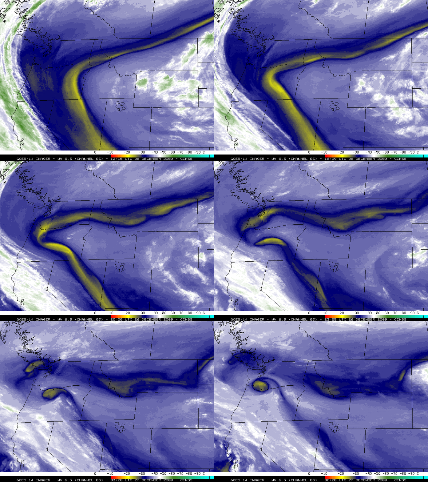
McIDAS images of the GOES-14 6.5 µm water vapor channel data (above; also available as a QuickTime animation) revealed that a pair of stratospheric intrusion vortices developed over the Pacific Northwest region of the US on 26 December – 27 December 2009. The spin-up of these vortices occurred within the pronounced dry band that had formed along the western periphery of the large central US Christmas Blizzard. As a part of its ongoing NOAA Science Test, the GOES-14 satellite had been placed into Rapid Scan Operations (RSO) mode, providing imagery as frequently as every 5 minutes.
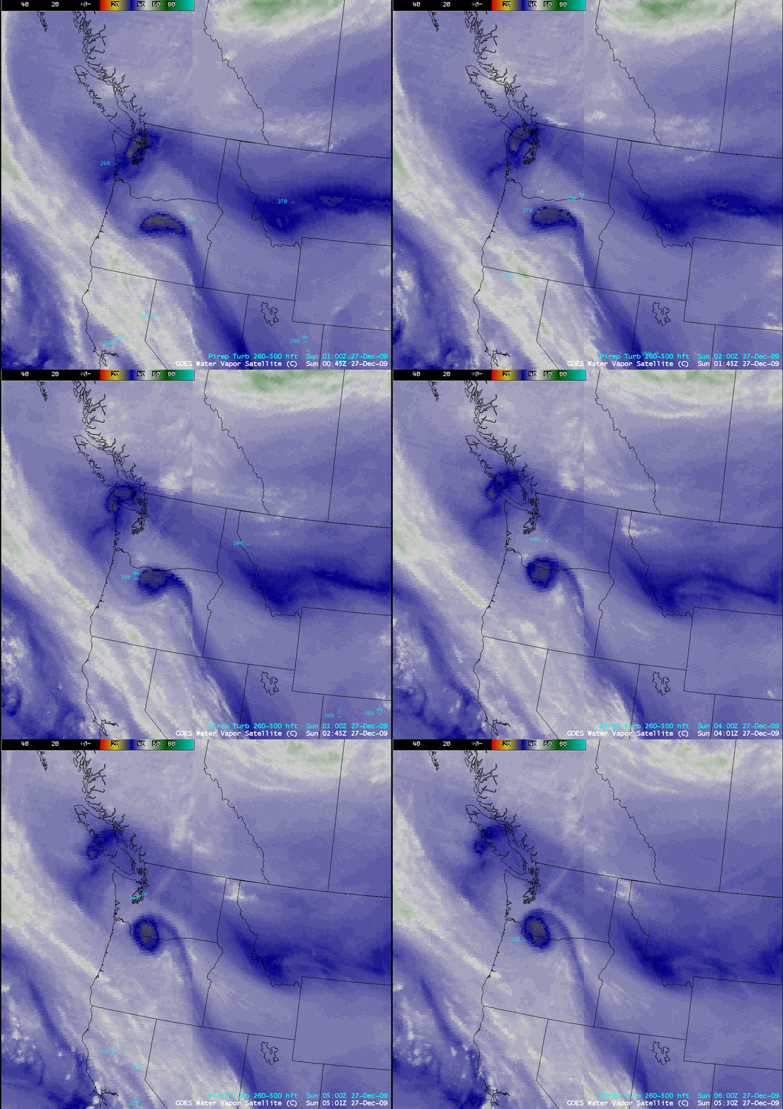
There have been cases where turbulence aloft has been associated with these types of stratospheric intrusion vortices — and in this instance, AWIPS images of the GOES-West/GOES-East composite water vapor channels with overlays of pilot reports (below) did indeed show a few reports of moderate turbulence between 26,000 feet and 40,000 feet above ground level in the vicinity of the vortices.
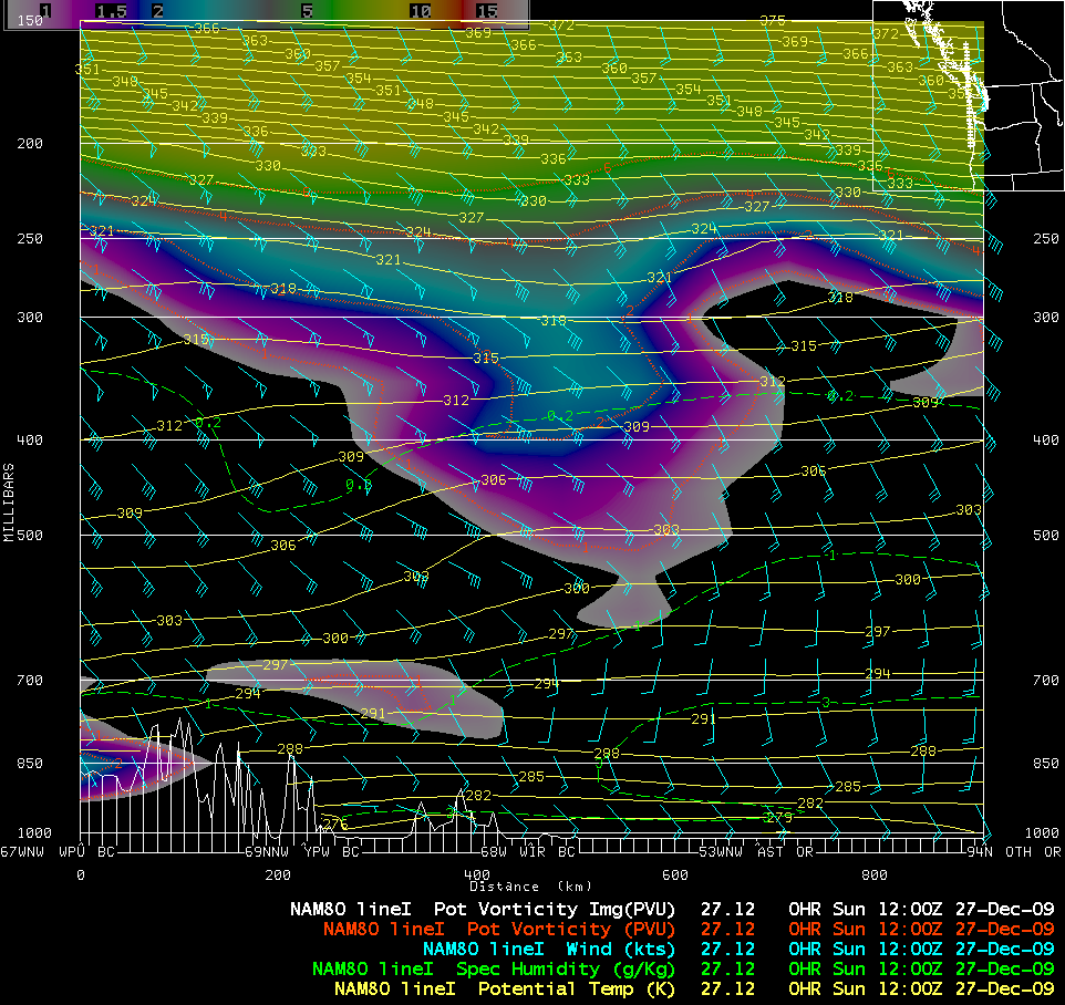
As the trailing vortex began to pass over Vancouver Island around 12 UTC on 27 December (water vapor image), a north-to-south oriented vertical cross section of NAM80 model fields (below) showed how the dynamic tropopause (taken to be the PV1.5 potential vorticity surface) was being pulled downward to around the 450 hPa pressure level. The GOES Sounder Total Column Ozone product also showed a slight increase in ozone values — to around 350 Dobson Units — associated with the stronger (trailing) stratospheric intrusion vortex.


