Drifting ice field in Green Bay
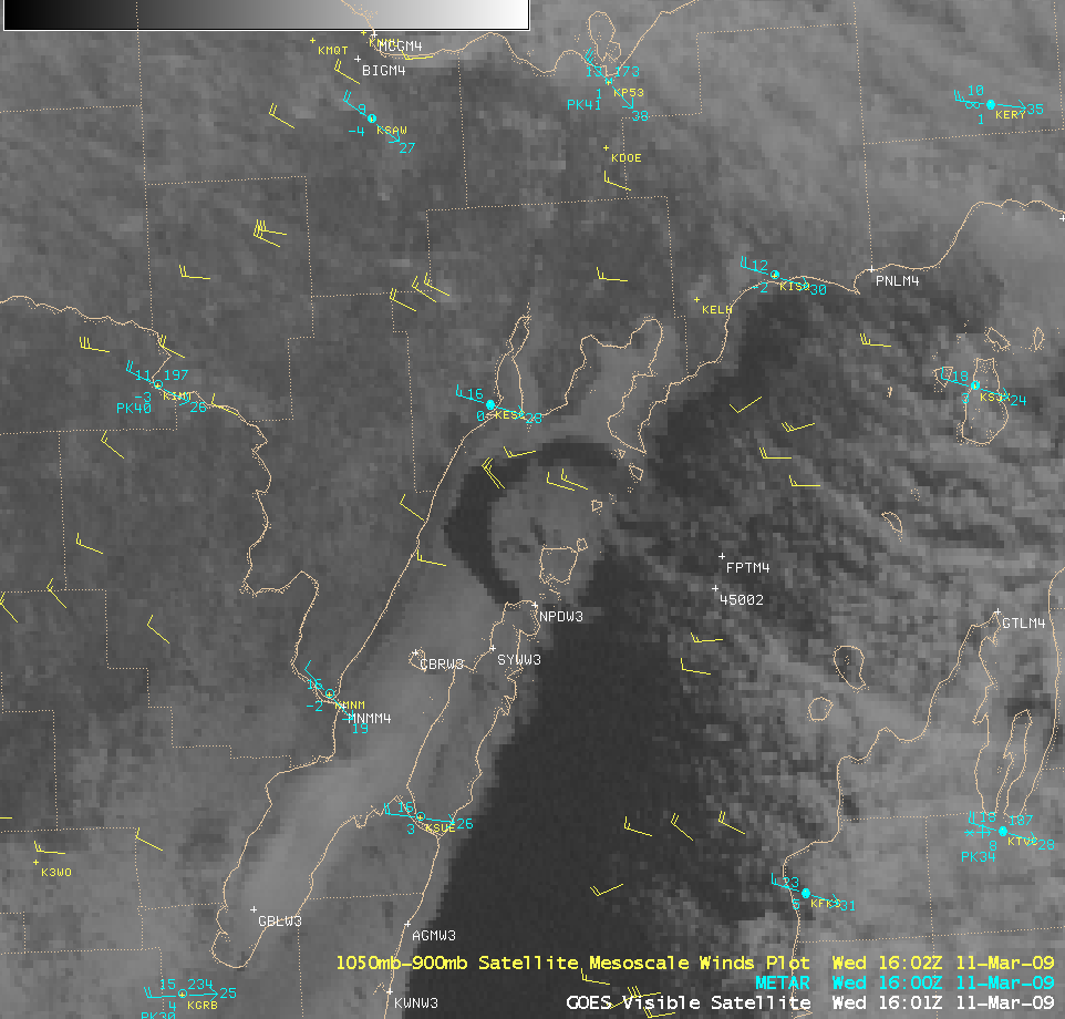
Strong northwesterly winds (gusting as high as 70 mph at Grand Marais in the Upper Peninsula of Michigan, and 57 mph at Washington Island in northeastern Wisconsin) caused a large portion of the land-fast ice in the far northern portion of Green Bay to break away and begin drifting eastward toward Lake Michigan on 11 March 2009. Once the clouds cleared over that region, GOES-13 visible images (above) showed the large ice feature as it moved slowly eastward.
According to the CIMSS Mesoscale Winds product (below), the speed of the ice field drift was in the 15-25 knot range. These wind vectors were generated by tracking targets on 3 consecutive GOES-12 visible images.
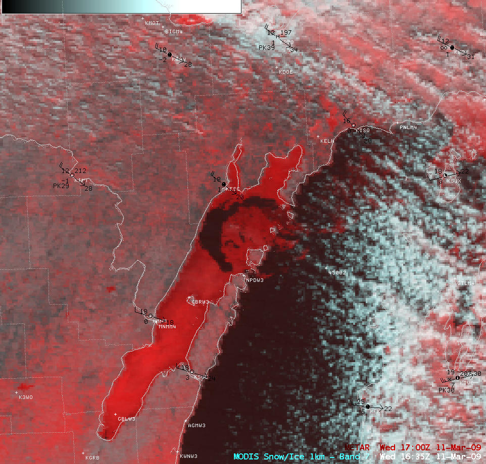
A false-color Red/Green/Blue (RGB) composite made using AWIPS images of the MODIS visible and the 2.1 µm “Snow/ice” channels (below) confirmed that this was indeed an ice feature — snow and ice are strong absorbers at the 2.1 µm wavelength, making snow cover (and especially ice features) exhibit a darker red appearance on the false-color imagery. In contrast, the supercooled water droplet clouds appear as cyan to brighter white colored features. The ability to create these types of RGB images should be a new feature available on future releases of AWIPS-2.
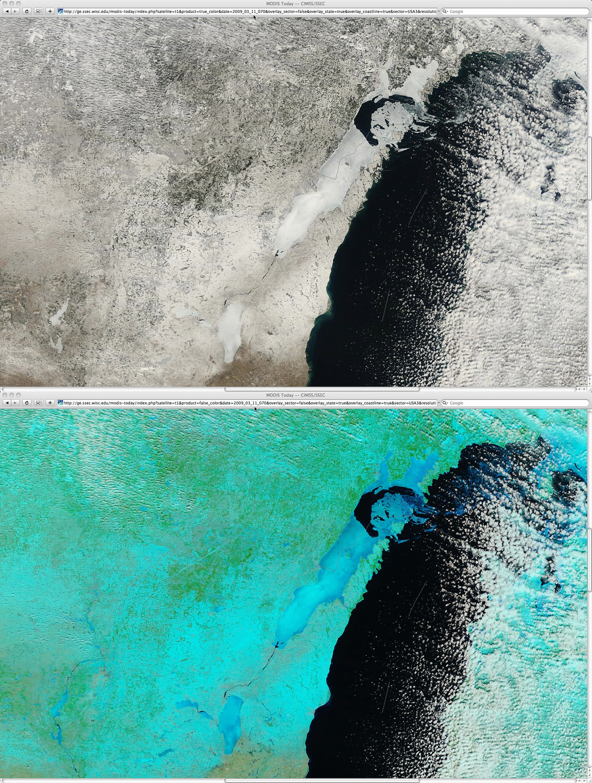
250-meter resolution “true color” and “false color” images from the SSEC MODIS Today site (below) showed better detail of the ice field structure. Also note the long, narrow southwest-to-northeast oriented tornado damage path (from the 07 June 2007 tornado event), located about 30 miles (48 km) inland to the west of Green Bay.


