Drifting ice in Green Bay
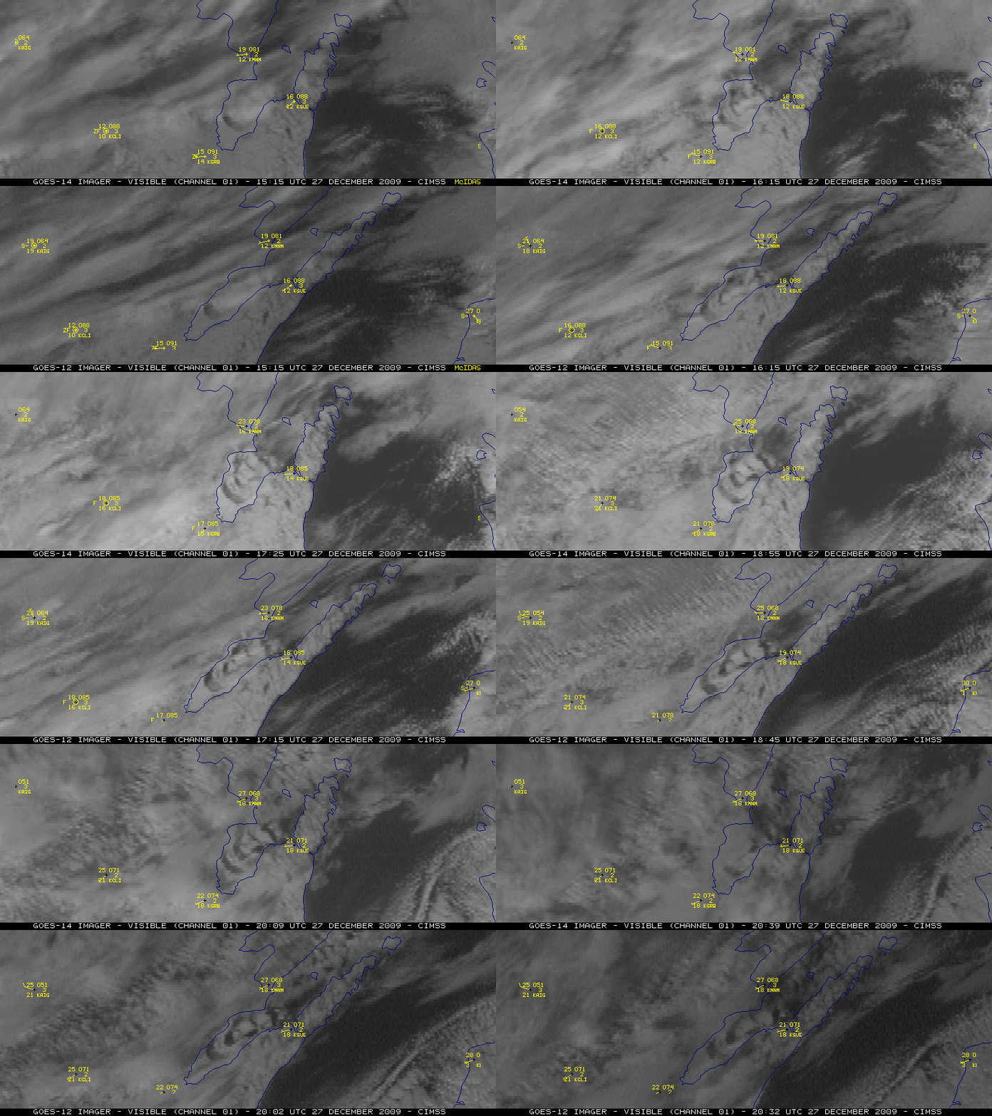
McIDAS images of GOES-14 and GOES-12 visible channel data (above) showed that a large portion of the land-fast ice in the southern half of Green Bay began to break away and drift slowly northeastward on 27 December 2009. Unlike a similar case seen on 11 March 2009 with strong surface winds, the southwesterly winds on this particular day were quite light (generally 10 knots or less at inland stations over northeastern Wisconsin) — however, winds were gusting to 13-18 knots farther to the northeast at coastal sites with an upwind exposure to the bay.
As part of its ongoing NOAA Science Test, the GOES-14 satellite had been placed into Rapid Scan Operations (RSO) mode, supplying imagery as frequently as every 5 minutes. The more frequent RSO imaging (along with the improved GOES-14 Image Navigation and Registration) allowed the motion of the drifting ice to be more accurately visualized compared to the 15-minute interval GOES-12 imagery with poorer image navigation.
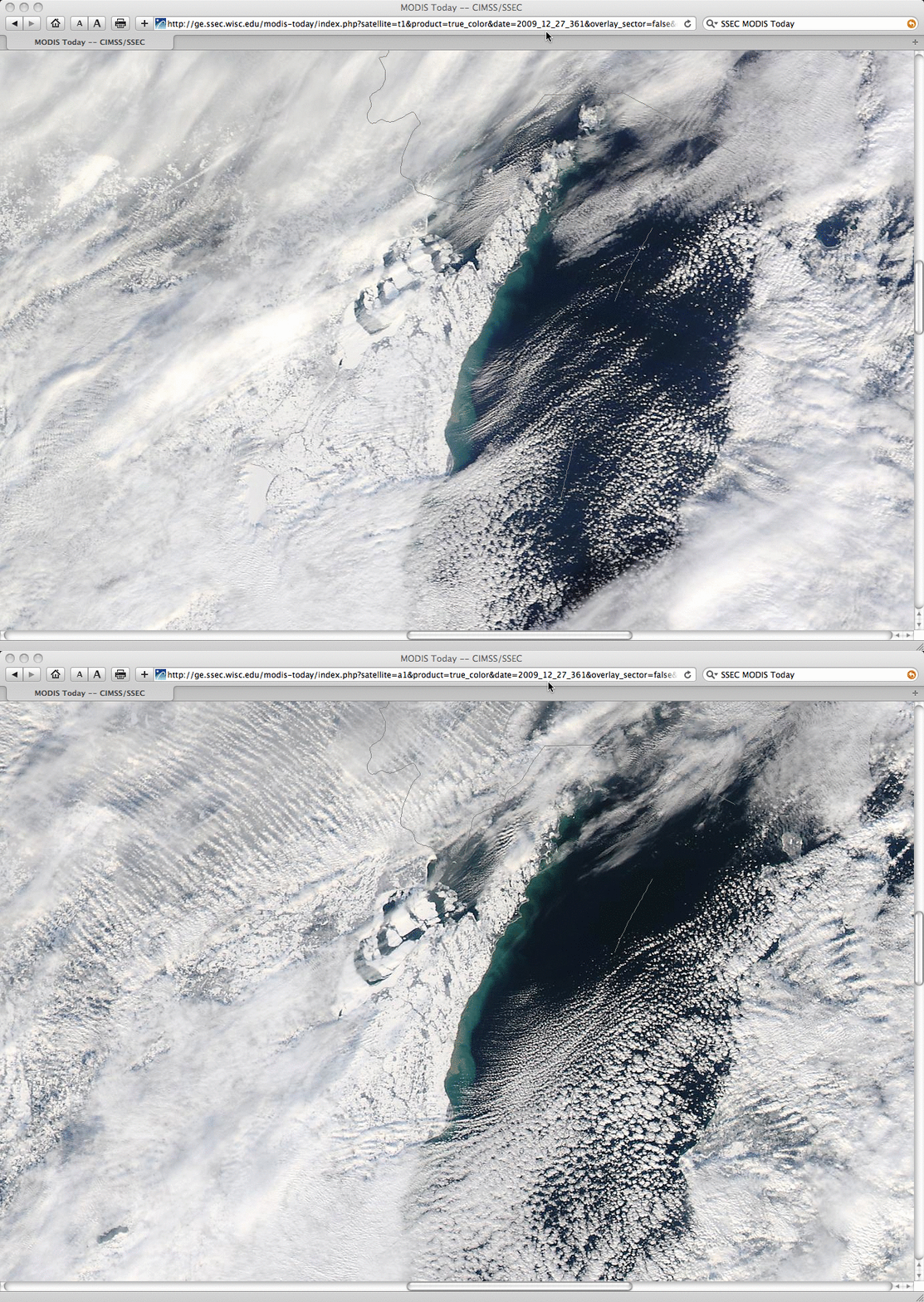
250-meter resolution MODIS true color images from the SSEC MODIS Today site (below) showed a more detailed view of the motion of the ice between the overpass of the Terra satellite at 17:10 UTC and the Aqua satellite at 18:55 UTC.


