This website works best with a newer web browser such as Chrome, Firefox, Safari or Microsoft Edge. Internet Explorer is not supported by this website.

Historic snowfall event in the Gulf Coast region

An historic snowfall event (SPC watches and warnings) impacted parts of the Gulf Coast region of the US on 04 December 2009 — this event produced the earliest snowfall on record at both Houston, Texas and Lake Charles, Louisiana, and total snowfall amounts were as high as 5.0 inches in Mississippi, 4.0 inches in Texas, and 3.0 inches... Read More

GOES-14 10.7 µm IR images

GOES-14 10.7 µm IR images

An historic snowfall event (SPC watches and warnings) impacted parts of the Gulf Coast region of the US on 04 December 2009 — this event produced the earliest snowfall on record at both Houston, Texas and Lake Charles, Louisiana, and total snowfall amounts were as high as 5.0 inches in Mississippi, 4.0 inches in Texas, and 3.0 inches in Louisiana. McIDAS images of the GOES-14 10.7 µm IR channel data (above) showed the development of the bands of elevated convection that produced the snowfall (the symbols of precipitation type are also plotted on the IR images).

AWIPS images of the GOES-12 10.7 µm IR channel data with overlays of surface METAR reports and cloud-to-ground lightning strikes (below) did indicate that there were a few lightning strikes early in the development of the bands of elevated convection over far southeast Texas (with a small number of strikes immediately offshore later in the morning), but as the snowfall event was unfolding farther north toward the Houston area there were no cloud-to-ground strikes seen. GOES-14 and GOES-12 IR cloud top brightness temperatures were in the -40 to -50º C range, which was near the tropopause on the Corpus Christi, Texas and Lake Charles, Louisiana rawinsonde data.

GOES-12 10.7 µm IR images + METARs + Cloud-to-Ground Lightning

GOES-12 10.7 µm IR images + METARs + Cloud-to-Ground Lightning

1-km resolution MODIS visible channel, 2.1 µm near-IR “snow/ice channel”, and 11.0 µm IR channel images (below) offered a view of the event at 16:58 UTC or 10:58 AM local time. Shadows from the tall convective elements could be seen on the visible image — and since the tops of the elevated convection were glaciated, they showed up as darker features on the snow/ice image. As was seen on the GOES-12 and GOES-14 IR images above, the IR cloud top brightness temperatures were in the -40 to -50º C range.

MODIS visible, 2,1 µm near-IR snow/ice, and 11.0 µm IR channel images

MODIS visible, 2,1 µm near-IR "snow/ice", and 11.0 µm IR channel images

1-km resolution AVHRR cloud products at 20:11 UTC or 2:11 PM local time (below) showed that the glaciated cirrus cloud type elements (red enhancement) had cloud top heights in the 9-10 km range (cyan color enhancement), with cloud top temperatures in the -40 to -50º C range (darker blue enhancement).

AVHRR Cloud Type, Cloud Top Height, and Cloud Top Temperature products

AVHRR Cloud Type, Cloud Top Height, and Cloud Top Temperature products

UPDATE: On the following morning, GOES-14 visible images (below) revealed the areal extent of the resulting snow cover that had not yet melted. Note the brighter white band of deeper snow cover near the Texas coast, where Lane City and Boling had received 4.0 inches. Some of the bright features seen in southwestern Louisiana were low stratiform clouds that were burning off as daytime heating increased.

GOES-14 visible images

GOES-14 visible images

MODIS true color image (displayed using Google Earth)

MODIS true color image (displayed using Google Earth)

MODIS true color images (displayed using Google Earth) showed another view of the remaining snow cover on the late morning hours on 05 December over Texas (above) and over Louisiana and Mississippi (below). The highest snowfall totals reported in each region are noted on the images.

MODIS true color image (displayed using Google Earth)

MODIS true color image (displayed using Google Earth)

View only this post Read Less
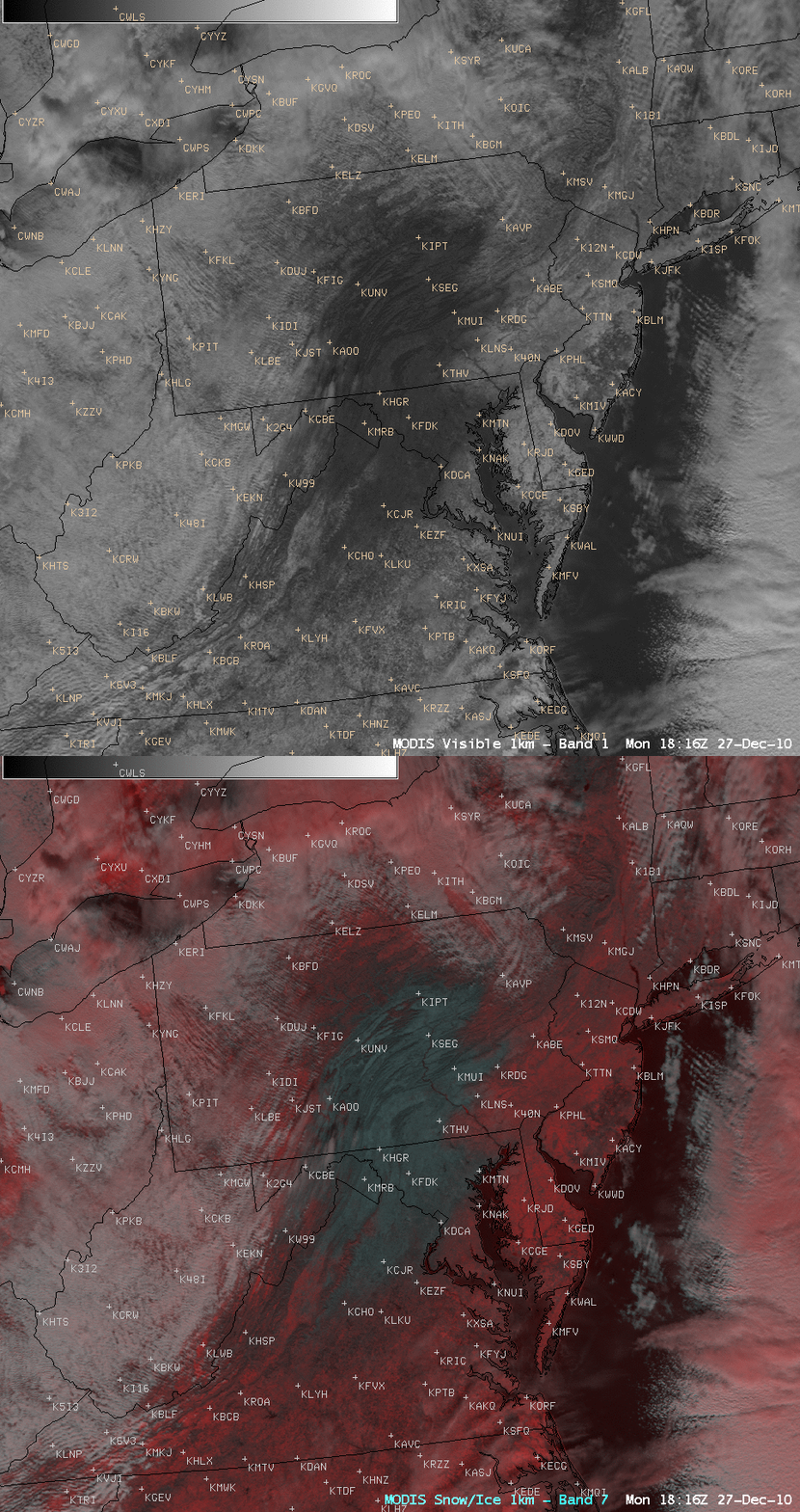
GOES-14: Full Disk images at 30-minute intervals

On Day 2 (01 December 2009) of the GOES-14 NOAA Science Test, the satellite was placed into a continuous “Full Disk” scan mode, providing images of the entire hemisphere at 30 minute intervals — full disk images of the GOES-14 6.5 µm “water vapor channel” are shown above. While the current GOES operational scan... Read More

GOES-14 Full Disk 6.5 µm water vapor images

GOES-14 Full Disk 6.5 µm water vapor images

On Day 2 (01 December 2009) of the GOES-14 NOAA Science Test, the satellite was placed into a continuous “Full Disk” scan mode, providing images of the entire hemisphere at 30 minute intervals — full disk images of the GOES-14 6.5 µm “water vapor channel” are shown above. While the current GOES operational scan schedule provides 1 full disk image every 3 hours, the ABI instrument on the upcoming GOES-R satellite will have the ability to provide full disk images every 5 minutes!

View only this post Read Less
Fire hotspot detection: a comparison of GOES-11, GOES-12, and GOES-14

A comparison of GOES-11 (GOES West), GOES-14, and GOES-12 (GOES East) 3.9 µm shortwave IR images (above) indicated that there were a number of fires burning across parts of southern British Columbia, Canada on 01 December 2009, as confirmed by the NOAA Hazard Mapping System. The 3 sets of images are displayed in the native... Read More

GOES-11, GOES-14, and GOES-12 3.9 µm shortwave IR images

GOES-11, GOES-14, and GOES-12 3.9 µm shortwave IR images

A comparison of GOES-11 (GOES West), GOES-14, and GOES-12 (GOES East) 3.9 µm shortwave IR images (above) indicated that there were a number of fires burning across parts of southern British Columbia, Canada on 01 December 2009, as confirmed by the NOAA Hazard Mapping System. The 3 sets of images are displayed in the native projection of their respective satellites. The fire “hotspots” showed up as warmer (darker black enhancement) pixels.

The plot below shows that the warmest 3.9 µm IR brightness temperature on the GOES-14 imagery was 325.8º K at 22:15 UTC, compared to 317.7º K on GOES-11 at 20:15 and 304.9º K on GOES-12 at 19:45 UTC. This difference in maximum fire pixel brightness temperature and time was due to such factors as different satellite viewing angles (compounded by the steep slopes of the mountainous terrain) and possible brief obscuration by clouds and/or smoke.

Plot of maximum fire pixel IR temperatures from GOES-11, GOES-12, and GOES-14

Plot of maximum fire pixel IR temperatures from GOES-11, GOES-12, and GOES-14

AWIPS images of the MODIS visible and 3.7 µm shortwave IR channel data from 19:46 UTC are shown below; again, a number of darker black fire hot spots can be seen on the shortwave IR image across parts of southern British Columbia (as well as to the east across southern Alberta). The visible image revealed that there was a great deal of snowpack in the mountains of the region — however, there were also a few patches of supercooled water droplet cloud and/or fog in the higher terrain, which showed up as darker gray features on the shortwave IR image (due to solar reflection off the tops of the supercooled clouds/fog).

MODIS visible and 3.7 µm shortwave IR channel images

MODIS visible and 3.7 µm shortwave IR channel images

View only this post Read Less
GOES-14: improved Image Navigation and Registration (INR)

GOES-14 (launched on 27 June 2009) began its NOAA Science Test on 30 November 2009 — and McIDAS images of the GOES-11, GOES-12, and GOES-14 visible channel data (above) showed an area of melting snow cover across the Texas / New Mexico border region. This area (southwest of Amarillo, Texas) had received 1-3 inches of new snowfall on... Read More

GOES-11, GOES-12, and GOES-14 visible images

GOES-11, GOES-12, and GOES-14 visible images

GOES-14 (launched on 27 June 2009) began its NOAA Science Test on 30 November 2009 — and McIDAS images of the GOES-11, GOES-12, and GOES-14 visible channel data (above) showed an area of melting snow cover across the Texas / New Mexico border region. This area (southwest of Amarillo, Texas) had received 1-3 inches of new snowfall on 29 November, which then rapidly melted under full sun on the following day. Note the improvement in Image Navigation and Registration (INR) on the GOES-14 images — there is much less image-to-image wobble compared to the GOES-11 (GOES West) and GOES-12 (GOES East) images. The 3 sets of images are displayed in the native projection of their respective satellites.

Better INR performance is critical to improving the accuracy of such satellite-derived products as the 1-hourly MADIS atmospheric motion vectors, seen overlaid on an AWIPS image of the MODIS 11.0 µm IR channel data (below).

MODIS IR image with MADIS 1-hour atmospheric motion vectors

MODIS IR image with MADIS 1-hour atmospheric motion vectors

A comparison of the MODIS visible and 2.1 µm near-IR “snow/ice channel” images (below) confirms that this feature was indeed snow — snow and ice are strong absorbers at the 2.1 µm wavelength, and appear as very dark features on the snow/ice image.

MODIS visible and near-IR snow/ice channel images

MODIS visible and near-IR "snow/ice" channel images

Note how the MODIS Land Surface Temperature (LST) product (below) was showing LST values in the upper 30s to low 40s F (green colors) over the snow-covered areas, in contrast to much warmer LST values in the middle 50s to low 60s F (yellow colors) over the surrounding bare ground. The surface air temperatures were also being held down into the upper 30s to low 40s F over the melting snow cover.

MODIS Land Surface Temperature product

MODIS Land Surface Temperature product

View only this post Read Less