This website works best with a newer web browser such as Chrome, Firefox, Safari or Microsoft Edge. Internet Explorer is not supported by this website.

Was there a waterspout/tornado in western Puerto Rico?

There were numerous media reports of a waterspout/tornado that moved inland near Mayaguez (station identifier TJMZ) in far western Puerto Rico around 16:45 UTC (12:45 pm local time) on 17 July 2010, causing tree and structural damage along with multiple injuries. However,... Read More

GOES-13 0.63 µm visible images

GOES-13 0.63 µm visible images

There were numerous media reports of a waterspout/tornado that moved inland near Mayaguez (station identifier TJMZ) in far western Puerto Rico around 16:45 UTC (12:45 pm local time) on 17 July 2010, causing tree and structural damage along with multiple injuries. However, due to a lack of visual confirmation, the NWS is not classifying this as a waterspout or a tornado event. McIDAS images of 1-km resolution GOES-13 0.63 µm visible channel data (above) did show a fast-moving outflow boundary / gust front moving from east to west across the island, causing wind gusts in excess of 50 mph at a number of locations. A strong thunderstorm then developed along this fast-moving boundary as it reached the far western end of the Puerto Rico.

Surface analyses from the NWS Ocean Prediction Center (below) depicted a westward-moving tropical wave  along the InterTropical Convergence Zone (ITCZ) that may have played a role in providing forcing for the convection that produced the initial  outflow boundary / gust front that raced westward across Puerto Rico.

NWS Ocean Prediction Center surface analysis

NWS Ocean Prediction Center surface analysis

The corresponding 4-km resolution GOES-13 10.7 µm IR images (below) revealed that cloud top IR brightness temperatures were as cold as -68º C (black color enhancement) at 17:45 UTC as the thunderstorm continued to grow and intensify.

GOES-13 10.7 µm IR images

GOES-13 10.7 µm IR images

A closer look using 1-km resolution Aqua MODIS 11.0 µm IR imagery at 17:44 UTC (below) showed what appeared to be a subtle “enhanced-v” storm top signature associated with this thunderstorm. The color enhancement is slightly different than that shown with the GOES-13 IR imagery, but the coldest/warmest IR brightnes temperatures within the enhanced-v signature were -75º C / -67º C respectively, making for a delta-T of 8º C. Enhanced-v storm top signatures over the continental US can exhibit delta-T values as large as 20-30º C, but to see an enhanced-v signature (even a subtle one) over Puerto Rico is rather unusual.

MODIS 11.0 µm IR image

MODIS 11.0 µm IR image

Related information:

Radar animation

YouTube damage video

View only this post Read Less

Forecasting Isolated Convection

How can satellite data be used to focus one’s attention to the relevant portion of an airmass when isolated convection is developing? That was a salient question late in the day on 16 July when a few convective cells developed over the upper midwest. Visible imagery (above) shows the development... Read More

How can satellite data be used to focus one’s attention to the relevant portion of an airmass when isolated convection is developing? That was a salient question late in the day on 16 July when a few convective cells developed over the upper midwest. Visible imagery (above) shows the development of a strong cell — that produced 1.75-inch hail southwest of Rochester in Waltham, MN.

Several satellite products from earlier in the day suggested convection could be sustained in this region. For example, the CIMSS Nearcasting product, which product uses a Lagrangian transport model of upper and lower level moisture observations from the GOES Sounder to make short-term predictions of convective instability (that is, the change in equivalent potential temperature with height), shows a ribbon of lower stability air arcing from Nebraska to southern Minnesota to central Wisconsin. Consider the forecast for 2000 UTC on 16 July made from observations at 1400 UTC, 1500 UTC, 1600 UTC and 1700 UTC. (A loop of the four forecasts valid at 2000 UTC is here). The forecast for lower level (around 800 mb) equivalent potential temperature to be 7-12 K warmer than the upper level (around 500 mb) equivalent potential temperature is very consistent from run to run.

Sounder Derived Product Imagery also shows destabilization ongoing in the region highlighted by the Nearcasting technique. The Lifted Index (above) derived from the Sounder Retrievals shows a ribbon of progressively more unstable air over the course of the day.

Once the region of interest is identified, UW Convective Initiation can be used to identify the specific cumulus cell that will grow. For example, consider the visible image at 2000 UTC, 2015 UTC, 2032 UTC and 2045 UTC . A convective cell develops over southern Minnesota out of a line of towering cumulus. By 2045 UTC, lightning is being produced. The UW Convective Initiation product, which uses both cloud-top cooling and cloud phase changes (both derived from GOES-13 imagery) to infer strong convective growth that leads to clouds with supercooled water and then ice, shows convective initiation likely over south-central Minnesota at 2032 UTC, and ongoing at 2045 UTC. A more complete visible loop that includes lightning plots is here. The complete visible loop with convective initiation values overlain is below. Strong convective cells from Nebraska to Wisconsin are recognized by the UWCI algorithm. Note that convective initiation only detects the start of convection; once the convective tower has glaciated, initiation is deemed to have ended and it is no longer detected. For this reason, UWCI may not show optimal results in regions of ice clouds. However, as the loop below shows, it commonly detects growing convective clouds before the convection produces lightning, and long before severe weather occurs.

View only this post Read Less

Isolated Convection over Nebraska

The loop above shows the window channel (11 micron) imagery from the night of 15 July over Nebraska. (Also plotted: METARS, lightning, and the UWCI product) An isolated convective storm — identified accurately by the UWCI algorithm — developed over central Nebraska near local midnight. There were no severe reports... Read More

The loop above shows the window channel (11 micron) imagery from the night of 15 July over Nebraska. (Also plotted: METARS, lightning, and the UWCI product) An isolated convective storm — identified accurately by the UWCI algorithm — developed over central Nebraska near local midnight. There were no severe reports associated with this system, but it did produce considerable lightning as it moved through eastern Nebraska. What can the satellite data reveal about the environment over Nebraska?

The convection that exists at the start of the loop formed near the dryline in western Nebraska. The 2315 UTC image shows a warmer surface (darker enhancement) over the Nebraska panhandle than points east. METARS shows temperatures there in the 90s, with low dewpoints, versus mid-80s and dewpoints in the 60s to the east. The dry air cools more rapidly, so that the panhandle shows a cooler surface (lighter enhancement) by 0315 UTC. Satellite data suggests that the dryline is not moving east, and forcing associated with it does not cause the convection over central Nebraska.

The CIMSS Nearcast product uses a Lagrangian model to describe the evolution of equivalent potential temperature at two levels in the atmosphere. Retrievals from the GOES Sounder are used to produce the moisture fields that are input into this model. Forecasts for 0600 UTC of the change of equivalent potential temperature from about 800 mb to about 500 mb, near the time of convective onset (Here is the IR Imagery from that time), are shown below as a loop of 5 forecasts — initial times from 00 UTC to 04 UTC — each valid at 0600 UTC. Note how the region of interest is well-highlighted, and is narrowing with time. The low-level equivalent potential temperature is 15-20 K warmer than the mid-level value.

GOES Sounder Lifted Index shows a tongue of lower values of Lifted Index through central Nebraska at 0500 UTC. The axis of minimum stability as denoted by the Lifted Index matches the prediction from the Nearcast product very nicely. Given this potential instability, is there anything that suggests a trigger mechanism? The surface METARS, plotted over the IR imagery shown at the top of this post, do not suggest any propagating boundary.

The GOES Imager Water Vapor loop, shown above, does not suggest a clear forcing mechanism for the observed convection. GOES Sounder water vapor, however, is available at three levels, rather than the one level of the GOES Imager. (The ABI on GOES-R will also include 3 water vapor channels that sample different parts of the atmosphere). Although the images at ~0500 UTC from 6.5 microns shows little in the way of forcing (the water vapor channel on the imager is also centered near 6.5 microns), the 7.0 microns and the 7.4-micron image both show a stronger gradient in water vapor near where the convection developed. This suggests that the forcing mechanism for the convection was closer to the surface than could be detected using the 6.5-micron channel on either the imager or the sounder. Weighting functions for the sounder channels (produced at this website computed at North Platte, NE at 00 UTC on 15 July (upstream of the region of convection), and at Valley, NE at 12 UTC on 15 July (downstream of the region of convection) show that the peak response for the 7.0 and especially the 7.4 micron channels is lower in the atmosphere than the peak response for the 6.5 micron channel. (Data from these weighting functions can guide you to search the correct horizontal level in the atmosphere to find the forcing that is causing convection) Thus, while a loop of the sounder 6.5-micron water vapor data shows little to suggest why the convection develops where it does (as expected, given that the sounder 6.5-micron data should show similar features (albeit at coarser sounder resolution) compared to the imager 6.5-micron data shown above), the loop of 7.0-micron sounder water vapor data is a bit more suggestive of a forcing mechanism, and the loop 7.4-micron sounder water vapor, shown below, most definitely shows a boundary that is associated with the convection that develops over central Nebraska. Detection of water vapor distributions at different levels can be key to understanding why convection forms where it does.

View only this post Read Less

Smoke from Canadian fires over the Upper Midwest states

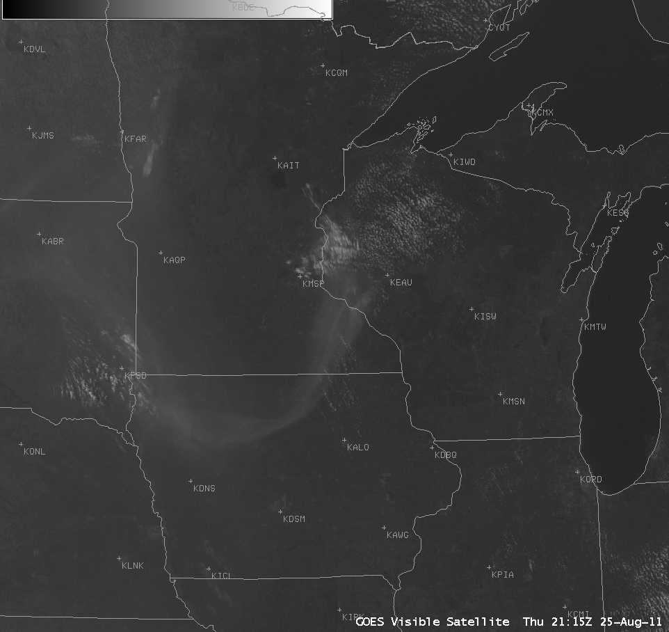
Wildfires had been burning across portions of the northern prairie provinces of Canada during early to mid July, and GOES-13 visible images (above) showed that a thick plume of smoke was drawn southward and eastward across the Upper Midwest states on 15 July 2010.A POES AVHRR false color Red/Green/Blue (RGB) image (below)... Read More

GOES-13 0.63 µm visible images

GOES-13 0.63 µm visible images

Wildfires had been burning across portions of the northern prairie provinces of Canada during early to mid July, and GOES-13 visible images (above) showed that a thick plume of smoke was drawn southward and eastward across the Upper Midwest states on 15 July 2010.

A POES AVHRR false color Red/Green/Blue (RGB) image (below) created using channels 01/02/04 showed the location of the thickest part of the smoke plume moving across North Dakota at 23:41 UTC.

POES AVHRR false color Red/Green/Blue (RGB) image

POES AVHRR false color Red/Green/Blue (RGB) image

The MODIS Aerosol Optical Depth (AOD) product (below) showed AOD values as high as 0.9 to 1.0 along the North Dakota / Minnesota border region.

MODIS Aerosol Optical Depth product

MODIS Aerosol Optical Depth product

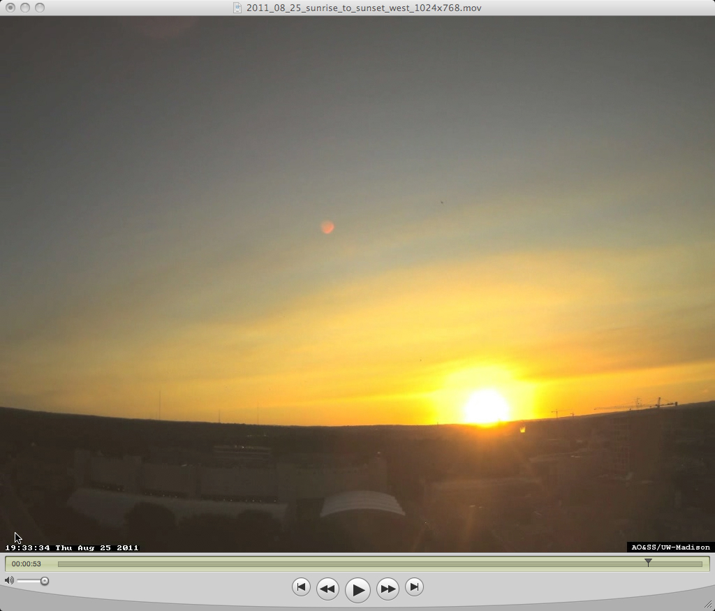
The smoke aloft contributed to a rather colorful sunset, as captured the the University of Wisconsin – Madison AOSS building rooftop camera (below; also available as a Quicktime animation).

University of Wisconsin - Madison AOSS building rooftop camera image

University of Wisconsin - Madison AOSS building rooftop camera image

View only this post Read Less