Tropical Storm Danielle
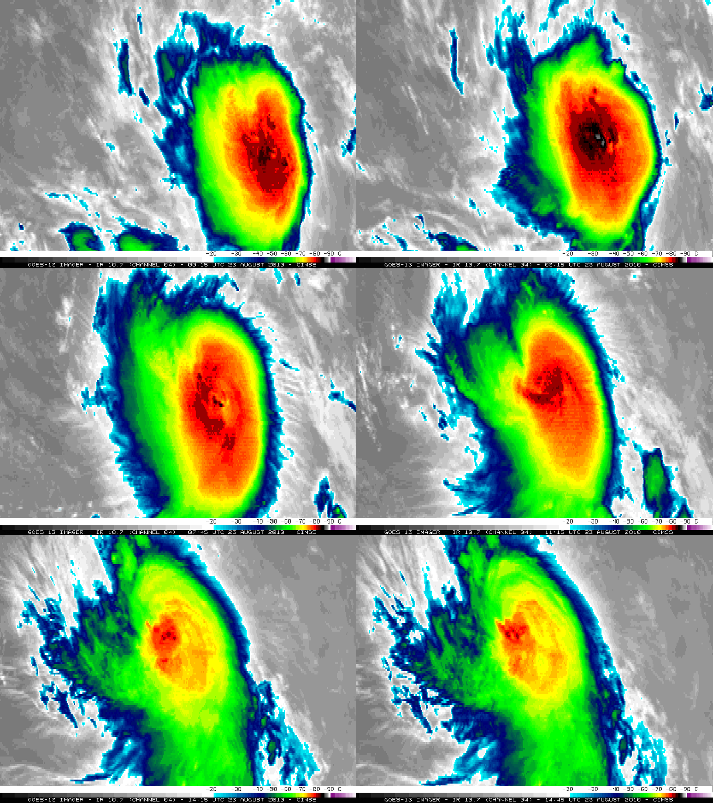
McIDAS images of GOES-13 10.7 µm IR data (above) revealed a classic convective burst signature as Tropical Storm Danielle began to intensity over the middle Atlantic Ocean on 23 August 2010. The coldest cloud top IR brightness temperature during this time period was -90º C at 07:15 UTC.
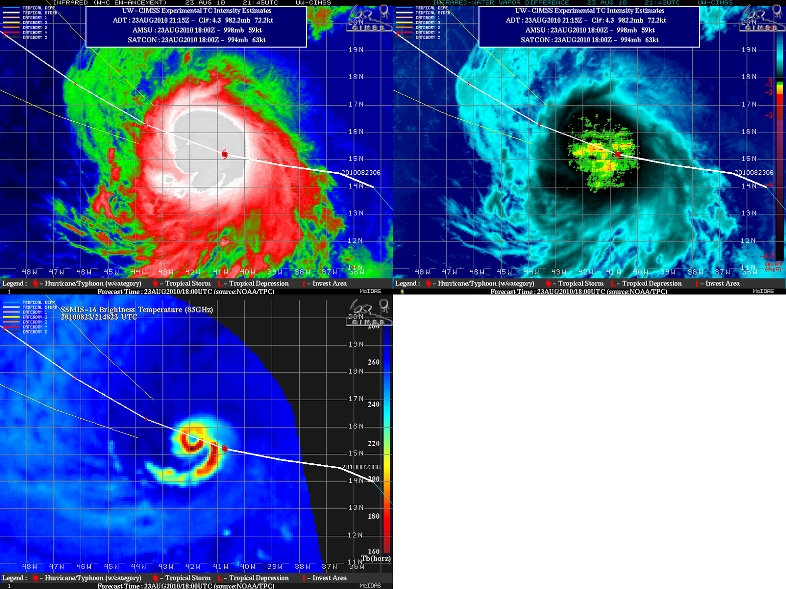
UPDATE: Danielle continued to intensify during the day, becoming the second hurricane of the 2010 Atlantic Basin Season. Images from the CIMSS Tropical Cyclones site (below) showed that Danielle continued to exhibit a large, cold Central Dense Overcast (CDO) on IR imagery, with a number of overshooting tops being indicated on the IR/Water Vapor difference product. However, a well-defined closed eyewall structure could be seen on SSMI/S-16 microwave imagery.
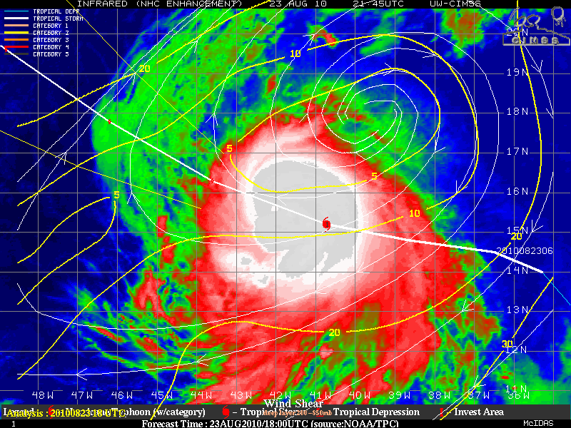
The CIMSS Deep Layer (200-850 hPa) Wind Shear product (below) showed that Danielle was within (and moving into) a very low shear environment, which was a favorable factor for further intensification. The nearly circular CDO was characteristic of tropical cyclones that are located within such a low shear environment.


