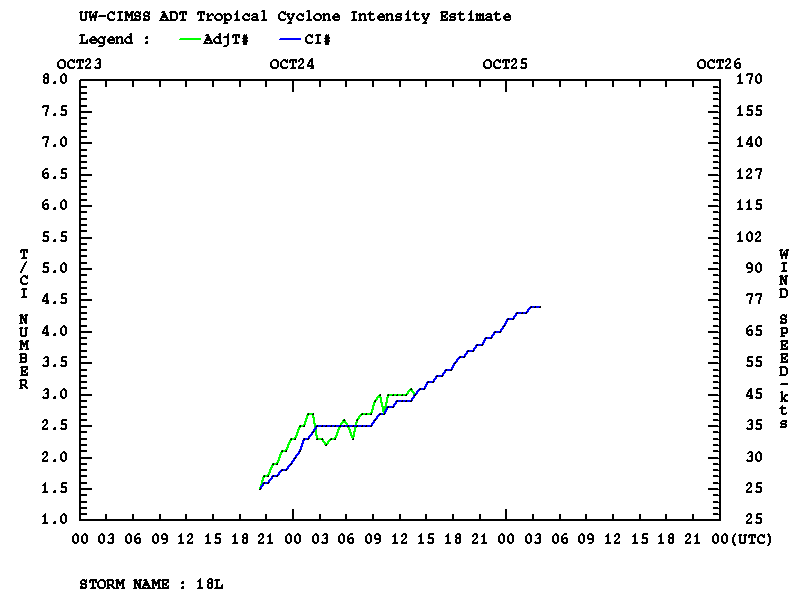
Tropical Storm Rina rapidly intensified (CIMSS ADT plot) to hurricane intensity off the coast of Honduras on 24 October 2011 — GOES-13 0.63 µm visible channel images with an overlay of ASCAT scatterometer surface winds from the CIMSS Tropical Cyclones site... Read More

GOES-13 0.63 µm visible channel images + ASCAT scatterometer surface winds
Tropical Storm Rina rapidly intensified (CIMSS ADT plot) to hurricane intensity off the coast of Honduras on 24 October 2011 — GOES-13 0.63 µm visible channel images with an overlay of ASCAT scatterometer surface winds from the CIMSS Tropical Cyclones site (above) showed that Hurricane Rina exhibited a central dense overcast early in the day, with convective bursts near the center of the circulation.
A longer animation of GOES-15 10.7 µm IR channel images (below; click image to play animation) revealed a number of convective bursts, with large areas of the central dense overcast exhibiting cloud top IR brightness temperatures of -80ºC or colder (violet color enhancement).
")
GOES-15 10.7 µm IR channel images (click image to play animation)
AWIPS images of the MIMIC Total Precipitable Water (TPW) product (below; click image to play animation) suggested that Hurricane Rina may have been tapping moisture from the Eastern Pacific Ocean Intertropical Convergence Zone / Monsoon Trough.
")
MIMIC Total Precipitable Water product + tropical surface analysis (click image to play animation)
It is interesting to note that an increasing pressure gradient between high pressure located over the Gulf of Mexico and the deepening circulation of Hurricane Rina was beginning to enhance the intensity of dry Tehuano gap winds flowing southward into the Gulf of Tehuantepec (below).

MIMIC TPW + Tropical surface analysis + ASCAT scatterometer surface winds
===== 25 October Update =====
 image")
NOAA-16 false color Red/Green/Blue (RGB) image
On 25 October 2011, widespread high altitude cirrus “transverse banding” was seen along the western periphery of Hurricane Rina on a 1-km resolution NOAA-16 false color Red/Green/Blue (RGB) image (above), created using AVHRR visible channels 1 (0.63 µm) and 2 (0.86 µm) along with IR channel 4 (10.8 µm).
4-km resolution GOES-13 6.5 µm “water vapor channel” images (below; click image to play animation) showed that Hurricane Rina was a prolific producer of transverse banding during much of the day. The GOES-13 satellite had been placed into Rapid Scan Operations (RSO) mode, providing images as often as every 5-10 minutes.
")
GOES-13 6.5 µm water vapor channel images (click image to play animation)
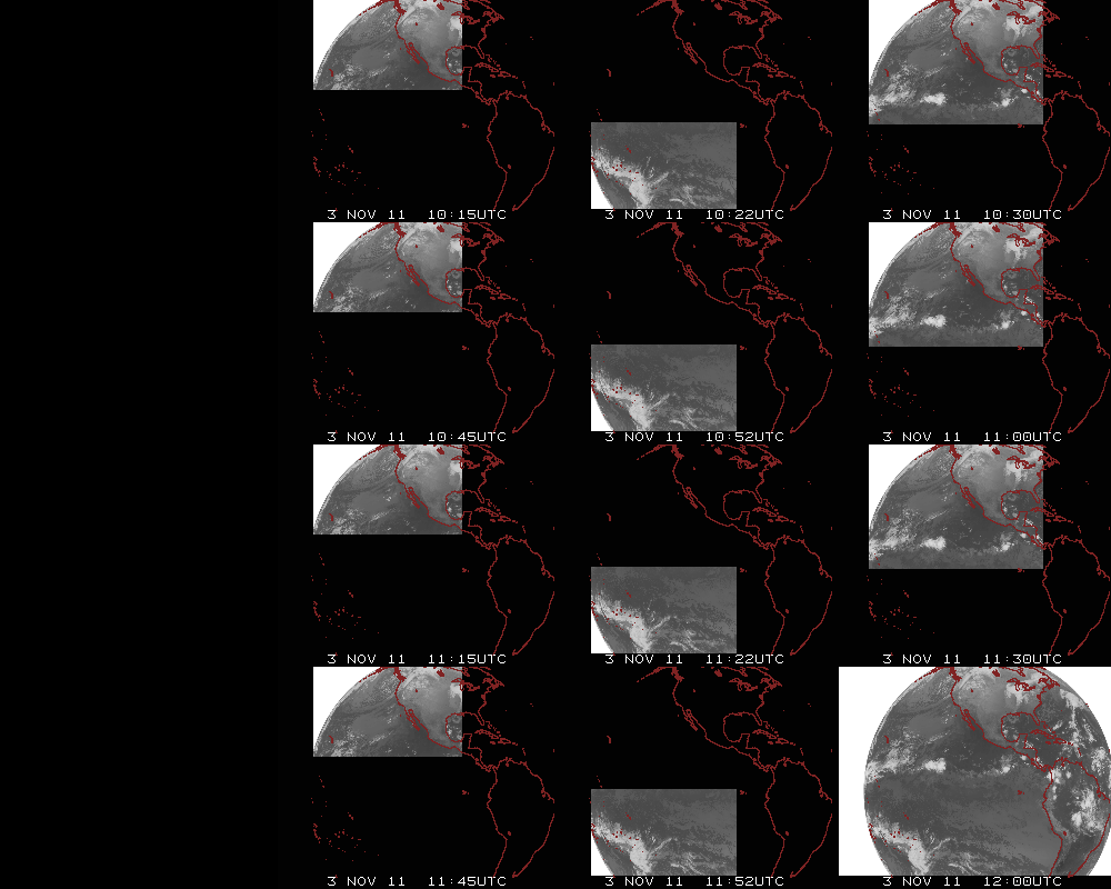
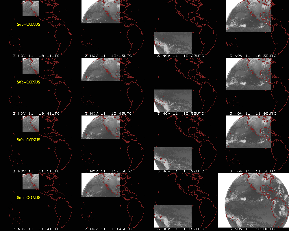
1-km resolution GOES-13 0.63 µm visible channel RSO images (below; click image to play animation) revealed the formation of a well-defined eyewall during the afternoon hours.
")
GOES-13 0.63 µm visible channel images (click image to play animation)
View only this post
Read Less

")
")

 image")
")
 images")
 image")

")
")
")
")
")
