Strong northeasterly winds created large plumes of blowing dust across parts of the Baja California region of Mexico on 27 November 2011. GOES-15 0.63 µm visible channel images (above; click image to play animation) showed the development of one blowing dust plume originating near the west coast of mainland Mexico, with another... Read More
")
GOES-15 0.63 µm visible channel images (click image to play animation)
Strong northeasterly winds created large plumes of blowing dust across parts of the Baja California region of Mexico on 27 November 2011. GOES-15 0.63 µm visible channel images (above; click image to play animation) showed the development of one blowing dust plume originating near the west coast of mainland Mexico, with another more broad plume fanning out from the Baja California peninsula.
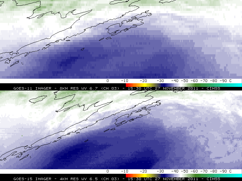
GOES-15 will be replacing GOES-11 as the operational GOES-West satellite on 06 December 2011 — and one of the benefits is improved Image Navigation and Registration (INR), which leads to less image-to-image “wobble” when viewing an animation. The improved GOES-15 INR is quite evident when compared to GOES-11 for this blowing dust case (below; click image to play animation).
")
GOES-11 0.65 µm and GOES-15 0.63 µm visible images (click image to play animation)
A 250-meter resolution MODIS true color Red/Green/Blue (RGB) image from the SSEC MODIS Today site (below) revealed more complex details about the structure of the blowing dust features.
 image")
MODIS true color Red/Green/Blue (RGB) image
AWIPS images of GOES-11 0.65 µm visible channel data with an overlay of MADIS 1-hour interval satellite winds (below) indicated that the airborne dust feature was moving southwestward at speeds of 15-20 knots.

GOES-11 0.65 µm visible images + MADIS satellite winds
A comparison of 1-km resolution MODIS 0.65 µm visible channel, 3.7 µm “shortwave IR” channel, and 11.0 µm “IR window” channel images (below) showed that (1) the thickest portions of the blowing dust plumes appeared several degrees warmer (darker black enhancement) on the shortwave IR channel image, due to reflection of incoming solar radiation off the small airborne dust particles, and (2) swaths of land which had significant amounts of blowing dust overhead exhibited a slightly cooler (lighter gray enhancement) signaure on the IR window channel image, since the dust was reducing the amount of solar radiation reaching the surface.

MODIS 0.65 µm visible, 3.7 µm "shortwave IR", and 11.0 µm "IR window" images
In fact, the corresponding 1-km resolution MODIS Land Surface Temperature (LST) product (below) displayed LST values in the 80s F in areas beneath the blowing dust plumes, in contrast to LST values in the 90s to around 100º F over adjacent areas.

MODIS 0.65 µm visible channel + MODIS Land Surface Temperature product
CIMSS participation in GOES-R Proving Ground activities includes making a variety of MODIS images and products available for National Weather Service offices to add to their local AWIPS workstations. Currently there are 49 NWS offices receiving MODIS imagery and products from CIMSS.
View only this post
Read Less
")


")
")


