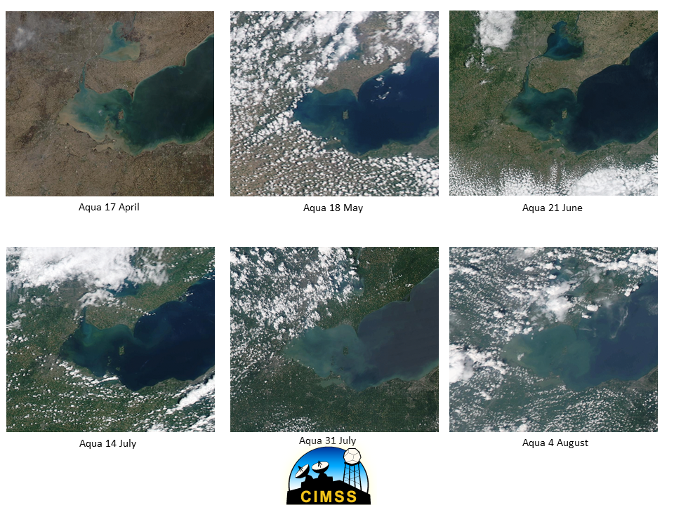
A supercell thunderstorm intensified as it moved eastward across the Chesapeake Bay (just ahead of an approaching surface cold front) on the morning of 24 July 2014 — as it reached the Virginia shore... Read More

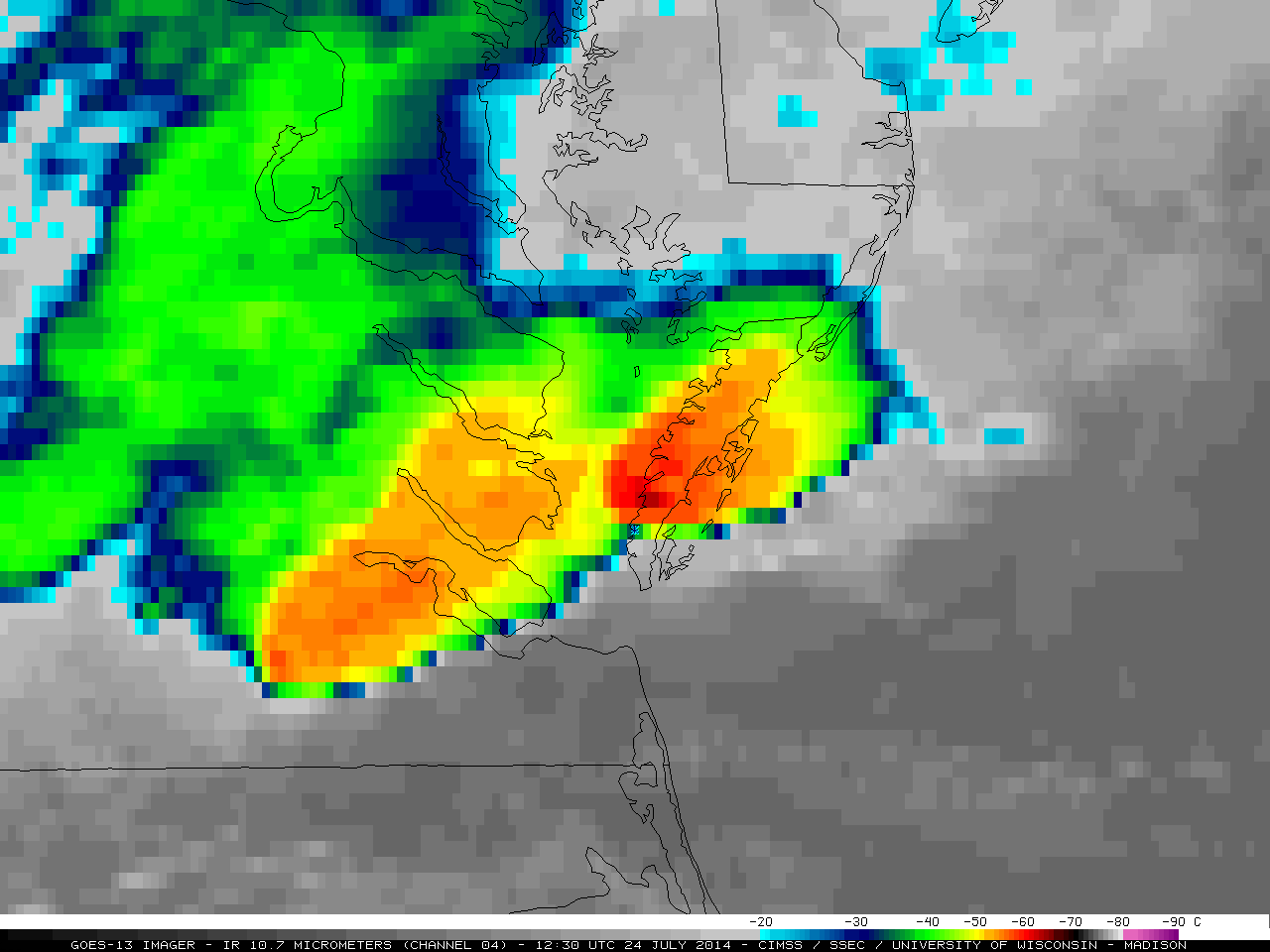
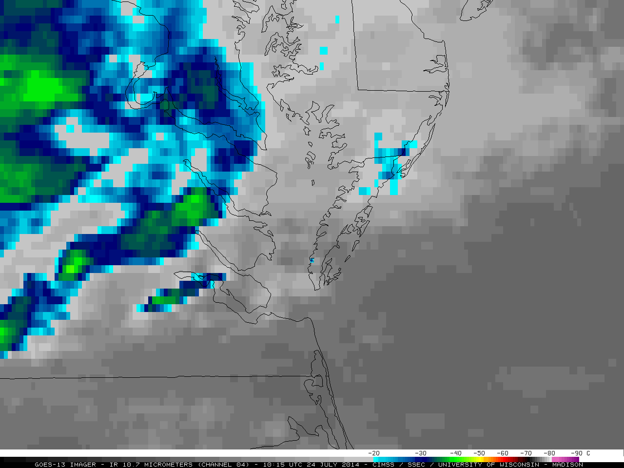
GOES-13 10.7 µm IR channel images (click to play animation)
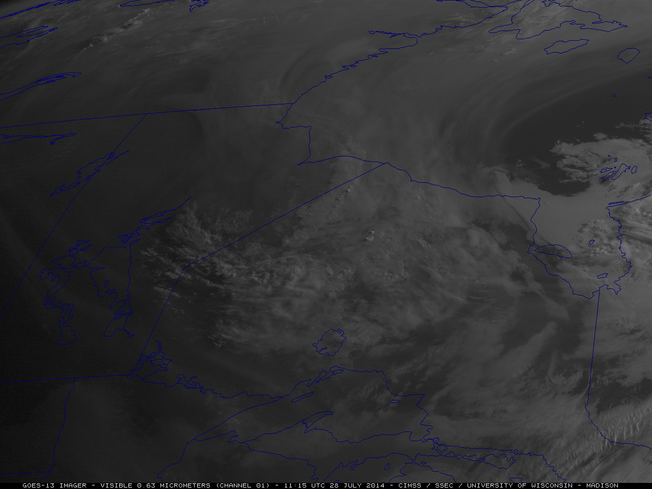
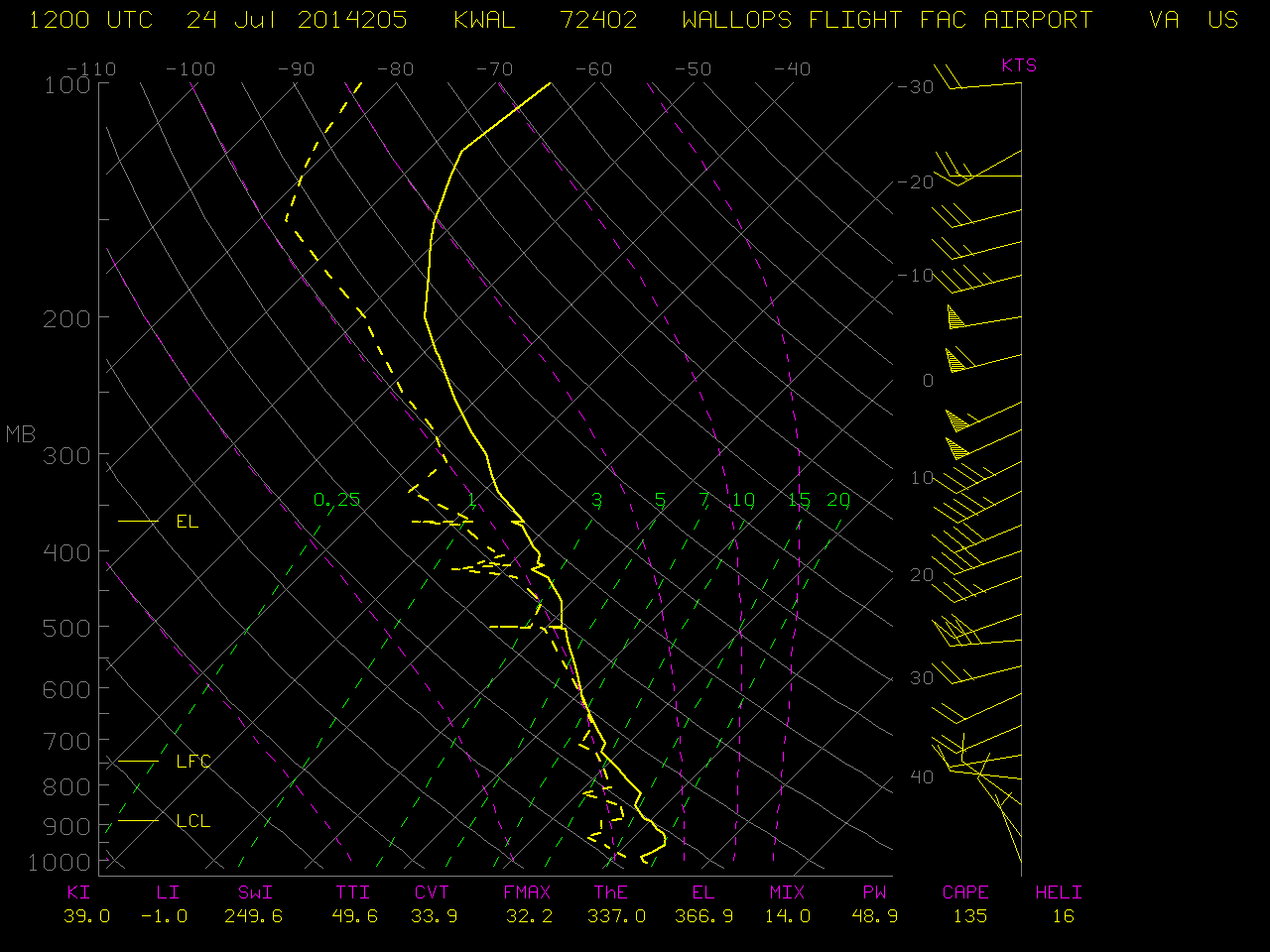
A supercell thunderstorm intensified as it moved eastward across the Chesapeake Bay (just ahead of an approaching surface cold front) on the morning of 24 July 2014 — as it reached the Virginia shore of the Delmarva Peninsula, it produced an EF-1 tornado and damaging straight line winds that were responsible for 2 fatalities and 36 injuries at the Cherrystone Family Camping Resort (located at the * symbol on the images). The storm also produced golf ball to baseball size hail (NWS damage survey | SPC storm reports). McIDAS images of GOES-13 10.7 µm IR channel data (above; click image to play animation; also available as an MP4 movie file) showed that the cloud-top IR brightness temperatures associated with the storm cooled quickly, from -45º C at 11:15 UTC to -64º C at 12:30 UTC. The temperature value was close to that of the tropopause (at a height of 15.4 km) on the 12 UTC rawinsonde data from Wallops Island, Virginia.
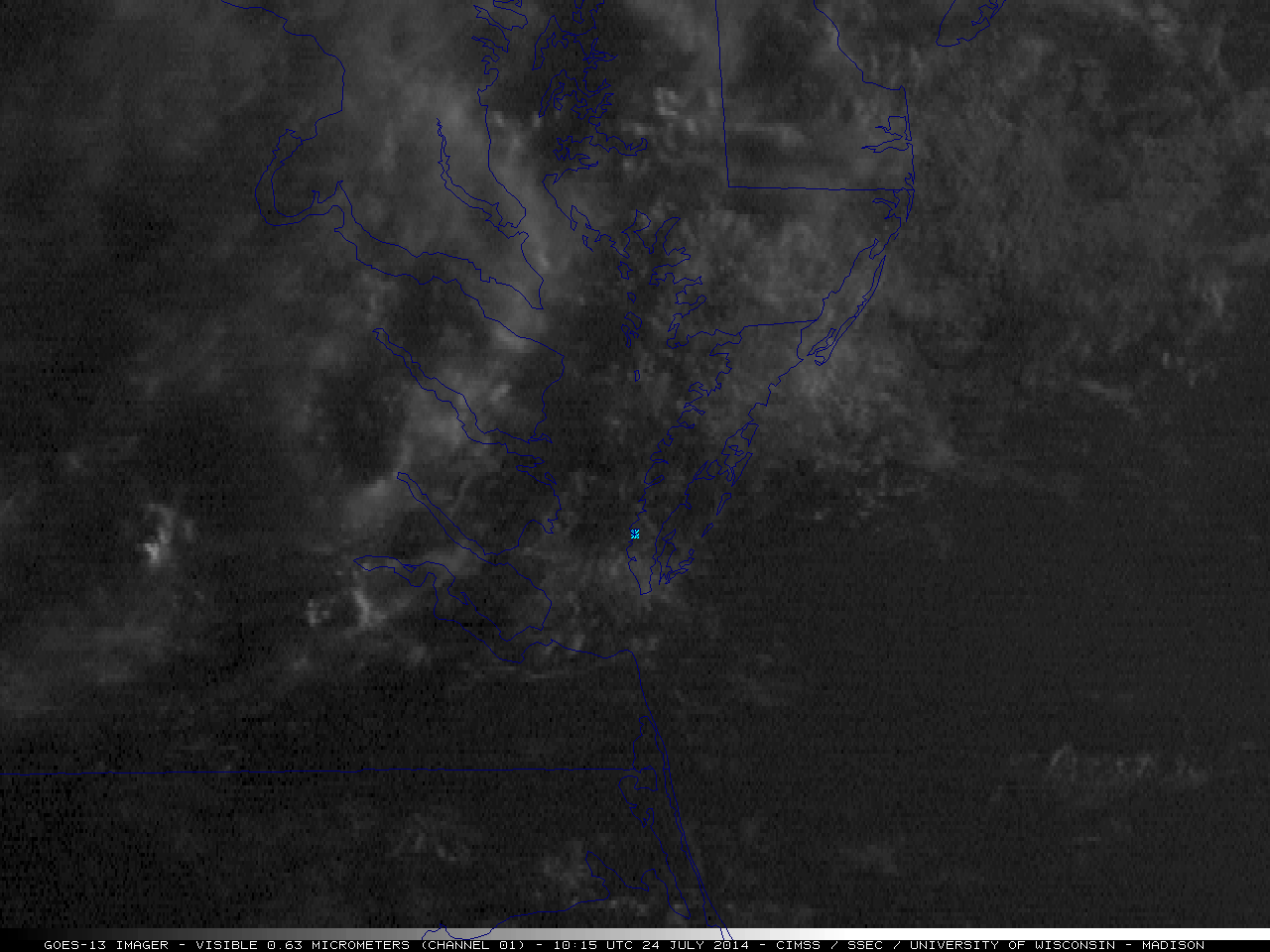
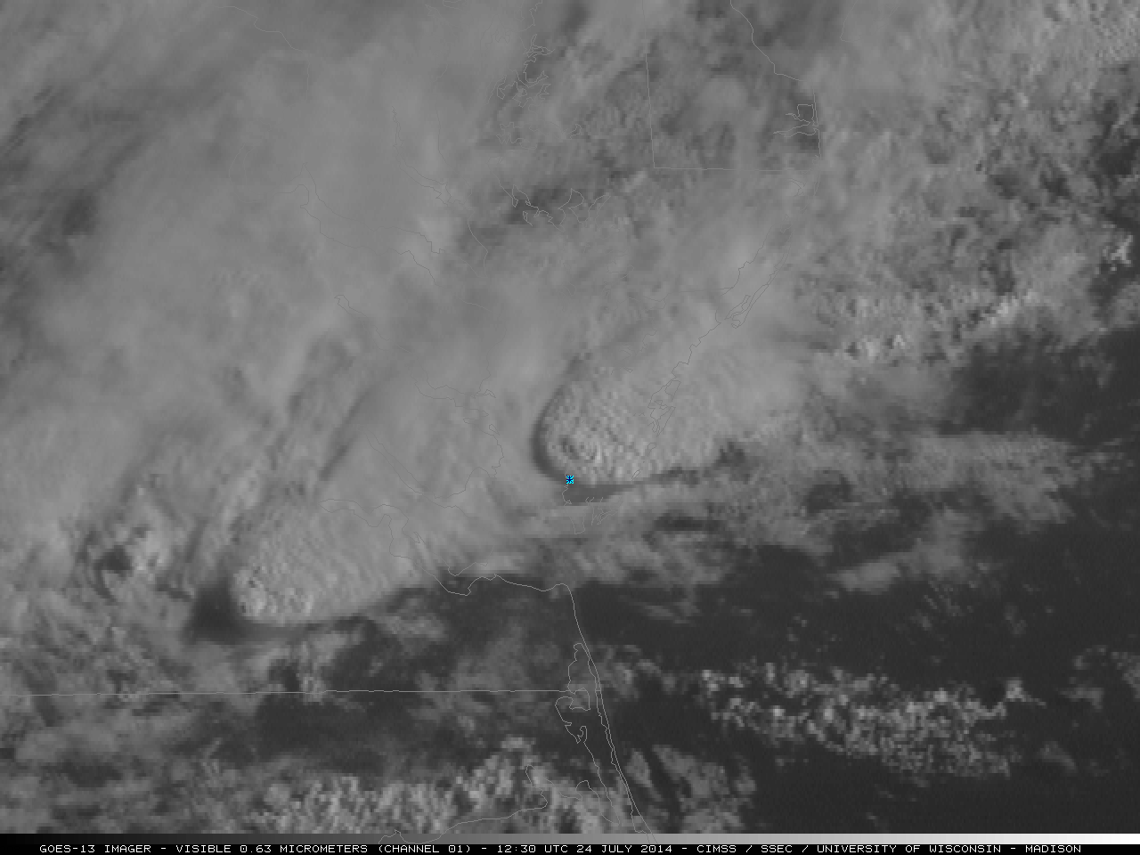
The corresponding GOES-13 0.63 µm visible channel images (below; click image to play animation; also available as an MP4 movie file) revealed the presence of an overshooting top at 12:30 UTC (the time that the IR cloud-top brightness temperature values reached their minimum), which was also flagged by the automated Overshooting Tops detection algorithm.
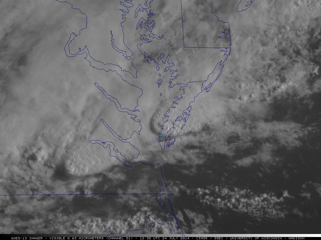
GOES-13 0.63 µm visible channel images (click to play animation)
AWIPS-II images of the NOAA/CIMSS ProbSevere product (below) followed the radar feature associated with the supercell thunderstorm. Around 11:30 UTC, the ProbSevere value was low, around 5-10%, a result of weak satellite-detected growth (and moderate glaciation) early in the storm’s life, along with low values of MRMS Maximum Expected Size of Hail (MESH). Environmental parameters from the Rapid Refresh model that were supportive of convection: MUCAPE exceeded 2200 J Kg and Shear values were greater than 30 m/s. As the cell tracked to the east and began to move over Chesapeake Bay, both MUCAPE and Shear gradually increased, to values near 2400 J/kg and 35 m/s, respectively. MRMS MESH was oscillating as the cell approached Chesapeake Bay, from 0.44 inches at 11:42 UTC (ProbSevere value of 10%) to 0.37 inches at 11:46 UTC (ProbSevere of 7%) to 0.65 inches at 11:48 UTC (ProbSevere of 29%) to 0.56 inches at 12:00 UTC (ProbSevere of 18%). As the storm moved over the Bay, MESH sizes jumped, to 0.86″ at 12:04 UTC (ProbSevere of 58%, the first crossing of the 50% threshold), to 1.02″ at 12:06 UTC (ProbSevere of 71%), to 1.86″ at 12:12 UTC (ProbSevere of 92% , the first crossing of the 90% threshold), and to 3.09″ (!) at 12:16 UTC (ProbSevere of 91%). At 12:20 UTC, when the Tornado Warning was issued, MRMS MESH was 3.51″ and ProbSevere remained at 91%. Thus, the warning was issued 16 minutes after ProbSevere exceeded 50%, and 8 minutes after ProbSevere was greater than 90%. The NWS storm survey indicated that the campsite fatalities occurred around 12:33 UTC, or 13 minutes after the issuance of the tornado warning.
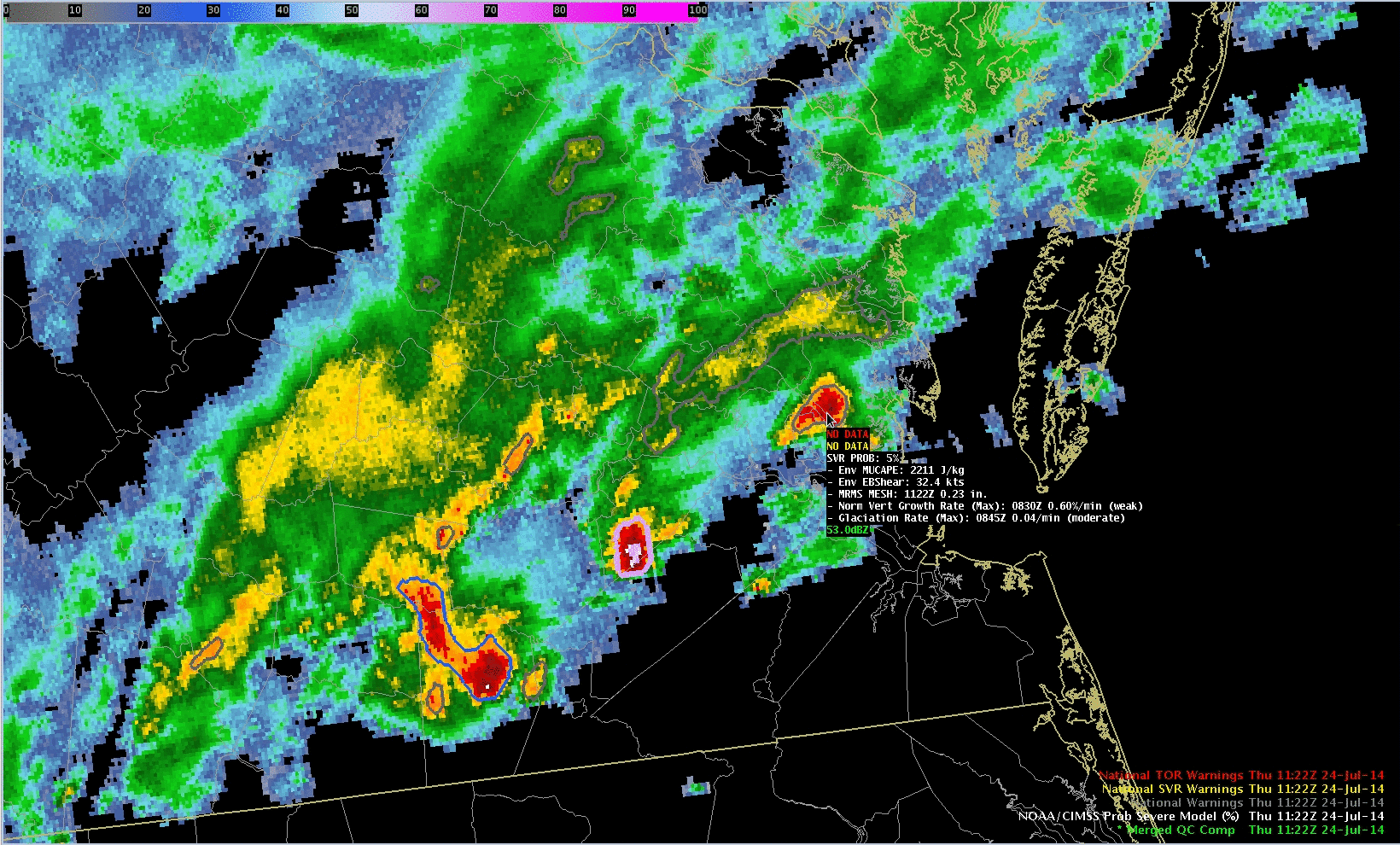
NOAA/CIMSS ProbSevere product
The rapid intensification of the system as it moved over the Chesapeake begs the question: was instability diagnosed? In the animation below, GOES-13 sounder Derived Product Images (DPI) of Lifted Index (top panel) and CAPE (bottom panel) showed a rich source of instability just south of the cloud-obscuring convection (and ahead of the southward-moving cold front). Lifted Index values derived at 1147 UTC were around -6 at the mouth of the Chesapeake Bay (bright yellow enhancement); CAPE values were around 2500 J/kg (yellow and red enhancements).
![GOES-13 Sounder DPI estimates of Lifted Index (top) and CAPE (bottom) [click to play animation]](https://cimss.ssec.wisc.edu/satellite-blog/wp-content/uploads/sites/5/2014/07/G13SNDR_LI_CAPE_24July_1147a.GIF)
GOES-13 Sounder DPI estimates of Lifted Index (top) and CAPE (bottom) [click to play animation]
View only this post
Read Less

![GOES-13 Sounder DPI estimates of Lifted Index (top) and CAPE (bottom) [click to play animation]](https://cimss.ssec.wisc.edu/satellite-blog/wp-content/uploads/sites/5/2014/07/G13SNDR_LI_CAPE_24July_0747-1247loop.GIF)
