Night-time VIIRS Day/Night Band images during the full “Pink Moon”
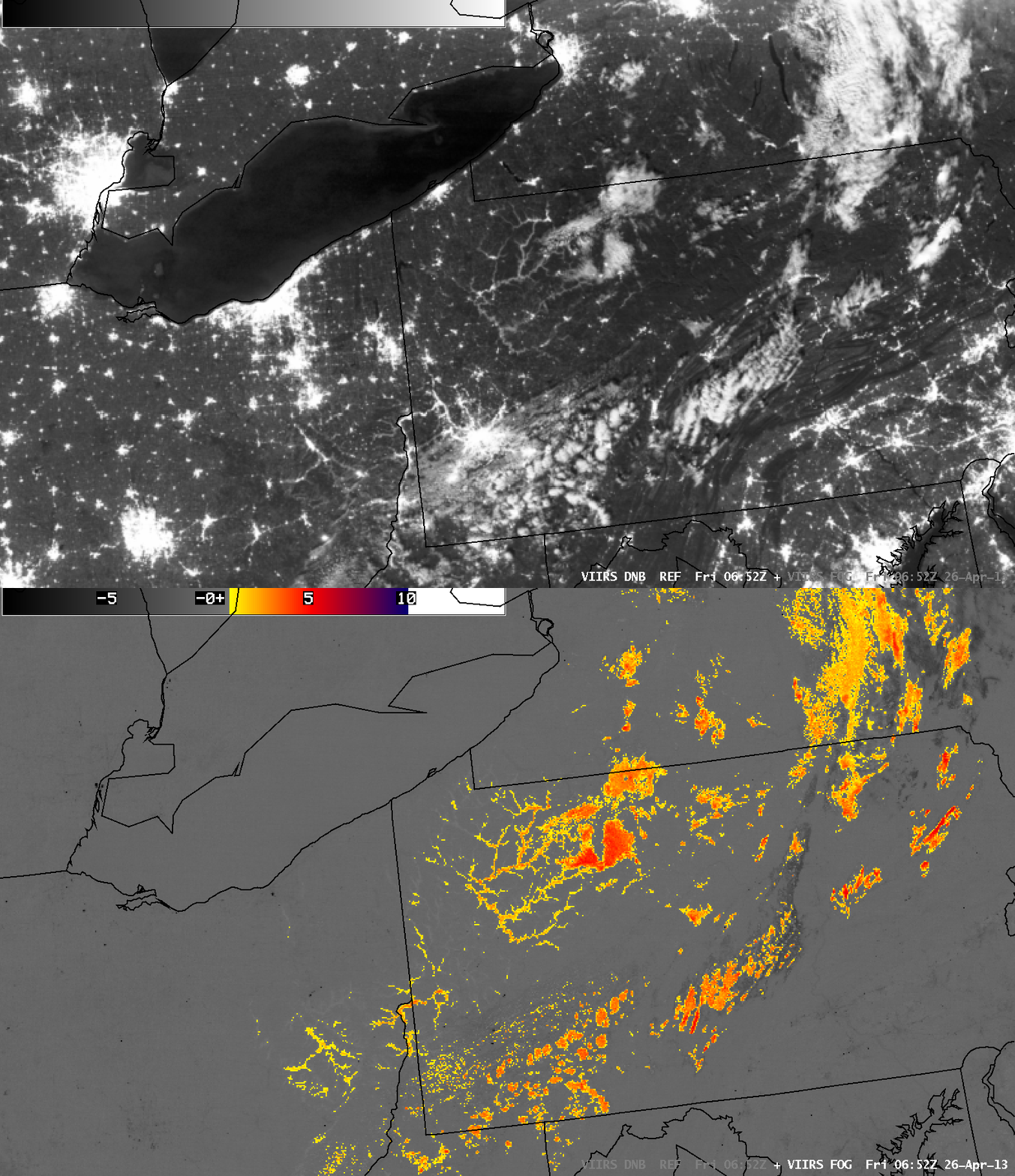
Suomi NPP VIIRS 0.7 µm Day/Night Band and IR brightness temperature difference “Fog/stratus product”
A number of interesting night-time images were available using the Suomi NPP VIIRS 0.7 µm Day/Night Band (DNB) on 26 April 2013 — since there was abundant illumination from the full “Pink Moon”, this allowed the DNB to provide “visible images at night” which showed city lights as well as a number of meteorological phenomena. We’ll begin our tour in the northeastern US, where a comparison of the VIIRS DNB with the corresponding IR brightness temperature diference (BTD) “Fog/stratus product” (above) showed narrow fingers of valley fog from northwestern Pennsylvania to eastern Ohio at 06:52 UTC or 2:52 AM local time.
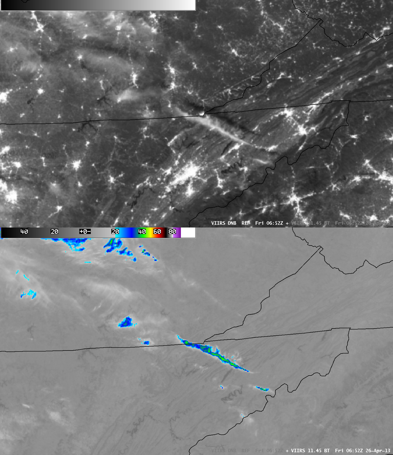
Farther to the south, a narrow band of thick cirrus cloud (which exhibited IR brightness temperatures as cold as -40º C) was casting a shadow on the ground from far southeastern Kentucky to northeastern Tennessee (below).
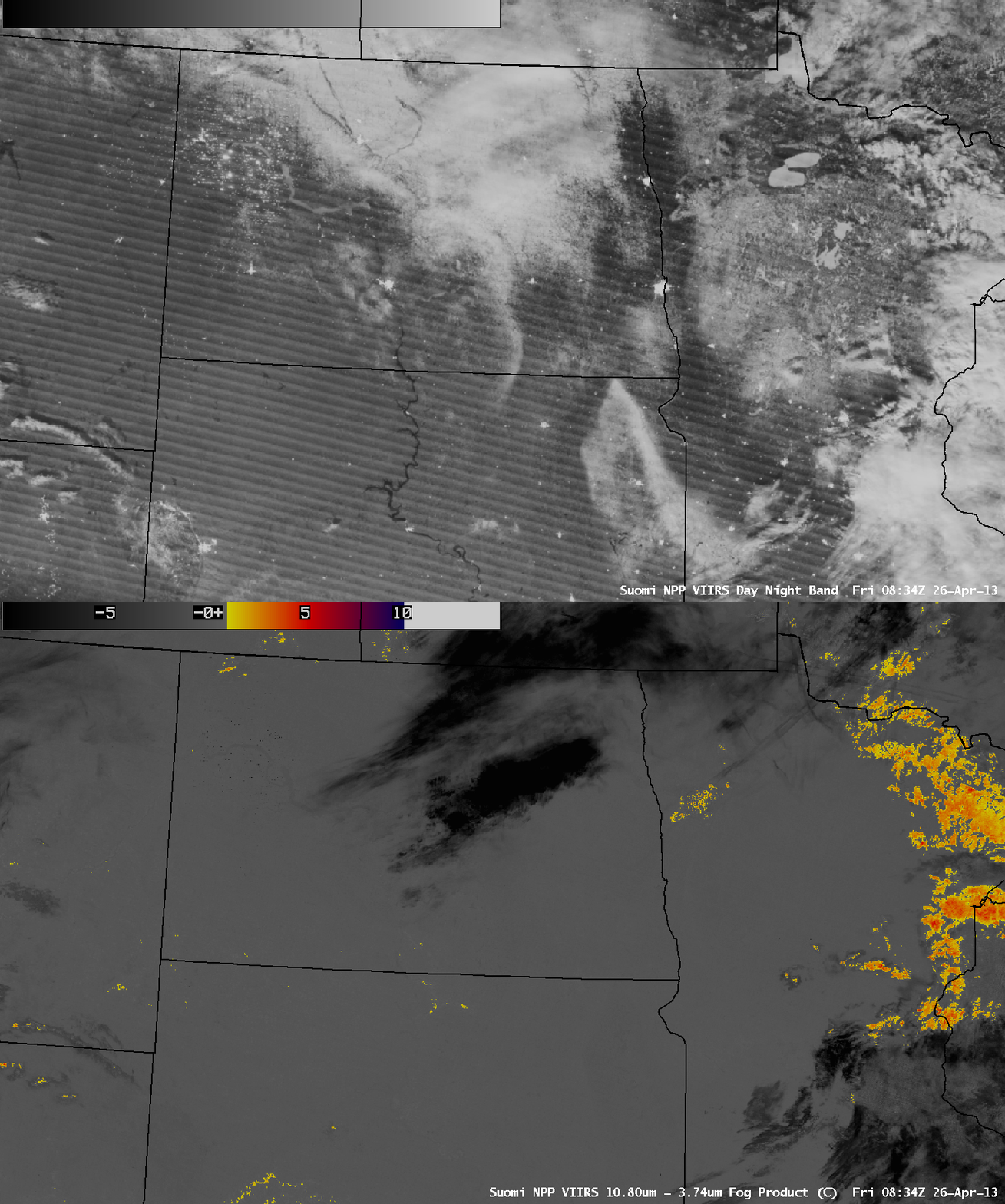
Over the north-central US, the VIIRS DNB showed areas that still had substantial snowpack remaining across parts of North Dakota, South Dakota, and Minnesota at 08:34 UTC or 3:34 AM local time (below). Even though there were patches of cirrus cloud over North Dakota (which appear black on the Fog/stratus product), features such as the ice-covered Lake Sakakawea, the Souris River (parts of which were in flood stage and producing moderate flooding), and the edge of the snow cover could still be identified through these high-level clouds on the DNB image.
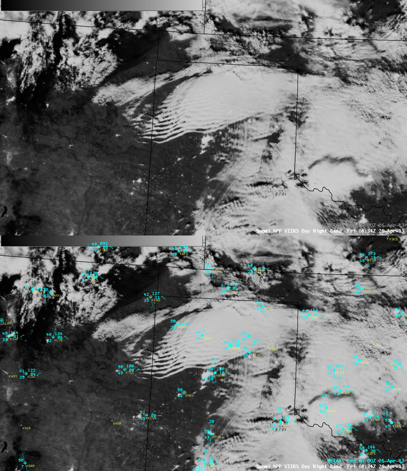
To the south, clouds bands associated with an undular bore could be seen on the DNB image over the Texas Panhandle region (below).
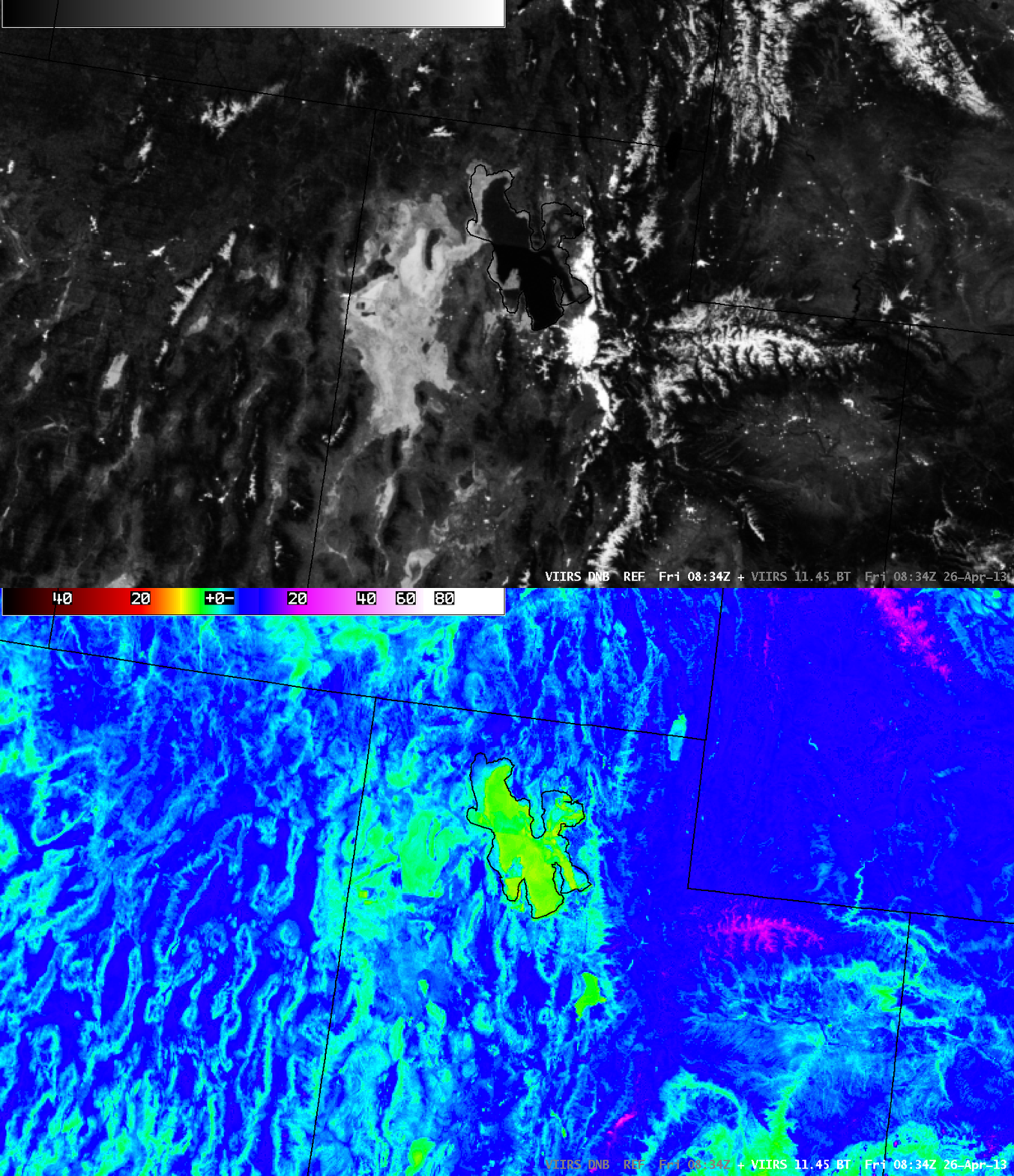
Moving toward the western US, images of the DNB and the 11.45 µm IR channel centered over the Salt Lake City, Utah area (below) revealed colder (violet color enhancement on the IR image) snow-covered mountain ranges (most notable were the Wasatch Range in Utah and the Wind River Range in Wyoming), as well as the large, bright area of the Bonneville Salt Flats in the Great Salt Lake Desert.
Finally, some interesting views along the West Coast of the US, beginning with a comparison of the VIIRS DNB and BTD Fog/stratus product centered over the Seattle and Vancouver Island region at 10:12 UTC or 3:12 AM local time (below). Fingers of marine layer stratus clouds could be seen moving inland across the Olympic Peninsula of far northwestern Washington State — and the snow-covered Olympic Mountains (which includes Mount Olympus at an elevation of 7,962 ft or 2,427 m) were plainly visible on the DNB image. Stratus clouds were also seen moving inland through the Strait of Juan de Fuca, as well as into the southern portion of Puget Sound.
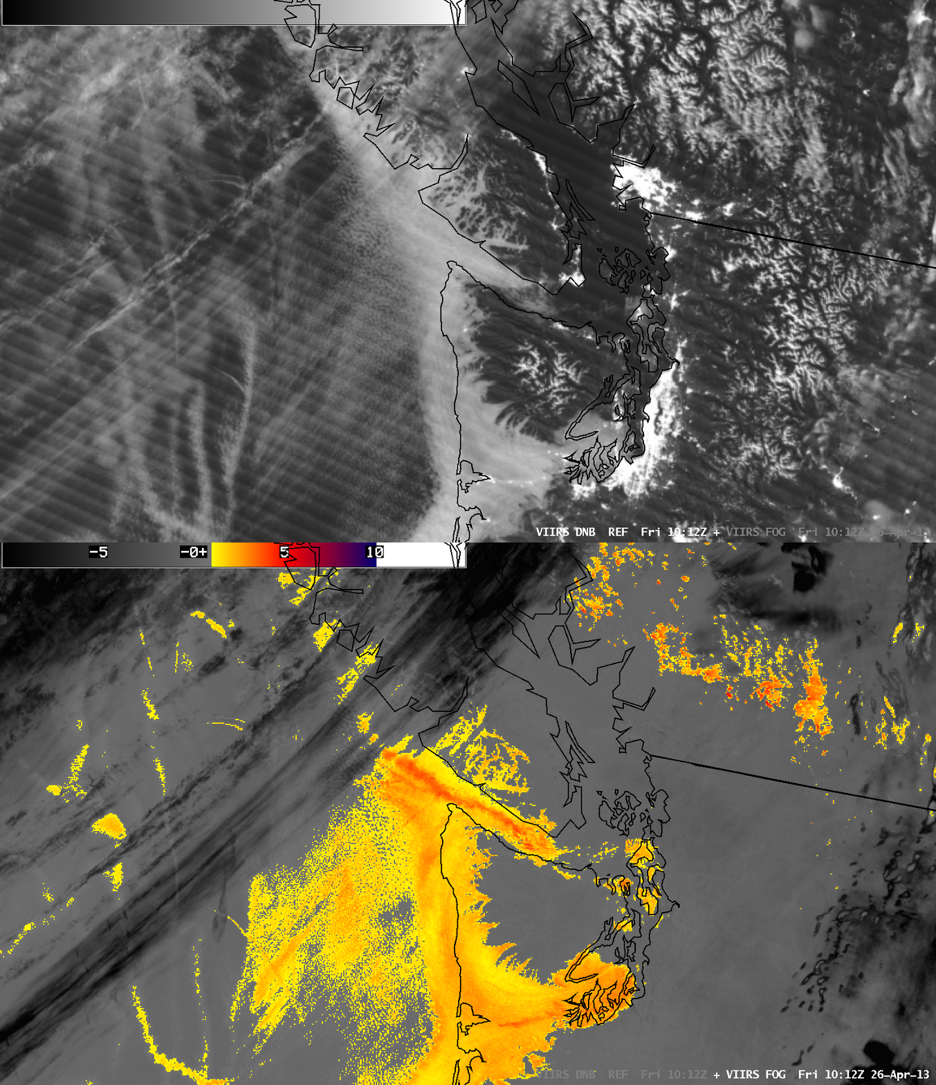
Suomi NPP VIIRS 0.7 µm Day/Night Band and IR brightness temperature difference “Fog/stratus product”
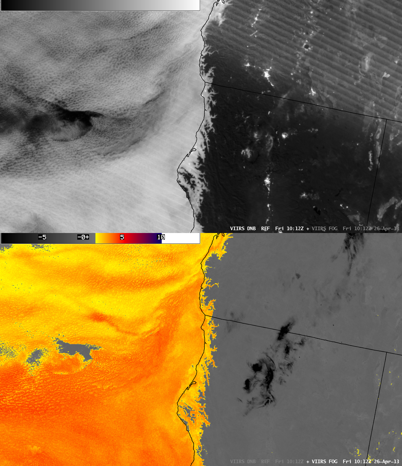
Farther to the south along the southern Oregon and northern California coasts, the inland extent of fingers of marine layer stratus clouds could again be seen on both the VIIRS DNB and BTD Fog/stratus product images (below).
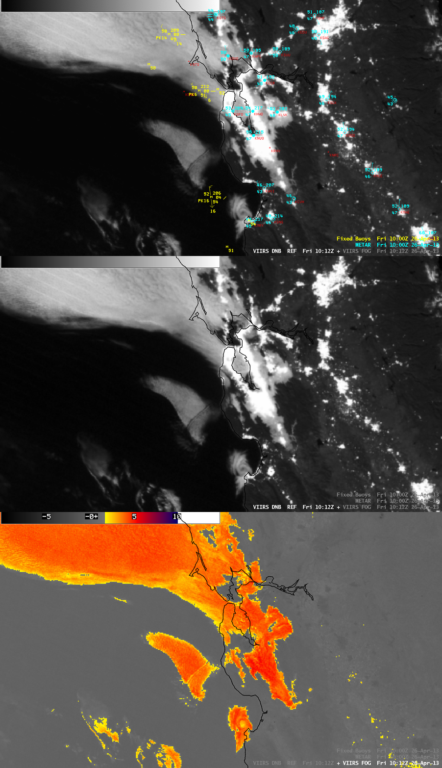
Finally, a comparison of VIIRS DNB and BTD Fog/stratus product images centered over the San Francisco area (below) showed where marine layer stratus clouds covered portions of the San Francisco Bay, San Pablo Bay, and adjacent inland valleys. Other features of interest included a small eddy circulation just offshore of Monterey (KMRY), as well as an aircraft dissipation trail slicing southwest-to-northeast through the patch of offshore stratus cloud located just to the northwest of the eddy (likely caused by a jet either ascending or descending through the cloud flying outbound or inbound from San Francisco International airport KSFO).


