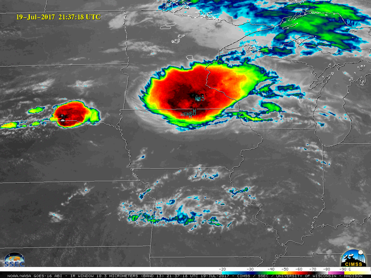
![GOES-16 Infrared Window (10.3 µm) images, with SPC storm reports plotted in cyan [click to play MP4 animation]](https://cimss.ssec.wisc.edu/satellite-blog/wp-content/uploads/sites/5/2017/07/960x1280_GOES16A_B13_G16_IR_DERECHO_19-20JUL2017_2017200_213718_0001PANEL.GIF)
GOES-16 Infrared Window (10.3 µm) images, with SPC storm reports plotted in cyan [click to play MP4 animation]
A long-lived mesoscale convective system (MCS) known as a derecho produced swath of damaging winds — as well as some large hail and a couple of tornadoes — that stretched from north-central South Dakota to northwestern Indiana on 19 July 2017 (SPC storm reports | TWC summary). GOES-16 “Clean” Infrared Window (10.3 µm) images (above) showed the southeastward propagation of the storm system.
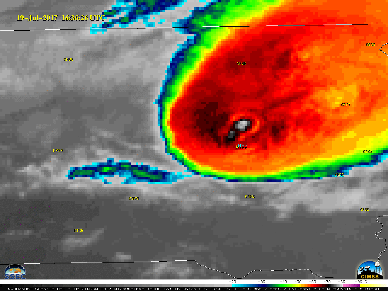
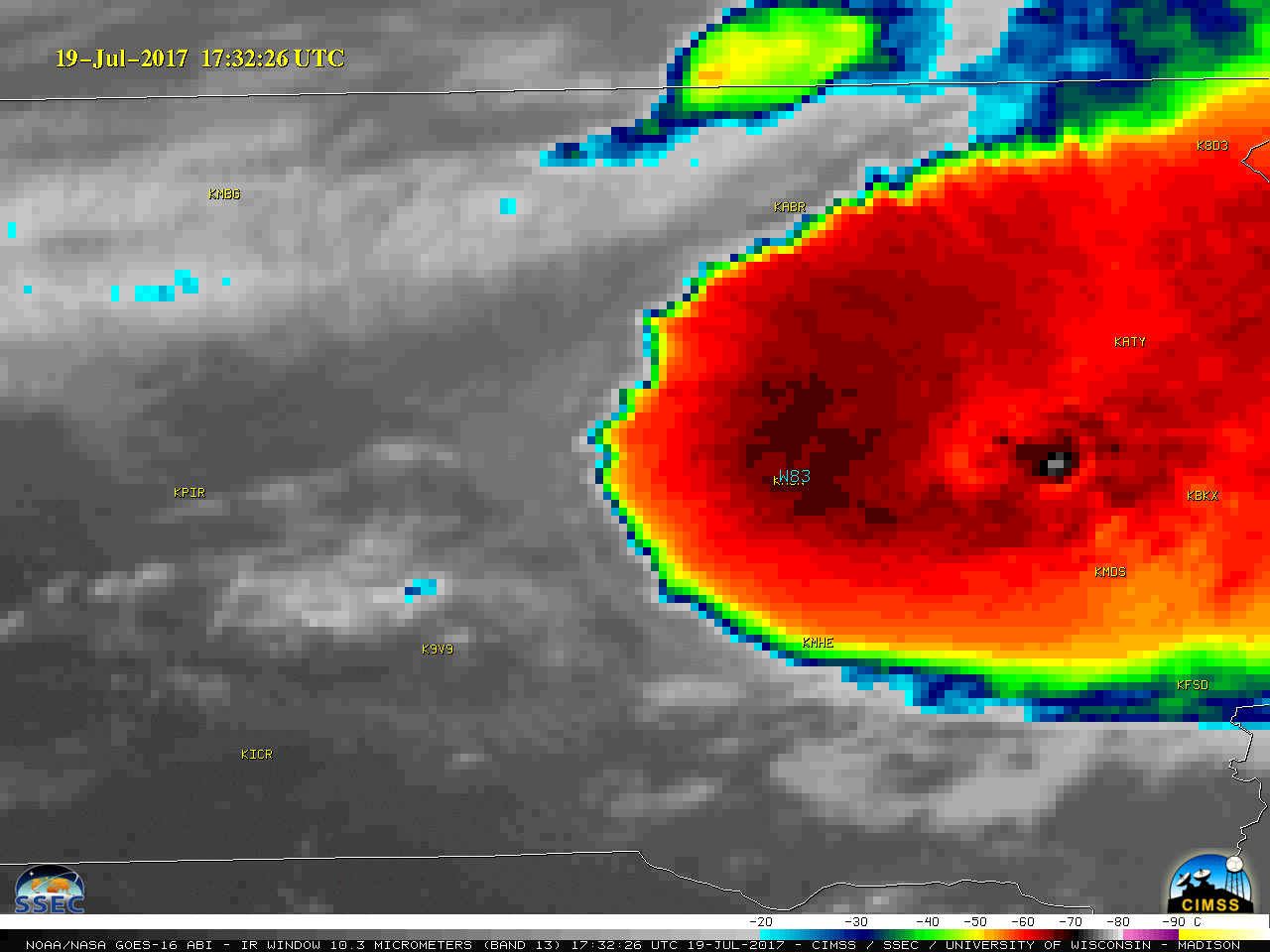
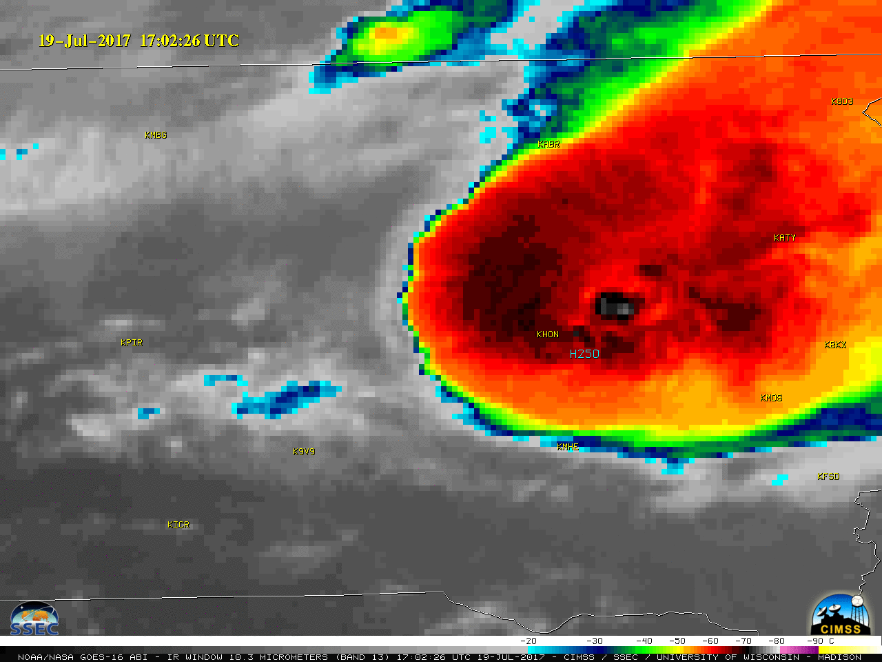
Closer views of the early stages of the derecho as it moved across central and eastern South Dakota are shown below, using GOES-16 “Red” Visible (0.64 µm) and Infrared Window (10.3 µm) images. The highest measured wind gust was 100 mph near Polo (1522 UTC), with 83 mph recorded at Huron (1636 and 1730 UTC). Hail of 2.50 inches in diameter fell near Cavour (1703 UTC). Note that most of the severe reports were in the general vicinity of the persistent cold overshooting top (black to white enhancement) seen on the Infrared imagery; due to parallax, the apparent location of this storm-top feature was shifted slightly north of its true location.
![GOES-16 Visible (0.64 µm) images, with SPC storm reports plotted in red [click to play MP4 animation]](https://cimss.ssec.wisc.edu/satellite-blog/wp-content/uploads/sites/5/2017/07/960x1280_GOES16A_B2_G16_VIS_SD_SVR_19UL2017_2017200_152226_0001PANEL.GIF)
GOES-16 Visible (0.64 µm) images, with SPC storm reports plotted in red [click to play MP4 animation]
![GOES-16 Infrared Window (10.3 µm) images, with SPC storm reports plotted in cyan [click to play MP4 animation]](https://cimss.ssec.wisc.edu/satellite-blog/wp-content/uploads/sites/5/2017/07/960x1280_GOES16A_B13_G16_IR_SD_SVR_19UL2017_2017200_152226_0001PANEL.GIF)
GOES-16 Infrared Window (10.3 µm) images, with SPC storm reports plotted in cyan [click to play MP4 animation]
![Terra MODIS Visible and Infrared Window (11.0 µm) images, with SPC storm reports [click to enlarge]](https://cimss.ssec.wisc.edu/satellite-blog/wp-content/uploads/sites/5/2017/07/170719_1656utc_terra_modis_visible_infrared_spc_storrm_reports_SD_MCS_anim.gif)
Terra MODIS Visible and Infrared Window (11.0 µm) images, with SPC storm reports [click to enlarge]
![Suomi NPP VIIRS Visible (0.64 µm) and Infrared Window (11.45 µm) images, with SPC storm reports [click to enlarge]](https://cimss.ssec.wisc.edu/satellite-blog/wp-content/uploads/sites/5/2017/07/170719_1846utc_suomi_npp_viirs_visible_infrared_spc_storm_reports_SD_MN_MCS_anim.gif)
Suomi NPP VIIRS Visible (0.64 µm) and Infrared Window (11.45 µm) images, with SPC storm reports [click to enlarge]
View only this post Read Less
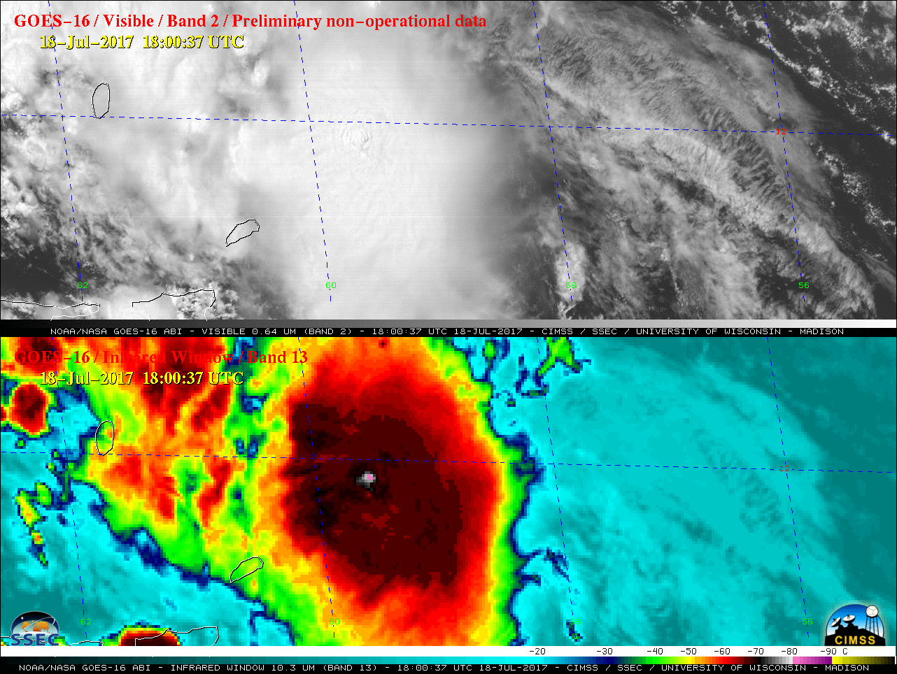
![GOES-16 Visible (0.64 µm, top) and Infrared Window (10.3 µm) images [click to play MP4 animation]](https://cimss.ssec.wisc.edu/satellite-blog/wp-content/uploads/sites/5/2017/07/G16_VIS_IR_DON_18JUL2017_480x1280_B213_2017199_180037_0002PANELS.GIF)
![GOES-13 Infrared Window (10.7 µm) images, with Tropical Overshooting Top and Deep-Layer Wind Shear products [click to enlarge]](https://cimss.ssec.wisc.edu/satellite-blog/wp-content/uploads/sites/5/2017/07/170718_1845utc_Infrared_TropicalOvershootingTops_WindShear_TS_Don_anim.gif)
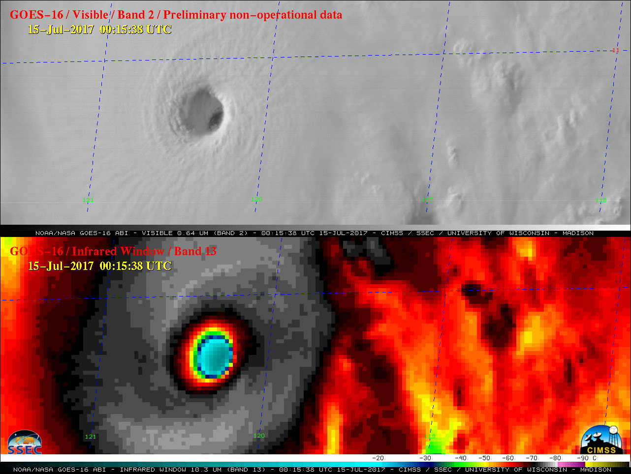
![GOES-16 Visible [0.64 µm, top) and Infrared Window (10.3 µm, bottom) images [click to play animation]](https://cimss.ssec.wisc.edu/satellite-blog/wp-content/uploads/sites/5/2017/07/170714_goes16_visible_infrared_Hurricane_Fernanda_anim.gif)
![GOES-16 Infrared Window (10.3 µm) images [click to play animation]](https://cimss.ssec.wisc.edu/satellite-blog/wp-content/uploads/sites/5/2017/07/170715-17_goes16_infrared_Hurricane_Fernanda_anim.gif)
![Terra MODIS Infrared Window (11.0 µm) image, with SPC storm reports of severe winds plotted in cyan [click to enlarge]](https://cimss.ssec.wisc.edu/satellite-blog/wp-content/uploads/sites/5/2017/07/170717_0558utc_terra_modis_infrared_spc_storm_reports_AZ_anim.gif)
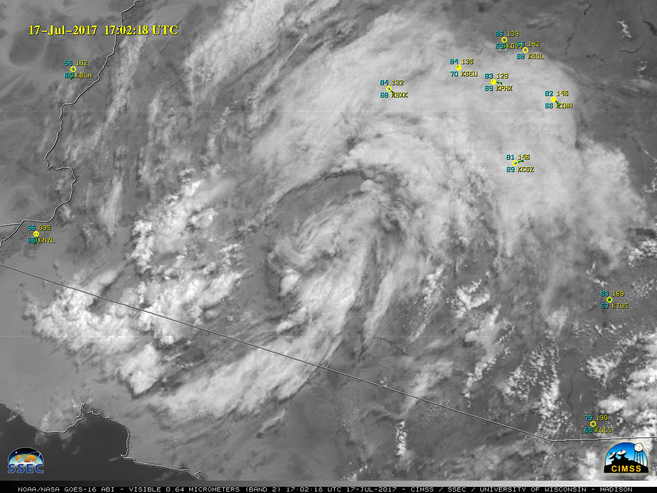
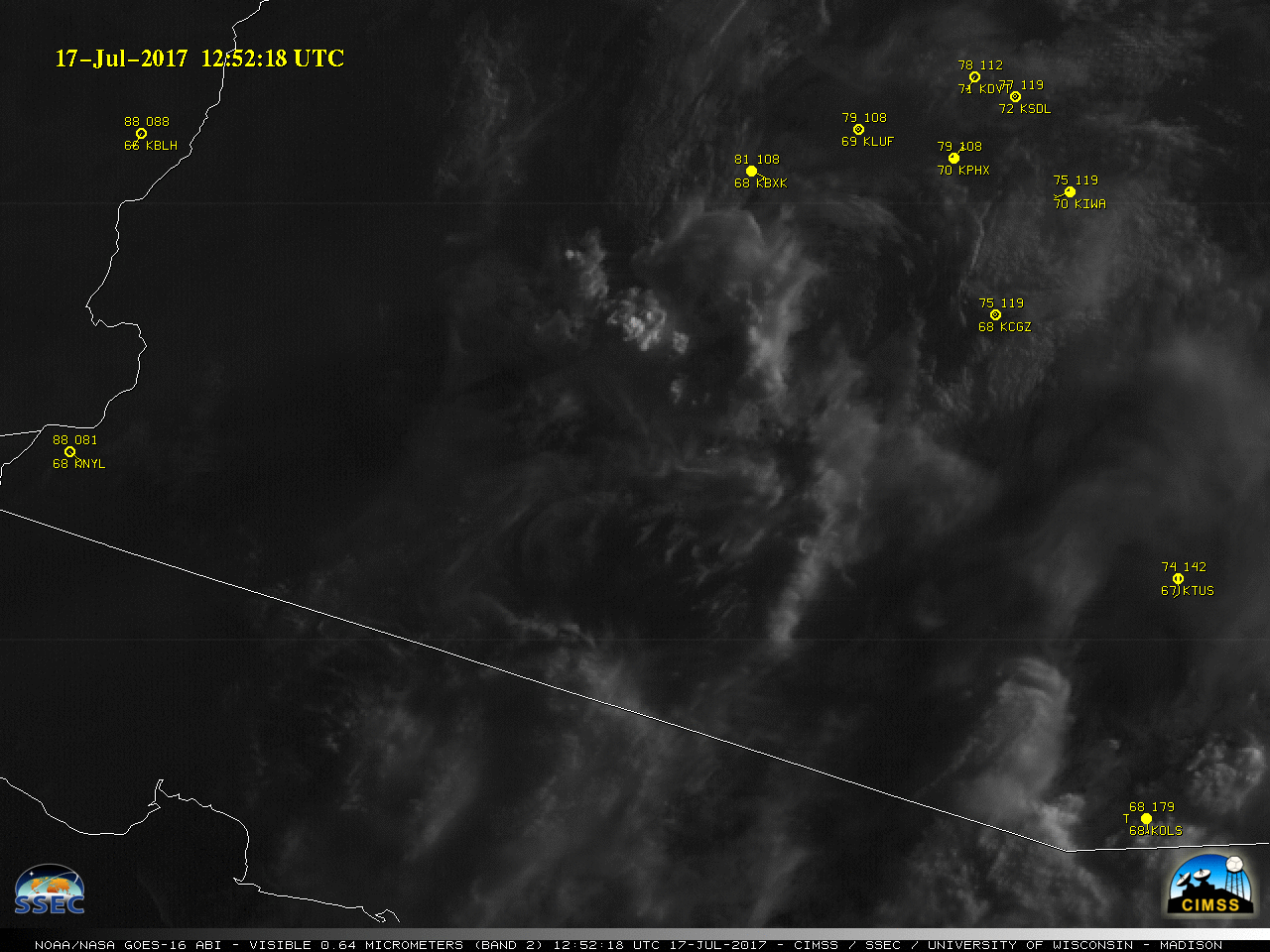
![GOES-16 Infrared Window (10.3 µm) images, with station identifiers plotted in yellow and SPC storm reports plotted in cyan [click to play animation]](https://cimss.ssec.wisc.edu/satellite-blog/wp-content/uploads/sites/5/2017/07/170717_goes16_infrared_AZ_pre-MCV_anim.gif)
![SPC Mesoscale Discussion [click to enlarge]](https://cimss.ssec.wisc.edu/satellite-blog/wp-content/uploads/sites/5/2017/07/170717_AZ_spc_mcd.png)
