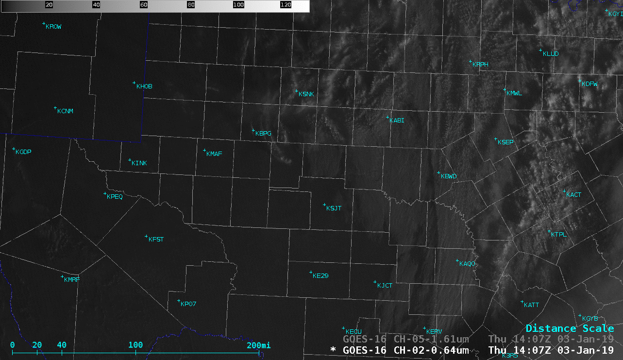
GOES-16 “Red” Visible (0.64 µm) and Near-Infrared “Snow/Ice” (1.61 µm) images [click to play animation | MP4]
View only this post Read Less
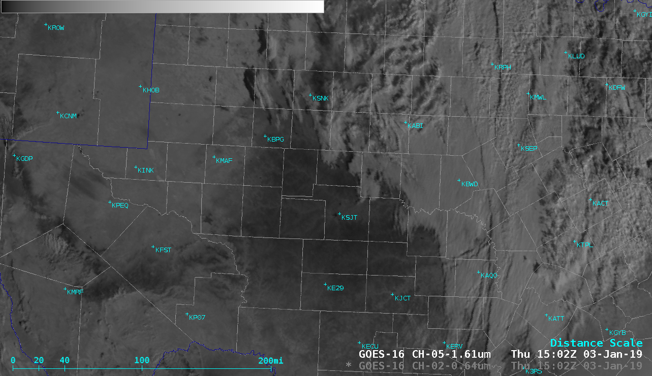
Portions of West Texas received a light accumulation of ice from freezing rain/drizzle/fog during the daytime and evening hours on 02 January 2019. On the following morning prior to melting, in a comparison of GOES-16 (GOES-East) “Red” Visible (0.64 µm) and Near-Infrared “Snow/Ice” (1.61 µm) images (above) the semi-transparent glaze of ice that covered... Read More
GOES-16 “Red” Visible (0.64 µm) and Near-Infrared “Snow/Ice” (1.61 µm) images [click to play animation | MP4]
View only this post Read Less
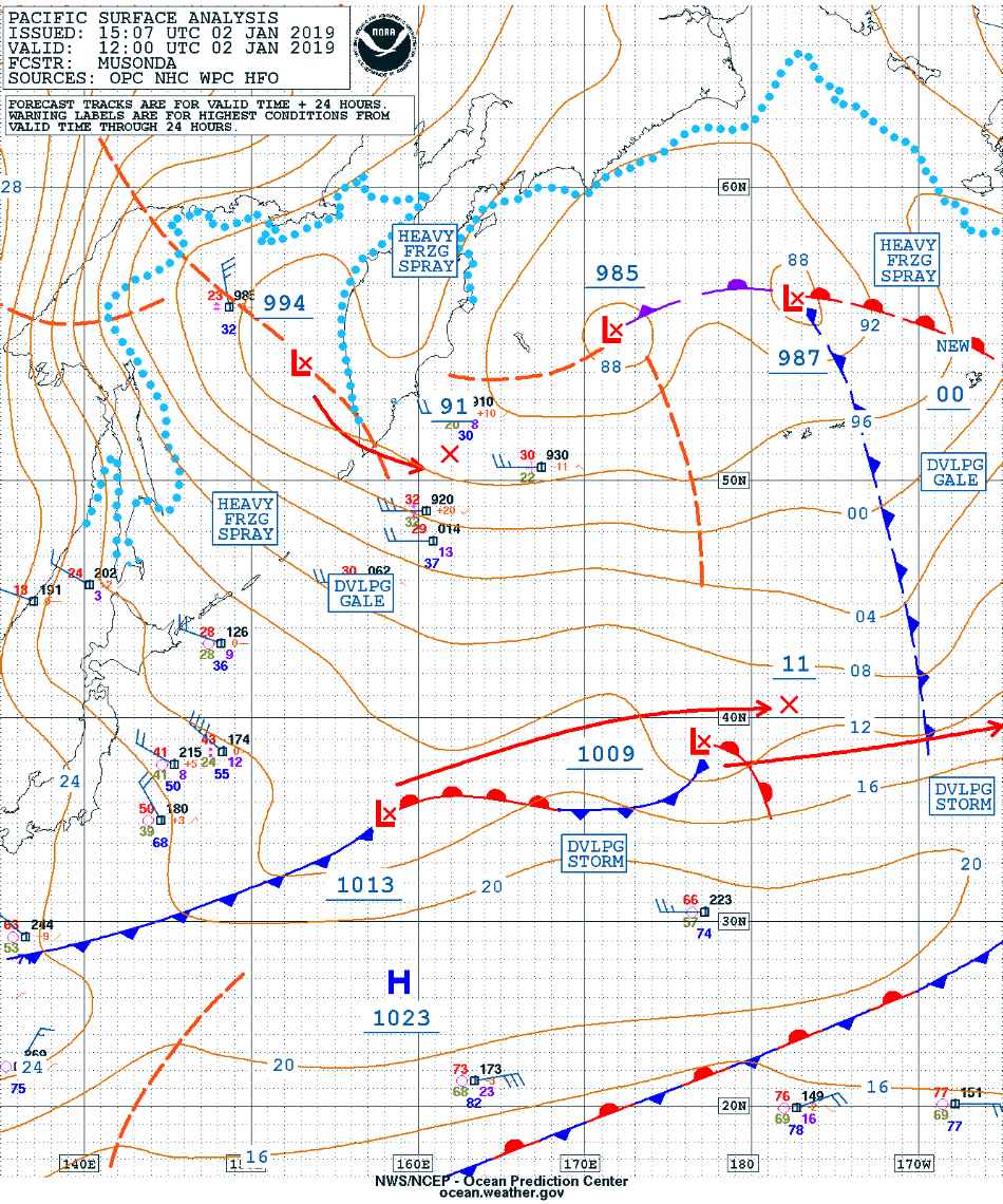
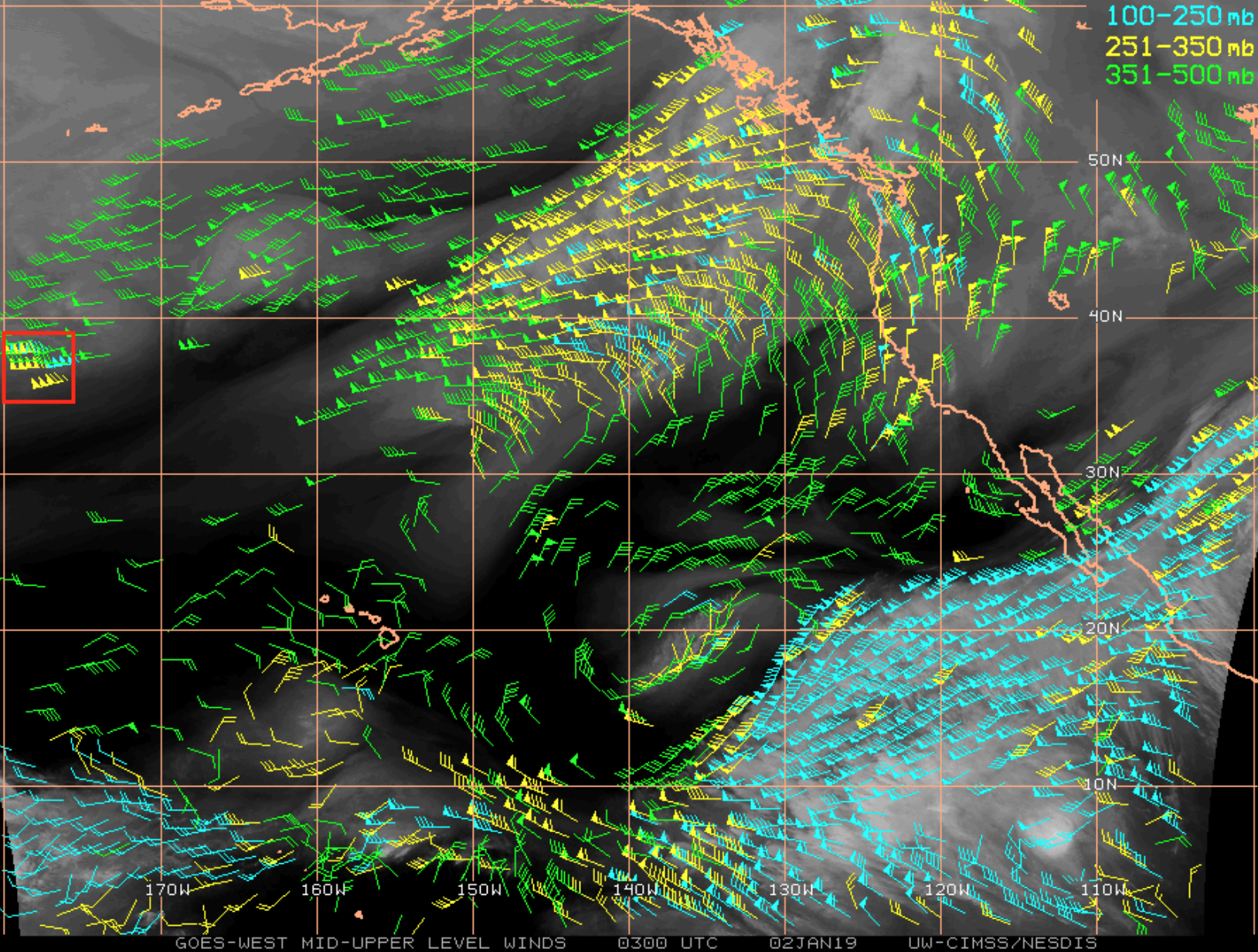
* GOES-17 images shown here are preliminary and non-operational *GOES-17 Mid-level Water Vapor (6.9 µm) images with an overlay of 250 hPa wind isotachs from the GFS90 model (above) showed a string of disturbances (surface analysis) along the axis of a 180-knot “Japan Jet” across the North Pacific Ocean on 02 January... Read More
![GOES-17 Mid-level Water Vapor (6.9 µm) images, with 250 hPa wind isotachs [click to play animation | MP4]](https://cimss.ssec.wisc.edu/satellite-blog/wp-content/uploads/sites/5/2019/01/190102_goes17_waterVapor_250hPa_isotachs_North_Pacific_anim.gif)
GOES-17 Mid-level Water Vapor (6.9 µm) images, with 250 hPa wind isotachs [click to play animation | MP4]
* GOES-17 images shown here are preliminary and non-operational *
GOES-17 Mid-level Water Vapor (6.9 µm) images with an overlay of 250 hPa wind isotachs from the GFS90 model (above) showed a string of disturbances (surface analysis) along the axis of a 180-knot “Japan Jet” across the North Pacific Ocean on 02 January 2019.
GOES-17 Split Ozone (9.6 µm – 10.3 µm) Brightness Temperature Difference images (below) include an overlay of PV1.5 pressure (an indicator of the height of the “dynamic tropopause”) — they showed the difference between cold polar air having a low tropopause (shades of cyan to blue) north of the jet stream and warm tropical air having a much higher tropopause (shades of yellow). The Split Ozone BTD is the Green component of the Air Mass Red-Green-Blue (RGB) product.
![GOES-17 Split Ozone (9.6 - 10.3 µm) images, with contours of PV1.5 pressure [click to play animation | MP4]](https://cimss.ssec.wisc.edu/satellite-blog/wp-content/uploads/sites/5/2019/01/190102_goes17_splitOzone_pv1.5pressure_North_Pacific_anim.gif)
GOES-17 Split Ozone (9.6 – 10.3 µm) images, with contours of PV1.5 pressure [click to play animation | MP4]
![Plots of rawinsonde data from St. Paul Island, Alaska [click to enlarge]](https://cimss.ssec.wisc.edu/satellite-blog/wp-content/uploads/sites/5/2019/01/190102_PASN_RAOBS.GIF)
Plots of rawinsonde data from St. Paul Island, Alaska [click to enlarge]
![Plots of rawinsonde data from Lihue, Hawai'i [click to enlarge]](https://cimss.ssec.wisc.edu/satellite-blog/wp-content/uploads/sites/5/2019/01/190102_PHLI_RAOBS.GIF)
Plots of rawinsonde data from Lihue, Hawai’i [click to enlarge]
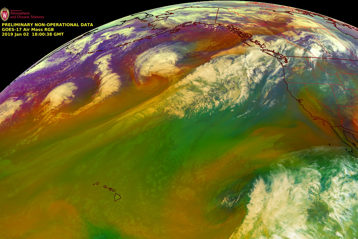
![GOES-17 Air Mass RGB images [click to play animation | MP4]](https://cimss.ssec.wisc.edu/satellite-blog/wp-content/uploads/sites/5/2019/01/190102_goes17_airmassRGB_North_Pacific_anim.gif)
GOES-17 Air Mass RGB images [click to play animation | MP4]
![Suomi NPP VIIRS Day/Night Band (0.7 µm) and Infrared Window (11.45 µm) images at 1427 UTC and 0022 UTC [click to enlarge]](https://cimss.ssec.wisc.edu/satellite-blog/wp-content/uploads/sites/5/2019/01/190102_suomiNPP_viirs_dayNightBand_infraredWindow_Bering_Sea_anim.gif)
Suomi NPP VIIRS Day/Night Band (0.7 µm) and Infrared Window (11.45 µm) images at 1427 UTC and 0022 UTC [click to enlarge]
![GOES-15 Water Vapor (6.5 µm) Derived Motion Winds [click to enlarge]](https://cimss.ssec.wisc.edu/satellite-blog/wp-content/uploads/sites/5/2019/01/190102_goes15_waterVapor_winds_North_Pacific_anim.gif)
GOES-15 Water Vapor (6.5 µm) Derived Motion Winds [click to enlarge]
View only this post Read Less
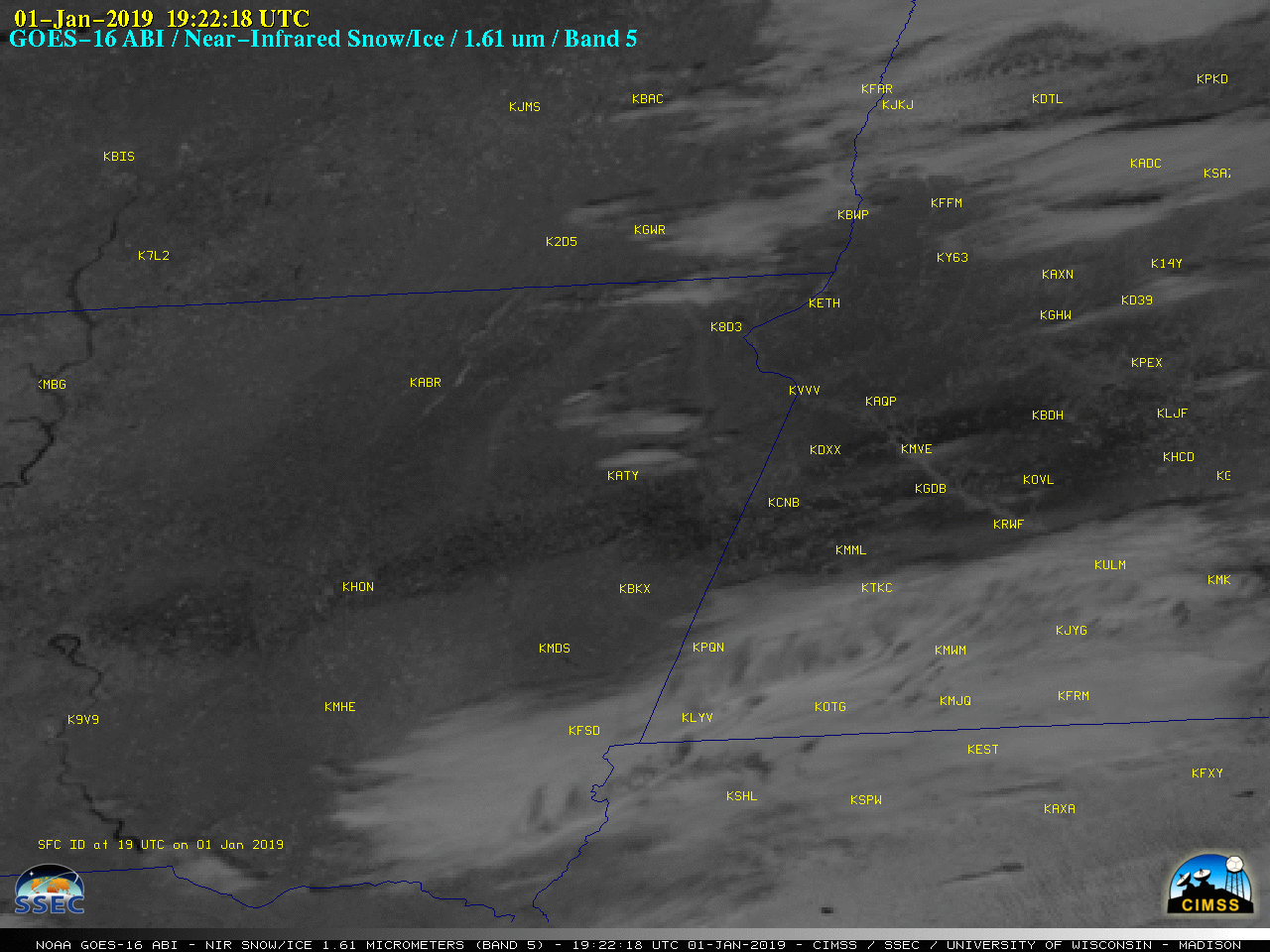
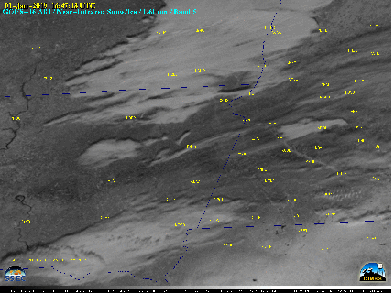
GOES-16 (GOES-East) Near-Infrared “Snow/Ice” (1.61 µm) images (above) revealed a darker swath — oriented southwest to northeast, from central South Dakota to central Minnesota — highlighting areas which received an accrual of ice (from freezing rain/drizzle) during a 30 December – 31 December 2018 mixed precipitation event (surface analyses). Light to moderate Freezing Rain was... Read More
GOES-16 Near-Infrared “Snow/Ice” (1.61 µm) images [click to play animation | MP4]
As seen in a plot of ABI Spectral Response Functions (below), snow and ice are efficient absorbers of radiation (and therefore exhibit a low relectance) at the 1.61 µm wavelength, making them appear darker on the Snow/Ice imagery — and since ice absorbs more strongly than snow, it appears as the darkest shades of gray/black. Strong northerly winds in the wake of the precipitation event then swept the residual ice-crusted snow cover clear of any new snowfall.
![Plots of Spectral Response Function for ABI Bands 1-5 [click to enlarge]](https://cimss.ssec.wisc.edu/satellite-blog/wp-content/uploads/sites/5/2019/01/ABI_Bands1-5_SRF.jpg)
Plots of Spectral Response Function for ABI Bands 1-5 [click to enlarge]
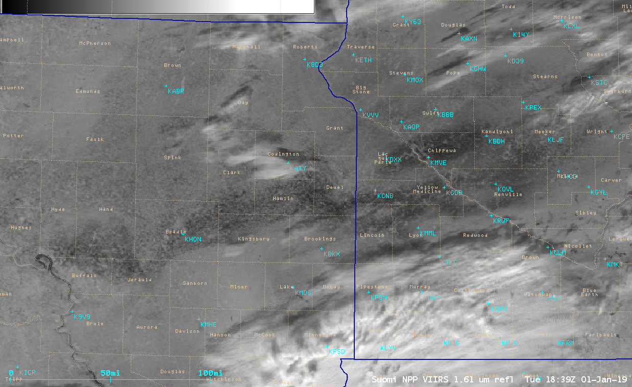
VIIRS Near-Infrared “Snow/Ice” (1.61 µm) images from NOAA-20 (at 1839 UTC) and Suomi NPP (at 1931 UTC) [click to enlarge]
View only this post Read Less
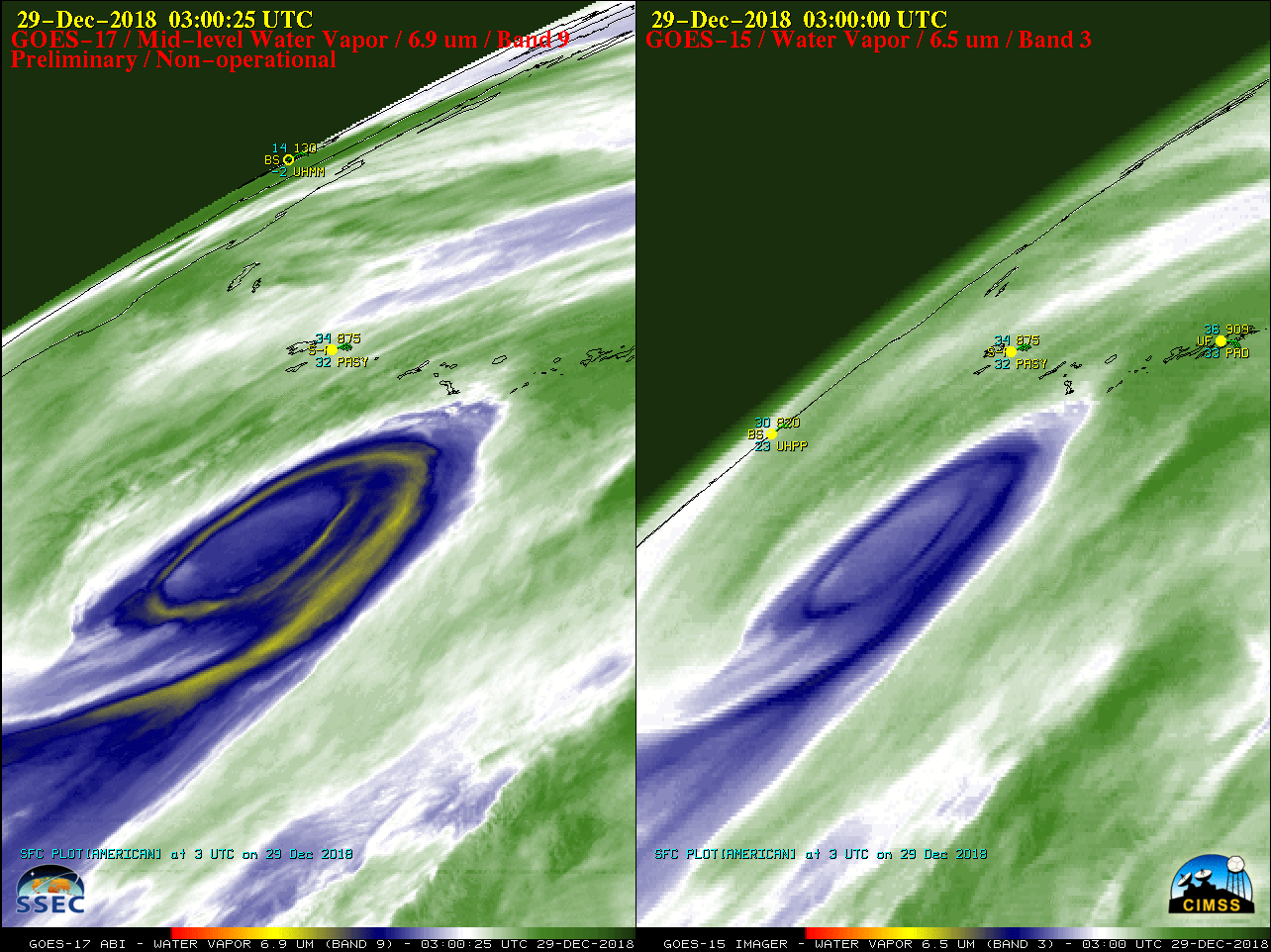
* GOES-17 images shown here are preliminary and non-operational *A mid-latitude cyclone moved northward over the far western Aleutian Islands late in the day on 28 December 2018, intensifying to a Hurricane Force low pressure system by 06 UTC on 29 December (surface analyses). A comparison of GOES-17 and GOES-15 (GOES-West)... Read More
![Water Vapor images from GOES-17 (6.9 µm, left) and GOES-15 (6.5 µm, right) [click to play animation | MP4]](https://cimss.ssec.wisc.edu/satellite-blog/wp-content/uploads/sites/5/2018/12/181228_181229_goes17_goes15_waterVapor_Aleutian_Islands_HF_low_anim.gif)
Water Vapor images from GOES-17 (6.9 µm, left) and GOES-15 (6.5 µm, right) [click to play animation | MP4]
* GOES-17 images shown here are preliminary and non-operational *
A mid-latitude cyclone moved northward over the far western Aleutian Islands late in the day on 28 December 2018, intensifying to a Hurricane Force low pressure system by 06 UTC on 29 December (surface analyses). A comparison of GOES-17 and GOES-15 (GOES-West) Water Vapor images (above) highlighted the improved spatial resolution of the GOES-17 data (2 km at satellite sub-point, vs 4 km for GOES-15). The view from GOES-15 was more oblique, since it was positioned at 128º W longitude (compared to 137.2º W longitude for GOES-17). GOES-17 is scheduled to become the operational GOES-West satellite in January 2019.
A toggle between GOES-17 Low-level (7.3 µm), Mid-level (6.9 µm) and Upper-level (6.2 µm) Water Vapor images at 1100 UTC is shown below. Although the satellite viewing angle was large, good detail could still be seen.
![GOES-17 Low-level (7.3 µm), Mid-level (6.9 µm) and Upper-level (6.2 µm) Water Vapor images at 1100 UTC [click to enlarge]](https://cimss.ssec.wisc.edu/satellite-blog/wp-content/uploads/sites/5/2018/12/18129_1100utc_goes17_waterVapor_Aleutian_Islands_anim.gif)
GOES-17 Low-level (7.3 µm), Mid-level (6.9 µm) and Upper-level (6.2 µm) Water Vapor images at 1100 UTC [click to enlarge]
![Suomi NPP VIIRS Visible (0.64 µm), Day/Night Band (0.7 µm) and Infrared Window (11.45 µm) images [click to enlarge]](https://cimss.ssec.wisc.edu/satellite-blog/wp-content/uploads/sites/5/2018/12/181229_suomiNPP_viirs_visible_dayNightBand_infrared_Aleutian_Islands_anim.gif)
Suomi NPP VIIRS Visible (0.64 µm), Day/Night Band (0.7 µm) and Infrared Window (11.45 µm) images [click to enlarge]
![Time series plot of surface weather data from Shemya Eareckson Air Station [click to enlarge]](https://cimss.ssec.wisc.edu/satellite-blog/wp-content/uploads/sites/5/2018/12/181228_181229_PASY_SFCMG.GIF)
Time series plot of Hourly surface weather data from Shemya Eareckson Air Station [click to enlarge]
![Time series plot of Hourly and Special surface weather data from Shemya Eareckson Air Station [click to enlarge]](https://cimss.ssec.wisc.edu/satellite-blog/wp-content/uploads/sites/5/2018/12/181229_PASY_SFCMG.GIF)
Time series plot of Hourly and Special surface weather data from Shemya Eareckson Air Station [click to enlarge]
View only this post Read Less
