Precipitable water plume in the Gulf of Mexico
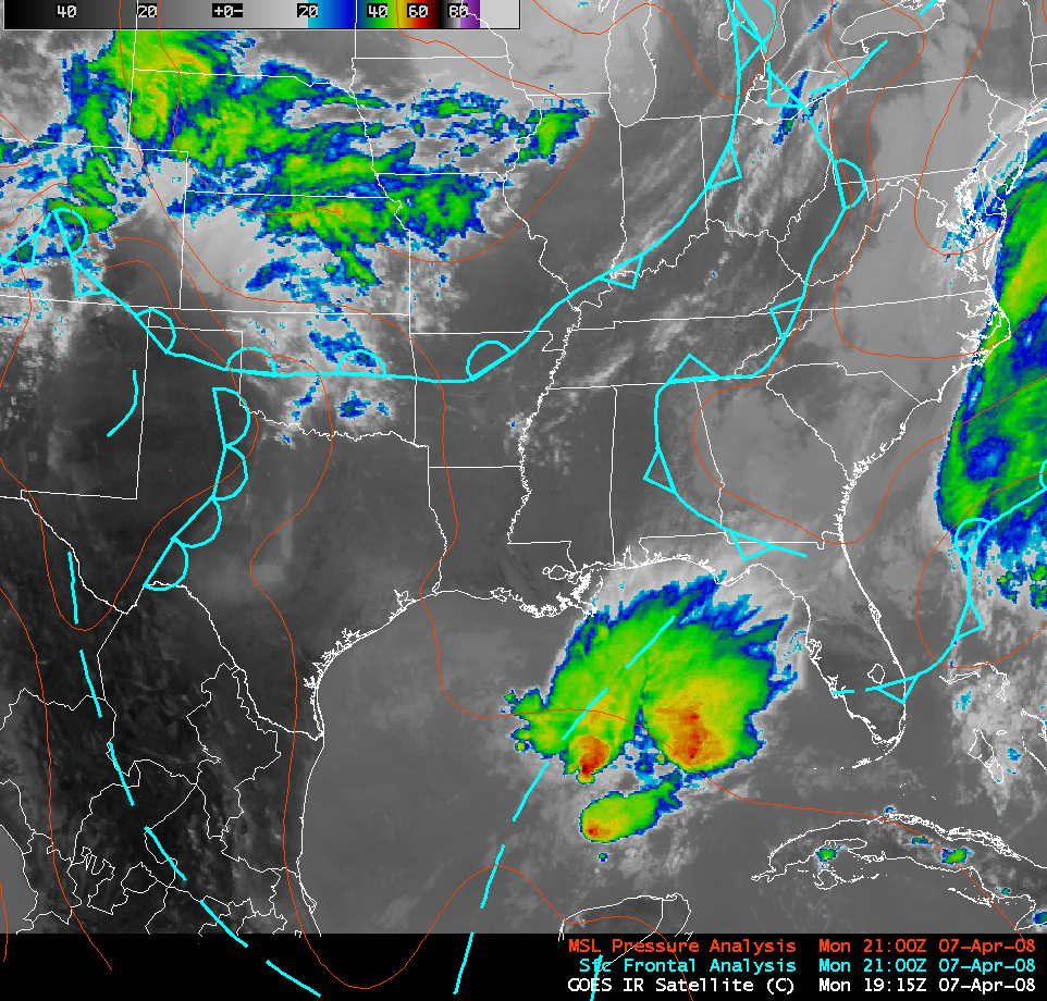
An AWIPS image of the GOES-12 10.7 µm “IR window” channel (above) showed a large cluster of convection that developed in the vicinity an inverted surface trough axis over the Gulf of Mexico on 07 April 2008.
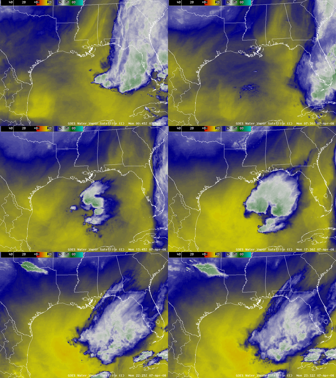
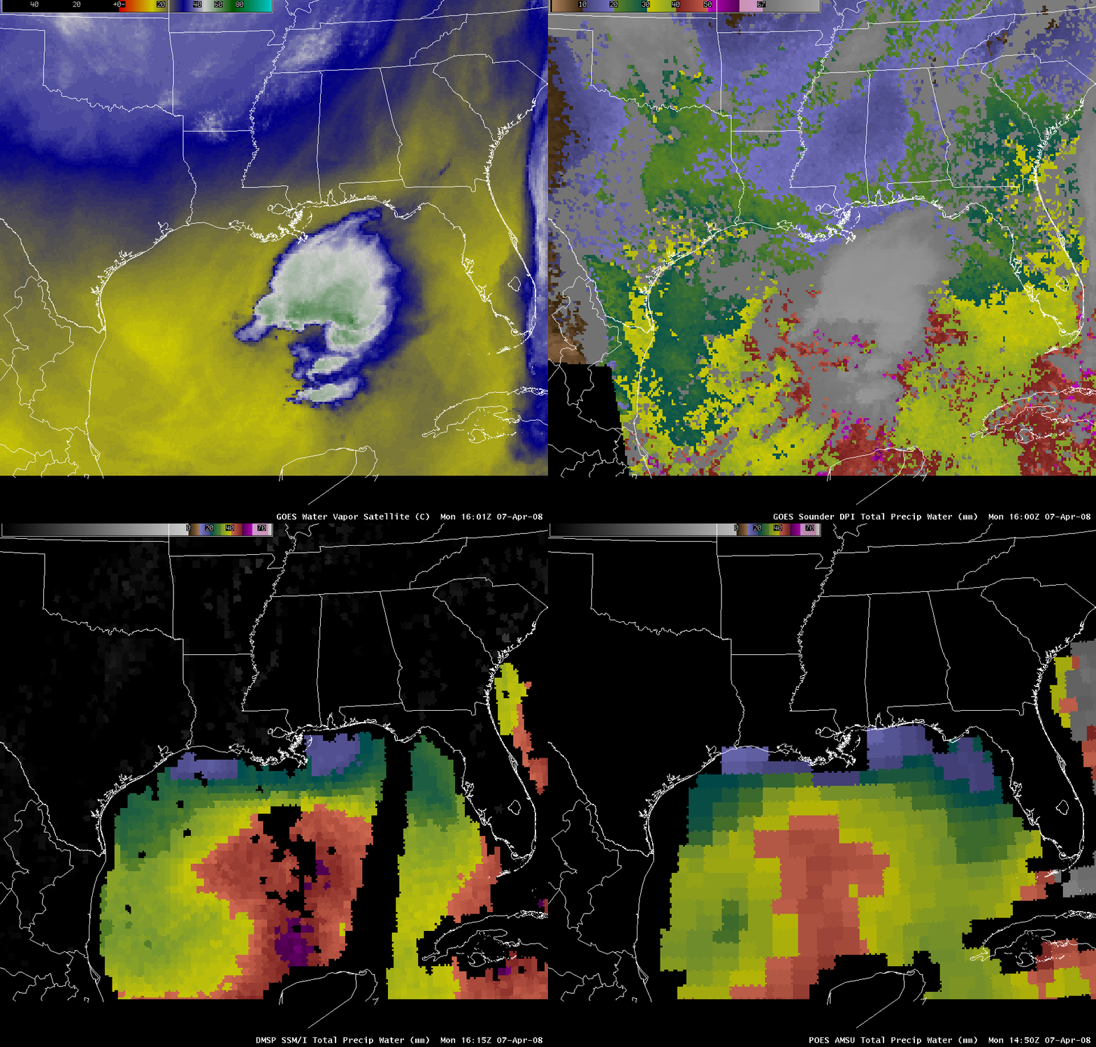
An animation of AWIPS images of the GOES-12 6.5 µm “water vapor channel” (above) suggested that much of the middle to upper troposphere was quite dry (yellow to orange colors) over the Gulf of Mexico region on that particular day.
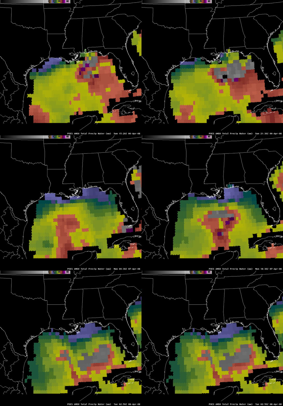
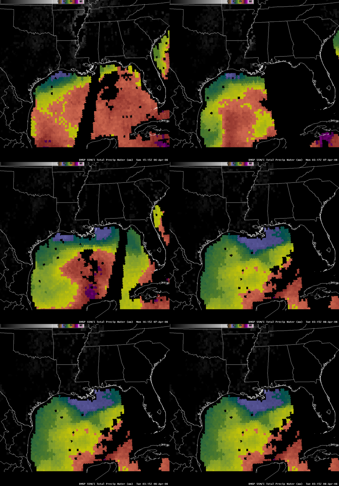
However, AWIPS images of the POES AMSU total precipitable water (above) and the DMSP SSM/I total precipitable water (below) revealed that a plume of significant moisture was moving northward into the central Gulf of Mexico during 06-07 April, providing a necessary ingredient for the development of the convection.
A comparison of the GOES water vapor channel image with total precipitable water products from the GOES sounder, POES AMSU, and DMSP SSM/I (below) demonstrates how misleading it would be to simply interpret the GOES vapor image alone and conclude that the entire Gulf of Mexico region was generally “very dry” (aside from the cluster of convection that had developed). The bulk of the precipitable water plume existed at lower levels of the atmosphere, below the layer that was being sensed by the GOES imager water vapor channel (which, according to the GOES water vapor weighting function plot for Brownsville, Texas at 12 UTC on 07 April was centered around 500 hPa).
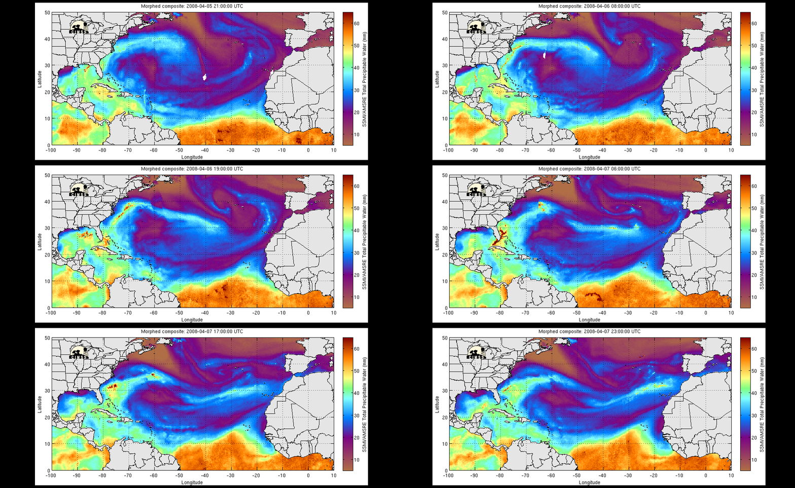
An animation of hourly composites of the CIMSS MIMIC total precipitable water product (below) showed the evolution of the moist plume as it emerged into the southwestern Gulf of Mexico and then moved northeastward into the central Gulf during the 06-07 April period. The MIMIC product blends microwave total precipitable water data from the DMSP SSM/I and the Aqua AMSR-E polar orbiting instruments, and advects the blended moisture fields using lower-tropospheric mean layer wind derived from the GFS model.


