GOES-17 arrives at its GOES-West position of 137.2º W longitude
![Full Disk images of the 16 ABI bands from GOES-17 [click to play MP4 animation]](https://cimss.ssec.wisc.edu/satellite-blog/wp-content/uploads/sites/5/2018/11/181115_1500utc_goes17_visible_FD.png)
1500 UTC Full Disk images of the 16 ABI bands from GOES-17 [click to play MP4 animation]
* GOES-17 images posted here are preliminary and non-operational *
GOES-17 arrived at its GOES-West position of 137.2º W longitude on 13 November 2018, and began to transmit imagery via GOES Re-Broadcast (GRB) at 1500 UTC and the AWIPS Satellite Broadcast Network (SBN) at 1700 UTC on 15 November (NOAA/NESDIS article). A toggle between Full Disk images of the 16 ABI spectral bands from GOES-17 at 1500 UTC is shown above, with a 16-panel multi-band animation from 1515-2300 UTC shown below..
![Full Disk images from the 16 ABI bands of GOES-17 [click to play MP4 animation]](https://cimss.ssec.wisc.edu/satellite-blog/wp-content/uploads/sites/5/2018/11/181115_2000utc_goes17_FD_16panel.png)
Full Disk images from the 16 ABI bands of GOES-17 [click to play MP4 animation]
![GOES-17 Low-level (7.3 µm), Mid-level (6.9 µm) and Upper-level (6.2 µm) Water Vapor images [click to play animation | MP4]](https://cimss.ssec.wisc.edu/satellite-blog/wp-content/uploads/sites/5/2018/11/181115_goes17_waterVapor_Full_Disk_anim.gif)
GOES-17 Low-level (7.3 µm), Mid-level (6.9 µm) and Upper-level (6.2 µm) Water Vapor images [click to play animation | MP4]
![GOES-17 Low-level (7.3 µm), Mid-level (6.9 µm) and Upper-level (6.2 µm) Water Vapor images [click to play animation | MP4]](https://cimss.ssec.wisc.edu/satellite-blog/wp-content/uploads/sites/5/2018/11/181115_goes17_waterVapor_Alaska_anim.gif)
GOES-17 Low-level (7.3 µm), Mid-level (6.9 µm) and Upper-level (6.2 µm) Water Vapor images [click to play animation | MP4]
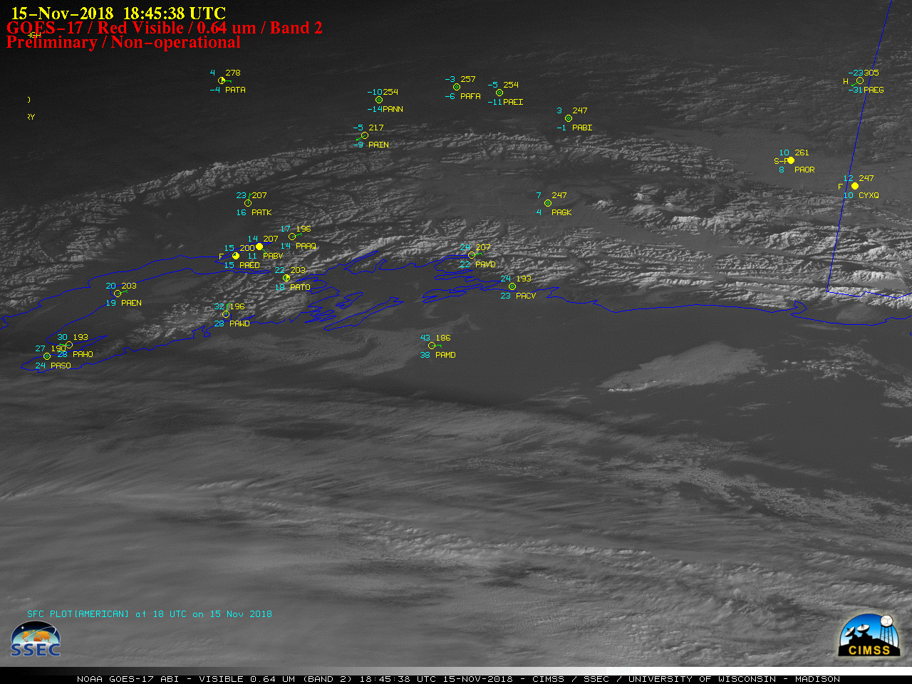
GOES-17 “Red” Visible (0.64 µm) images, with hourly plots of surface reports [click to play animation | MP4]
GOES-17 “Red” Visible (0.64 µm) images, with hourly plots of surface observations [click to play animation | MP4]
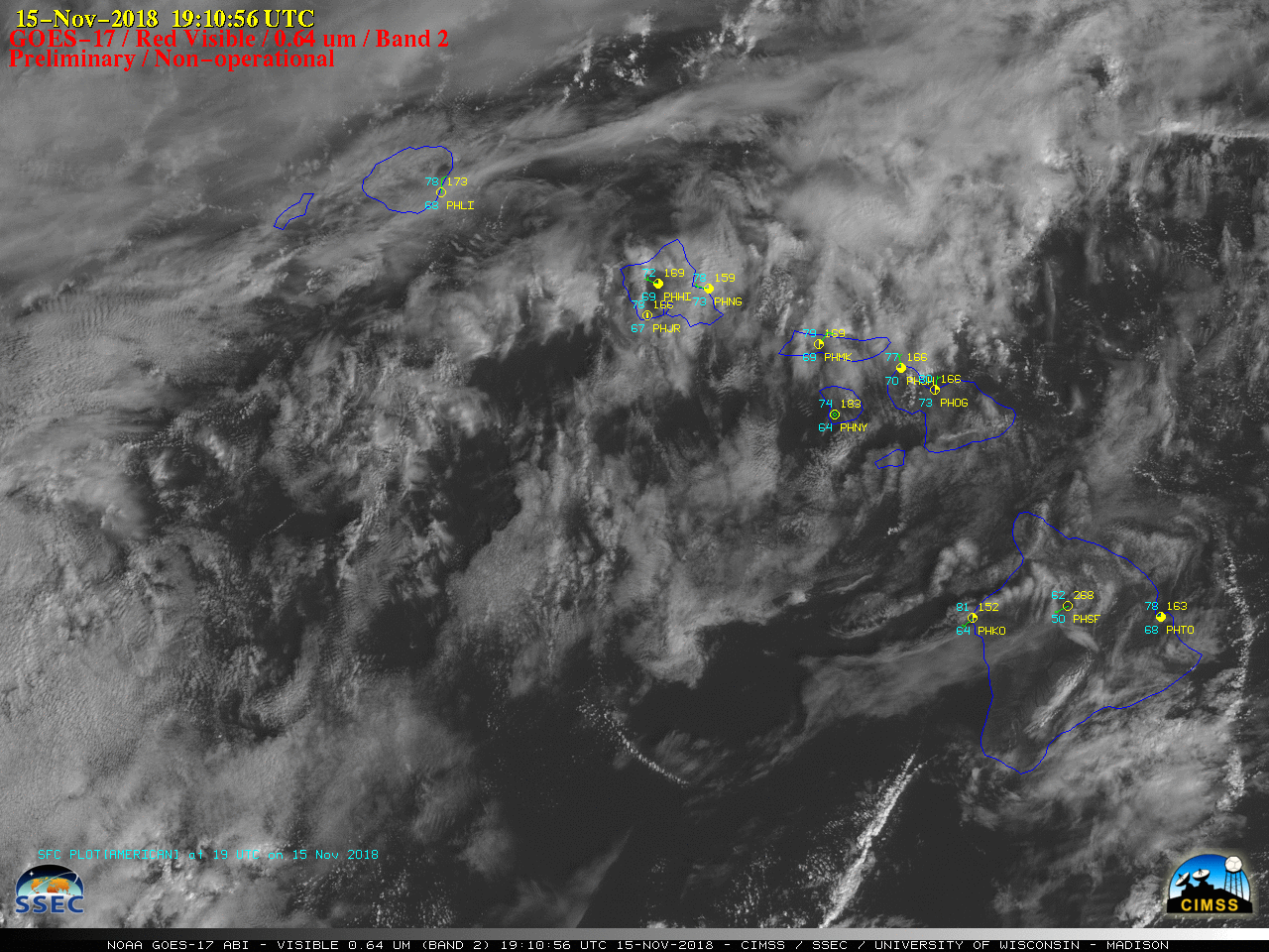
![GOES-17 "Red" Visible (0.64 µm) images, with hourly plots of surface observations [click to play animation | MP4]](https://cimss.ssec.wisc.edu/satellite-blog/wp-content/uploads/sites/5/2018/11/181115_goes17_visible_Guam_anim.gif)
GOES-17 “Red” Visible (0.64 µm) images, with hourly plots of surface observations [click to play animation | MP4]
![GOES-17 "Red" Visible (0.64 µm) images [click to play animation | MP4]](https://cimss.ssec.wisc.edu/satellite-blog/wp-content/uploads/sites/5/2018/11/181115_goes17_visible_infrared_Antarctica_anim.gif)
GOES-17 “Red” Visible (0.64 µm) and “Clean” Infrared Window (10.3 µm) images [click to play animation | MP4]
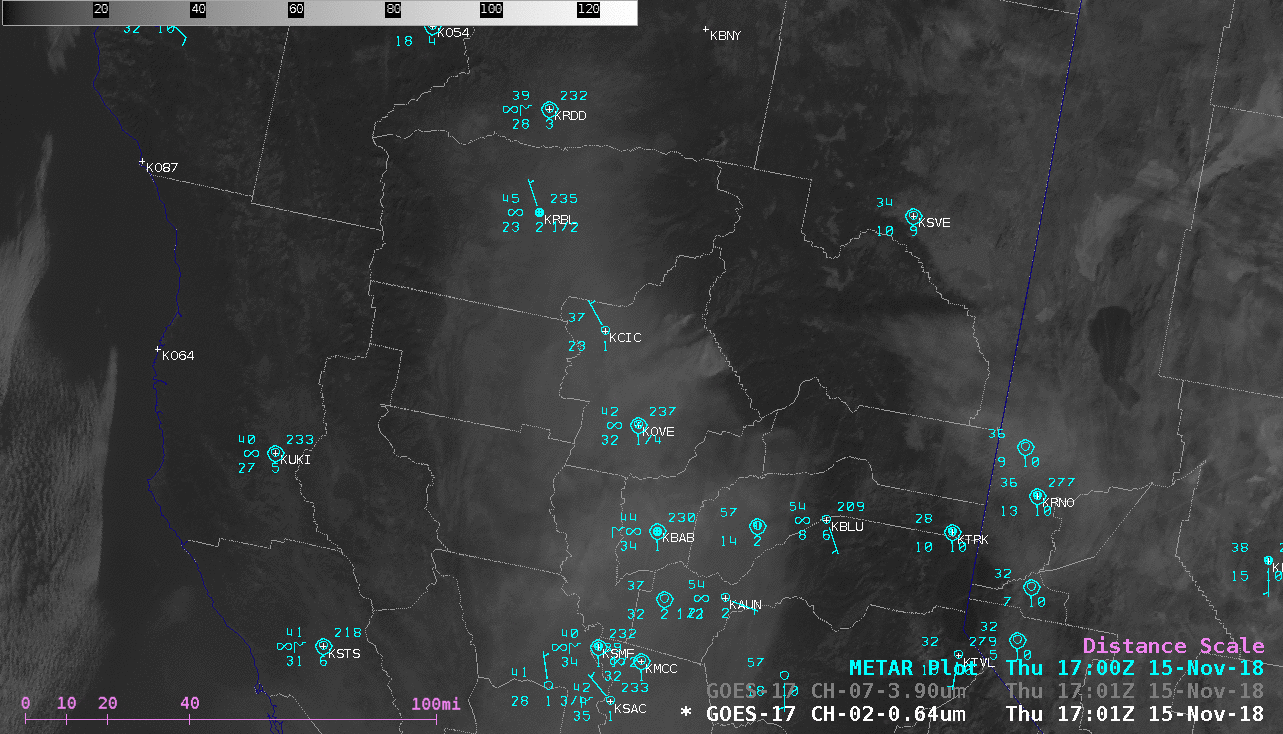
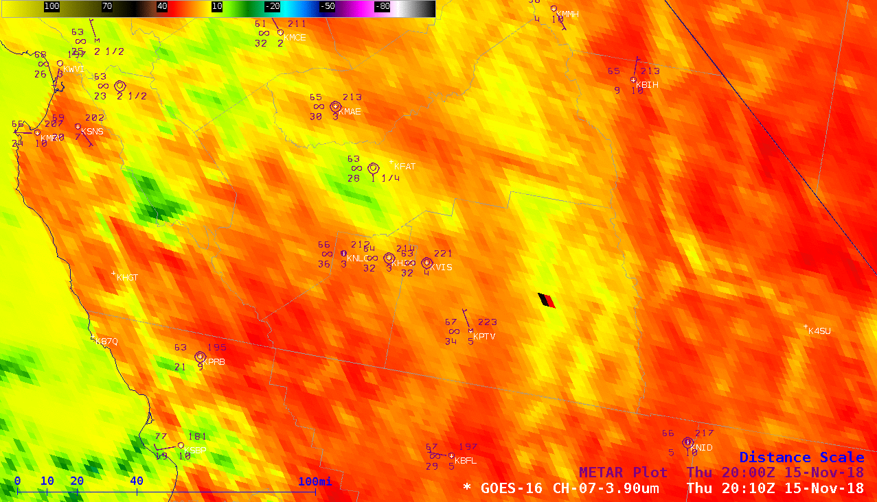
GOES-17 “Red” Visible (0.64 µm) and Shortwave Infrared (3.9 µm) images, with hourly plots of surface reports [click to play animation | MP4]
![GOES-16 vs GOES-17 Shortwave Infrared (3.9 µm) images [click to play MP4 animation]](https://cimss.ssec.wisc.edu/satellite-blog/wp-content/uploads/sites/5/2018/11/ca_swir_overlap-20181115_201026.png)
GOES-16 vs GOES-17 Shortwave Infrared (3.9 µm) images [click to play MP4 animation]