Search results for SRSO
GOES-14 Full Disk images at 30-minute intervals
As a part of the GOES-14 Super Rapid Scan Operations for GOES-R (SRSOR) testing, the satellite provided full-disk images at 30-minute intervals during the day on 14 September 2012. For current GOES satellites, the operational full-disk image interval is 3 hours; the ABI instrument on GOES-R will... Read More
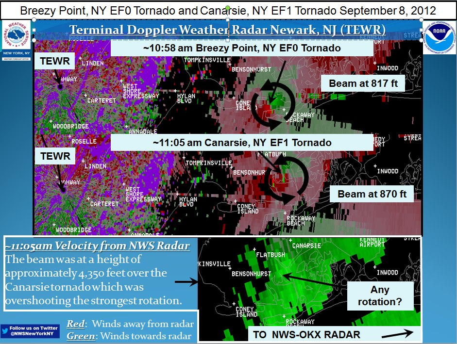
Tornadoes in metropolitan New York City
Tornadoes touched down on Long Island within the confines of New York City on September 8th, 2012. This image shows the terminal radar velocities from Newark associated with the two touch downs. This google map link shows both Canarsie and Breezy Point on a map of eastern Long Island.The GOES-15 image above, from... Read More
Hurricane Isaac
Isaac reached Category 1 hurricane intensity mid-day on 28 August 2012. AWIPS images of 1-km resolution visible and IR data from the VIIRS, AVHRR, and MODIS instruments (below) showed curved banding features and convective bursts with overshooting... Read More
