The beginning of the extratropical transition of Hurricane Larry
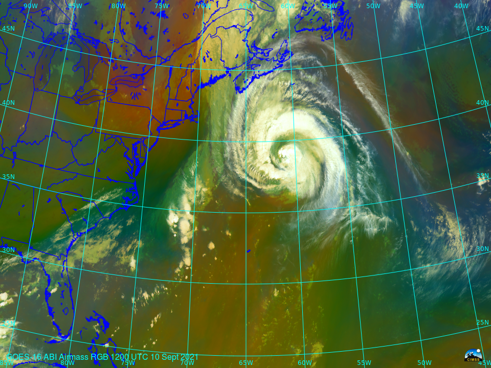
The animation above (created using Geo2Grid) with a 3-h time step shows the approach of a mid-latitute shortwave trough (that produced large hail over Wisconsin on Tuesday 7 September; SPC Storm Reports) to Hurricane Larry over the tropical Atlantic. The Potential Vorticity anomaly associated with the mid-latitude trough (moving from the western Great Lakes on the 8th... Read More