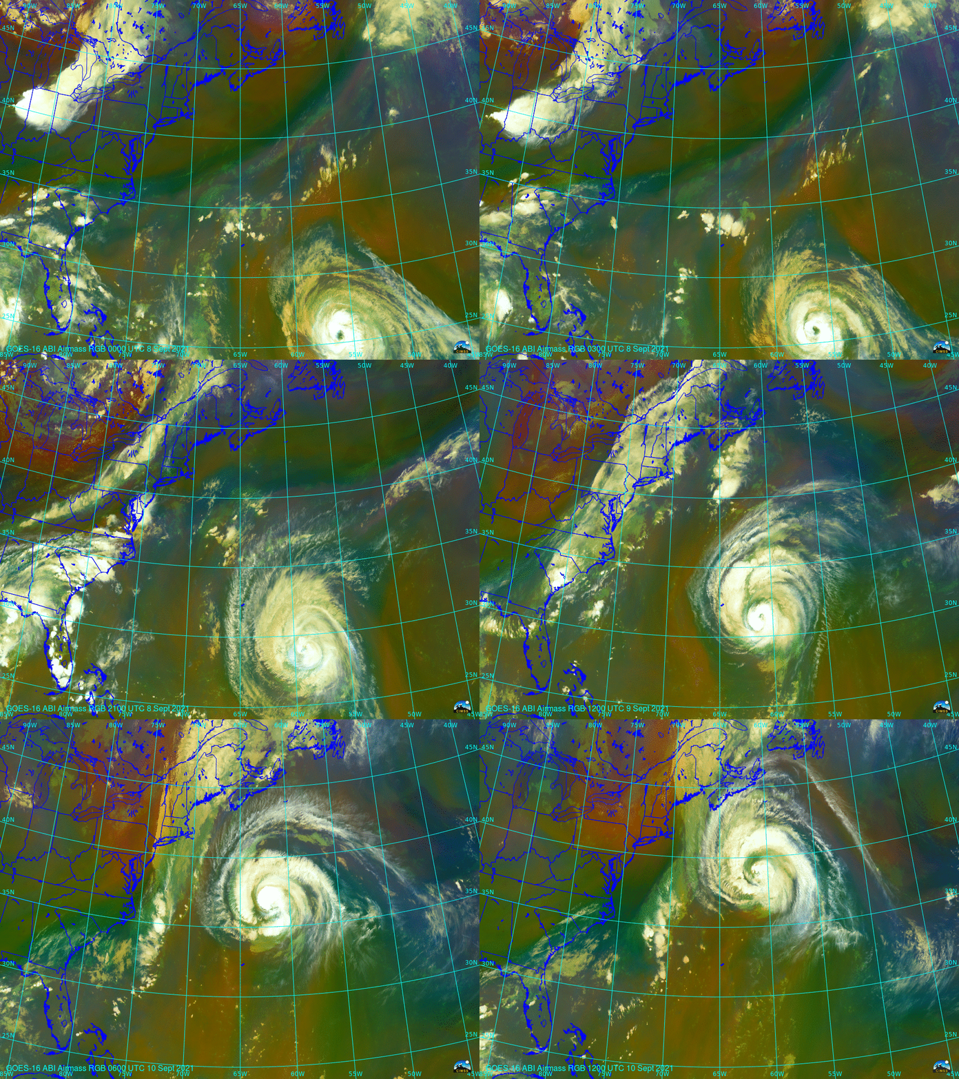
The beginning of the extratropical transition of Hurricane Larry

The animation above (created using Geo2Grid) with a 3-h time step shows the approach of a mid-latitute shortwave trough (that produced large hail over Wisconsin on Tuesday 7 September; SPC Storm Reports) to Hurricane Larry over the tropical Atlantic. The Potential Vorticity anomaly associated with the mid-latitude trough (moving from the western Great Lakes on the 8th to the east coast on the 10th) appears as red/orange in the RGB imagery, and by 1200 UTC on the 10th, the anomaly sits over the eastern United States with Larry to its east. The RGB at 1200 UTC on the 10th shows orange/red hues to the south and east of the the hurricane center; in that region, however, the orange colors do not signify upper level potential vorticity anomalies, but rather dry air in the mid-tropopshere.
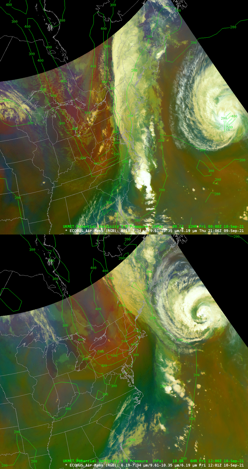
The correlation between red/orange values in the RGB and large values of potential vorticity in the upper troposphere with the feature in the midwest United States is confirmed by the overlay below that shows a pressure analysis on the 1.5 Potential Vorticity Unit (PVU) surface. The UKMET Office model data shows pressure values below 500 mb.

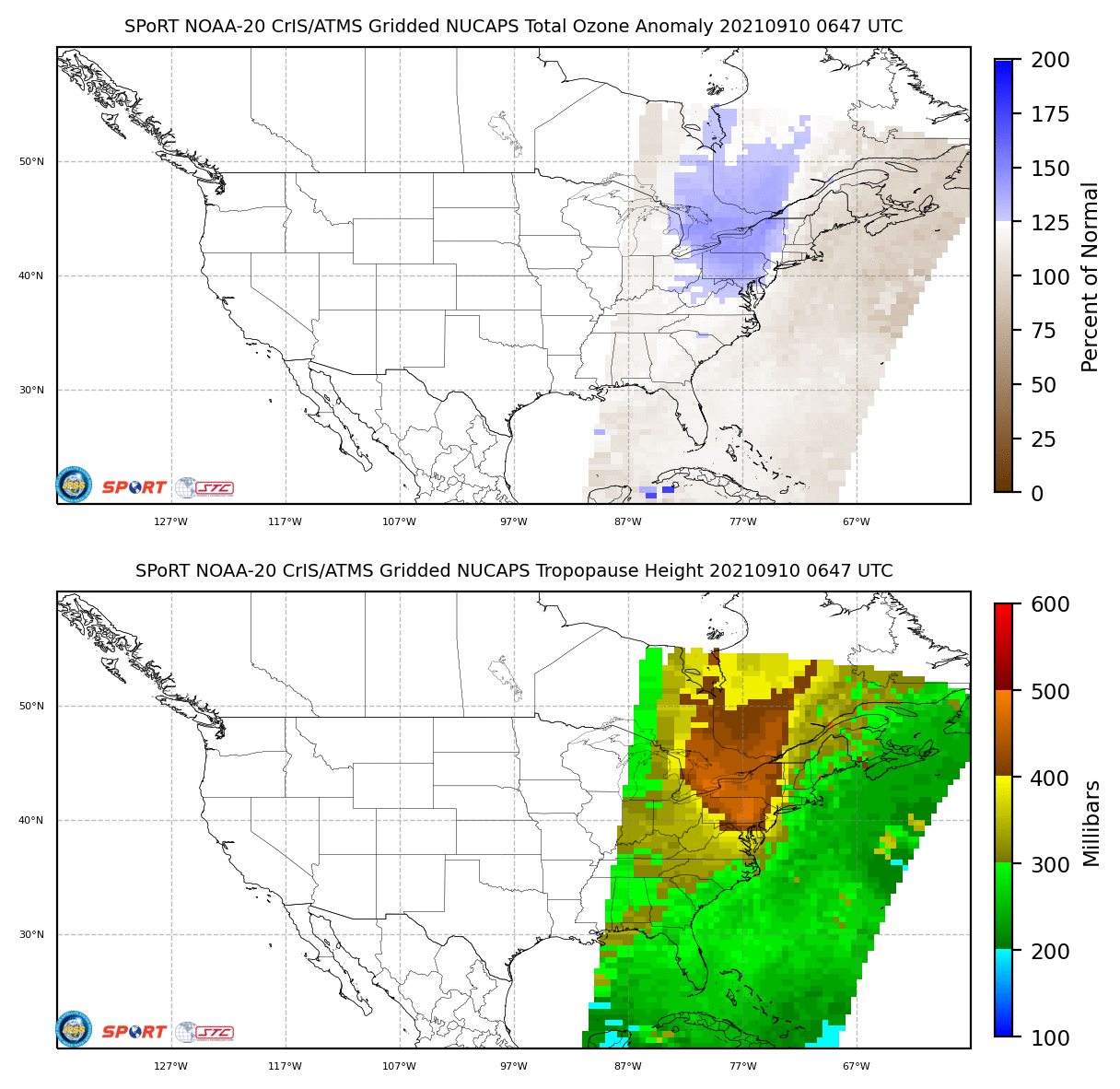
NUCAPS (NOAA-Unique Combined Atmospheric Processing System) profiles yield information about the thermal structure of the atmosphere, and also measure ozone concentration. Gridded values from the profiles, shown below (from this url) show a low tropopause and enhanced ozone (both suggestive of a tropopause fold/stratospheric intrusion) over the eastern US at 0647 UTC on 10 September (and also at 1812 UTC on 10 September).

For more information on Larry, refer to the webpages of the National Hurricane Center.

