Tropical Depression Fred north of Cuba
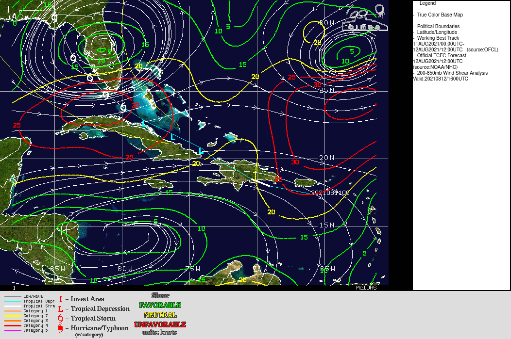
GOES-16 CONUS sector imagery, above, captured from CSPP Geosphere (link), over Tropical Depression Fred just north of eastern Cuba in the Atlantic Ocean, shows a ragged circulation with very little convection in the center (click here to download the mp4 above). Fred has been disrupted by its passage over the terrain of Hispaniola. Fred is embedded within southwesterly shear as shown below; that shear and the lack of convection near the center limits the speed with which Fred will be able to intensify.
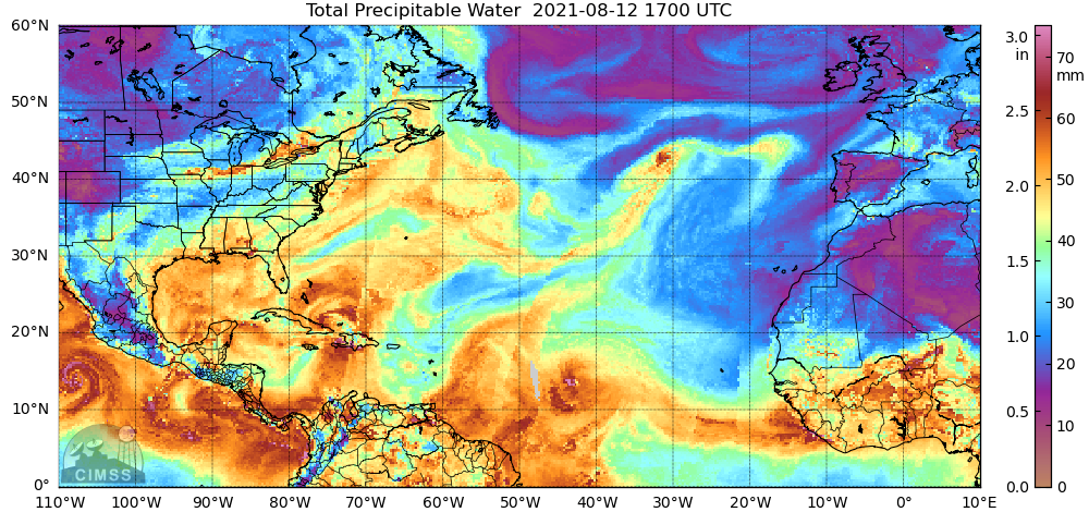
Will dry air limit Fred’s intensification? MIMIC (Morphed Integrated Microwave Imagery at CIMSS) Total Precipitable Water (TPW) imagery at 1700 UTC on 12 August 2021, below, shows some pockets of dry air over the central Caribbean, and to the north of Fred and just west of Fred (and a large area of dry air to the east). (Note also Pacific Hurricane Linda to the south of Mexico at the western edge of the domain!) Overall however, the environment seems moist.
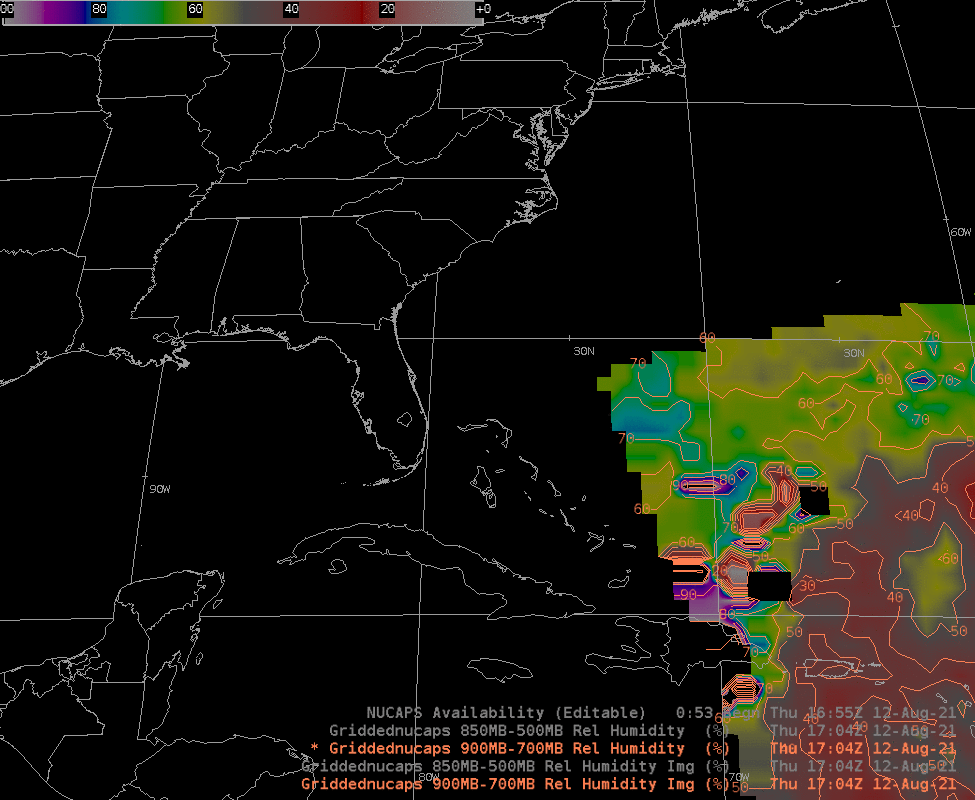
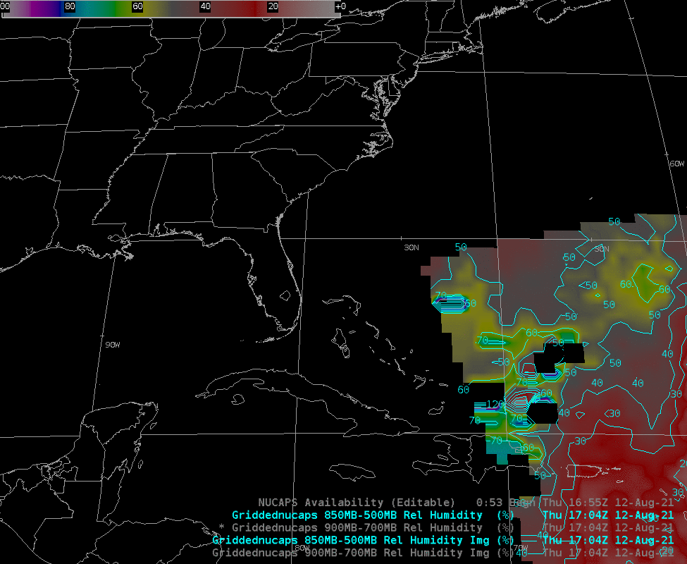
Gridded NUCAPS estimates of low-level moisture in the form of 900-700 mb mean Relative Humidity, below, and of 850-500 mb mean Relative Humidity, at bottom, are more indicative of dry air in the lower troposphere surrounding the storm. Gridded fields of NUCAPS relative humidity are available online here.
For more information on Fred, refer to the National Hurricane Center website (here) or the SSEC/CIMSS Tropical Weather website (here).