Tropical Storm Elsa forms in the Atlantic
Night Time Microphysics (at night) and True-Color imagery (during the day) over the eastern Atlantic, 0920 – 1220 UTC on 1 July 2021
Tropical Storm Elsa has formed over the tropical eastern Atlantic Ocean. True-color imagery from CSPP Geosphere (link) shows the storm with occasional bursts of deep convection. Elsa has formed at the southern edge of a large area of Saharan Air (shown below, link, from this site), and the storm’s future could be influenced by this dry air.
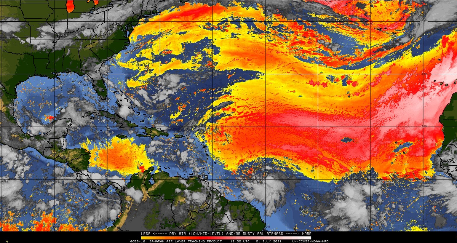
Saharan Air Layer analysis, 1200 UTC on 1 July 2021 (Click to enlarge)
The abundant dry air to the north of Elsa is also apparent in the low-level water vapor imagery, as shown below.
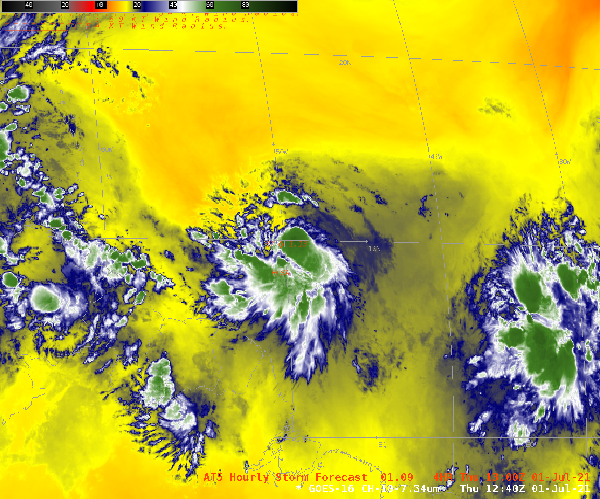
GOES-16 ABI infrared low-level water vapor (Band 10, 7.34 µm) at 1240 UTC on 1 July 2021. NHC prediction of the 1300 UTC position of Elsa along with 34-knot wind radii are shown (Click to enlarge)
The dry air associated with the SAL shows up nicely in gridded NUCAPS fields, too. The toggle below steps through the CIMSS True Color RGB and GOES-16 Band 10 imagery (7.34 µm) along with 850-700 mb relative humidity from gridded NUCAPS.
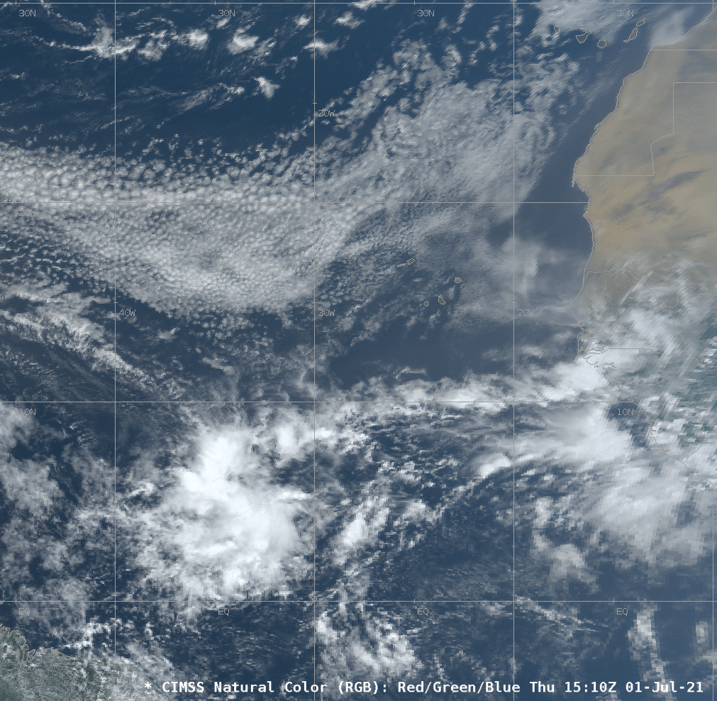
CIMSS True Color RGB, GOES-16 ABI Band 10 infrared water vapor (7.34 µm), 850-700 mb relative humidity, 1510 UTC on 1 July 2021 (Click to enlarge)
For more information on Elsa, see the SSEC Tropical Website. Official forecasts are on the website of the National Hurricane Center (link; direct link to Elsa’s webpages there)