Upper-tropospheric stability around wildfires
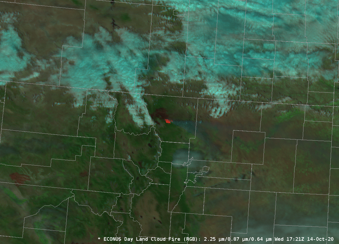
Day Land Cloud Fire RGB over northern Colorado, 1721-2216 UTC, 154 October 2020 (Click to animate)
Strong winds on 14 October invigorated the Cameron Peak fire to the west of Fort Collins, producing an extensive smoke plume. The Day Land Cloud Fire RGB, above, includes the near-infrared 2.25 µm channel (GOES-16 Band 6) that shows the active fire in red and the ‘Veggie’ Band at 0.87 µm (a useful channel to show the burn scar to the west of the active fire). Note that a second fire is detected shortly after 2100 UTC in north-central Grant County to the west-southwest of the Cameron Peak fire.
Vigorous fires occasionally force pyrocumulonimbus clouds (as shown here, for example, for the Cameron Peak fire in early September). What tools are available in mid-day to assess the likelihood of a pyrocumulonimbus?
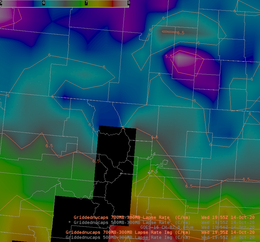
NOAA-20 overflew Colorado (from this site) shortly after 2000 UTC on 14 October 2020. NUCAPS Profiles from that overpass can be used to diagnose atmospheric stability. Gridded NUCAPS fields show lower stability south of the fire, and greater stability north, over Wyoming (the colorbar of the field has been altered to highlight lapse rates between 5 and 8 C / km). A similar plot showing 700-300 mb lapse rate also shows the increase in stability to the north.
The increase in stability as the airmass moves from the north will affect the likelihood of Pyrocumulonimbus development. This (large) 4-panel animated gif (from this blog post) shows the evolution of the fire — with 1-minute time-steps — during the day on 14 October.
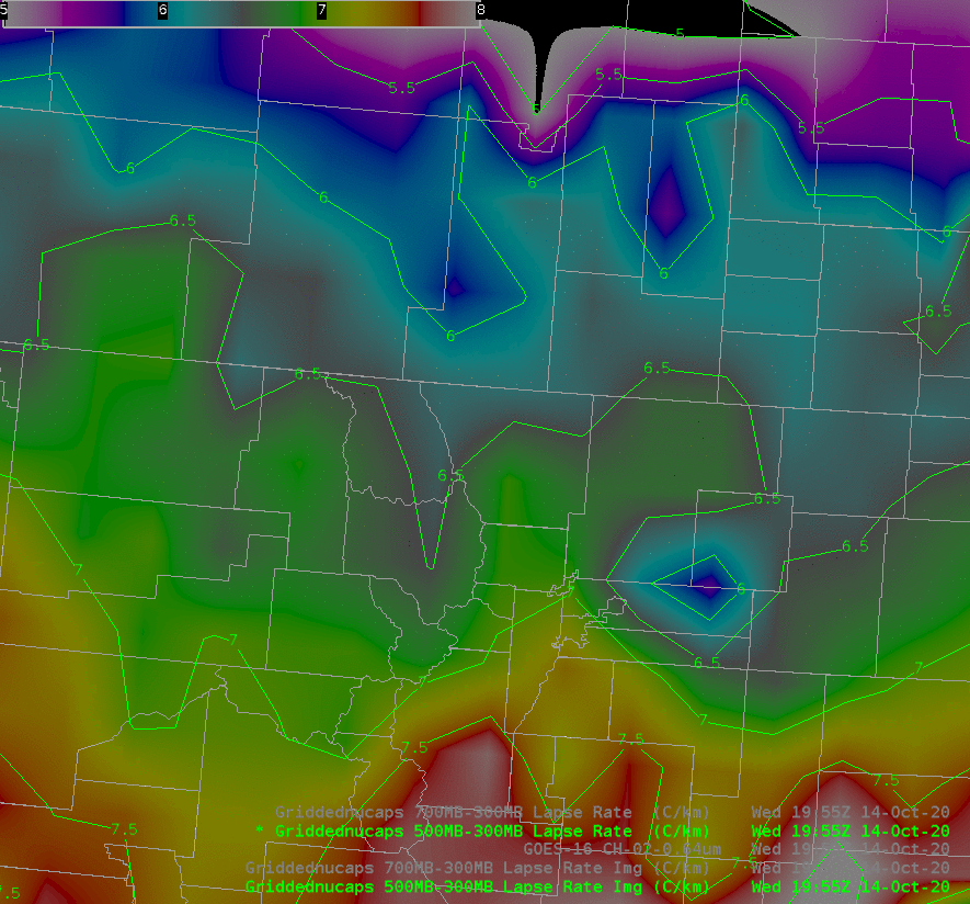
GOES-16 Visible Imagery (0.64 µm) and gridded NUCAPS fields of 500-300 mb Lapse Rate (Click to enlarge)
The six NUCAPS soundings that surround the fire show the steep upper-tropospheric lapse rates, below.
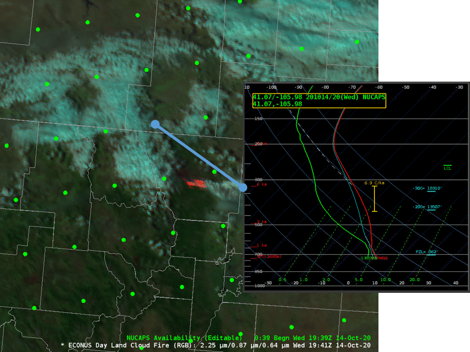
NUCAPS Profiles at 2000 UTC surroundings the Cameron Peak Fire (Click to enlarge)