This website works best with a newer web browser such as Chrome, Firefox, Safari or Microsoft Edge. Internet Explorer is not supported by this website.

Warm and cold conveyor belts

An animation of GOES-11 6.7 µm “water vapor channel” imagery (above) shows the development and intensification of a mid-latitude cyclone over the eastern North Pacific Ocean on 13 January 2008. Of particular interest in the water vapor imagery is the appearance of well-defined satellite signatures of an initial warm conveyor... Read More

GOES-11 6.7µm water vapor images (Animated GIF)

An animation of GOES-11 6.7 µm “water vapor channel” imagery (above) shows the development and intensification of a mid-latitude cyclone over the eastern North Pacific Ocean on 13 January 2008. Of particular interest in the water vapor imagery is the appearance of well-defined satellite signatures of an initial warm conveyor belt (WCB1), with a secondary warm conveyor belt (WCB2) later forming; a cold conveyor belt (CCB) is also seen emerging from beneath the secondary warm conveyor belt (as shown on the annotated image below). The “conveyor belt model” was developed and refined (most recently by authors such as Browning, Carlson, and Young) to help visualize the airflow through mid-latitude cyclones (schematic 1 | schematic 2); the flow is ascending in all 3 conveyor belts (producing the enhanced moisture and cloud signatures seen on the water vapor imagery), but the air rises to higher altitudes in the two warm conveyors than in the cold conveyor.

conveyor belts

AWIPS images of the GOES-11 water vapor channel at 3-hour intervals (below) show that during the following 2-3 days this cyclone rapidly occluded, became quasi-stationary, and then eventually transitioned to a “cut-off low” which began to slowly retrograde to the northwest on 15-16 January.

GOES-11 6.7µm water vapor images (Animated GIF)

View only this post Read Less
Rare January tornadoes in southern Wisconsin

Tornadoes are very rare in the state of Wisconsin during the month of January; however, severe convection did produce at least two tornadoes that moved across far southeastern Wisconsin during the afternoon hours on 07 January 2008. AWIPS images of the MODIS 11.0... Read More

MODIS IR + visible images (Animated GIF)

Tornadoes are very rare in the state of Wisconsin during the month of January; however, severe convection did produce at least two tornadoes that moved across far southeastern Wisconsin during the afternoon hours on 07 January 2008. AWIPS images of the MODIS 11.0 µm IR and visible channels (above) depicted one of the early rounds of thunderstorms that produced several reports of hail around 17:00 UTC (11:00 AM local time). Note the unusually warm temperatures and high dew points that were surging northward behind a warm frontal boundary — new daily record maximum temperatures were set for 07 January at Milwaukee (63ºF; this was also Milwaukee’s warmest temperature on record for the entire month of January) and at Madison (50ºF). As this warm and moist air mass began to move over the deep snowpack (NOHRSC modeled snow depth) that was still in place on the previous day (06 January), new daily record high minimum temperature records were also set (39ºF at Milwaukee and 37ºF at Madison), and dense fog formed that afternoon which reduced visibilities to near zero and contributed to a series of chain-reaction accidents (involving around 100 vehicles) along Interstate 90 near Madison, Wisconsin.

AWIPS images of the GOES-12 10.7 µm IR channel (below) showed the evolution of the severe convection that produced the tornadoes in southeastern Wisconsin between about 21:45 UTC and 22:45 UTC. The corresponding radar imagery from NWS Milwaukee/Sullivan revealed a well-defined hook echo as the tornado moved across Kenosha county in extreme southeastern Wisconsin (producing EF-3 damage).

Prior to this event, only one January tornado had ever been recorded in the state of Wisconsin — a long-track F3 in Green and Rock counties on 24 January 1967.

GOES-12 10.7 µm IR images (Animated GIF)

View only this post Read Less
Powerful Pacific storm begins to impact the US West Coast

AWIPS images of global water vapor composites (above) showed a large and powerful Pacific storm that was beginning to impact the US West Coast on 04 January 2008. This storm was tapping a very long plume of high total precipitable water (TPW) originating from the western Pacific Ocean, as seen in an... Read More

AWIPS global water vapor imagery (Animated GIF)

AWIPS images of global water vapor composites (above) showed a large and powerful Pacific storm that was beginning to impact the US West Coast on 04 January 2008. This storm was tapping a very long plume of high total precipitable water (TPW) originating from the western Pacific Ocean, as seen in an animation of MIMIC TPW (below).

MIMIC total precipitable water (Animated GIF)

MIMIC total precipitable water

The dynamics associated with this storm were also impressive, with a very strong polar jet stream that stretched across the entire Pacific Ocean. AWIPS images of the GFS model Maximum Wind field (below) indicated jet stream wind speeds as high as 210 knots over the North Pacific (south of Alaska’s Aleutian Islands) and greater than 170 knots over Japan at 06:00 UTC on 04 January.

GFS model maximum winds (Animated GIF)

MADIS satellite-derived atmospheric motion vectors (AMVs) produced using hourly water vapor imagery (below) showed a large number of high-altitude wind targets having speeds of greater than 200 knots during the period between 03 January at 12:00 UTC and 04 January at 18:00 UTC. The highest satellite-derived water vapor wind speed seen was 252 knots at a pressure of 258 mb; satellite winds of greater that 100 knots had moved inland over California after 15:00 UTC on 04 January.

GOES-11 water vapor imagery + satellite winds

A beautiful view of the storm was captured on AWIPS images of the MODIS visible, IR window, and water vapor channels (below).

AWIPS MODIS visible + IR + water vapor images (Animated GIF)

View only this post Read Less
The transition to Winter across southern Wisconsin

A sequence of MODIS true color images (from the SSEC MODIS Direct Broadcast site) covering the period from 27 November 2007 to 02 January 2008 (above) shows the transition from predominantly bare ground (with only isolated patches of thin snow cover) at the end of November to widespread deep snow cover across all... Read More

MODIS true color images (Animated GIF)

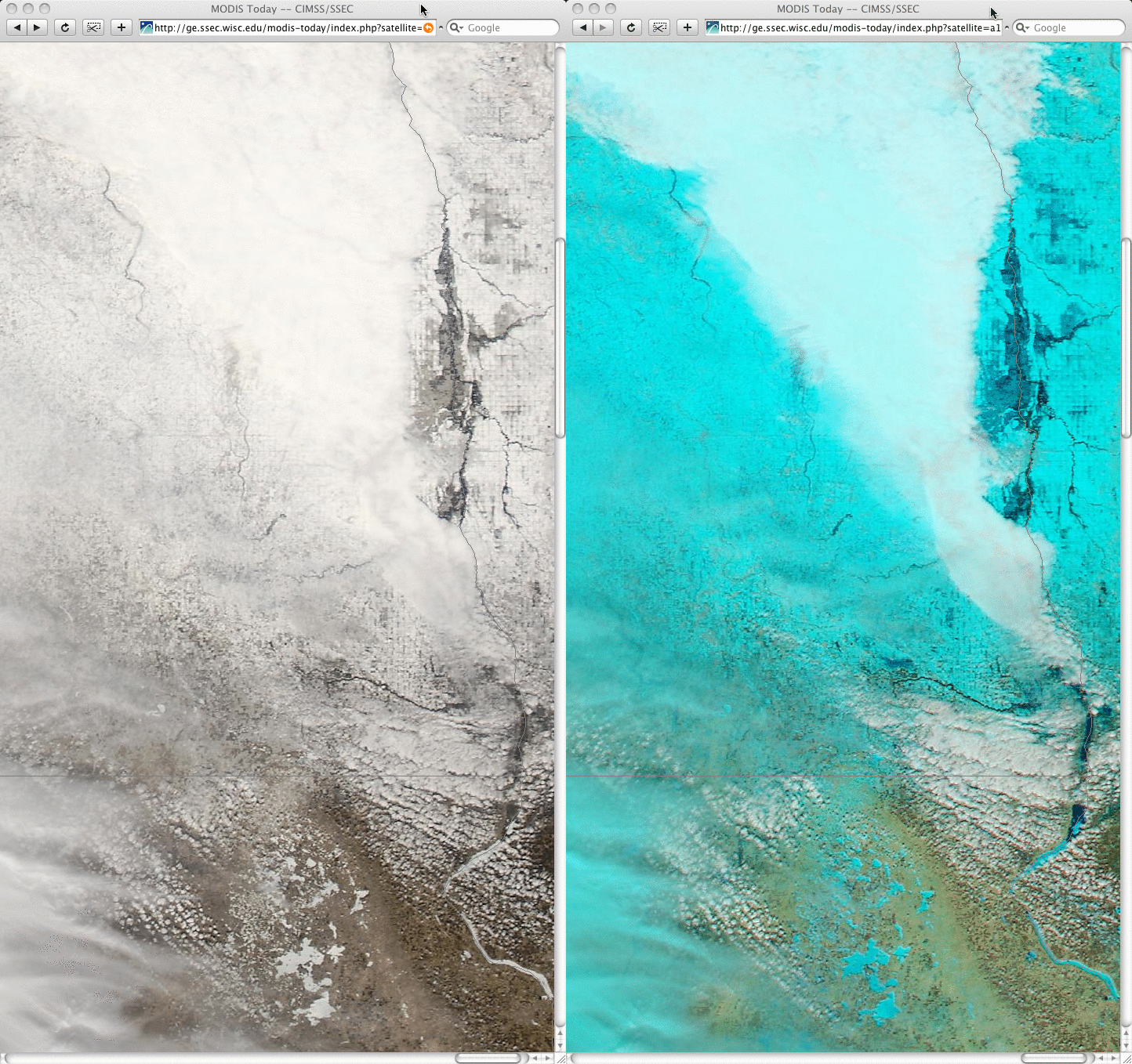
A sequence of MODIS true color images (from the SSEC MODIS Direct Broadcast site) covering the period from 27 November 2007 to 02 January 2008 (above) shows the transition from predominantly bare ground (with only isolated patches of thin snow cover) at the end of November to widespread deep snow cover across all of southern Wisconsin during the month of December 2007. Madison, Wisconsin (located at the center of the images) experienced its second snowiest December on record, with 33.5 inches falling during the month. The maximum snow depth at the Madison airport was 12 inches (on both 12 and 16 December), but NWS Cooperative Observers in the Madison metro area reported snow depths as high as 16 inches; across southern Wisconsin, a maximum snow depth of 22 inches was reported at Germantown and Jackson.

While the official temperature at the Madison airport did get as low as -10ºF on 06 December, the month as a whole was only 1.8ºF below normal (average temperature: 21.2ºF); as a result, the lakes in the Madison area froze within about a week of their median freeze dates. The images above show that several of the more shallow lakes southeast of Madison were the first to freeze, with the largest of the Madison lakes (Lake Mendota) appearing totally frozen and white with deep snow cover on the final 02 January 2008 true color image. Contrast this to the previous winter season, when Lake Mendota did not freeze until 20 January 2007 (the second latest freeze date on record!).

View only this post Read Less