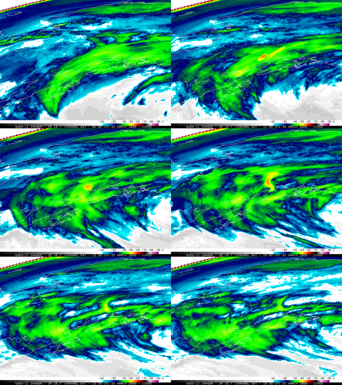
The Mt. Redoubt volcano (located about 100 miles southwest of Anchorage, Alaska) produced a series of explosive eruptions beginning around 06:38 UTC on 23 March 2009. GOES-11 10.7 µm IR images (above) showed a few of the volcanic eruption clouds, which exhibited IR... Read More

GOES-11 10.7 µm IR images
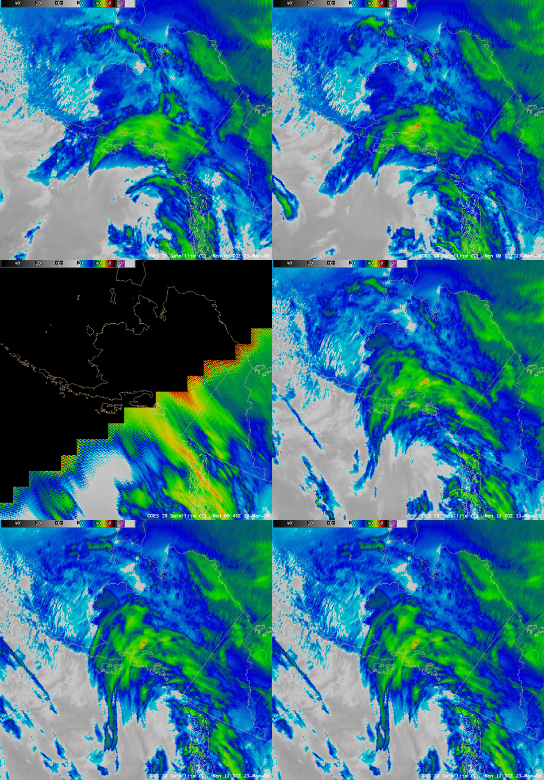
The Mt. Redoubt volcano (located about 100 miles southwest of Anchorage, Alaska) produced a series of explosive eruptions beginning around 06:38 UTC on 23 March 2009. GOES-11 10.7 µm IR images (above) showed a few of the volcanic eruption clouds, which exhibited IR brightness temperature values of -50 to -58º C (yellow to red colors). Note that there was a 2 hour gap in the imagery, with no GOES-11 images available from 08:00 to 10:15 UTC — this was due to the fact that the GOES-11 satellite was in a “Spring eclipse” period, where the satellite was in the Earth’s shadow (and the solar panels could not generate the power necessary to operate the instruments).
AWIPS images of the “GOES IR Satellite” data (below) demonstrated that the substitution of GOES-12 (GOES-East) imagery during the GOES-11 (GOES-West) eclipse period did not allow the continual tracking of the volcanic plume features (the images with missing data and the jagged edges are from GOES-12).

AWIPS "GOES IR Satellite" images (GOES-11, with GOES-12 during eclipse)
The GOES-11 IR imagery indicated that most of the initial volcanic plumes headed toward the northeast, remaining to the north of Anchorage — but the plume from the later (and stronger) eruption that began after 12:30 UTC was seen to begin elongating and spreading out in more of a north-south direction, with the southern edge of that plume taking a path that appeared to be approaching Anchorage. Using AWIPS cursor sampling and referencing the 12:00 UTC Anchorage AK rawinsonde data, the coldest GOES-11 IR brightness temperature of -58º C corresponded to an altitude just over 30,000 feet — but the maximum height of the eruption cloud was reported to be as high as 50,000-60,000 feet above ground level. A number of Volcanic Ash Advisories were issued, and Alaska Airlines canceled 35 flights in and out of Anchorage International Airport as a precaution (since airborne volcanic ash is known to be a significant hazard to aviation).
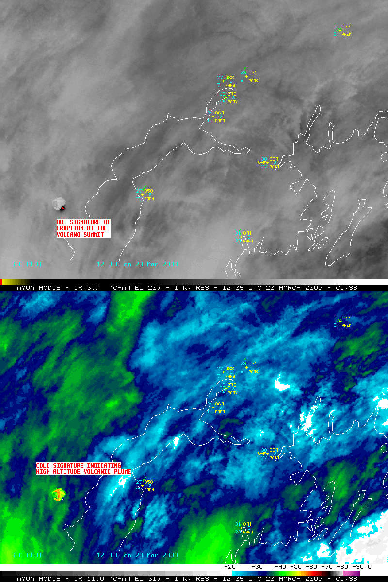
The beginning phase of the later, stronger eruption that began around 12:30 UTC can be seen on MODIS imagery (below). Note the cluster of very hot pixels on the 3.7 µm Channel 20 shortwave IR image (red color enhancement, temperatures as high as +57º C), which was a signature of the heat of the eruption at the summit of the volcano — in contrast, very cold IR brightness temperatures seen on the 11.0 µm Channel 31 IR image (as cold as -57º C, orange to red color enhancement) highlighted the portion of the volcanic eruption cloud that had reached very high altitudes in a very short time.

MODIS 3.7 µm and 11.0 µm IR images
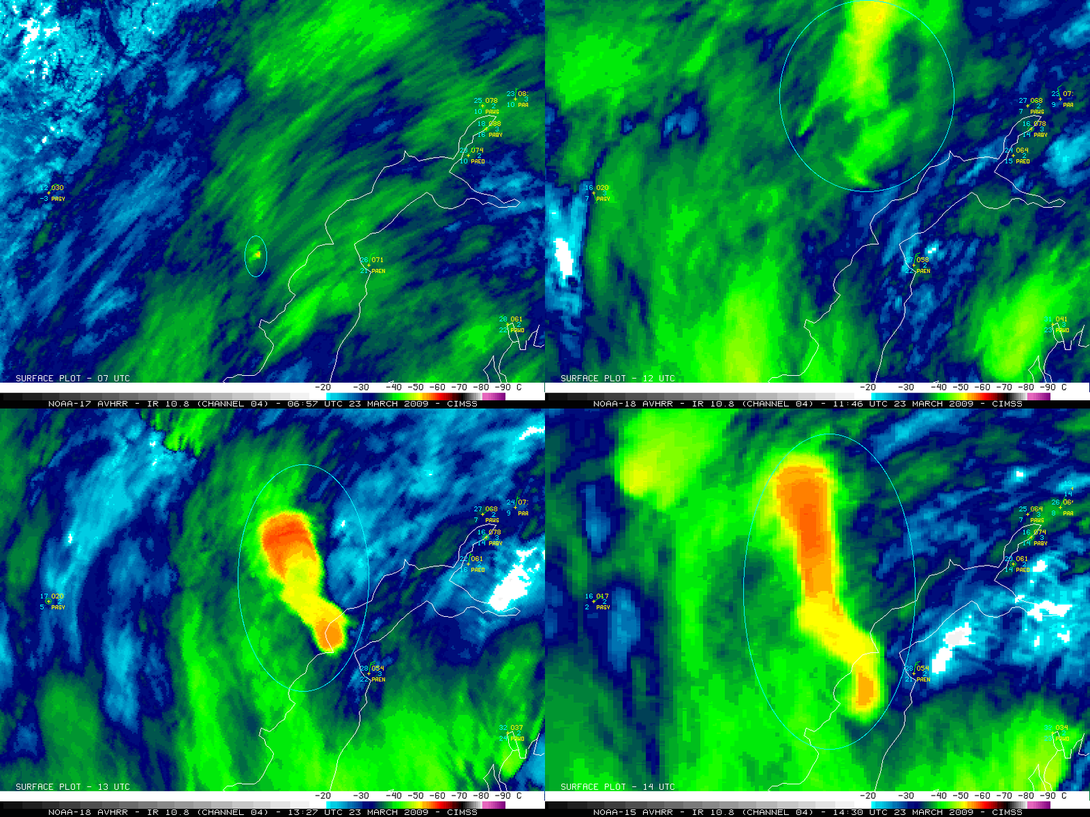
A sequence of 1-km resolution NOAA-15, NOAA-17 and NOAA-18 10.8 µm IR images (below) shows a few of the initial volcanic plume features (circled in cyan) at 4 different times — 06:52 UTC, just after the initial eruption; 11:46 UTC, with an elongated plume which had drifted off to the northeast of Redoubt; 13:27 UTC, with a more dense plume feature that appeared to be spreading out in a NW-SE direction; and 14:30 UTC, showing another dense plume that had spread out even further in the N-S direction.

NOAA-15 / NOAA-17 / NOAA-18 10.8 µm IR images
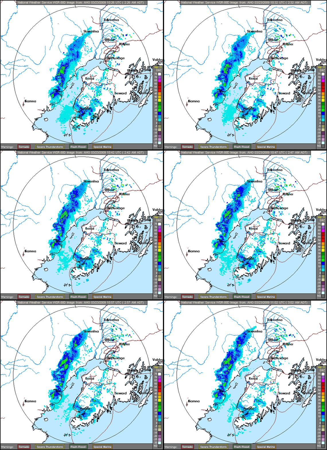
The volcanic plume could also be seen on imagery from the WSR-88D radar located near Kenai, Alaska (below). Surface ash falls of 1/8 to 1/4 inch were reported at Skwentna (northwest of Anchorage), and ash was reported on all airport surfaces at Talkeetna (north of Anchorage) — in fact, ash was reported on the ground as far north as Healy.

Kenai, Alaska radar composite reflectivity
A 500-meter resolution MODIS “true color” Red/Green/Blue (RGB) composite image (below) shows a signature of ash fall on top of the pristine white snow cover of the Alaska Range (as denoted by the lighter brown tint). A higher resolution version is available from the Alaska Volcano Observatory.
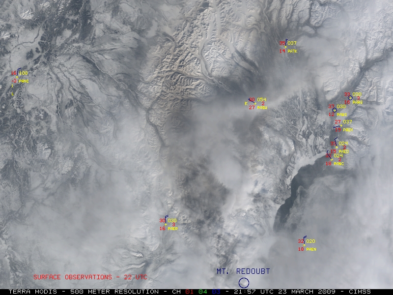
MODIS "true color" RGB composite image
===== 24 MARCH UPDATE =====
(courtesy of Mike Pavolonis, NOAA/NESDIS/ASPB)
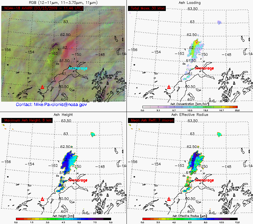
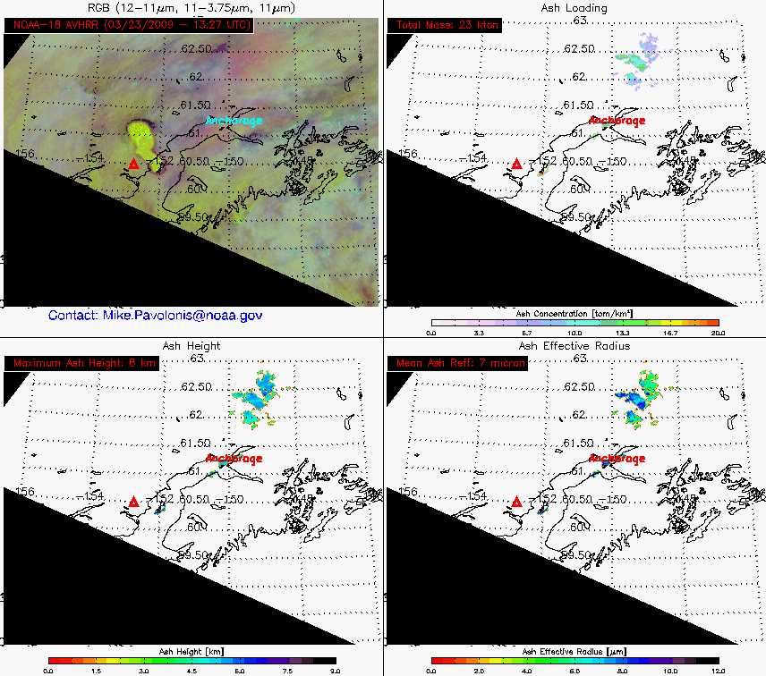
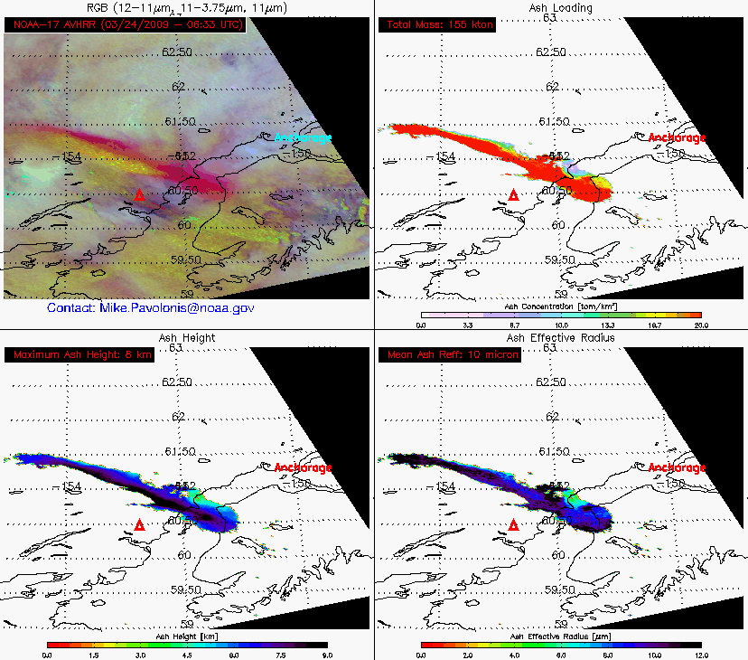
Shown below are some AVHRR ash retrievals (ash concentration, ash height, and ash effective particle radius) from the 23-24 March eruptions.  All of these AVHRR products will be produced operationally by NOAA/NESDIS starting sometime next Spring (2010).  Ash shows up as red in the accompanying false color images (upper left panels).  Notice that the retrieved ash particle sizes are fairly large (mean effective radius of 7-10 micron).  This may be one of the reasons that the 11 – 12 micron brightness temperature difference (BTD) signal was “weak” (very few negative BTD’s were present in the imagery).  The presence of larger ash particles may also speak to the relatively quick dissipation of the visible ash cloud as seen in the imagery.  Of course multi-layered meteorological clouds complicate matters further.  Our retrieval takes into account the lower level meteorological clouds (limited by certain assumptions), but the complicated nature of the scene still results in additional uncertainty.
Nevertheless, the results indicate that the largest amount of ash (only including ash that is not obscured by higher level hydrometeors), 155 kilo-tons, was seen after the 7:41 PM AKDT eruption on March 23 (03:41 UTC on March 24).  We estimated the maximum height of the ash-dominated portion of the various volcanic clouds to be around 8-km, which is about 1 km shy of the Anchorage tropopause.  The ice/SO2 dominated portion of the cloud likely went much higher.

AVHRR volcanic ash retrieval products -- 23 March 11:46 UTC
=================================================

AVHRR volcanic ash retrieval products -- 23 March 13:27 UTC
=================================================

AVHRR volcanic ash retrieval products -- 24 March 06:33 UTC
===== 26 MARCH UPDATE =====
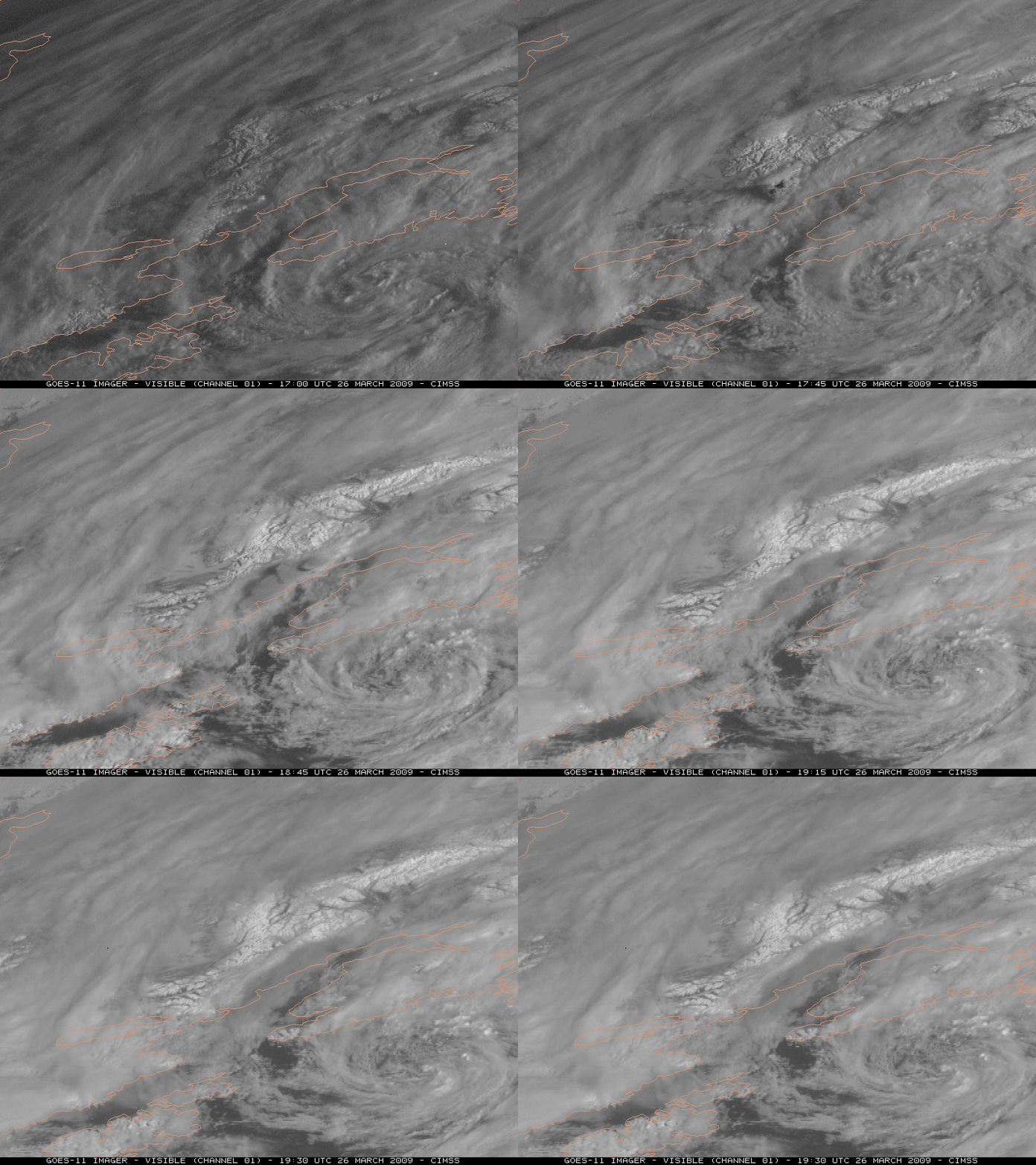
Another explosive eruption of the Mt. Redoubt volcano occurred around 17:24 UTC on 26 March 2009, sending ash to an estimated 65,000 feet. GOES-11 visible images (below) show the volcanic eruption cloud.

GOES-11 visible images
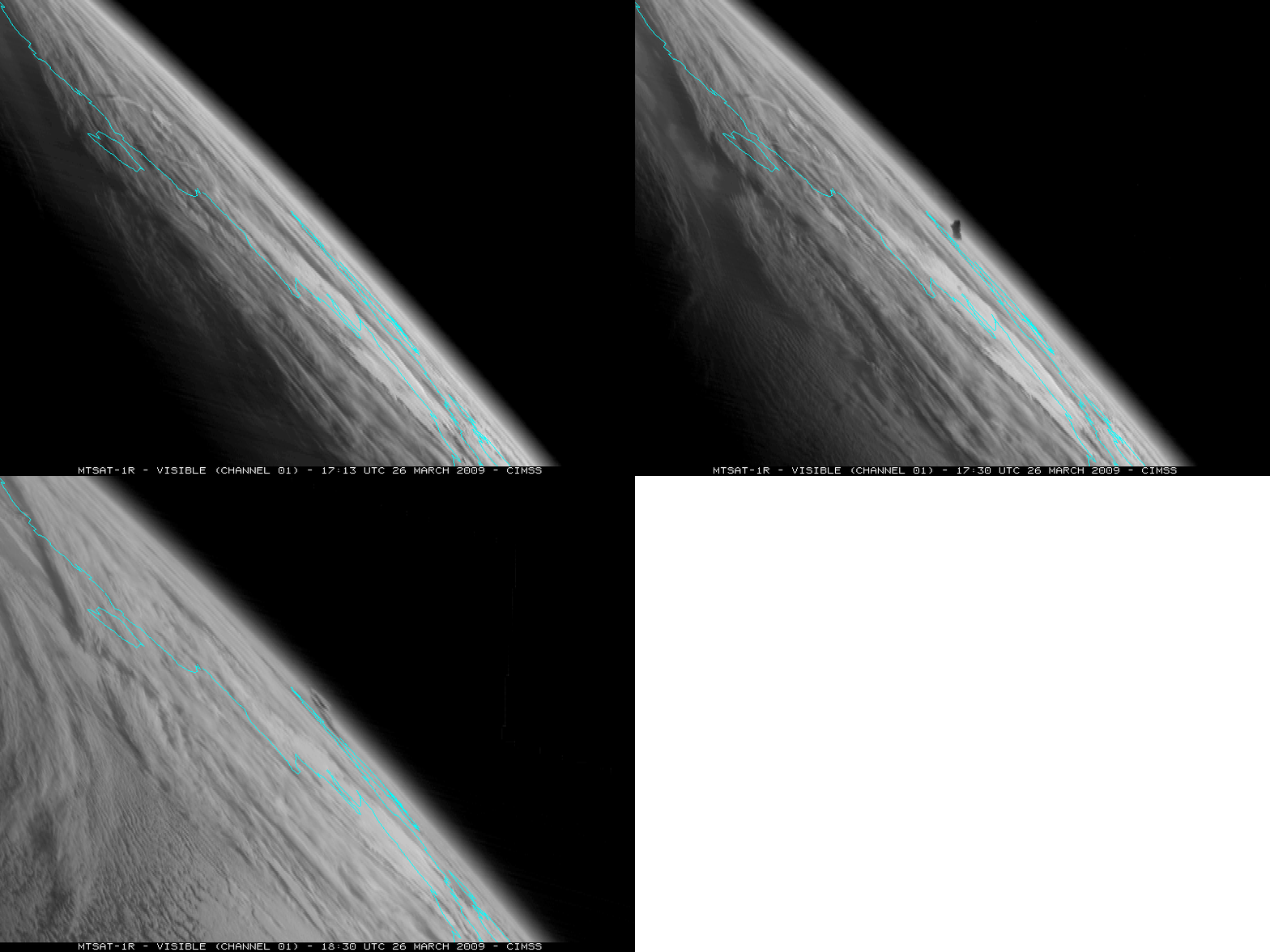
The large viewing angle from the MTSAT-1R satellite offered a nice depiction of the initial volcanic eruption plume (below).

MTSAT-1R visible images
Using a GOES-11 Sounder IR difference product — Band 10 (7.4 µm) minus Band 5 (13.3 µm) – that is sensitive to SO2, one can follow the signature of an SO2 plume (darker black filaments) as it moved southward from British Columbia in Canada over the Intermountain West region of the US (below).

GOES-11 Sounder IR difference product (Band 10 - Band 5)
===== 27 MARCH UPDATE =====
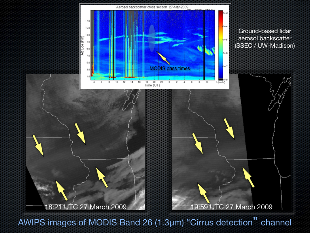
MODIS Band 26 near-IR (1.3µm) data can be used to detect particles that are good scatterers of light (such as cirrus ice crystals, airborne dust/haze/ash, etc); such scattering particles will exhibit a “brighter†signal on greyscale MODIS “cirrus detection” images. On 2 consecutive overpasses of the MODIS instrument (on Terra at 18:21 UTC, and on Aqua at 19:59 UTC) there was a subtle signal of an elevated volcanic plume that was oriented SW-NE across Iowa, southern Wisconsin, and far northern Illinois during the day on 27 March 2009 — this plume originated from one of the eruptions of the Redoubt volcano in Alaska a few days earlier. Ground-based lidar at the Space Science and Engineering Center (University of Wisconsin – Madison) depicted enhanced aerosol backscatter aloft, with multiple layers seen between 11-13 km around the time of the 2 MODIS images (below).

MODIS 1.3 µm "cirrus detection" images + SSEC lidar aerosol backscatter
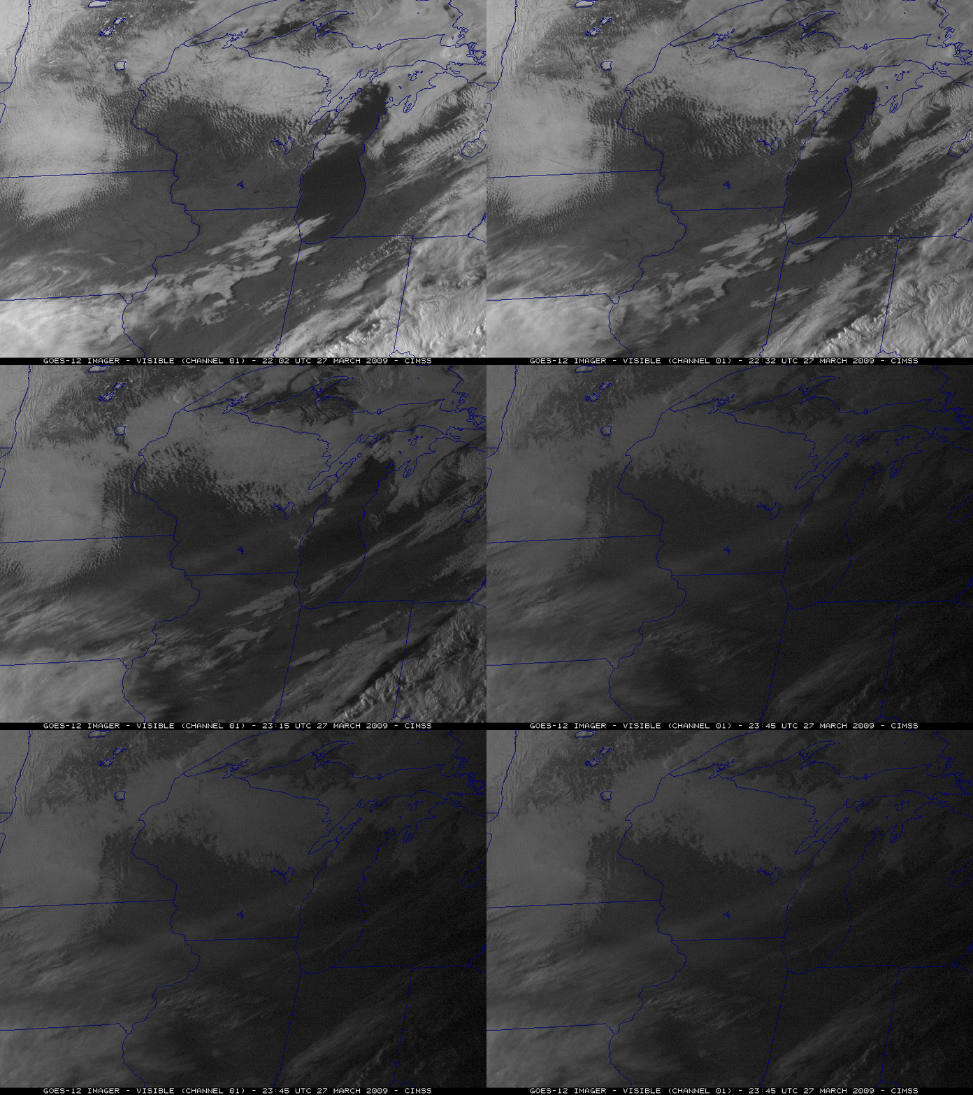
Taking advantage of the large “forward scattering angle” of GOES-12 imagery late in the day, the volcanic plume could also be seen as a hazy feature on the visible channel imagery (below).

GOES-12 visible imagery
Related links:
View only this post
Read Less


