This website works best with a newer web browser such as Chrome, Firefox, Safari or Microsoft Edge. Internet Explorer is not supported by this website.

Archive: Jun 2024

The Bear Fire in California and NGFS detection

GOES-18 imagery over California at 1836 UTC (above, left) show a very strong signal over San Luis Obispo County: very bright in visible imagery and warm in the shortwave infrared. In the GOES-16 imagery, that signal is not present. In contrast, the warm signal in the shortwave infrared in GOES-18... Read More

Heavy rainfall across American Samoa

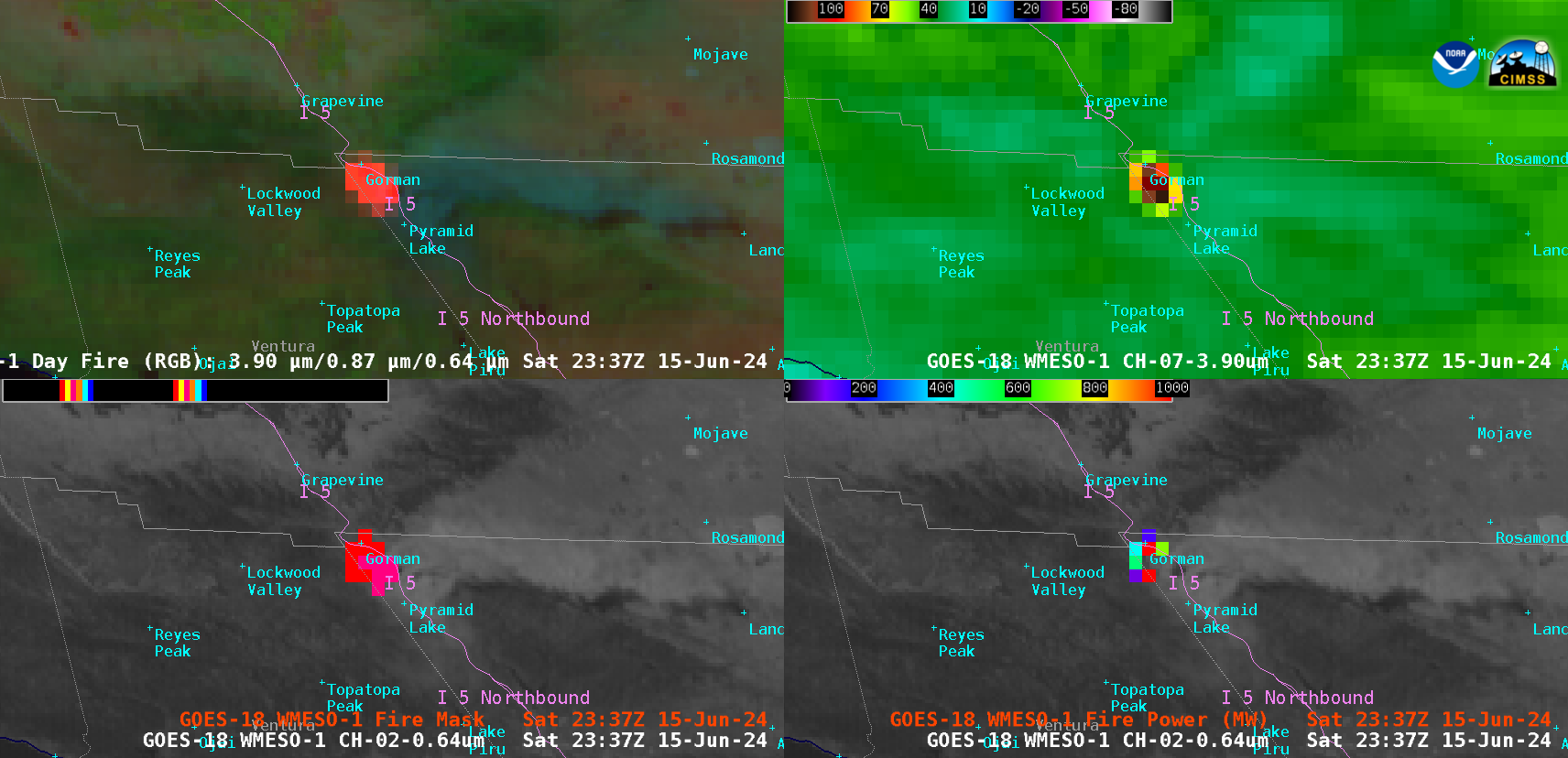
1-minute Mesoscale Domain Sector GOES-18 (GOES-West) “Clean” Infrared Window (10.3 µm) images (above) displayed areas of convection that moved across the islands of American Samoa on 12 June 2024 (1-minute imagery was requested by NWS Pago Pago to monitor the approach of thunderstorms capable of producing heavy rainfall and potential flooding — and since they lack radar coverage, 1-minute satellite... Read More

Record 1-hour rainfall accumulation at Sarasota, Florida

5-minute CONUS Sector GOES-16 (GOES-East) “Clean” Infrared Window (10.3 µm) images (above) displayed areas of convection that moved inland along the west coast of Florida on 11 June 2024. Sarasota/Bradenton International Airport received very heavy rainfall (3.93 inches) during the 1-hour period ending at 2353 UTC or 7:53 PM local time (METARs | decoded surface reports | plot of surface report data) —... Read More