Hail swath across the Texas Panhandle Plains

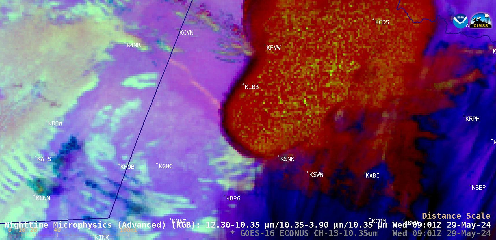
GOES-16 Nighttime Microphysics RGB images [click to play animated GIF | MP4]
GOES-16 (GOES-East) Nighttime Microphysics RGB images (above) showed a thunderstorm that moved southeast from the New Mexico / Texas border across the southern Texas Panhandle Plains on 29 May 2024. A narrow northwest-to-southeast oriented hail swath produced by this storm — from south of Clovis, New Mexico (KCVN) to south of Lubbock, Texas (KLBB) — showed up as pale shades of beige.

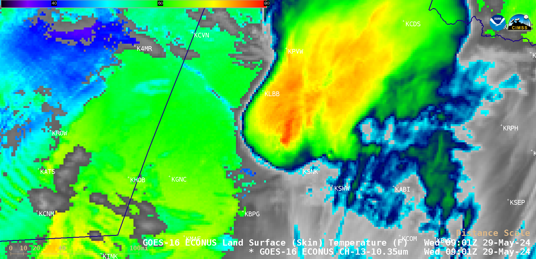
GOES-16 “Clean” Infrared Window (10.3 µm) images, with and without an overlay of the Land Surface Temperature derived product (in cloud-free areas) [click to play animated GIF | MP4]
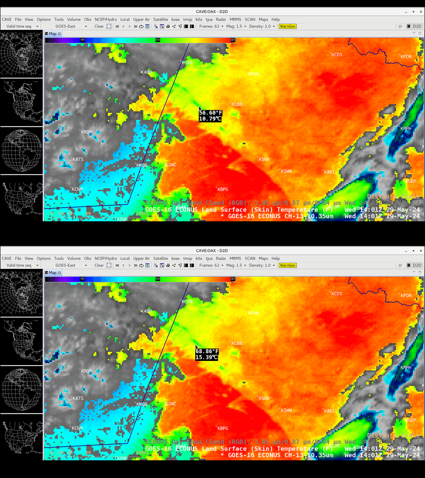
GOES-16 “Clean” Infrared Window (10.3 µm) images with/without an overlay of the hourly Land Surface Temperature (LST) derived product (in cloud-free areas) (above) indicated that the LST within the hail swath was as much as 10-12ºF cooler than adjacent bare ground (even after sunrise). A cursor sample of LST values within and immediately adjacent to the hail swath at 1401 UTC is shown below.

Cursor sample of Land Surface Temperature values (ºF) within and immediately adjacent to the hail swath at 1401 UTC [click to enlarge]
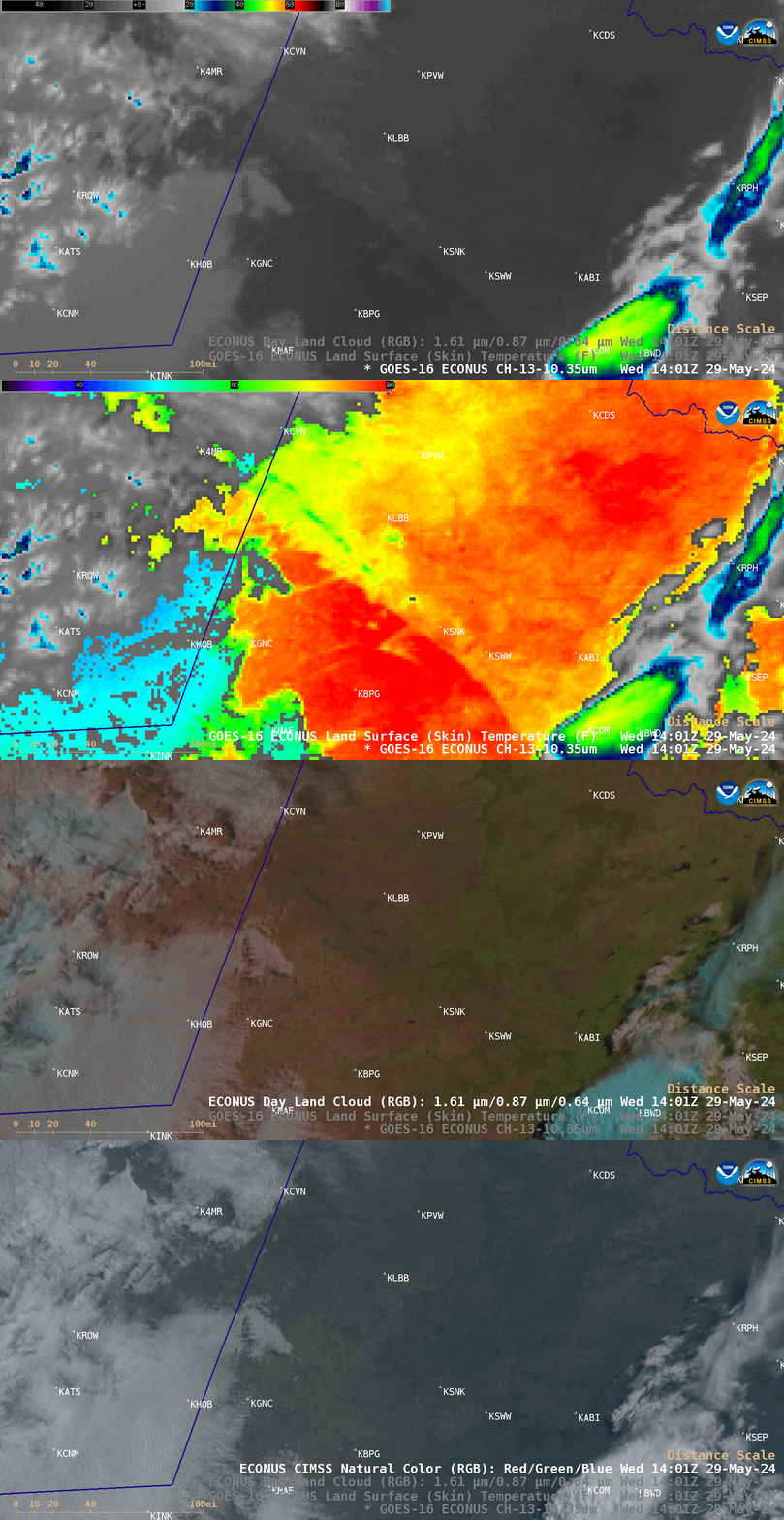
In a comparison of GOES-16 Infrared, Infrared + Land Surface Temperature, Day Land Cloud RGB and CIMSS Natural Color RGB images at 1401 UTC (below) note that the hail swath signature was not evident in the CIMSS Natural Color RGB image.

GOES-16 Infrared, Infrared + Land Surface Temperature, Day Land Cloud RGB and CIMSS Natural Color RGB images at 1401 UTC [click to enlarge]
Hat tip to NWS Midland and NWS Lubbock for pointing out this interesting feature!

