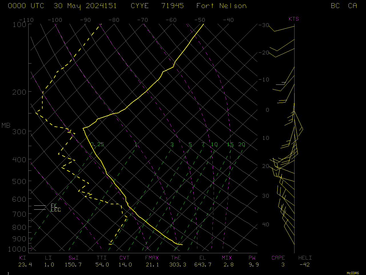
Wildfire in British Columbia produces 2 pyrocumulonimbus clouds
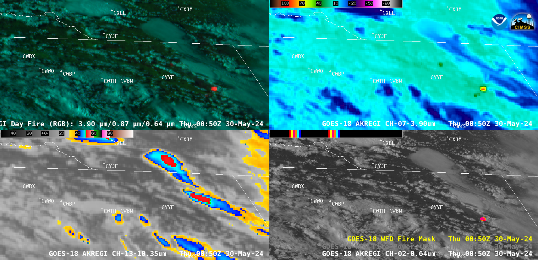
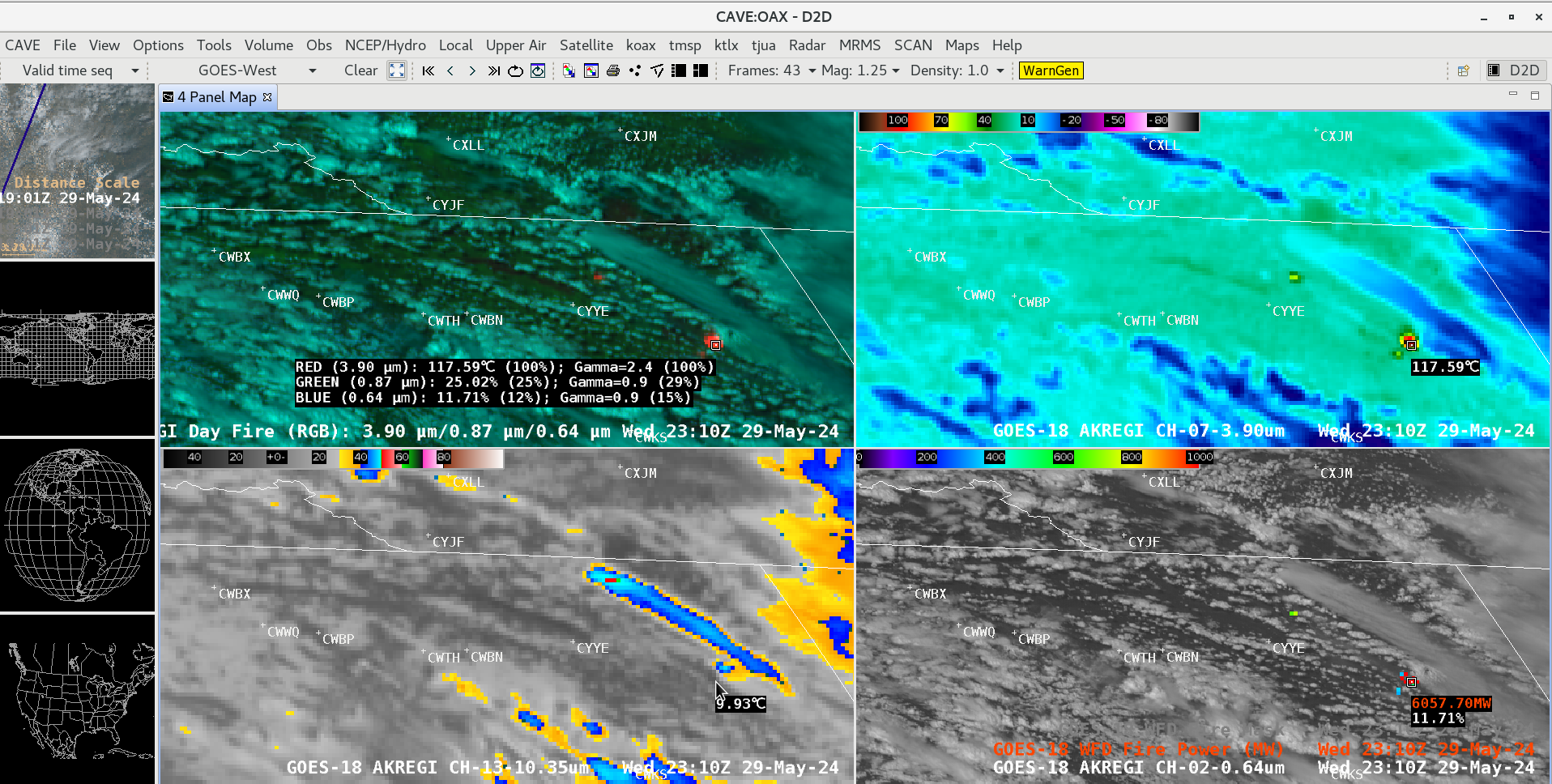
GOES-18 Day Land Cloud Fire RGB (top left), Shortwave Infrared (3.9 µm, top right), “Clean” Infrared Window (10.3 µm, bottom left) and “Red” Visible (0.64 µm) images with an overlay of the Fire Mask derived product (bottom right), from 1900 UTC on 29 May to 0200 UTC on 30 May [click to play animated GIF | MP4]
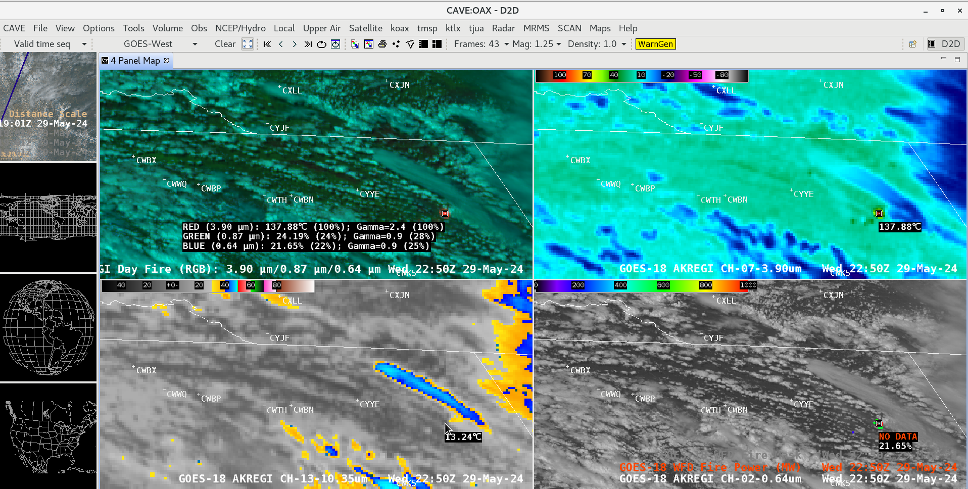
A similar animation that includes GOES-18 Visible images with an overlay of the Fire Power derived product — another component of the FDCA — is shown below.
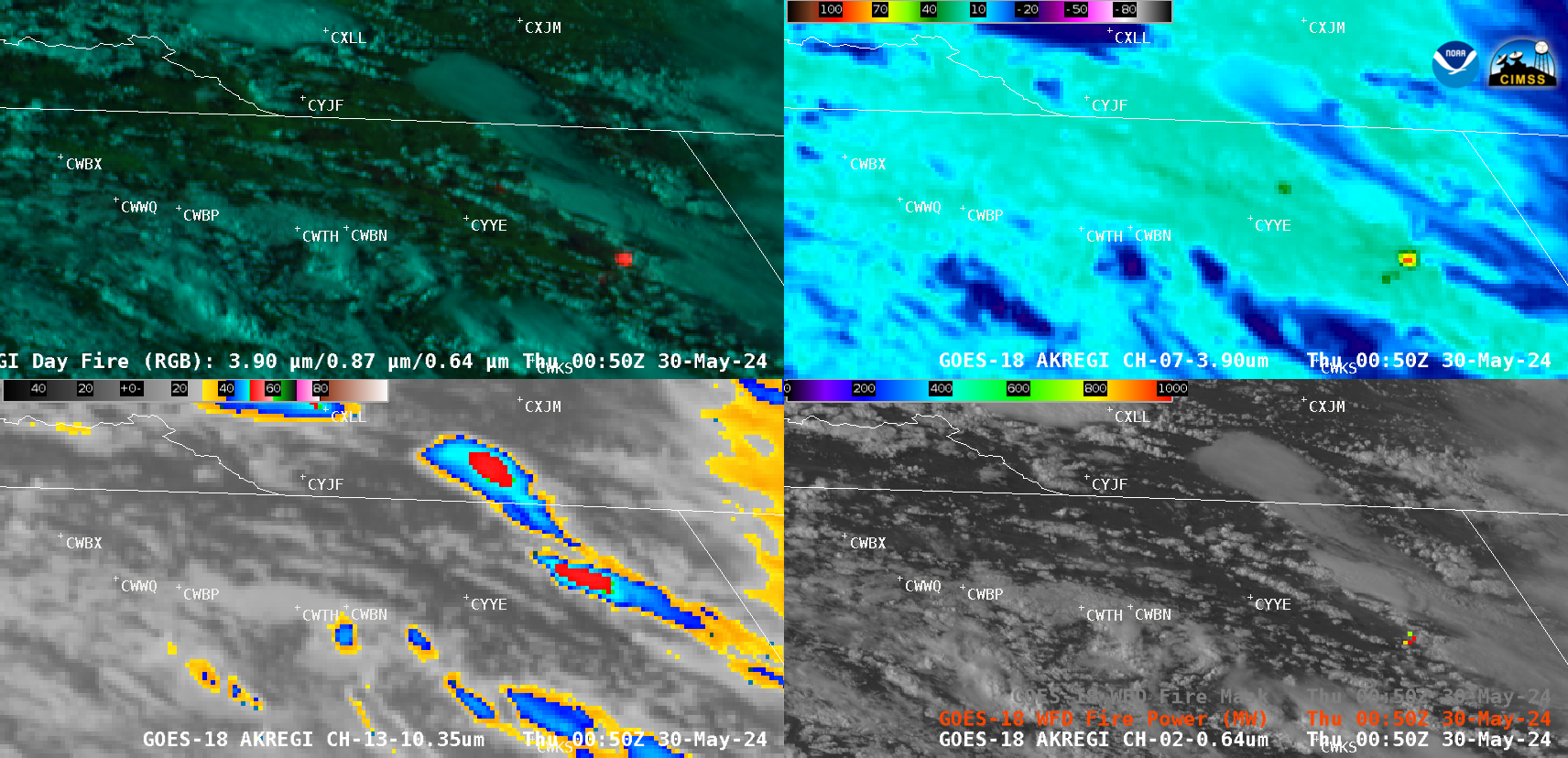
GOES-18 Day Land Cloud Fire RGB (top left), Shortwave Infrared (3.9 µm, top right), “Clean” Infrared Window (10.3 µm, bottom left) and “Red” Visible (0.64 µm) images with an overlay of the Fire Power derived product (bottom right), from 1900 UTC on 29 May to 0200 UTC on 30 May [click to play animated GIF | MP4]
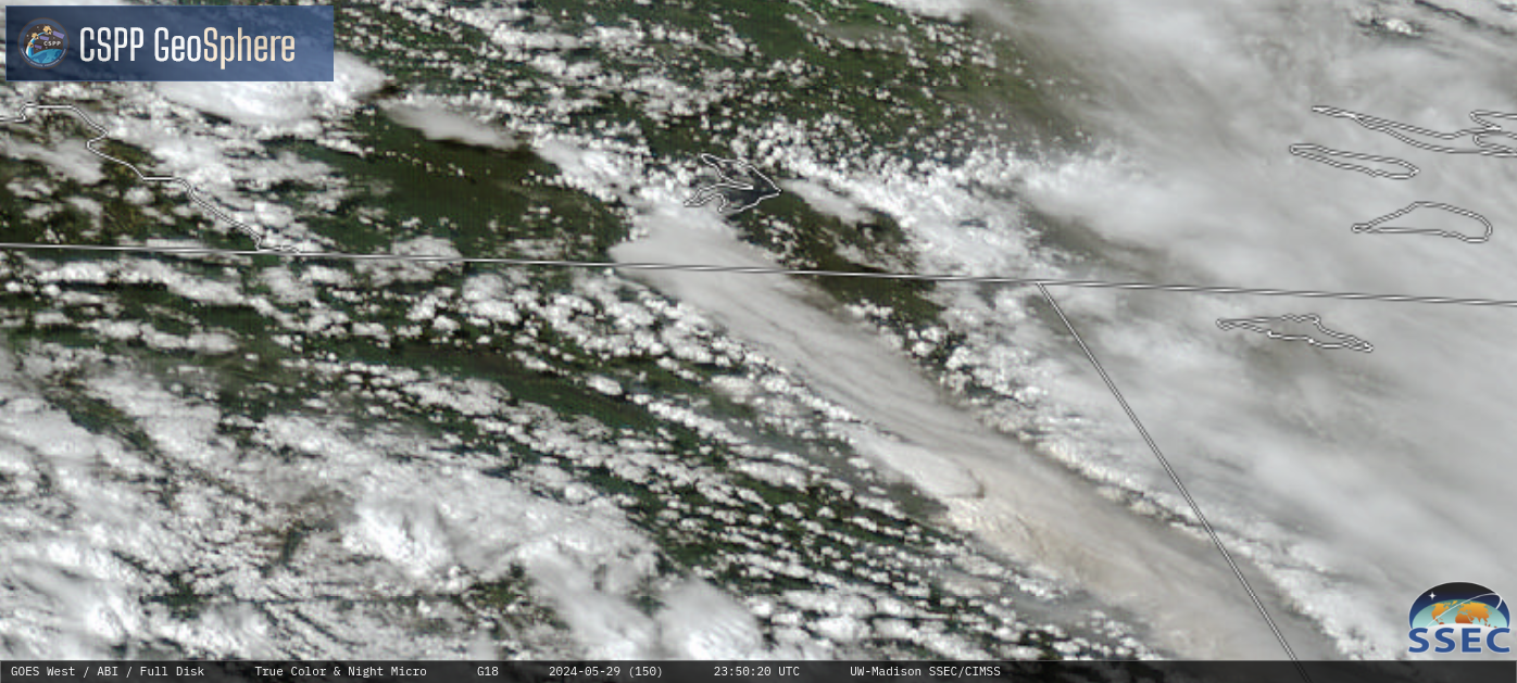
GOES-18 True Color RGB images, from 1800 UTC on 29 May to 0200 UTC on 30 May [click to play MP4 animation]


