This website works best with a newer web browser such as Chrome, Firefox, Safari or Microsoft Edge. Internet Explorer is not supported by this website.

Archive: Jun 2023

Large hail event at a Red Rocks concert in Colorado, viewed using GOES-16 and GOES-18

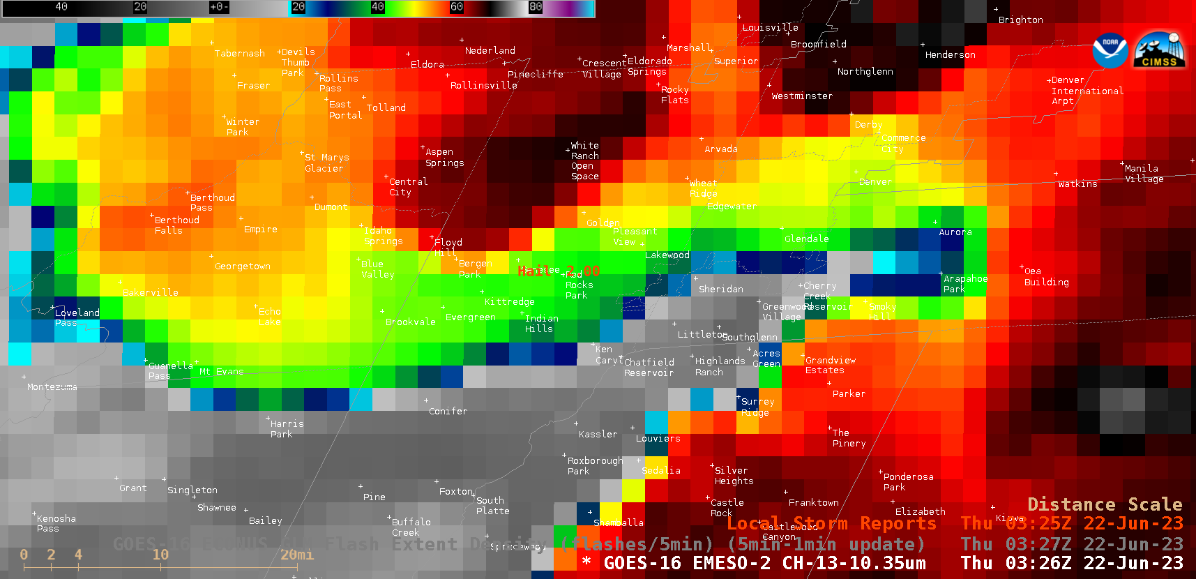
As also discussed in this blog post, large hail injured as many as 90 people at a Red Rocks outdoor concert in Colorado just after local sunset on 21 June 2023. 1-minute Mesoscale Domain Sector “Clean” Infrared Window (10.3 µm) images (with/without an overlay of GLM Flash Extent Density) from GOES-16 (GOES-East) (above) and GOES-18 (GOES-West) (below) showed the east-northeastward motion... Read More

Tropical Storm Bret

1-minute Mesoscale Domain Sector GOES-16 (GOES-East) “Clean” Infrared Window (10.3 µm) images (above) showed Atlantic Tropical Depression Three as it intensified to become Tropical Storm Bret at 2100 UTC on 19 June 2023. Overshooting tops exhibited infrared brightness temperature values as cold as -79ºC.Bret was in a favorable environment for continued intensification, as shown by low values of deep-layer wind shear from the CIMSS Tropical Cyclones site (below)... Read More

Pyrocumulonimbus cloud produced by the Pulp Road Fire in North Carolina

GOES-16 (GOES-East) “Clean” Infrared Window (10.3 µm) + Fire Power (a component of the GOES Fire Detection and Characterization Algorithm FDCA), Shortwave Infrared (3.9 µm), Day Land Cloud Fire RGB and Fire Temperature RGB images (above) showed thermal signatures and pyrocumulus pulses associated with the Pulp Road Fire in far southeastern North Carolina on 16 June 2023. Beginning at 1646... Read More