Pyrocumulonimbus cloud produced by the Pulp Road Fire in North Carolina
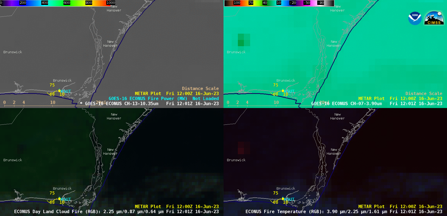
GOES-16 “Clean” Infrared Window (10.3 µm) + Fire Power (top left), Shortwave Infrared (3.9 µm, top right), Day Land Cloud Fire RGB (bottom left) and Fire Temperature RGB (bottom right) [click to play animated GIF | MP4]
A toggle between VIIRS Infrared Window (11.45 µm), Shortwave Infrared (3.74 µm), True Color RGB and False Color RGB images from Suomi-NPP (valid at 1747 UTC) and NOAA-20 (valid at 1819 UTC) (below) revealed that the fire produced a pyrocumulonimbus (pyroCb) cloud, which exhibited anvil-top 11.45 µm brightness temperature values of -40ºC and colder (shades of blue). Data used to create the VIIRS imagery were downloaded and processed by the SSEC/CIMSS Direct Broadcast ground station.
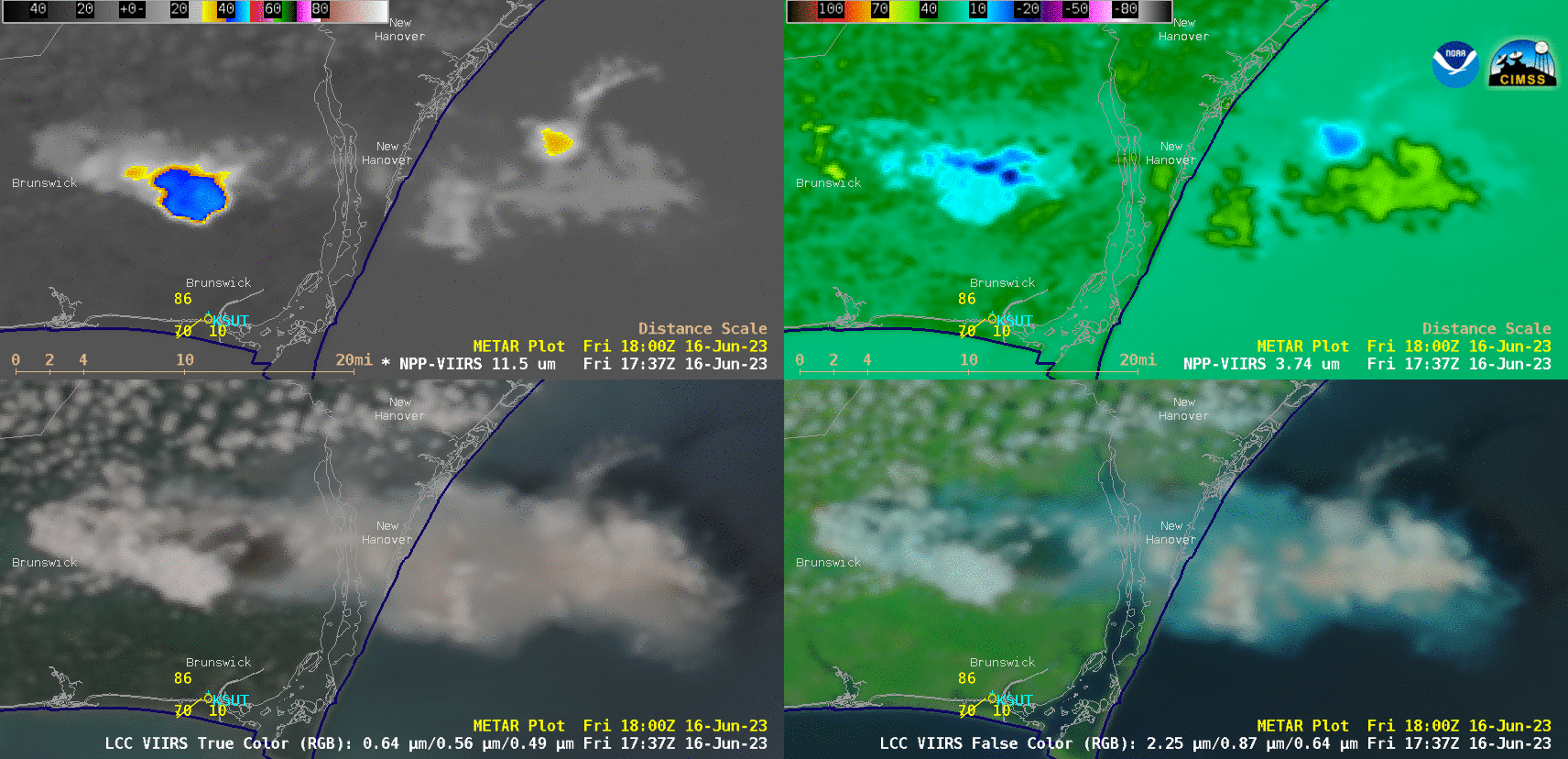
Suomi-NPP and NOAA-20 VIIRS Infrared Window (11.45 µm, top left), Shortwave Infrared (3.74 µm, top right), True Color RGB (bottom left) and False Color RGB (bottom right) [click to enlarge]