This website works best with a newer web browser such as Chrome, Firefox, Safari or Microsoft Edge. Internet Explorer is not supported by this website.

Archive: Jun 2023

Perryton, Texas tornado
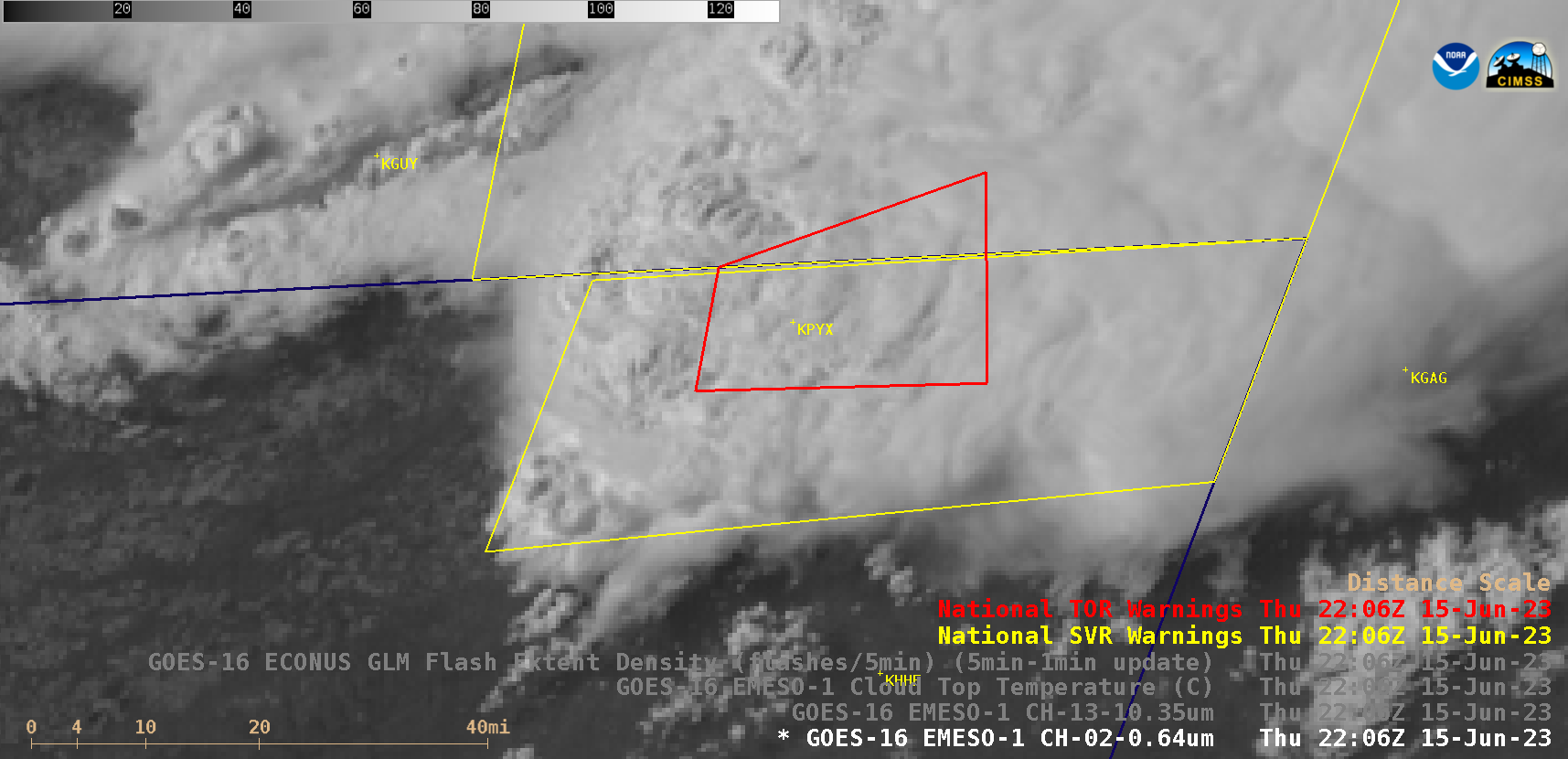
1-minute Mesoscale Domain Sector GOES-16 (GOES-East) “Red” Visible (0.64 µm) images (above) with/without an overlay of GLM Flash Extent Density (above) showed the development of a thunderstorm that produced the fatal EF3-rated tornado that moved through Perryton, Texas (located about 4 miles southwest of airport identifier KPYX) from 2206-2217 UTC on 15 June 2023. A modest amount of lightning activity was associated... Read More

Severe thunderstorms across the Deep South

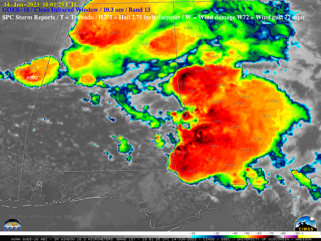
1-minute Mesoscale Domain Sector GOES-16 (GOES-East) “Clean” Infrared Window (10.3 µm) images with time-matched (+/- 3 minutes) plots of SPC Storm Reports (above) showed thunderstorms that produced several tornadoes, hail as large as 5.00 inches in diameter, and damaging winds to 82 mph across parts of Mississippi, Alabama, Georgia and Florida on 14 June 2023. Pulses of overshooting tops exhibited infrared brightness temperatures... Read More

Severe thunderstorms in the Southern Plains (with examples of overshooting tops with “warm trench” signatures)

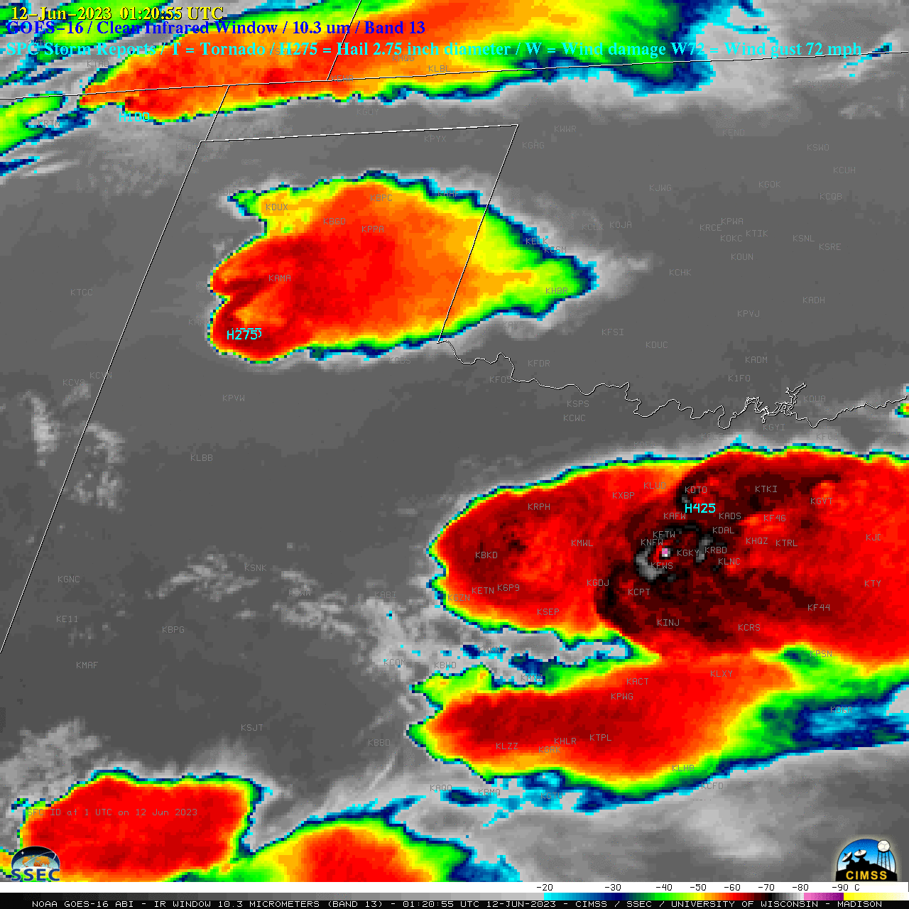
1-minute Mesoscale Domain Sector GOES-16 (GOES-East) “Clean” Infrared Window (10.3 µm) images with time-matched (+/- 3 minutes) plots of SPC Storm Reports (above) showed thunderstorms that produced hail as large as 4.50 inches in diameter, damaging winds to 71 mph and a tornado across parts of New Mexico, Texas and Oklahoma from the late afternoon into the subsequent... Read More