By Scott Bachmeier •
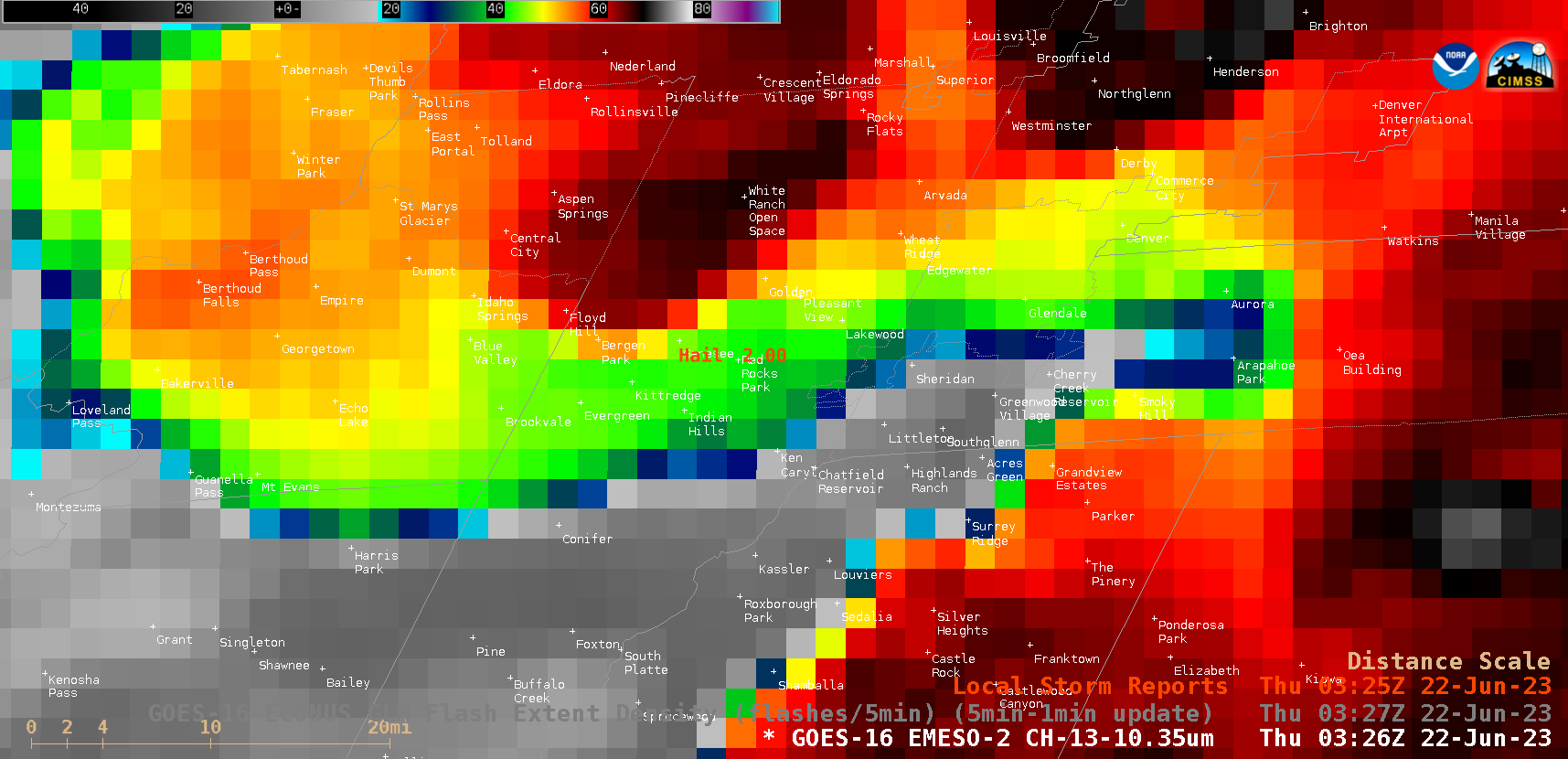
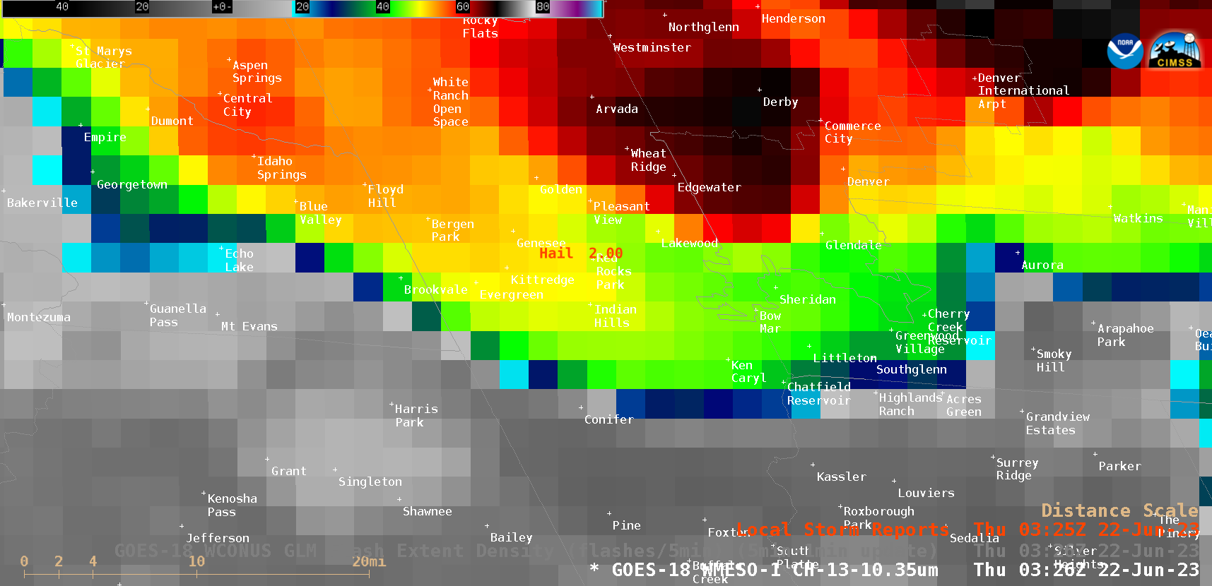
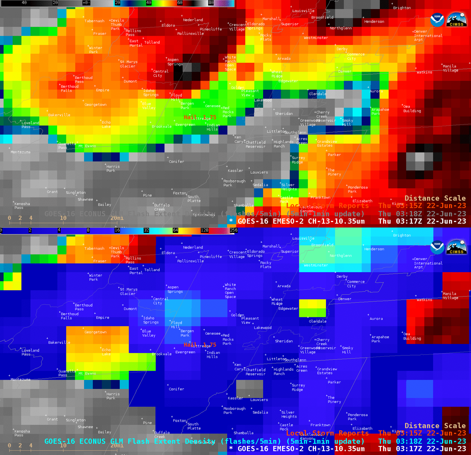
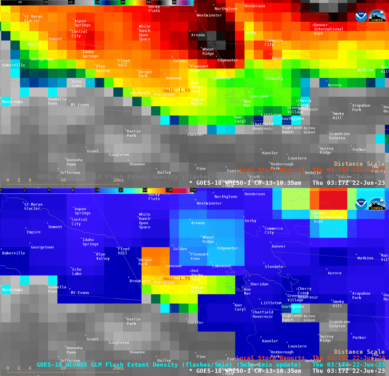
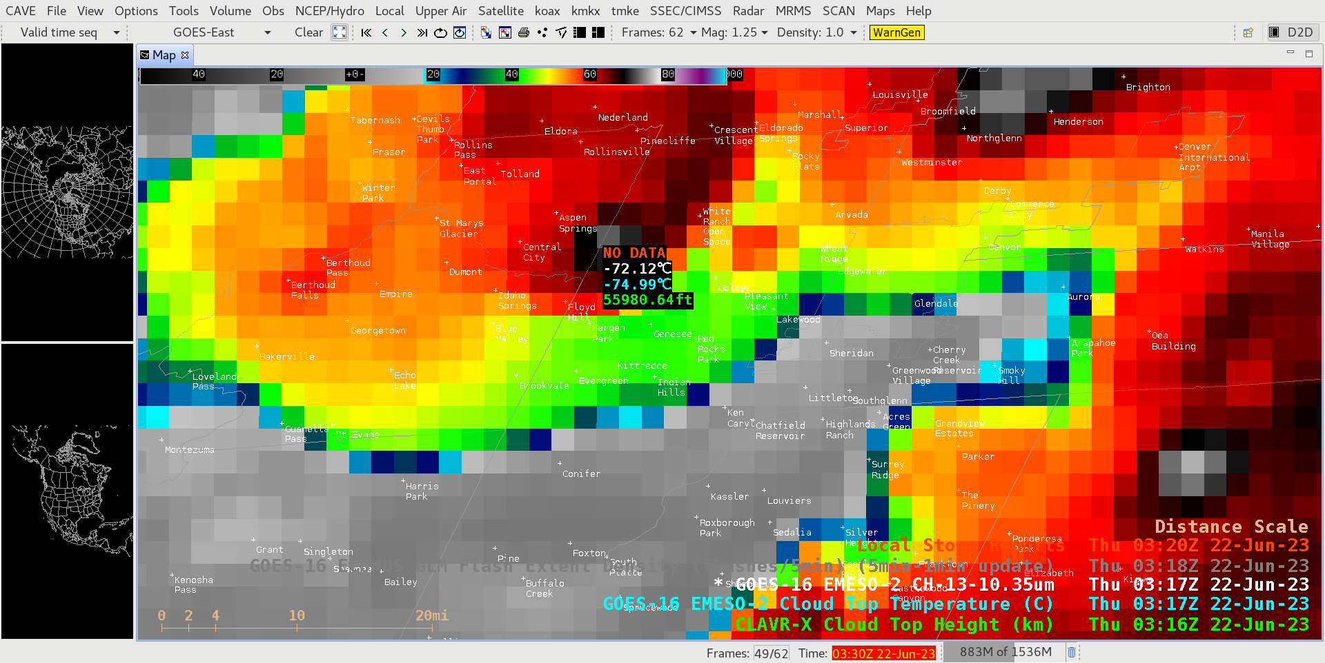
As also discussed in this blog post, large hail injured as many as 90 people at a Red Rocks outdoor concert in Colorado just after local sunset on 21 June 2023. 1-minute Mesoscale Domain Sector “Clean” Infrared Window (10.3 µm) images (with/without an overlay of GLM Flash Extent Density) from GOES-16 (GOES-East) (above) and GOES-18 (GOES-West) (below) showed the east-northeastward motion of the parent thunderstorm, and the resultant path of damaging wind and large hail reports. Red Rocks Park is located near the center of the GOES-16/GOES-18 images. Pulses of overshooting tops exhibited infrared brightness temperatures as cold as -72ºC at 0317 UTC (below) — which was about 9 minutes prior to the Local Storm Report of 2-inch diameter hail at Red Rocks — and that cold overshooting top occurred during a brief lightning jump (from 0311-0318 UTC), as indicated by GLM Flash Extent Density. Note the differences in parallax offset between the 2 satellites — a 50,000-ft cloud top feature over central Colorado would be displaced about 22 km (13.7 miles) to the northwest of its actual surface location in GOES-16 imagery, but displaced about 23 km (14.3 miles) to the northeast of is actual surface location in GOES-18 imagery. Parallax correction would therefore have displayed the cold overshooting top closer to the location of the 1.75-inch diameter hail report. The CIMSS-produced full resolution (nominal 2 km) CLAVR-x Cloud Top Height of the coldest overshooting top was around 56,000 ft (below).Categories: CLAVR-x, GLM, GOES-16, GOES-18, Lightning, Severe convection