Eruption of Volcán Wolf in the Galápagos Islands
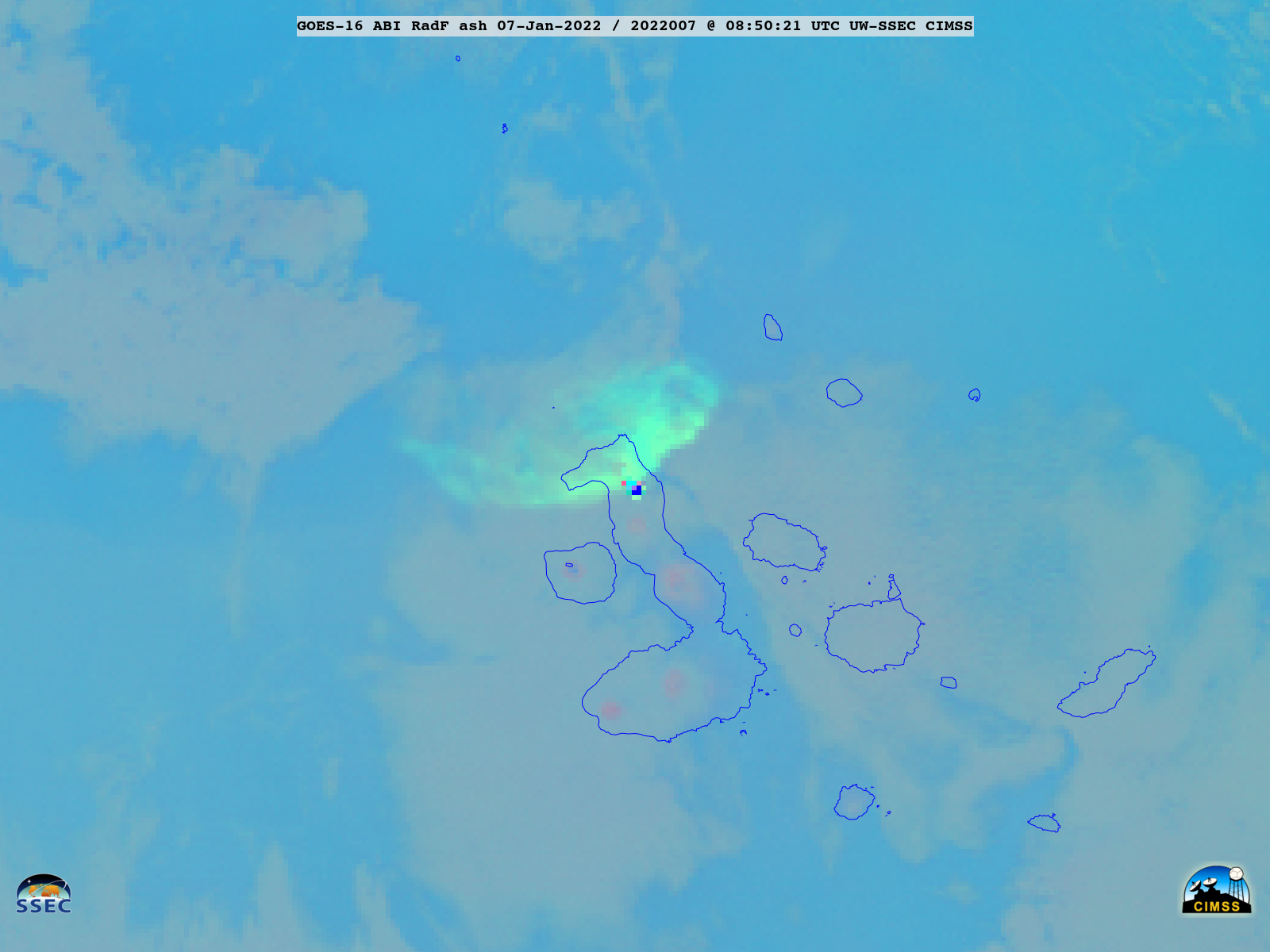
GOES-16 Ash RGB images created using Geo2Grid (above) displayed the expansion of 2 volcanic clouds following the eruption of Wolf in the Galápagos Islands on 07 January 2022 — one moving northeastward and dissipating, and the other moving westward. The green shades of the volcanic cloud suggested that it contained fairly... Read More
