The Great Lakes, viewed using GOES-16 and NOAA-20 imagery
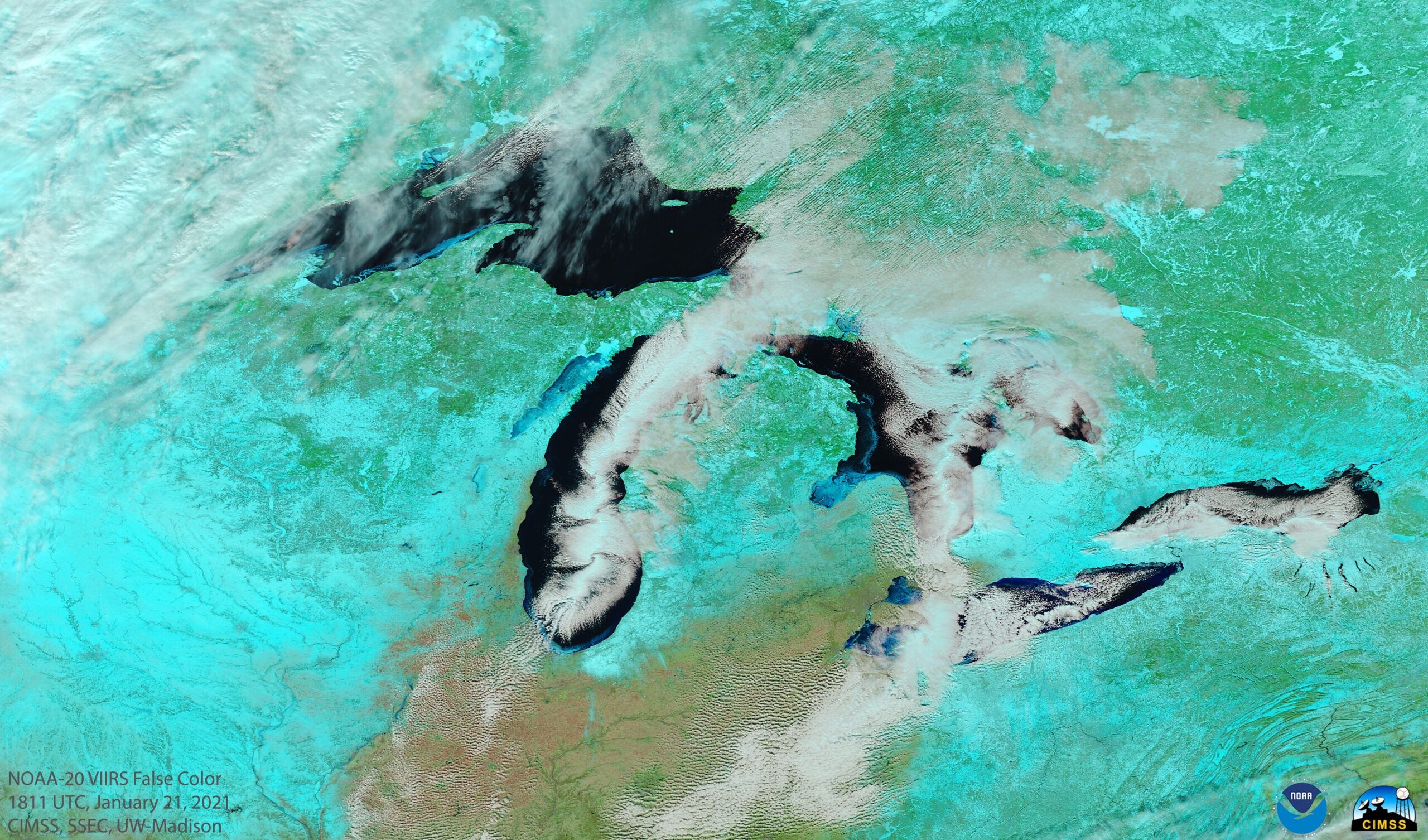
1-minute Mesoscale Domain Sector GOES-16 (GOES-East) “Red” Visible (0.64 µm) images (above) displayed mesovortices over southern Lake Michigan on 21 January 2022. The formation of these mesovortex features was aided by a mid-lake convergence of surface winds, which was suggested by RAP40 surface wind fields and shown n more detail by Metop-C ASCAT... Read More
