Standing wave clouds over northeastern Minnesota
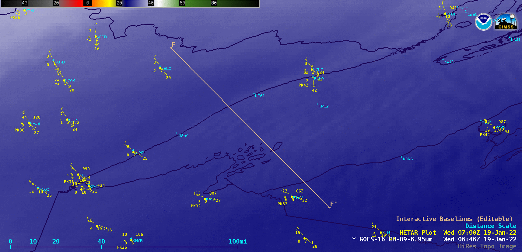
GOES-16 Mid-level Water Vapor (6.9 µm) images [click to play animated GIF | MP4]
In a toggle between GOES-16 Water Vapor and Suomi-NPP VIIRS Infrared Window images at 1811 UTC (below), the coldest cloud-top infrared brightness temperatures were around -40ºC (lime green enhancement).
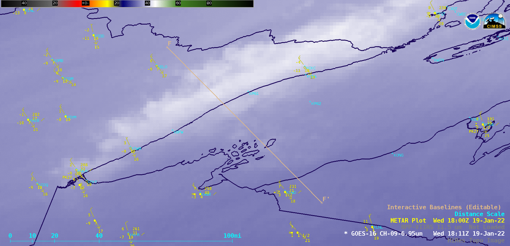
GOES-16 Mid-level Water Vapor (6.9 µm) and Suomi-NPP VIIRS Infrared Window (11.45 µm) images at 1811 UTC [click to enlarge]
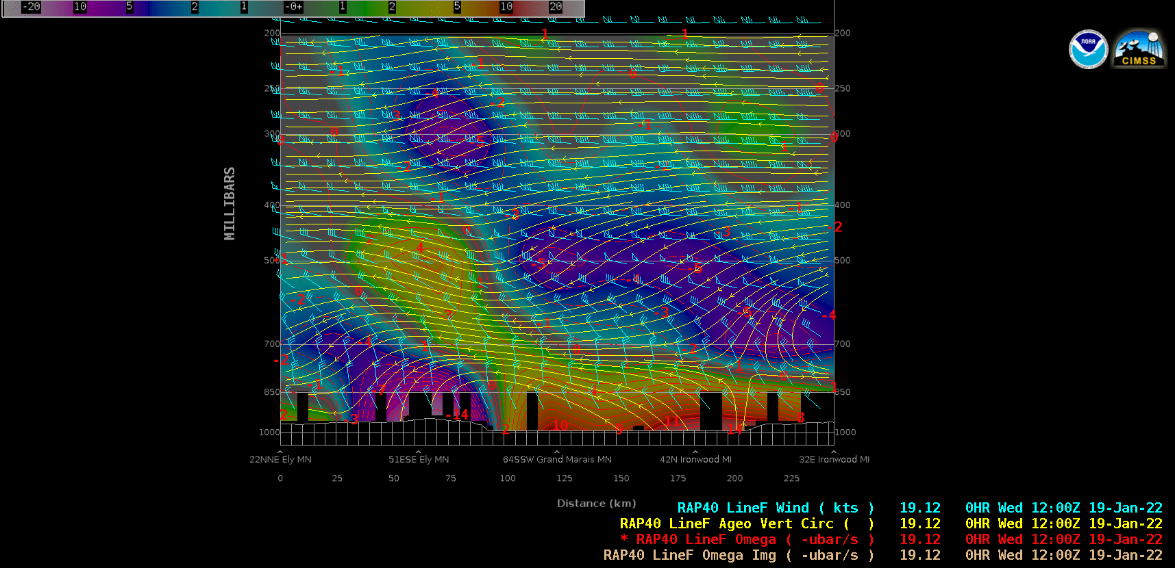
RAP40 model cross sections along Line F-F’ [click to play animated GIF | MP4]