This website works best with a newer web browser such as Chrome, Firefox, Safari or Microsoft Edge. Internet Explorer is not supported by this website.

Archive: Oct 2021

Severe thunderstorms across Missouri and Illinois

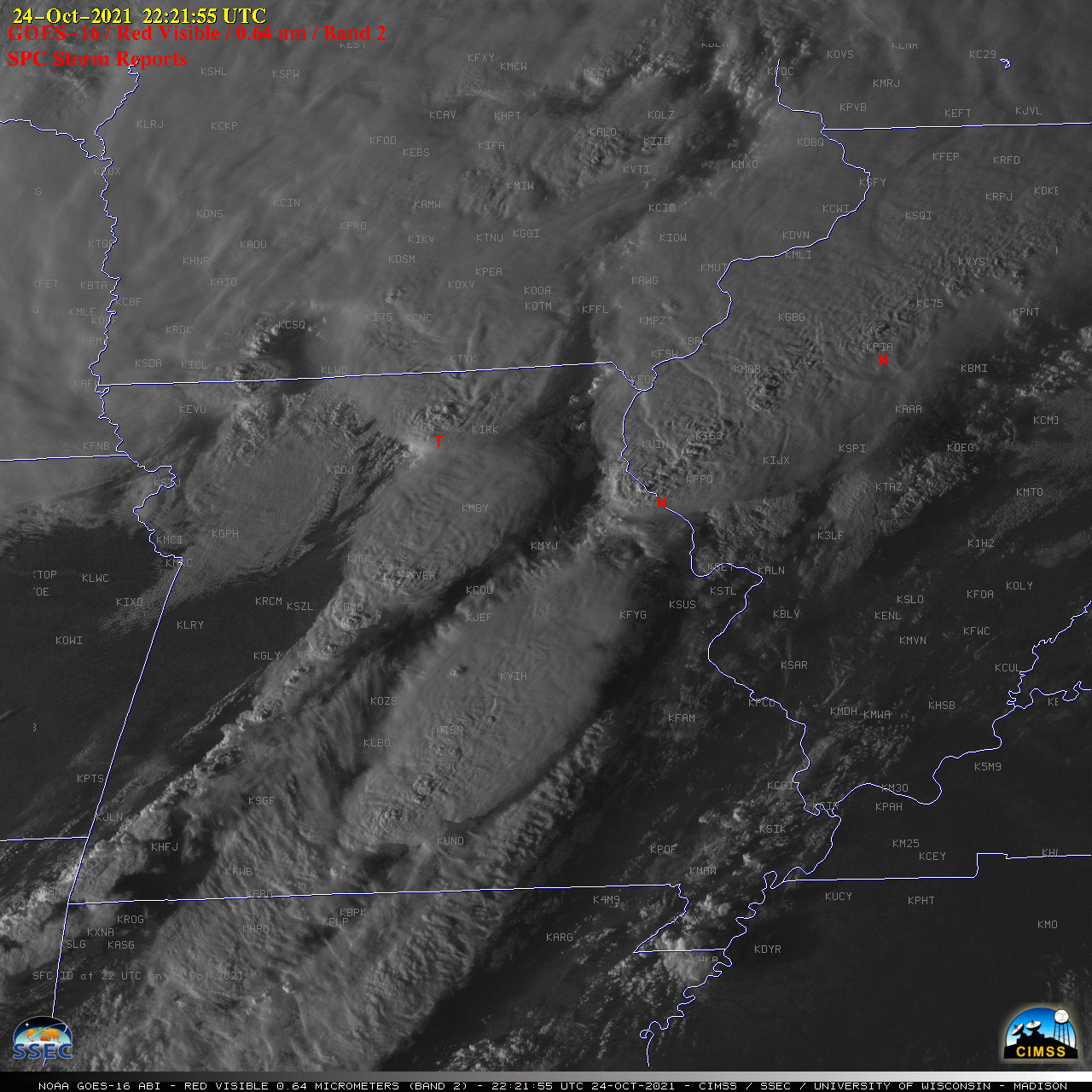
1-minute Mesoscale Domain Sector GOES-16 (GOES-East) “Red” Visible (0.64 µm) images (above) include time-matched plots of SPC Storm Reports — and showed severe thunderstorms movng eastward across Missouri and Illinois during the late afternoon and early evening hours on 24 October 2021. Most of these storms were developing along and ahead of an advancing cold front (surface analyses), and they produced several tornadoes including a... Read More

Moisture returns to the US West Coast

A sequence of two intense storms in the north Pacific Ocean, noted in the GOES-17 airmass RGB below, has drawn moisture into the northwestern United States. A MIMIC (Morphed Integrated Microwave Imagery at CIMSS) Total Precipitable Water rocking animation, above (rocking animation from this site), shows the development of a ribbon... Read More

Viewing Fall lightning with RealEarth

Cooler temperatures across the Midwest are often heralded by thunderstorms. Yesterday evening and last night, a system brought rain and lightning to parts of Iowa, Minnesota, Wisconsin, Illinois, and Michigan, moving over Ohio by Thursday morning. RealEarth, a web-based visualization platform developed at UW-Madison, can display data from GOES-16 to... Read More