Comparing SAR data over Lake Superior to radar

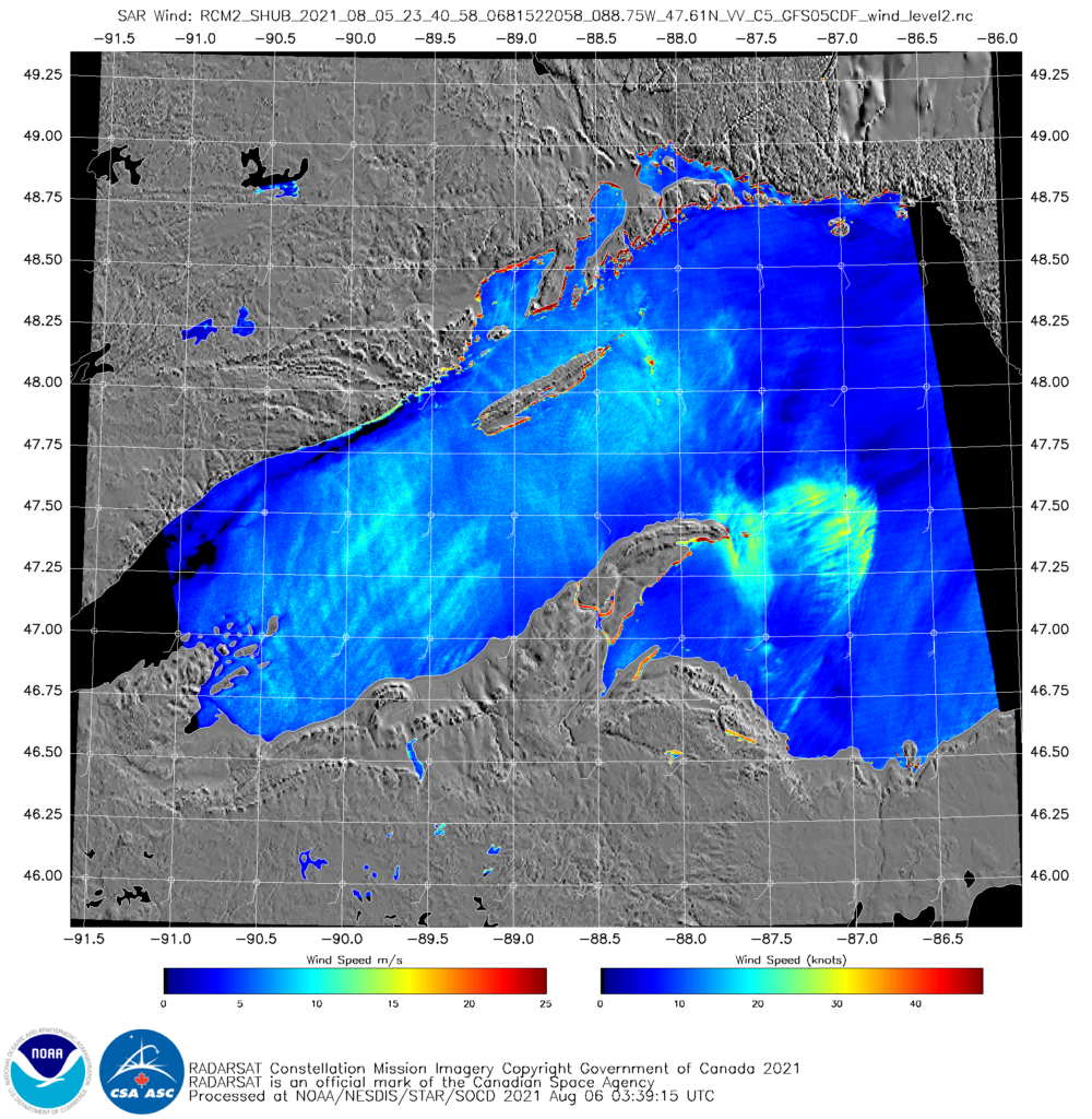
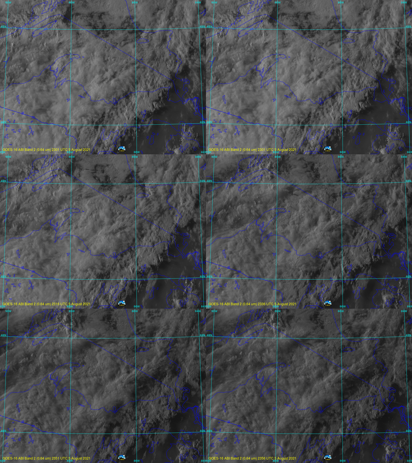
Synthetic Aperture Radar (SAR) winds are derived from a microwave signal pinged from a satellite; backscatter is converted into winds (given a background field that is typically from a numerical model). The wind structure here is suggestive of a bowing feature to a convective downdraft. How does it compare to radar or satellite imagery? GOES-16 Satellite imagery for the hour bracketing the imagery above is shown below. Convection (weak) is apparent moving east from the tip of Keewenaw peninsula.

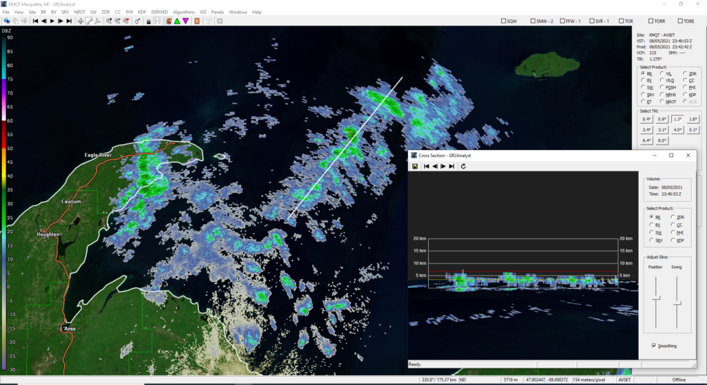
What did radar imagery look like at this time? The imagery below, courtesy Nick Langlieb, the SOO at WFO Marquette, shows radar echoes (base reflectivity) at a different level than the Lake-surface values sampled by SAR, so a direct comparison is a challenge (click here to see Correlation Coefficient at the same time). It’s peculiar that no radar signal is apparent to match the strong SAR winds just offshore from the tip of the Keewenaw peninsula (between 88º and 87.5º W) — although there is a feature oriented north-south a small distance to the west of the peninsular tip; there seems to be a better (but not exact) match with the SAR winds near 87º W.


