Tropical Storm Nepartak approaches Japan
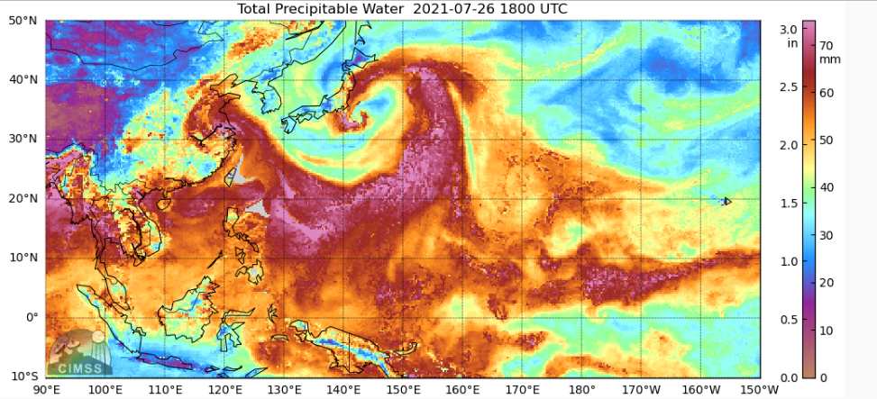
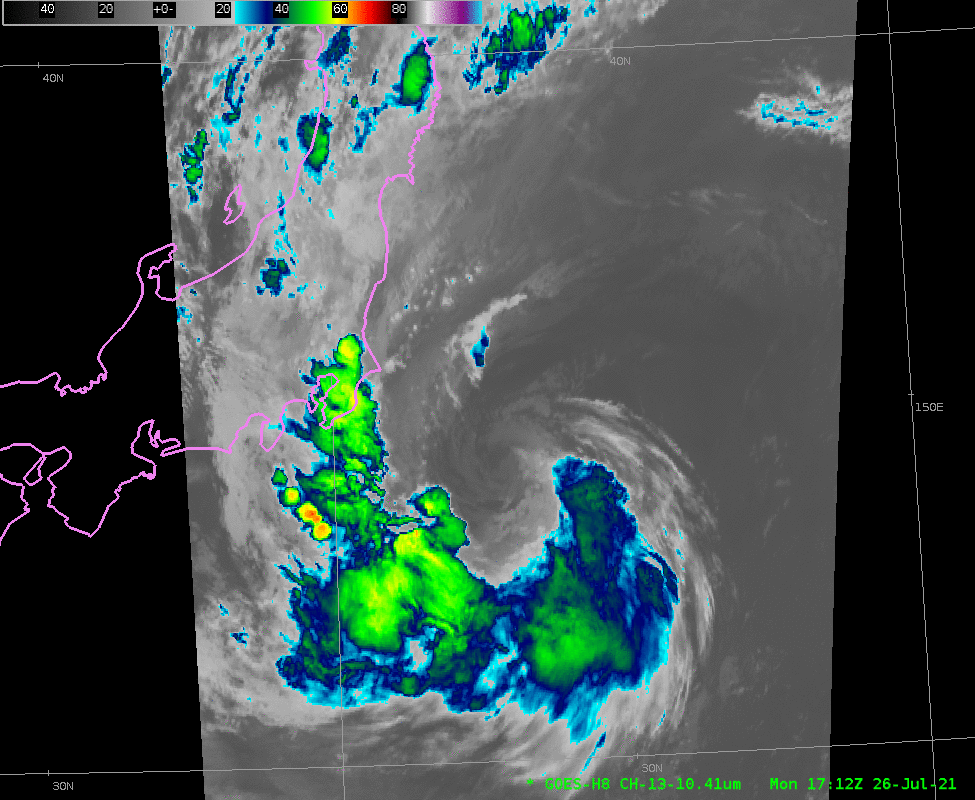
As the games of the 2021 Olympics progress, a weakening Tropical Storm Nepartak is moving over coastal waters to the east of Honshu, the main island of Japan. The Total Precipitable Water imagery, above, from MIMIC TPW, shows a plume of moisture wrapped around the circulation center. Himawari-8 Clean Window infrared (10.41 µm) imagery, below , from the Himawari-8 Target scene (courtesy of JMA; here’s a link to more JMA satellite imagery), shows the progression of the storm.
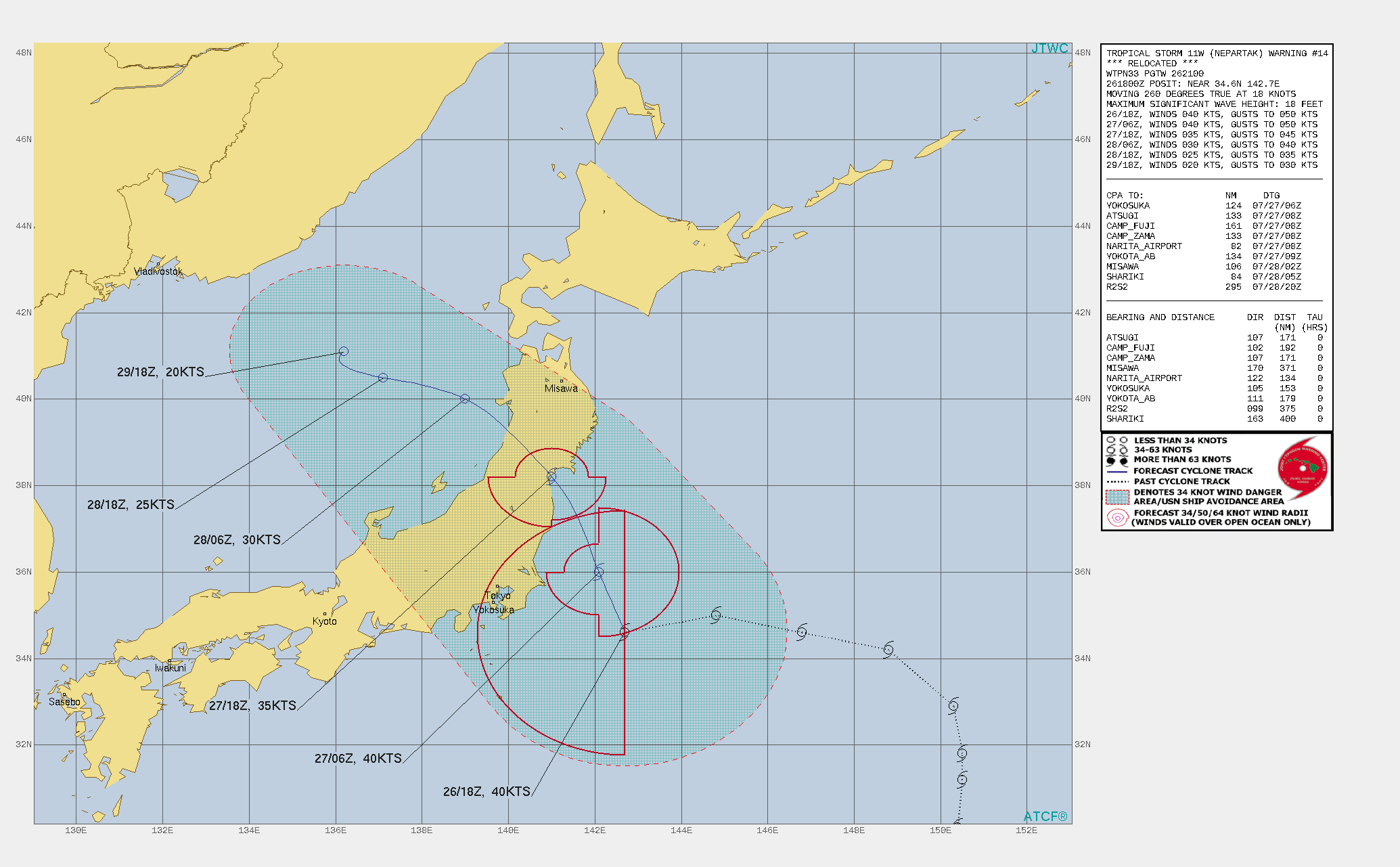
The forecast from the Joint Typhoon Warning Center (JTWC) as of 1800 UTC has the weakening storm backing into northern Honshu (forecast track; it’s also available from JMA). As of 2300 UTC, the center of Nepartak had moved north to Tokyo’s latitude, and convective bands on the west side of the storm are affecting areas around Tokyo, Yokohama, Sagami Bay and Chiba prefecture. Interests in Japan should monitor closely the progress of this storm.
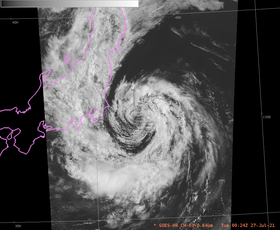
Visible imagery from shortly after sunrise on Tuesday 27 July in Japan shows the storm to the east of Japan; very little convection is within the storm center.
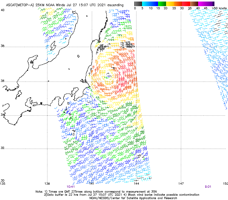
Metop-A overflew Japan at around 1040 UTC on 27 July. Scatterometry (source) showed the wind structure of the storm very nicely.