This website works best with a newer web browser such as Chrome, Firefox, Safari or Microsoft Edge. Internet Explorer is not supported by this website.

Archive: Jan 2021

Cold air advection in the Bering Sea

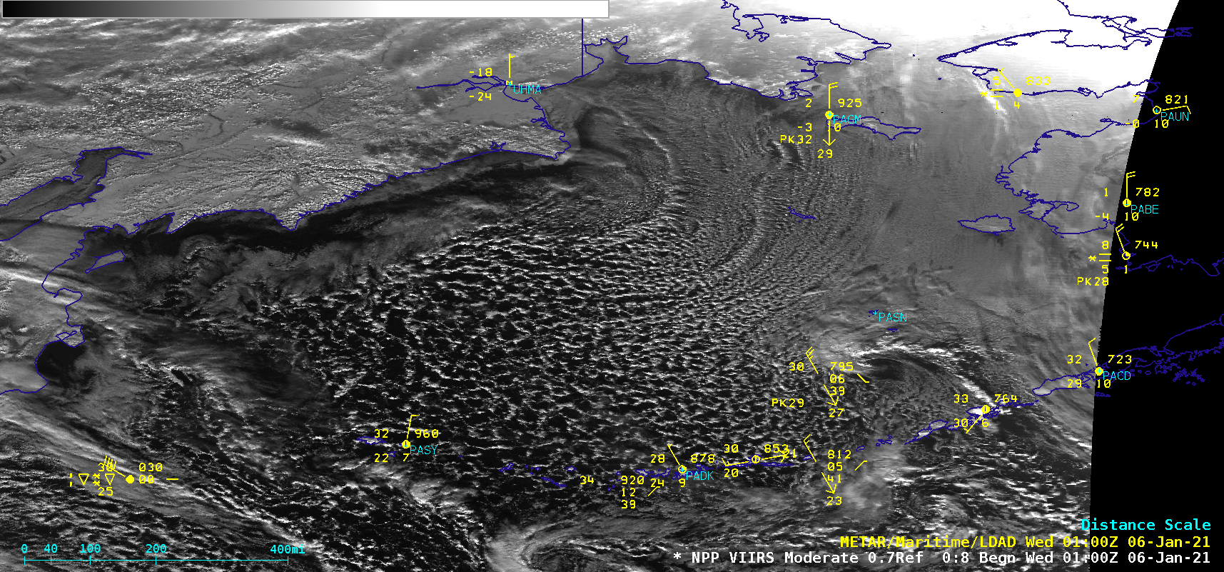
GOES-17 (GOES-West) “Red” Visible (0.64 µm) images (above) displayed cloud streets across the Bering Sea — cloud features that frequently occur in areas with a strong flow of cold air over warmer water. This northerly flow of cold air across the Bering Sea was due to a strong pressure gradient between... Read More

There GOES 2020

Daily Full Disk imageryBy animating daily NOAA GOES-16 or GOES-17 ABI Full Disk visible imagery, the year are 2020 can be shown quickly in review. The GOES-16 loops show an 18 UTC image each day of 2020, while GOES-17 shows an image from 21 UTC. The images are Rayleigh-corrected composites.... Read More