Snowfall across Virginia and North Carolina
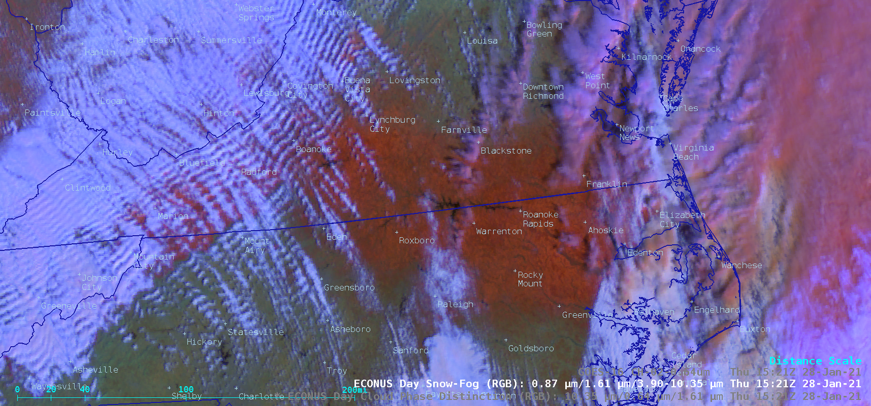
GOES-16 (GOES-East) Mid-level Water Vapor (6.9 µm) images with plots of hourly surface weather type (above) showed the broad areal coverage of precipitation across Virginia and North Carolina during the nighttime and morning hours on 28 January 2021. Storm total snowfall and peak wind gusts associated with this event are listed... Read More
