Heavy rainfall and snowfall in Southern California
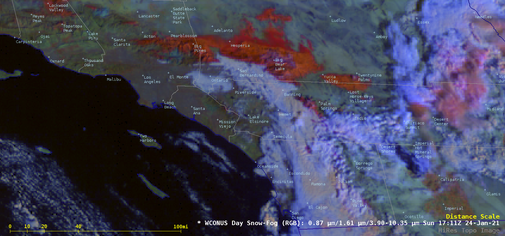
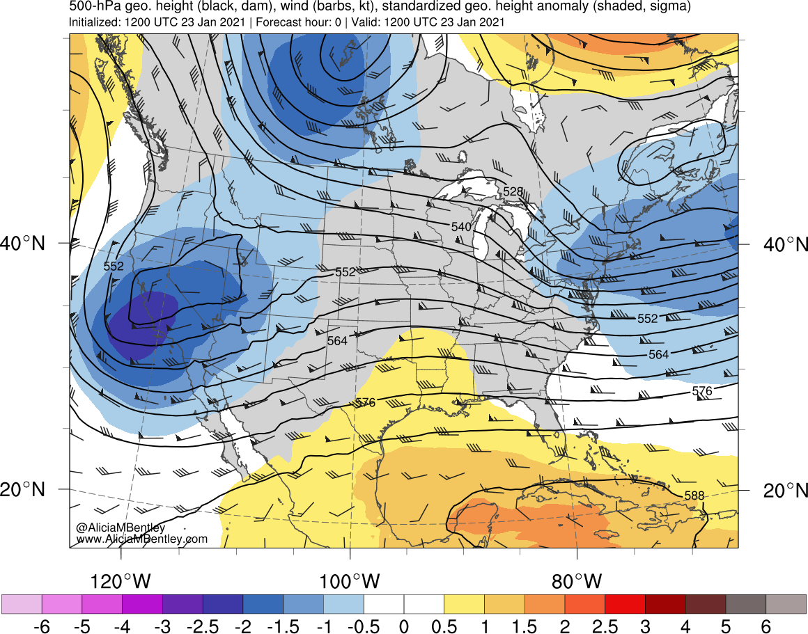
As an anomalously-deep 500 hPa low began to move inland over Southern California during the 23 January – 24 January 2021 period, GOES-17 (GOES-West) Air Mass RGB images (above) showed a compact Potential Vorticity (PV) anomaly approaching the coast — and the RAP40 model indicated that the “dynamic tropopause” (defined here as the pressure of the... Read More
