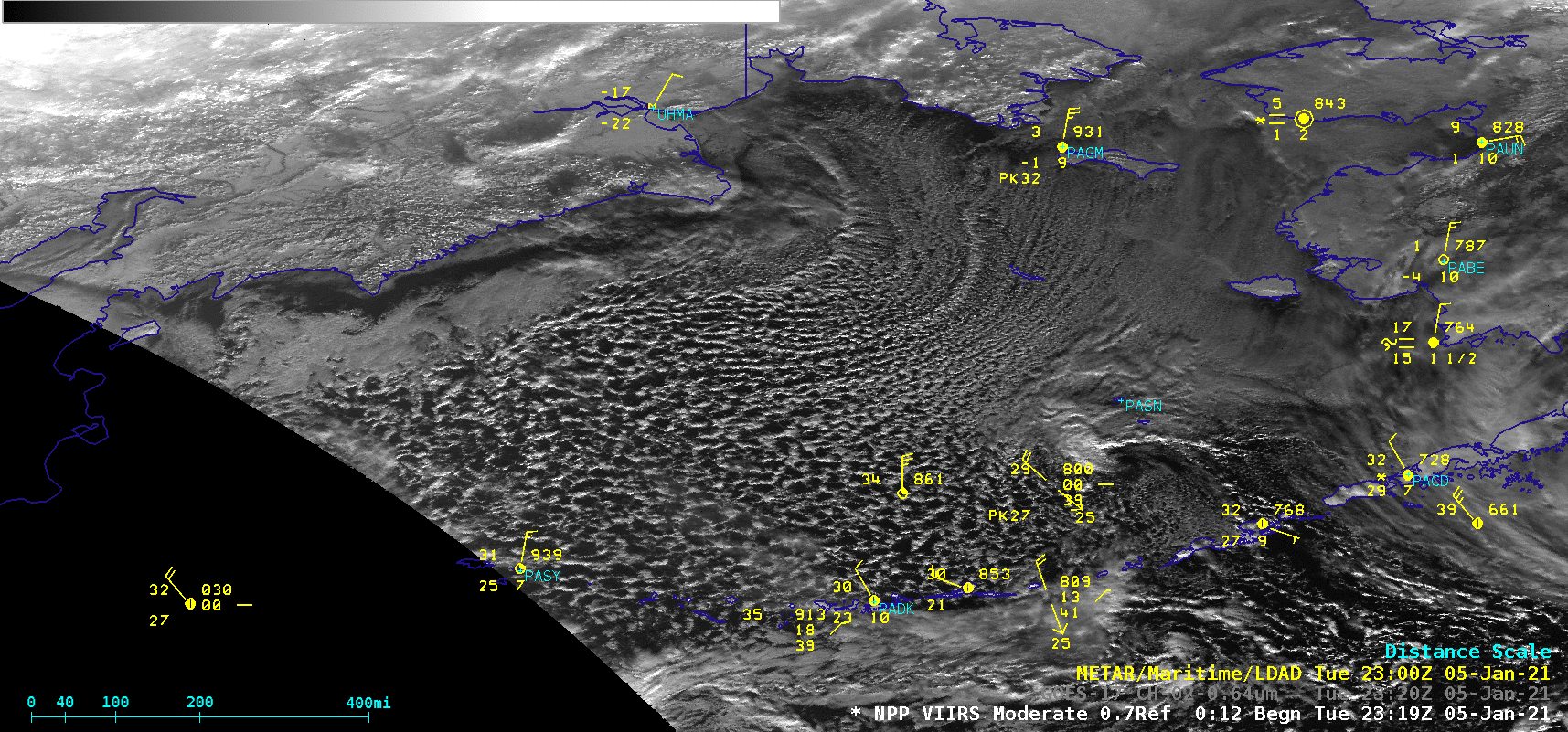
Cold air advection in the Bering Sea

GOES-17 “Red” Visible (0.64 µm) images [click to play animation | MP4]
In a GOES-17 Visible image with plots of ASCAT scatterometer surface winds from Metop-A (below), ASCAT sampled winds with speeds as high as 33 knots (although the instrument did not adequately sample the western portion of the Bering Sea, where the strongest winds likely existed).
![GOES-17 "Red" Visible (0.64 µm) image, with plots of Metop-A ASCAT winds [click to enlarge]](https://cimss.ssec.wisc.edu/satellite-blog/images/2021/01/ber_vis_ascat-20210105_211031.png)
GOES-17 “Red” Visible (0.64 µm) image, with plots of ASCAT winds from Metop-A [click to enlarge]
![Suomi NPP VIIRS Day/Night Band (0.7 µm) images [click to enlarge]](https://cimss.ssec.wisc.edu/satellite-blog/images/2021/01/210105_suomiNPP_viirs_dayNightBand_Bering_Sea_anim.gif)
Suomi NPP VIIRS Day/Night Band (0.7 µm) images [click to enlarge]
Suomi NPP VIIRS Day/Night Band (0.7 µm) and GOES-17 “Red” Visible (0.64 µm) images [click to enlarge]