This website works best with a newer web browser such as Chrome, Firefox, Safari or Microsoft Edge. Internet Explorer is not supported by this website.

Archive: Fri Jun 2020

Cutoff low over northern Alaska

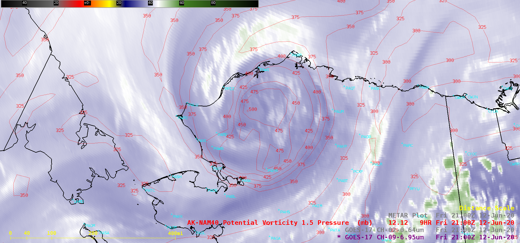
GOES-17 (GOES-West) Mid-level Water Vapor (6.9 µm) images (above) showed the circulation of an anomalous middle-tropospheric cutoff low over the northwestern portion of Alaska on 12 June 2020. A Potential Vorticity (PV) anomaly associated with this low was causing the dynamic tropopause — represented by the pressure of the PV1.5 surface —... Read More

Shower initiation over Wisconsin

Showers developed over southern Wisconsin late in the day on 12 June 2020. What satellite products could be used to anticipate where the showers would develop? The animation of visible and radar, above, shows that the storms initiated near a boundary (mostly stationary) that separated Lake Michigan-influenced air with less... Read More

Mount St. Helens: June 1980

SMS-2The main Mount St. Helens eruption was May 18, 1980 — yet there were also later paroxysmal eruptions. Imagery from NASA’s SMS-2 (Synchronous Meteorological Satellite) monitored two more Mount St. Helens eruptions on June 12th (local time), 1980, as shown above. Note that in “UTC-time”, the eruption took place on June 13th. A... Read More